Contributory members are able to log private notes and comments about each site
Sites Anne T has logged. View this log as a table or view the most recent logs from everyone
The Portsburgh Stone
Trip No.11 Entry No.1 Date Added: 2nd Mar 2017
Site Type: Natural Stone / Erratic / Other Natural Feature
Country: Scotland (Midlothian)
Visited: Yes on 20th Feb 2017. My rating: Condition 3 Ambience 3 Access 5
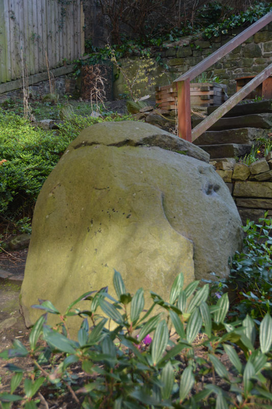
The Portsburgh Stone submitted by Anne T on 23rd Feb 2017. The Portsburgh Stone, photograph taken over the iron railings of the West Port Community Garden, which is only open on Sundays.
(View photo, vote or add a comment)
Log Text: Portsburgh Stone, Natural Erratic, Edinburgh: Intrigued by the 'no photograph' of this site in the heart of Edinburgh, I determined to find it, although we did mis-interpret the location published in the Portal text and walked in a couple of decreasing circles! The actual grid reference is NT 25283 73276, the West Port Garden (or Geddes Garden).
A notice on the padlocked gate to the garden told us that the garden was only open on Sundays, so I had to stand looking over the iron railings to try and get the best photographs I could of the stone.
Couldn’t spot any other erratics in the adjacent walls. Located the old Salvation Army building, and also walked around the nearby Art School buildings, but didn’t see anything. The Vennel, with its many steps, was very interesting to walk up.
The Ponteland Boulder
Date Added: 24th May 2015
Site Type: Rock Art
Country: England (Tyne and Wear)
Visited: Yes on 17th May 2015. My rating: Condition 3 Ambience 3 Access 5

The Ponteland Boulder submitted by Anne T on 18th May 2015. This recently discovered boulder sits in the gardens of the Great North Museum, to the right hand side of the access road which leads to the bank of bins at the rear door of the museum.
(View photo, vote or add a comment)
Log Text: The Ponteland Boulder, The Great North Museum, Newcastle-upon-Tyne: We'd been told about this boulder in March by one of guys at the Archaeological Group who is a very keen tracker of any new rock art found in the region. Then, strangely, it came up in Rock Articles which was emailled to me by Dr. Kate Sharpe at the University of Durham. Having been asked to look after our very young granddaughter for the day, plans for a long day out walking were truncated so we decided to head off into Newcastle and go searching for this boulder.
Walking through the University of Newcastle campus, we crossed Claremont Road and walked almost right round the museum and back again without spotting this stone. I was just about to head off into the museum to ask when my husband dived off into a small garden area fronting onto the main road, towards the bins. He came rushing back to tell me he'd found it.
Sited almost opposite the bank of big blue wheelie bins on the access road to the rear/delivery entrance to the museum wasn't maybe the best spot for this boulder, but here it was never-the-less.
There is obvious plough damage to the edges of the stone and it has been quarried at some point, making it originally much larger than it currently is.
The cup and ring motifs, particularly those at the edges of the boulder, had peck marks (like at Fowberry Park) next to them.
Definitely worth a visit if passing by. Note to those of you with families: at the far side of the museum, next to the car park, there is a large stone rhinoceros which is interesting to be photographed next to (but definitely not megalithic!).
The Poind And His Man
Date Added: 25th Aug 2014
Site Type: Standing Stone (Menhir)
Country: England (Northumberland)
Visited: Yes
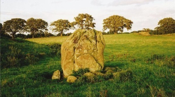
The Poind And His Man submitted by Bladup on 30th Dec 2013. The Poind And His Man, The standing stone (the man) with the edge of the barrow on the left and the outcrop in the background on the right.
(View photo, vote or add a comment)
Log Text: I didn’t expect this site to be as atmospheric as it was. We parked on the road that runs just south of Bolam Lake, in a small layby about 100 yards to the south west of Craig Hall, approx. grid reference: NZ 07126 82266 (only a couple of kilometres from the busy A696). We walked down the gravelled footpath past which turns left from this road through Bolam West Houses; in the second field to our left hand side past the houses, the tumulus came into view on the horizon. Whilst it is marked on the map as being just a tumulus, it is actually a tumulus with standing stone on its southern side.
Being on a slight hill, the tumulus stood out well against the surrounding terrain. There was no sign of the standing stone from this point, although some stones were poking up from the grass at the left hand (eastern) side of the tumulus.
We found out afterwards that there was actually no public access to this tumulus and standing stone, so I felt guilty about walking up to it, although it was a short distance from the main footpath. The field was full of the most beautiful sheep, all kinds of different breeds. As we approached the tumulus, the standing stone is on its southern side appeared - much larger than I anticipated.
I got the tape measure out, and husband Andrew helped me take the approximate dimensions of the standing stone: 2 metres from the current ground height, width on widest faces: 1.50 and 1.54m, and on the narrowest faces 0.6 metres each.
There were stunning views across the fields to the hills in the far distance to the east, south and west. The views to the north were blocked by the trees of the North Plantation. The sun was also very strong, and I didn’t manage to take photographs of the most spectacular views across to the south west and west.
There appeared to be another small circular mound slightly to the south west of the tumulus, and we wondered if this might be another tumulus.
Similar to the standing stone at Newtown Mill (which we saw on 17th August), the Devil’s Causeway Roman Road, which runs within a few yards to the east of Newtown Mill standing stone, runs immediately to the west of this tumulus, although this is no sign of the road in the landscape that we could spot.
There is a Northumberland County Council leaflet (Exploring Bolam, walk number 3, Bolam Lake to Shaftoe Crags) describing the tumulus: (this) “barrow or burial mound is in a prominent position and is 28m in circumference and 1.5m high. It was excavated in 1718 by Warburton, an Excise Officer with a keen interest in antiquities. Writing to a friend Warburton described that he - “found a stone coffin about 3ft in length and 2ft in breadth and 2ft deep which was black inside with smoke, and in it several lumps of glutinous matter….pieces of the dead heroes flesh” It is likely that that the main burial may be intact as Warburton did not dig deep enough. Such mounds were frequently re-used and may have many burials of different ages. The mound was important in Medieval times when Watches were set to warn of Scottish raids. In 1552 Wharton, Warden of the English East March stipulated that Watches should be set at “the two stones the Poind and his Man with two men nightly the inhibitors of Bolam”. The second stone is at Wallington Hall and was probably moved there by William Blackett. The Devil’s Causeway runs just to the west of the mound.”
In the same field, about 100 yards to the east of the Poind and His Man, there was an outcrop of rock, similar to the formation at West Agra, and we wandered over. The strong sunlight brought out what might be cup marks; in particular, there was a line of deep cup marks against a ledge in a crack in the middle of the rock, and what appeared to be a grouping of heavily weathered cup marks to the eastern edge. We need to research if Stan Beckensall has listed any marks on the ERA site.
The Pillar Stones
Date Added: 27th Aug 2014
Site Type: Early Christian Sculptured Stone
Country: Wales (Pembrokeshire)
Visited: Yes on 21st Aug 2014. My rating: Condition 3 Ambience 4 Access 5
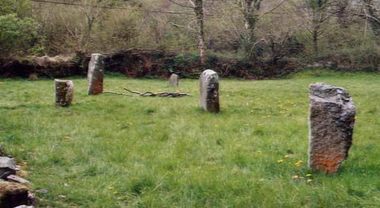
Pillar Stones submitted by PaulM on 24th Apr 2003. The Pillar Stones are a group of four Christianised stones located in a churchyard in the Gwaun Valley in Pembrokeshire (SN123340).
The reverse of each of the stones is carved a cross of differing designs. A fifth stone seems to act as a font.
(View photo, vote or add a comment)
Log Text: Pillar Stones, Cwm Gwaun. These stones were the second of the ancient monuments we saw during our visit to Pembrokeshire, and a great start to our trip.
The five pillar stones were visible from the road, in the grounds of a small chapel, so we parked in the driveway to get off the single track road. It was only when we tried to go into the chapel that we realised it had been converted to a private house and the pillar stones were in the garden.
We were able to make our crosses on three of the stones (inscribed on the sides facing away from the chapel, looking east). I wasn’t sure if there was any particular alignment to the stones; they didn’t particularly appear to have been arranged in rows.
There is also an old font under the bell tower of the church.
The Monk's Well
Trip No.167 Entry No.2 Date Added: 22nd Jul 2021
Site Type: Holy Well or Sacred Spring
Country: Wales (Powys)
Visited: Couldn't find on 12th Jul 2021
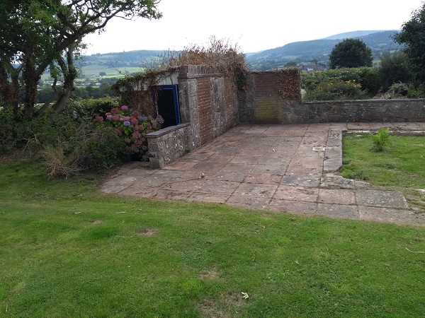
The Monk's Well submitted by geoffstickland on 3rd Sep 2018. Pump house on site of the original pool
(View photo, vote or add a comment)
Log Text: Monk's Well, Clyro: Despite having the grid reference and the Coflein information, we were unable to find this well, which appears to be on private land.
The Maiden Stone (Tullibody)
Trip No.109 Entry No.7 Date Added: 12th Nov 2018
Site Type: Sculptured Stone
Country: Scotland (Clackmannanshire)
Visited: Yes on 31st Oct 2018. My rating: Condition 3 Ambience 3 Access 4
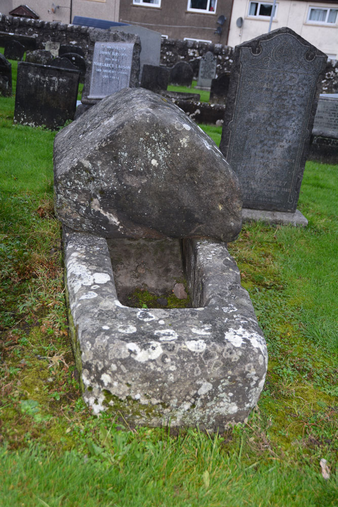
The Maiden Stone (Tullibody) submitted by Anne T on 12th Nov 2018. Site in Clackmannanshire Scotland. The Maiden Stone from the east. Whilst there are no visible carvings on the coped cover, I thought it might resemble how a hogback looked on a Viking tomb.
(View photo, vote or add a comment)
Log Text: The Maiden Stone, Tullibody: This stone coffin is next to the ruins of the old church. We parked in the car park for the new church and walked through the graveyard which runs parallel to the road. Some really unusual tombstones, and quite spooky to walk through the graveyard and look around the outside of the Old Church as dusk was falling on Halloween!
The Longstone (Shovel Down)
Trip No.135 Entry No.14 Date Added: 1st Aug 2019
Site Type: Standing Stone (Menhir)
Country: England (Devon)
Visited: Yes on 16th May 2019. My rating: Condition 3 Ambience 4 Access 3
The Longstone (Shovel Down) submitted by cazzyjane on 16th Apr 2012. The longstone at Shovel Down with Kestor Rock behind.
(View photo, vote or add a comment)
Log Text: The Longstone: A welcoming standing stone, very prominent in the landscape, sitting between rows 5 and 6. I had fun posing the group for photographs around the stone.
The Kettles (Wooler)
Trip No.36 Entry No.2 Date Added: 31st Jul 2017
Site Type: Hillfort
Country: England (Northumberland)
Visited: Yes on 30th Jul 2017. My rating: Condition 3 Ambience 5 Access 4
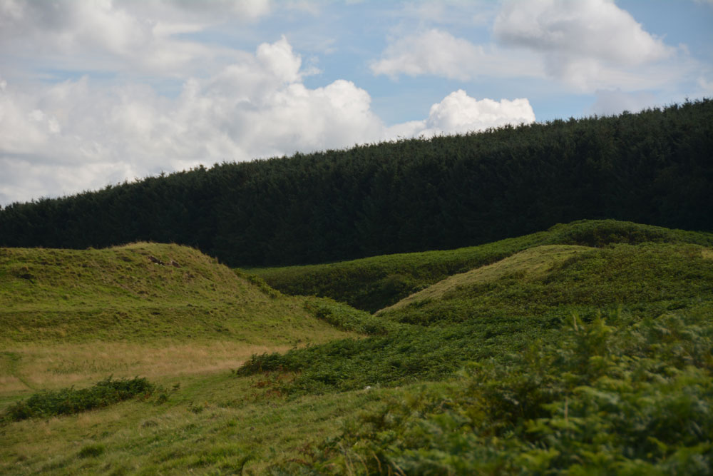
The Kettles (Wooler) submitted by Anne T on 31st Jul 2017. Getting closer to the rampart and ditch on the north western edge of the hillfort. The banks stand really tall, with steep sides, with an earth and stone construction.
(View photo, vote or add a comment)
Log Text: The Kettles Hillfort, Wooler: From Green Castle, we continued along the track leading first south west up the small hill, then turns south east along the top of the promontory. Our GPS told me there was just over 511 metres to walk from the small parking area to the grid reference given by Pastscape, but it seemed a lot less than this.
The paths are well kept, as on the Breamish Valley trails, with low, mown grass which is soft underfoot and easy to walk. As we walked along the promontory, the northern section of ramparts came into view. As we got closer, it became obvious how large these were.
Paths lead up into round the exterior edges of the hillfort. There are bracken and scree covered valleys on either side. The first thing we came across were some strange concrete blocks and what looked like the tiled remains of an old toilet at approx. NT 98398 27352, but then there are the recorded remains of pillboxes in this area, so must have been used for military training during the last war.
As we walked along, we crossed three distinct banks which had been cut by the paths, which are the three ramparts (in places four) that cut the fort into two. Walking past the fourth rampart, it felt as it had on Little Hill in the Scottish Borders, as if I was on the prow of a ship looking down across the land below. Crossing to the eastern side of the fort, at this point, we were almost directly above Maiden Well and the King’s Chair. To reach these, we would have need climbing equipment to abseil down, so we walked back to the car and drove round to the path leading to The Pin Well.
Looking at the aerial images on UK Grid Reference Finder, the outline of the fort is clearly visible.
The Kendal Cross
Trip No.178 Entry No.1 Date Added: 21st Jun 2022
Site Type: Ancient Cross
Country: England (Cumbria)
Visited: Yes on 21st Jun 2022. My rating: Condition 3 Ambience 3 Access 4
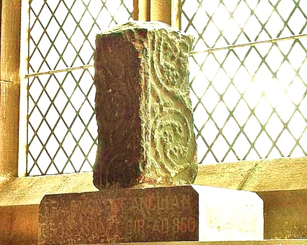
The Kendal Cross submitted by Sunny100 on 30th May 2010. The Kendal Cross, Cumbria, at SD.517922.
(View photo, vote or add a comment)
Log Text: The Kendal Cross: located on a window sill in the Lady Chapel (east end of south aisle) in the Parish Church of Kendal, Holy Trinity.
The fragment was sited in strong sunlight at the time of our visit, so difficult to photograph.
Such a huge church, apparently the widest in Cumbria, and also the oldest in Kendal, with the site older than the building, as 'evidenced by the 8th/9th century cross shaft'.
A replica of the cross sits outside the western end of the church, on the green between the western entrance gates and the church.
The Hatching Well (Gilcrux)
Trip No.81 Entry No.3 Date Added: 10th Jul 2018
Site Type: Holy Well or Sacred Spring
Country: England (Cumbria)
Visited: Yes on 9th Jul 2018. My rating: Condition 4 Ambience 3 Access 5
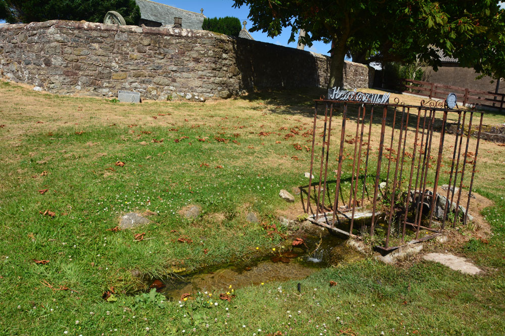
The Hatching Well (Gilcrux) submitted by Anne T on 10th Jul 2018. Standing just to the west of The Hatching Well, looking towards the southern boundary wall of St Mary's churchyard, just behind.
(View photo, vote or add a comment)
Log Text: The Hatching Well, Gilcrux: We arrived here and find this well bubbling away just outside the church - completely unexpected as it's not got any entries on Pastscape or Historic England. Neither is it mentioned in the Wikipedia entry for Gilcrux.
I guess finding this well made up for not being able to get into the church, which was very firmly locked and bolted, despite thinking we'd be able to get in. I'm trying to arrange with the vicar to go back mid-August to see AS Corpus Gilcrux 01.
The Hanging Stone (Haydon)
Trip No.128 Entry No.2 Date Added: 7th May 2019
Site Type: Standing Stone (Menhir)
Country: England (Northumberland)
Visited: Yes on 6th May 2019. My rating: Condition 3 Ambience 4 Access 4
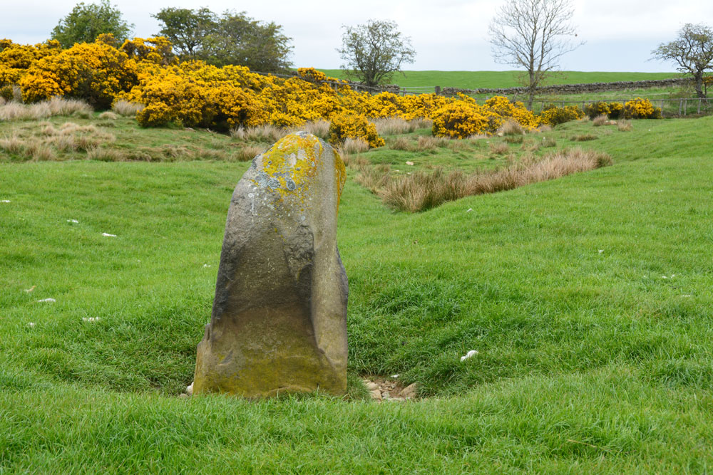
The Hanging Stone (Haydon) submitted by Anne T on 7th May 2019. Standing just behind the stone looking north east. The stone is in a slight dip in the landscape and a (water?) channel runs almost from the base of the stone to the north east, where it joins another small stream. I wondered if at some point the stone marked the location of a spring, although this is not shown on the early OS maps. From here, it looks as if the top half of the stone is 'hooked'
(View photo, vote or add a comment)
Log Text: The Hanging Stone, south of Haydon Bridge: We tried to find the Treacle Well (Traking Well) in Slaley, but despite an old footpath opposite the church being shown on the OS map, we couldn’t find our way through the houses to see it, so headed off through Hexham and off west on the B6305 to find The Hanging Stone.
This is marked on the OS map; Andrew found it on the 1860 map of the area, so it has been there a long time. There are no references to it on HE (although it is marked on their map), and only the briefest of mentions on Pastscape.
This stone wasn’t what I was expecting. I half thought that we’d see a flat stone marking the site of a gallows, not a standing stone! But it is very definitely a standing stone, and one that seems to have been here for some considerable time.
The road was very busy and the cars very fast. We did manage to bump up onto the soft verge, but for safety should have pulled up on the driveway up to the farm. The entrance to the field is at NY 88081 61695. After photographing the stone over the stone wall, I didn’t fancy trekking all the way up to the farm house in the distance, so took a chance and let myself into the field.
The stone is located in a dip, below current ground level, and has stones packed around its base. To its north east a rounded channel runs off to join a stream or modern field drain, as if the stone marked the start of a spring at some point.
The Govan Stones
Trip No.107 Entry No.3 Date Added: 8th Nov 2018
Site Type: Museum
Country: Scotland (North Lanarkshire)
Visited: Yes on 29th Oct 2018. My rating: Condition 3 Ambience 5 Access 5
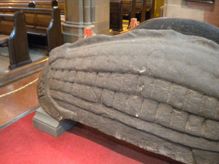
The Govan Stones submitted by joedkins on 19th Jun 2011. Hogback stone in Govan Old Church, Glasgow
(View photo, vote or add a comment)
Log Text: The Govan Stones, Govan Old Church: We only found out about this exhibition/display through a chance email to Glasgow Life, enquiring if St Mungo's Museum of Religious Life and Art next to Glasgow Cathedral had any early Christian stones we could see and photograph. They replied 'no' but told us about The Govan Stones. With only a few days to go before the exhibition closed for the winter on 31st October, we rushed to see it at the first opportunity, and were blown away!
We spent about 2 hours here, wandering around, looking at the stones, hogbacks and the sarcophagus. A guide joined us for part of our visit and put on special lights in which to view the sarcophagus.
I photographed most of the stones, and am still trying to find out more about each one. This exhibition deserves to be much, much wider known than it currently is. It is the best display of early Christian stones that we've seen to date, and I would go again in a heart-beat.
Very, very highly recommended indeed.
Since my visit, I've been in touch with Govan Heritage Trust to find out more information about the stones. They have been immensely helpful and even provided some of the photographs for submission here.
The Gathering Stone
Trip No.83 Entry No.1 Date Added: 24th Jul 2018
Site Type: Standing Stone (Menhir)
Country: Scotland (Stirling)
Visited: Yes on 13th Jul 2018. My rating: Condition 3 Ambience 4 Access 4
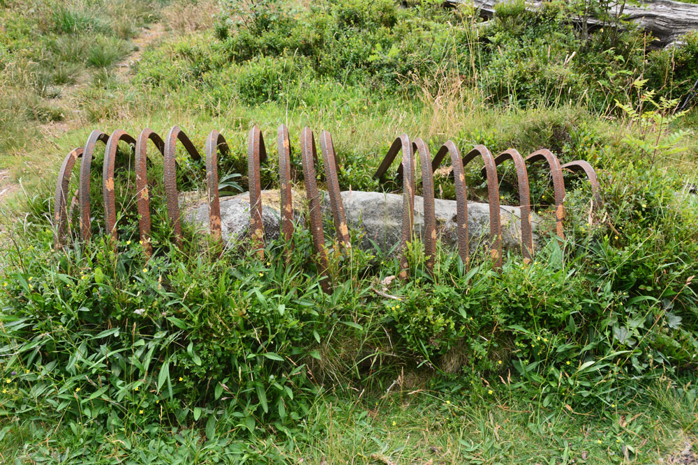
The Gathering Stone submitted by Anne T on 24th Jul 2018. Getting nearer, this is the Gathering Stone, split into at least three pieces. Its iron ribs are reminiscent of old graves being protected from grave robbers, but these metal strips screamed at me "we're stopping this standing stone from becoming upright again".
(View photo, vote or add a comment)
Log Text: The Gathering Stone, Sheriffmuir: From the Sheriffmuir Cairn & Macrae Clan Monument at NN 81569 01934, we followed the footpath to its eastern side, between the main monument and the cairn, following the line of the stone wall, heading in a roughly north westerly direction.
Eventually a path split off to our left, slightly more westwards and this led us to the Gathering Stone – a strange, strange sight, being protected by its ‘iron ribs’. It most definitely looks like a recumbent standing stone, now split into at least three parts.
The ribs are very reminiscent of graves covered to protect them from graverobbers. To me, in this setting, it felt like the iron bars constrained the standing stone from getting up off the ground and becoming upright again.
Continuing slightly further west along the track, you cross some rocks which have been much graffitied. We read that the mounds of earth here are the graves of 600 of the fallen from the Battle of Sheriffmuir.
The Galloway Stone
Trip No.15 Entry No.2 Date Added: 3rd Apr 2017
Site Type: Natural Stone / Erratic / Other Natural Feature
Country: England (Cumbria)
Visited: Yes on 2nd Apr 2017. My rating: Condition 3 Ambience 2 Access 5
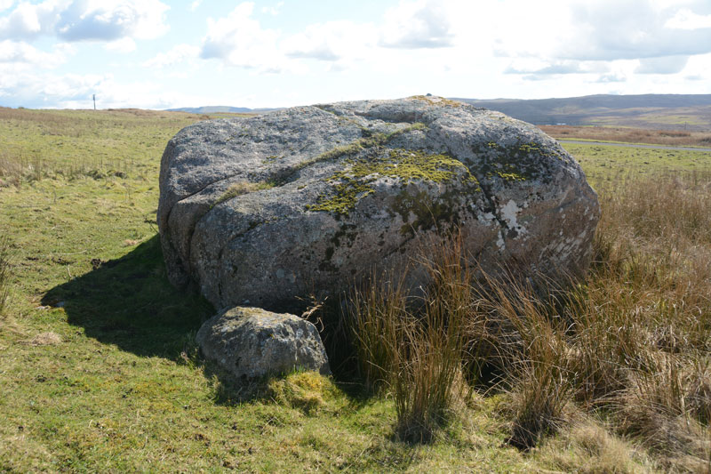
The Galloway Stone submitted by Anne T on 3rd Apr 2017. Looking south east over the Galloway Stone to the hills beyond.
(View photo, vote or add a comment)
Log Text: The Galloway Stone, near Orton, Cumbria: Spotted this named stone on the map as we drove towards Orton to find refreshments. There were many other large (but not quite as large as this) stones in the vicinity. With the M6 Northbound carriageway almost immediately behind, and above, this stone, I could have been forgiven for thinking this was left over from building the motorway.
In close up, the stone is clearly pink Shap granite, and had a red tint in the sunlight. A big surprise was find the bench mark with its large rivet on top of the stone.
The Fawns (Kirkwhelpington)
Trip No.118 Entry No.5 Date Added: 17th Feb 2019
Site Type: Rock Art
Country: England (Northumberland)
Visited: Yes on 14th Feb 2019. My rating: Condition 2 Ambience 4 Access 3
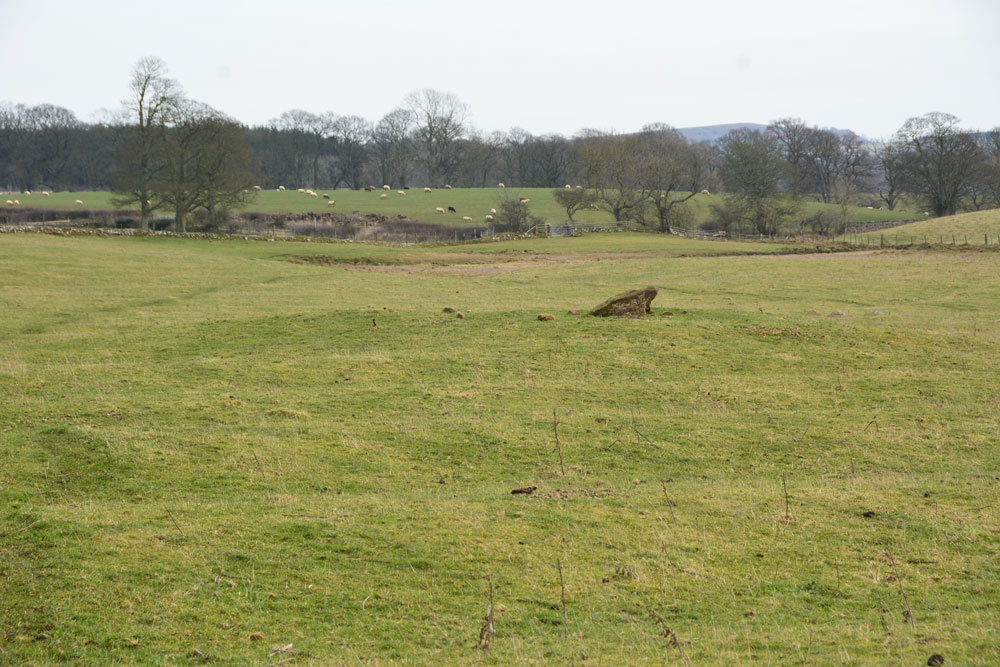
The Fawns (Kirkwhelpington) submitted by Anne T on 17th Feb 2019. First view of the cairn as we made our way south east from the Fawns Moated Manorial Site up the hill. The cairn has been partly damaged by later ploughing, but the rig and furrow seem to respect the centre of the barrow. It is located at the foot of two hillocks which are prominent in the landscape. To the south, the gate out of this field crosses a small stream which needs to be stepped across.
(View photo, vote or add a comment)
Log Text: Cairn SE of The Fawns (220m west of Broom House farm): This cairn is easily visible from the top of the ridge, as we walked from the Fawns Farm/Moated Manorial Earthworks, along the footpath, then down hill. The brown blob of the rubbing post comes into sight first, then the circular mound of the cairn comes into view as you get nearer.
A lovely spot to be buried in - very peaceful and quiet, at the bottom of two hillocks, with a small stream (now) running to the south. The gate from this field onto the footpath back to the village crosses this stream, which needs a long stride to get over it, but it's not very deep.
Wish I'd been able to see the rock art panel and the urns, but a trip to London would be necessary (if the British Museum can find these!).
It is a gentle walk down to the river valley below from here, following ancient dry stone walls now white with lichen. We drove to Kirkharle for a cup of tea and some soup, then visited St Wilfred's Church just along the road, which is where Capability Brown was baptised (he was born in Kirkharle). We stopped to see a very strange monument dedicated to "A Most Unfortunate Man" at the side of the road between the church and Kirkharle Courtyard.
The Elsdon Stone
Trip No.119 Entry No.3 Date Added: 27th Feb 2019
Site Type: Early Christian Sculptured Stone
Country: England (Northumberland)
Visited: Yes on 24th Feb 2019. My rating: Condition 3 Ambience 4 Access 4
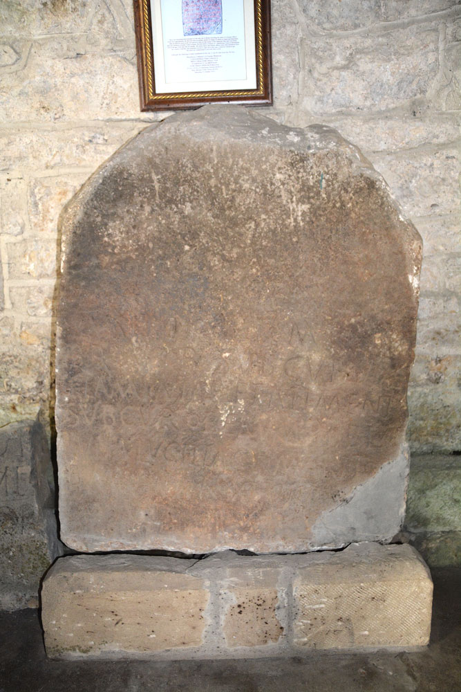
The Elsdon Stone submitted by Anne T on 27th Feb 2019. This is the unique Elsdon Stone, which is sited against the north wall of the nave, opposite the south door into the church. The inscription is barely visible unless the light catches it. There is a notice above with an explanation of the stone with a brief history of the Roman officer, and what remains of the legible inscription, in Latin.
(View photo, vote or add a comment)
Log Text: St Cuthberts, Elsdon (The Elsdon Stone): We stopped off at the very friendly and informal tea shop for tea (one tea bag in a pot for 2) and an ‘omelette sandwich’ (was supposed to be fried egg, and it took me a while to recover from the taste). We’ve been to the church before, but not with the HE and Pastscape information with us.
Spotted the unique Roman soldier’s tombstone (it lists his entire military career), the medieval cross slabs and the horse skulls. We thought we’d seen everything in this church on a previous visit on 25th August 2013, but indeed missed a great deal. Whilst I photographed most of what we took in today, at the time I wasn’t so interested in the medieval grave slabs and the Elsdon Stone (after all, it was only Roman, wasn’t it?!). I really wished I’d thought to take Peter Ryder’s articles on the medieval grave slabs, but until we got to the village, had no real thought of going back to the church.
I was really saddened to see how much the inside of the church has deteriorated since our visit four and a half years ago. There is so much black mould and dust around, especially towards the western end of the church.
I also hadn’t realised how complicated the stone work around the junction of the nave and the transept was – all small spaces and intricate junctions.
I could have spent all afternoon the churchyard photographing all the amazing grave markers.
The Dragon Stone
Date Added: 12th Oct 2014
Site Type: Early Christian Sculptured Stone
Country: England (Yorkshire (North))
Visited: Yes on 10th Oct 2014. My rating: Condition 3 Access 5

The Dragon Stone, Levisham submitted by Sunny100 on 1st Jun 2010. The Dragon Stone at Levisham, N.Yorkshire, at SE.832907.
(View photo, vote or add a comment)
Log Text: The Dragon Stone, St John The Baptist, Levisham: The last time I was in Levisham was on a sunny but extremely cold January morning, when our department went on a ‘team building exercise’ – 7½ miles on a circular walk followed by lunch at The Horseshoe Inn. We stopped half way round the walk for a break and our guide told us we were sitting next to some ancient land boundaries but wasn’t knowledgeable to tell us what to look for, and no-one at the time was sufficiently interested to ask, as we had an hour to race back to The Horseshoe Inn for our pre-booked lunch. Shame.
Having stopped of in Kirkdale and Middleton on our way over to Levisham we had planned to stop off in Pickering for lunch, but arrived at the start of a ‘war re-enactment weekend’; almost everyone was in 1940s clothing or uniform – hundreds and hundreds of people. We felt out of place, and there was certainly no-where to park so we went into Malton.
Driving back to Levisham through Lockton, I recognised the scenery, but had no memory of the steep climb up to the village. Levisham is such a tiny village, built along both sides of a wide street. On my last visit, I hadn’t even noticed the tiny chapel tucked away at the road junction near the pub. This time, the whole of the street was lined with ‘no parking’ cones and large notices saying ‘no parking for the war time event’ (even though Levisham station was a good mile and a half away).
St John The Baptist is left open during the day (it has a 'church open' notice next to the door). It looked and felt very much like a Methodist church. The Dragon Stone is tucked right up against the north wall of the church, wedged between the pulpit and a storage heater at its east end and a pew at the west end. During our visit, there was a large stand of flowers over the stone, which we carefully had to slide out of shot (but only just as it was so heavy) and replace before we left.
There is a laminated sheet with a description of the stone on the window-ledge above it: “The Levisham Dragon Stone: This grave slab is decorated in the Viking Age style known as Mammen, which suggests a dating of the late 10th or early 11th century. The writhing beast carved onit is clearly derived from Norse pagan legends. But is it a dragon or a serpent – possibly Migarösorms (The World Serpent) – or something idiosyncratic? One theory is that it is a dedication to someone called Ormr, signifying ‘worm’ or ‘serpent’, a common name among the Vikings or their descendents. If so, Ormr, almost certainly a Christian convert, is represented here. The modern surname Hornsby, a derivation of Ormabyr, meaning Orm’s farm or settlement can be traced to this area.
The Dragon Stone was found in the vicinity of the old Levisham parish church of St. Mary, where it must have been lying for over a thousand years. It has been known to archaeologists since at least 1927, when it figures in a book by W.G. Collingwood. At some point it was brought up to the village to be housed in the present church. Information supplied by the University of Hull, 2009.”
The Dod
Trip No.29 Entry No.6 Date Added: 31st Jul 2017
Site Type: Ancient Village or Settlement
Country: Scotland (Scottish Borders)
Visited: Yes on 3rd Jun 2017. My rating: Condition 2 Ambience 4 Access 5
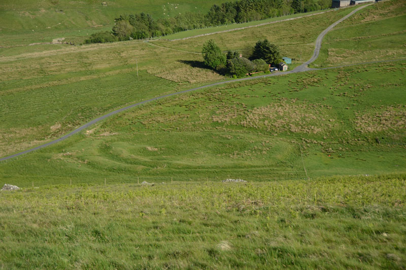
The Dod submitted by Anne T on 5th Jun 2017. The Dod settlement as seen from the slope just to the east of Burgh Hill Stone Circle.
(View photo, vote or add a comment)
Log Text: The Dod, near Bugh Hill Stone Circle and Hillfort: It was amazing what could be seen of this site from the slope just below Burgh Hill Stone Circle. Looking at the plan on Canmore, it is cut in two by the syke by the farm to it's south, but what remains, looking at the settlement from the road, are deep ditches and reasonably high banks.
The area is boggy, but the settlement can be reached by entering the field at its north-eastern end, walking westwards along the fence line next to the gate, then cutting across the field at the far end. For those not keen on boggy ground, a lot can be seen from the road.
Thankfully (after Burgh Hill Hillfort) The Dod was not windy! The sun was very strong at the time of our arrival here, and I struggled to avoid flare even using a polaroid and UV filters together. Was really pleased to have seen this site, but with so many other settlements and hill forts in the area, how to fit them all in? We decided to call it a day, calling in at Midshiels Standing Stone and Cairn on the way back home.
The Cockpit
Date Added: 1st Jul 2014
Site Type: Stone Circle
Country: England (Cumbria)
Visited: Yes on 28th Jun 2014. My rating: Condition 3 Ambience 4 Access 3
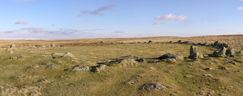
The Cockpit submitted by LivingRocks on 18th Mar 2005. A panoramic view of the Cockpit Stone Circle which according to Magicmap ‘includes a circular kerbed stone bank 2.8m -11.2m wide and up to 0.5m high which encloses an area approximately 27m in diameter. There are 27 (?) standing and recumbent stones set largely into the internal face of this bank, thereby creating the stone circle. The tallest standing stone measures about 0.95m high and some of the recumbent stones are up to 1.9m in length. Within the eastern side of the stone circle, abuttin...
(View photo, vote or add a comment)
Log Text: Almost at the course of High Street Roman Road, there is a view of Ullswater from the footpath just below the Cock Pit Stone Circle.
As the circle is on a good footpath, most of the people stopped at the circle. It's always nice to see people appreciate ancient sites, but I had to wait quite a while to get take photographs without anyone else in it! We found a couple of the outlying stones, and identified a couple of cairns nearby, but couldn't get good enough photographs to make these out properly.
By standing just below the circle, on the main footpath, it's possible to make out the bank.
Well worth a visit, and the view of Ullswater and Pooley Bridge below was worth the easy walk.
The Chesters
Trip No.52 Entry No.8 Date Added: 10th Oct 2017
Site Type: Hillfort
Country: Scotland (East Lothian)
Visited: Yes on 27th Sep 2017. My rating: Condition 3 Ambience 4 Access 4

The Chesters submitted by uisdean on 1st May 2008. Southerly ramparts of The Chesters. The hill overlooking the fort can be seen rising to the left of the picture.
(View photo, vote or add a comment)
Log Text: The Chesters Hillfort, East Lothian: Most places we drove past today had signposts to The Chesters, so reluctant to go back to the house before dark, we decided to stop off and look at this hillfort, which I thought must have been visited by many other Portal users/members, but only uisdean has submitted photographs – I was very surprised.
There is a small car park near Dalvreck Farm House, with a signposted walk through (at this time of the evening) a dark wood. This opens out into a meadow, which has tall wire fences all around it, “to prevent rabbit damage”, and to my horror, a very tall stile leading over another fence into the fort itself.
Actually, this stile was one of the easiest I’ve ever used to get over, as it had supports at the top to let me stand upright and feel balanced and secure, before clambering down the other side.
This is certainly a complex site. I was fascinated by a large boulder to the east of the site, and there is also an unknown part of the meadow to the north.
We tramped around, enjoying the quiet and the complexity of the site, until dusk fell really heavily and we decided it was time to go back and have something to eat.
