<< Our Photo Pages >> The Kettles (Wooler) - Hillfort in England in Northumberland
Submitted by Anne T on Monday, 31 July 2017 Page Views: 2818
Iron Age and Later PrehistorySite Name: The Kettles (Wooler) Alternative Name: Maiden Castle (Wooler); Cauterdale; Greenside Camp (Wooler); Kenterdale Hill (Wooler)Country: England County: Northumberland Type: Hillfort
Nearest Town: Wooler
Map Ref: NT98472730
Latitude: 55.539416N Longitude: 2.025801W
Condition:
| 5 | Perfect |
| 4 | Almost Perfect |
| 3 | Reasonable but with some damage |
| 2 | Ruined but still recognisable as an ancient site |
| 1 | Pretty much destroyed, possibly visible as crop marks |
| 0 | No data. |
| -1 | Completely destroyed |
| 5 | Superb |
| 4 | Good |
| 3 | Ordinary |
| 2 | Not Good |
| 1 | Awful |
| 0 | No data. |
| 5 | Can be driven to, probably with disabled access |
| 4 | Short walk on a footpath |
| 3 | Requiring a bit more of a walk |
| 2 | A long walk |
| 1 | In the middle of nowhere, a nightmare to find |
| 0 | No data. |
| 5 | co-ordinates taken by GPS or official recorded co-ordinates |
| 4 | co-ordinates scaled from a detailed map |
| 3 | co-ordinates scaled from a bad map |
| 2 | co-ordinates of the nearest village |
| 1 | co-ordinates of the nearest town |
| 0 | no data |
Internal Links:
External Links:
I have visited· I would like to visit
Anne T visited on 30th Jul 2017 - their rating: Cond: 3 Amb: 5 Access: 4 The Kettles Hillfort, Wooler: From Green Castle, we continued along the track leading first south west up the small hill, then turns south east along the top of the promontory. Our GPS told me there was just over 511 metres to walk from the small parking area to the grid reference given by Pastscape, but it seemed a lot less than this.
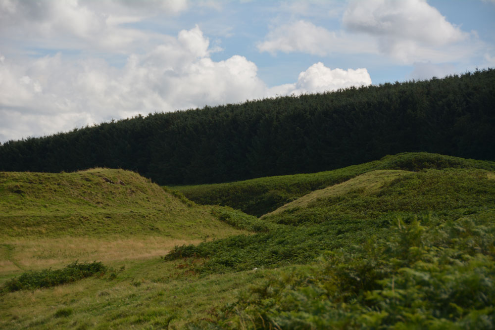
The paths are well kept, as on the Breamish Valley trails, with low, mown grass which is soft underfoot and easy to walk. As we walked along the promontory, the northern section of ramparts came into view. As we got closer, it became obvious how large these were.
Paths lead up into round the exterior edges of the hillfort. There are bracken and scree covered valleys on either side. The first thing we came across were some strange concrete blocks and what looked like the tiled remains of an old toilet at approx. NT 98398 27352, but then there are the recorded remains of pillboxes in this area, so must have been used for military training during the last war.
As we walked along, we crossed three distinct banks which had been cut by the paths, which are the three ramparts (in places four) that cut the fort into two. Walking past the fourth rampart, it felt as it had on Little Hill in the Scottish Borders, as if I was on the prow of a ship looking down across the land below. Crossing to the eastern side of the fort, at this point, we were almost directly above Maiden Well and the King’s Chair. To reach these, we would have need climbing equipment to abseil down, so we walked back to the car and drove round to the path leading to The Pin Well.
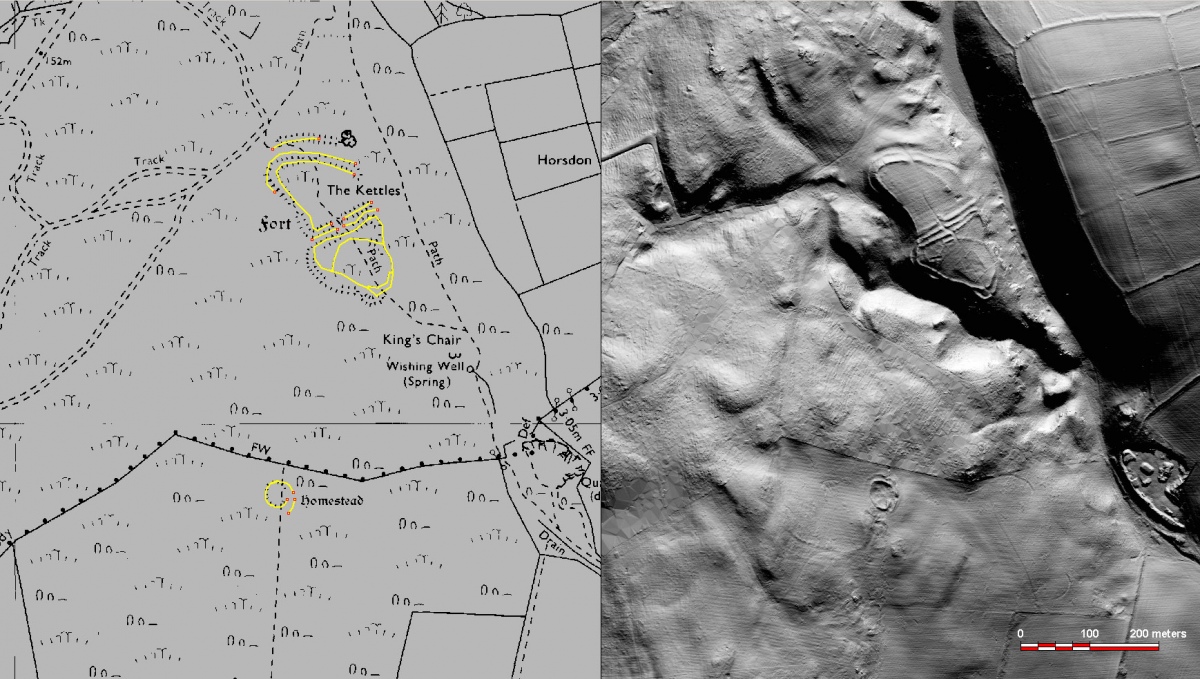
Looking at the aerial images on UK Grid Reference Finder, the outline of the fort is clearly visible.

This hillfort, known as The Kettles, Maiden Castle, Greenside Camp, Kenterdale Hill or Cauterdale, encloses around 4.5 acres, is an Iron Age fort taking advantage of a natural promontory on the eastern slope of Kenterdale Hill, which lies not quite 1 mile west of Wooler. It was later adapted as a Romano-British enclosed settlement. It is recorded as both Pastscape Monument No. 2671 and Historic England ID 1006530.
The Historic England entry says the hillfort: "has steep natural slopes to the south, east and north east with more gradual slopes in other directions. The enclosure is irregularly-shaped, reflecting the local topography, and is separated into two parts by triple ramparts which run perpendicular to its long north west to south east axis and have an entrance in their centre allowing access between the two parts. The north west portion of the enclosure measures approximately 108m by 100m and the south east portion is roughly 70m by 88m. The enclosure is surrounded by earthworks, which comprise a single rampart in areas where the slope is naturally steep. To the north, where the approach is easier, the rampart is strengthened by a single-scarped bank and an additional outer rampart. There is a small annexe at the south west tip of the monument with a main entrance on the north side. The interior of the south east portion of the enclosure is divided by low earthworks. The complex form of the earthwork is understood to partially be the result of later Romano-British reoccupation and elaboration."
Pastscape adds: "the ground, which forms a promontory, (is) cut off at the isthmus by three, and in a part by four, ramparts. These are formed of earth and stones where the defences of the cliff are not sufficient. The south-east end of the promontory is defended by an additional rampart across the part where the slope is least; and at this spot is a narrow opening in the ramparts which led down to the seat-like rock called the King's Chair, and to the spring below, called the Kettle, or Cattle Well."
The complex layout of the site can be clearly seen either using UK Grid Reference Finder or Google Earth.
You may be viewing yesterday's version of this page. To see the most up to date information please register for a free account.


Do not use the above information on other web sites or publications without permission of the contributor.
Click here to see more info for this site
Nearby sites
Key: Red: member's photo, Blue: 3rd party photo, Yellow: other image, Green: no photo - please go there and take one, Grey: site destroyed
Download sites to:
KML (Google Earth)
GPX (GPS waypoints)
CSV (Garmin/Navman)
CSV (Excel)
To unlock full downloads you need to sign up as a Contributory Member. Otherwise downloads are limited to 50 sites.
Turn off the page maps and other distractions
Nearby sites listing. In the following links * = Image available
264m SSE 159° Maiden Well (Kettle Hill)* Holy Well or Sacred Spring (NT9856427053)
291m SE 138° Maiden Well (Northumberland) Holy Well or Sacred Spring (NT9866427082)
624m NNW 332° Green Castle Ringwork* Misc. Earthwork (NT9818027853)
653m NNW 334° Green Castle 2 Rock Art (NT9818227887)
901m NW 316° Green Castle 1 Rock Art (NT9784227949)
1.1km N 1° Highburn House 1 Rock Art (NT9849128424)
1.2km NE 46° Wooler Cottage Wall Rock Art (NT993281)
1.4km NNE 20° Tankerville Arms Hotel Cist* Cist (NT9894328604)
1.4km NNE 22° Tankerville Arms Cist* Cist (NT990286)
2.0km WNW 298° Humbleton Hill* Hillfort (NT9670628252)
2.1km SW 232° Hart Heugh* Stone Circle (NT968260)
2.5km E 99° Coldmartin Tower Rock Art (NU0090026910)
2.5km ENE 78° Coldmartin 3 Rock Art (NU0095827816)
2.6km ENE 78° Coldmartin 2* Rock Art (NU0097627830)
2.6km ENE 73° Coldmartin 4* Rock Art (NU0100628049)
2.7km ENE 74° Coldmartin 1* Rock Art (NU0103428019)
2.7km NW 323° Bendor Stone* Standing Stone (Menhir) (NT9681929460)
2.7km SSW 208° Carey Burn (Harthope Valley)* Ancient Village or Settlement (NT97172491)
2.8km NE 38° Weetwood Bridge Portable Rock Art (NU0018029500)
3.0km ENE 70° Weetwood Moor North ab, ad & ae Rock Art (NU0130028300)
3.0km ENE 79° Whitsunbank 1b* Rock Art (NU0143827898)
3.0km ENE 78° Whitsunbank 1a* Rock Art (NU0143827909)
3.0km ENE 70° Weetwood Moor North B* Rock Art (NU0132028328)
3.0km ENE 70° Weetwood Moor North C Rock Art (NU0132628329)
3.0km ENE 70° Weetwood Moor North aa Rock Art (NU0132628334)
View more nearby sites and additional images


 We would like to know more about this location. Please feel free to add a brief description and any relevant information in your own language.
 Wir möchten mehr über diese Stätte erfahren. Bitte zögern Sie nicht, eine kurze Beschreibung und relevante Informationen in Deutsch hinzuzufügen.
 Nous aimerions en savoir encore un peu sur les lieux. S'il vous plaît n'hesitez pas à ajouter une courte description et tous les renseignements pertinents dans votre propre langue.
 Quisieramos informarnos un poco más de las lugares. No dude en añadir una breve descripción y otros datos relevantes en su propio idioma.