Contributory members are able to log private notes and comments about each site
Sites Anne T has logged. View this log as a table or view the most recent logs from everyone
Four Stones Hill Standing Stones
Trip No.15 Entry No.3 Date Added: 3rd Apr 2017
Site Type: Standing Stones
Country: England (Cumbria)
Visited: Couldn't find on 2nd Apr 2017. My rating: Access 3
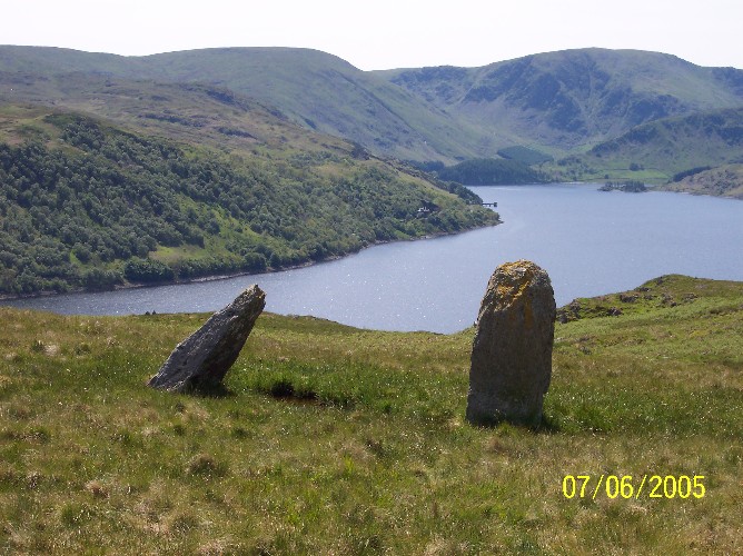
Four Stones Hill Standing Stones submitted by donstobbart on 11th Jun 2005. I have to agree with Nicoladidsbury that I did not feel any ambience when I visited this site. But I did get a great view of the lake!
(View photo, vote or add a comment)
Log Text: Four Stones Hill, Haweswater: Ashamed to say I was defeated by the large stiles with big drops and missing steps. Was so looking forward to going to see this site and from Google Earth, it seemed possible for me to walk this route. Did look for gates in the fields to avoid the stiles, but up by Lower Drybarrows, couldn't find any entry/exits; the one there was said very clearly "no public right of way". Perhaps I should have ignored those and tramped through the fields anyway, but it would have left me feeling guilty. Will try again. Note to self: parking was very difficult up by Winder Hill. Needed to wedge the car in besides a stone wall to leave ready access to the fields.
Bell Mount
Trip No.14 Entry No.1 Date Added: 3rd Apr 2017
Site Type: Natural Stone / Erratic / Other Natural Feature
Country: England (Cumbria)
Visited: Yes on 25th Mar 2017. My rating: Condition 2 Ambience 3 Access 5
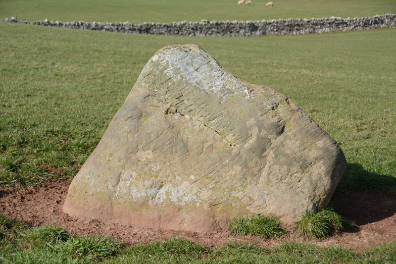
Bell Mount submitted by Anne T on 3rd Apr 2017. This stone sits almost on the brow of the hill. There are striations on its surface (plough or glacial?) indicating it has lain prone at some point in its history. There is slight evidence it is set within a depression.
(View photo, vote or add a comment)
Log Text: Bell Mount Erratic (or standing stone?): Saw this very briefly on our first visit to Newbeggin, but whizzed by in the car and didn't stop. This time, we parked by the open gate to the field. There being no stock, we took the chance to walk up the grassy slope to see this stone. Whilst it's not marked on the OS map (neither is the Sewborwens stone not far away), it showed distinct striations on one of the surfaces indicating it had lain prone at some point and been stood up. My geology isn't good enough to tell it the marks were as a result of glaciation or the plough, although the stone seemed to be set into a slight depression which was even all round, and didn't look like stock had been rubbing around it. Note to self: need to check geology of the area.
Pocklington's Druid Stone
Trip No.155 Entry No.3 Date Added: 15th Jan 2020
Site Type: Modern Stone Circle etc
Country: England (Cumbria)
Visited: Yes on 12th Jan 2020. My rating: Condition 4 Ambience 4 Access 4
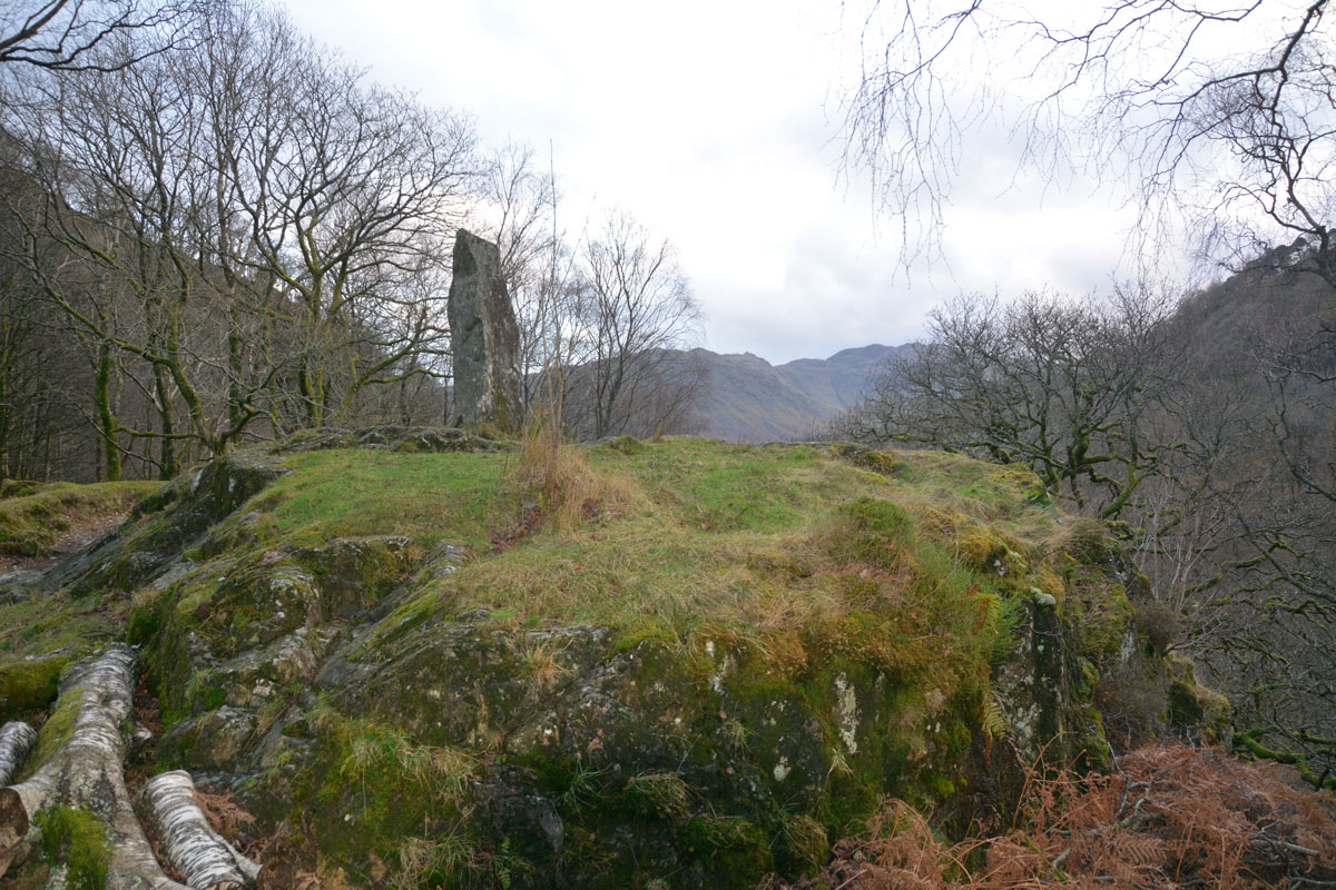
Pocklington's Druid Stone submitted by Anne T on 15th Jan 2020. Pocklington's Druid Stone, a relatively modern megalith, having been erected here in around 1778, stands on top of a rocky outcrop just to the south of the Bowder Stone. This view looks south, with the B5289 and the River Derwent below.
(View photo, vote or add a comment)
Log Text: Pockington's Druid Stone at the Bowder Stone: A short distance from the Bowder Stone, almost hidden from sight by a small cottage, this 'modern' monolith stands on top of a rocky outcrop high above the road below. At first, I thought it might be a memorial, as there appeared to be writing on the stone. Getting closer, the 'writing' was just striations on the stone.
Moor Divock Cairn
Date Added: 18th May 2022
Site Type: Cairn
Country: England (Cumbria)
Visited: Yes on 14th May 2022. My rating: Condition 2 Ambience 3 Access 4
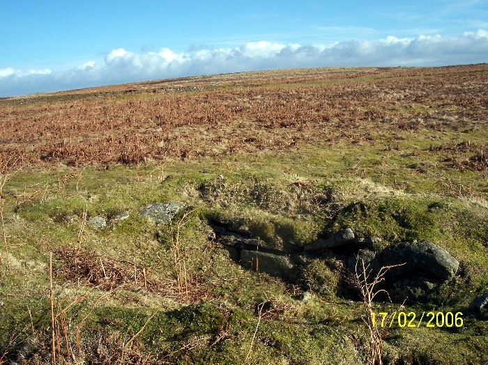
Moor Divock Cairn submitted by donstobbart on 24th Jul 2006. Along the side of the cairn, with a good view of the straight edge that can be seen in the interior of the carn.
(View photo, vote or add a comment)
Log Text: Moor Divock Cairn - Query: We, too, found this feature, just to the right hand side of the main bridleway/footpath leading towards White Raise Cairn. I photographed it, just in case it was documented on what used to be Pastscape, or Historic England. Some 70m to the north west of Moor Divock 3/Askham Fell Cairn and Stone Row, we debated long and hard as to whether this is part of an old quarry, a shooting butt, or part of a robbed cairn (we know Canon Greenwell carried out extensive excavations around here in the 1880s).
Hallrigg Standing Stone
Trip No.175 Entry No.1 Date Added: 28th May 2022
Site Type: Standing Stone (Menhir)
Country: England (Cumbria)
Visited: Saw from a distance on 28th May 2022. My rating: Condition 3 Ambience 3 Access 1
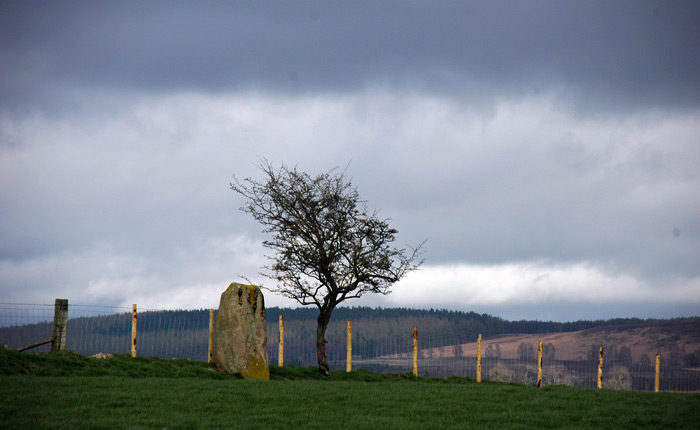
Hallrigg Standing Stone submitted by nicoladidsbury on 9th Apr 2007. Hallrigg Standing Stone - rediscovered standing stone, 2 miles north of Lowhouse Standing Stone, 5 miles north of Penrith. It appears to be red sandstone, approx 1.5m tall
(View photo, vote or add a comment)
Log Text: Hallrigg Standing Stone, Plumpton: The nearest we could get was the very back (staff only area) of the Pot Place Car Park, and we asked permission to take this photograph from the member of staff working in this area.
We did try numerous other ways to get closer to the standing stone, but couldn't even find a track and/or gate to walk across the fields, or who to ask permission off.
Photo taken with a tripod and 50-300mm zoom lens at maximum zoom, but even this didn't give an excellent photo, given the haze in the atmosphere.
Hyssop Holme Well (Carlisle)
Trip No.176 Entry No.1 Date Added: 6th Jun 2022
Site Type: Holy Well or Sacred Spring
Country: England (Cumbria)
Visited: Yes on 4th Jun 2022. My rating: Condition 4 Ambience 3 Access 4
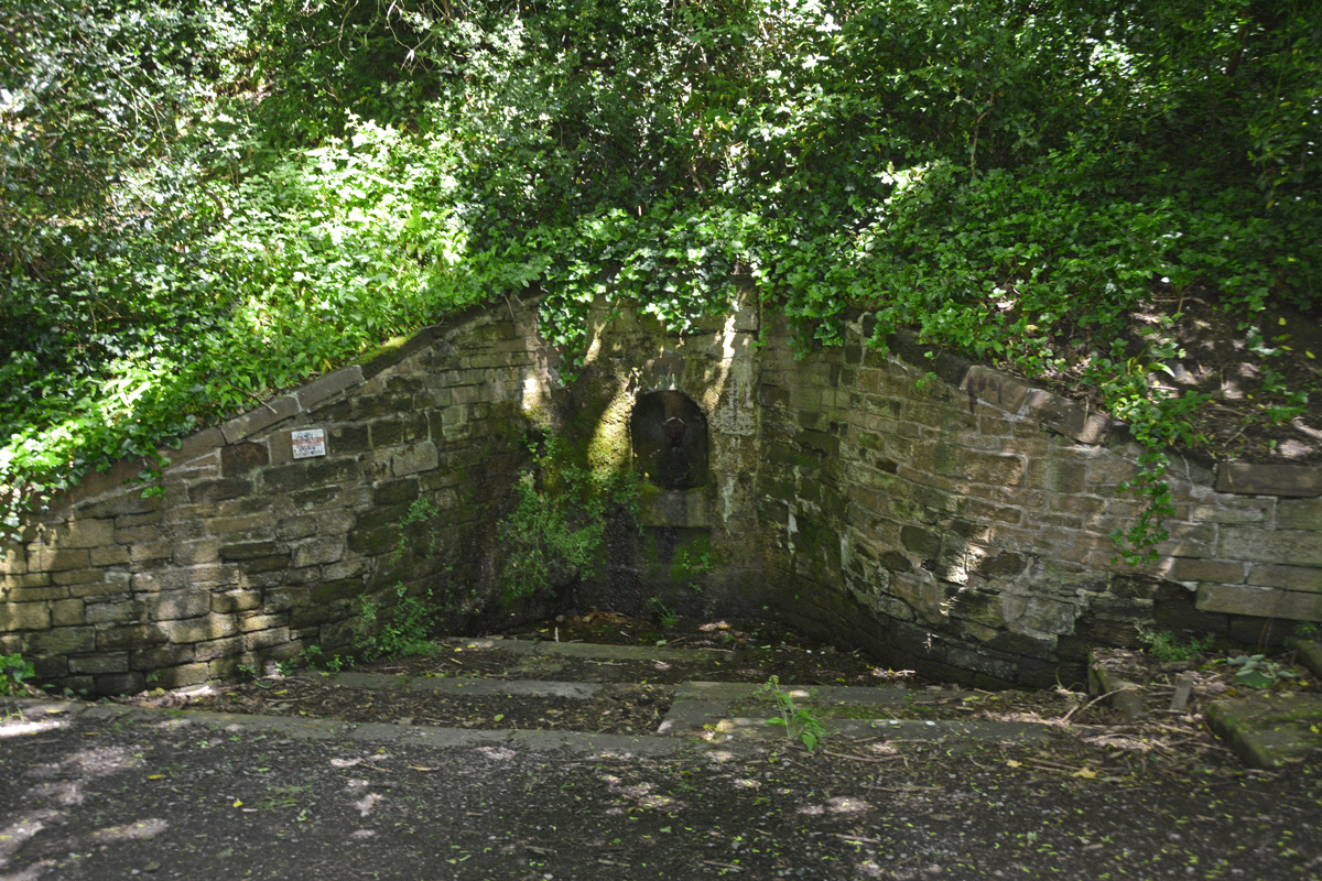
Hyssop Holme Well (Carlisle) submitted by Anne T on 5th Jun 2022. The well was in deep shade at the time of our visit. A slow, steady trickle of water emerged from the pipe at the back of the well, trickling down the moss into the small well basin, then out to modern drains to a small pond/water feature.
(View photo, vote or add a comment)
Log Text: Hyssop Holme Well (Carlisle): A very pleasant, short walk down slope to this well house, the sound of wood on willow from the nearby Cricket Ground accompanying our steps. Am trying to trace the Antiquarian history books which mention this site, as I'm trying to ascertain if the well predates the 1817 date on the keystone, and why the water was regarded as a spa in days gone by, and what properties the water had.
Finglandrigg Spa Well (Chalybeate)
Trip No.176 Entry No.2 Date Added: 6th Jun 2022
Site Type: Holy Well or Sacred Spring
Country: England (Cumbria)
Visited: Yes on 4th Jun 2022. My rating: Condition 2 Ambience 3 Access 3
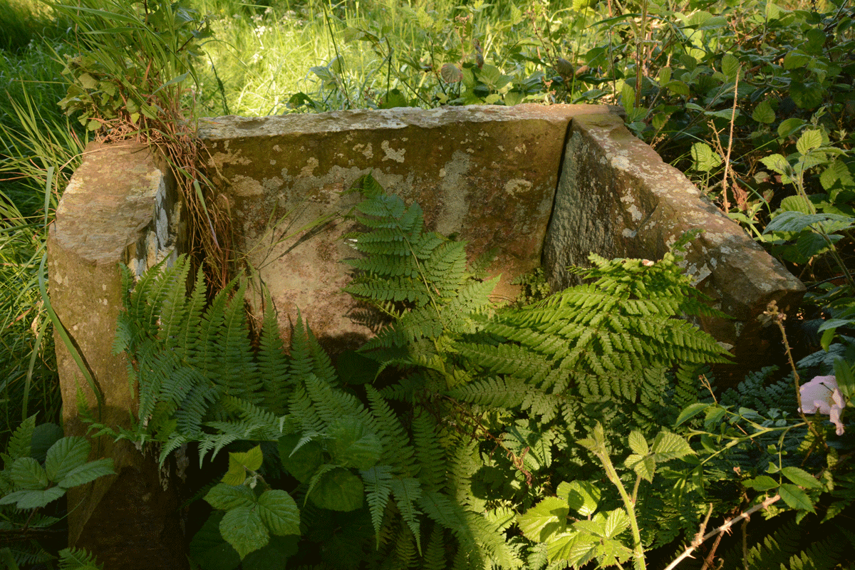
Finglandrigg Spa Well (Chalybeate) submitted by Anne T on 5th Jun 2022. There's nothing left of the information board shown on old photographs of this well. See Heritage and History for photographs taken in 2009.
(View photo, vote or add a comment)
Log Text: Finglandrigg Spa Well: A very pleasant walk through this nature reserve, although the well is not where the published map says it is. In the end, we walked round and round, then tried to find a spot with a phone signal so we could find a rough grid reference, which we acquired from the Old Cumbria Gazetteer. Some 50m from the published path, down a grassy 'lane'. Ruined, but ticked this one off the list. Am trying to trace what properties this water had, and added the nearby Toddel Well to my list of places to visit in the near future.
The Kendal Cross
Trip No.178 Entry No.1 Date Added: 21st Jun 2022
Site Type: Ancient Cross
Country: England (Cumbria)
Visited: Yes on 21st Jun 2022. My rating: Condition 3 Ambience 3 Access 4
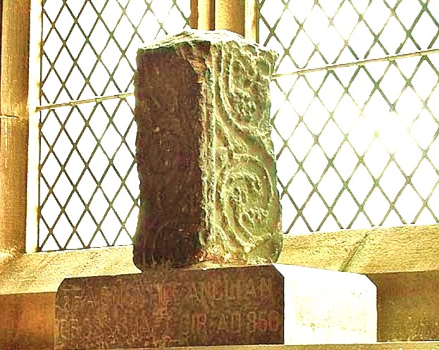
The Kendal Cross submitted by Sunny100 on 30th May 2010. The Kendal Cross, Cumbria, at SD.517922.
(View photo, vote or add a comment)
Log Text: The Kendal Cross: located on a window sill in the Lady Chapel (east end of south aisle) in the Parish Church of Kendal, Holy Trinity.
The fragment was sited in strong sunlight at the time of our visit, so difficult to photograph.
Such a huge church, apparently the widest in Cumbria, and also the oldest in Kendal, with the site older than the building, as 'evidenced by the 8th/9th century cross shaft'.
A replica of the cross sits outside the western end of the church, on the green between the western entrance gates and the church.
St Peter's Church (Heversham)
Trip No.178 Entry No.3 Date Added: 22nd Jun 2022
Site Type: Ancient Cross
Country: England (Cumbria)
Visited: Yes on 21st Jun 2022. My rating: Condition 3 Ambience 3 Access 4
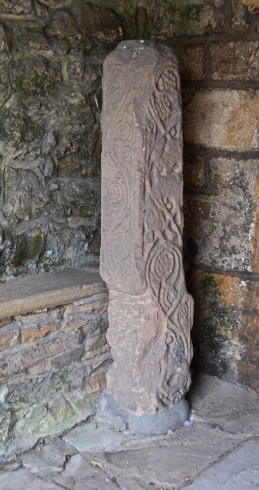
St Peter's Church (Heversham) submitted by Anne T on 22nd Jun 2022. Heversham 01, located in the south porch, near the south door. Dating to the late eighth century. The church guide says that the war memorial in the churchyard is probably a replica of what this cross would originally have looked like.
(View photo, vote or add a comment)
Log Text: St Peter's Church, Heversham: A lovely little village, but so very full of builders with loud radios, which there was no avoiding.
Inside the church was quiet, but a number of other visitors who came and went. We looked at the cross shaft (and the very old south door) in the south porch, and easily found the small fragment in the external wall to the east of the porch, in the south wall.
The church itself was simple and unremarkable, apart from an old wooden pew which was carved with the date 1626, and a huge chest at the east end of the north aisle, which dates from1400.
Anchorite Well (Kendal)
Trip No.178 Entry No.2 Date Added: 22nd Jun 2022
Site Type: Holy Well or Sacred Spring
Country: England (Cumbria)
Visited: Yes on 21st Jun 2022. My rating: Condition 4 Ambience 3 Access 4
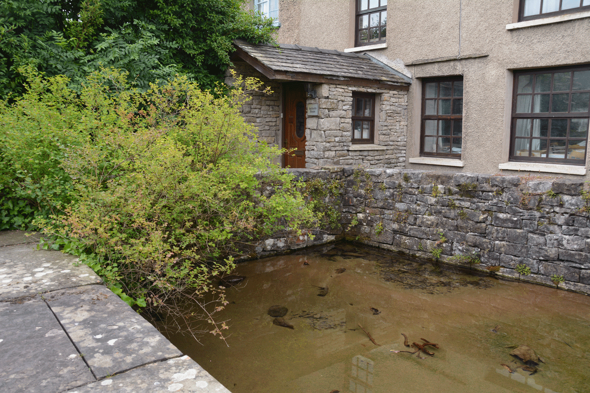
Anchorite Well (Kendal) submitted by Anne T on 22nd Jun 2022. Looking southwards towards Anchorite Cottage. Whilst the cottage looks relatively modern, the style of the windows indicate this structure is older than it looks (but not as old as the original hermitage!).
(View photo, vote or add a comment)
Log Text: Anchorite Well, Kendal: a short-ish walk from Trinity Church (Kendal Parish Church), through a modern housing estate. The roads have some interesting names: Buttery Well Road (couldn't find the well, though), Mint Cake Cottages and Kirkbarrow.
The well was easily spotted as there is a large green metal sign at the entrance to the site.
Beautifully clear water. Would have liked to have been able to walk all the way around the well pool, but the western side path was private access only to the cottages.
Plague Stone (Penrith)
Trip No.180 Entry No.1 Date Added: 10th Jul 2022
Site Type: Ancient Cross
Country: England (Cumbria)
Visited: Yes on 9th Jul 2022. My rating: Condition 3 Ambience 3 Access 4
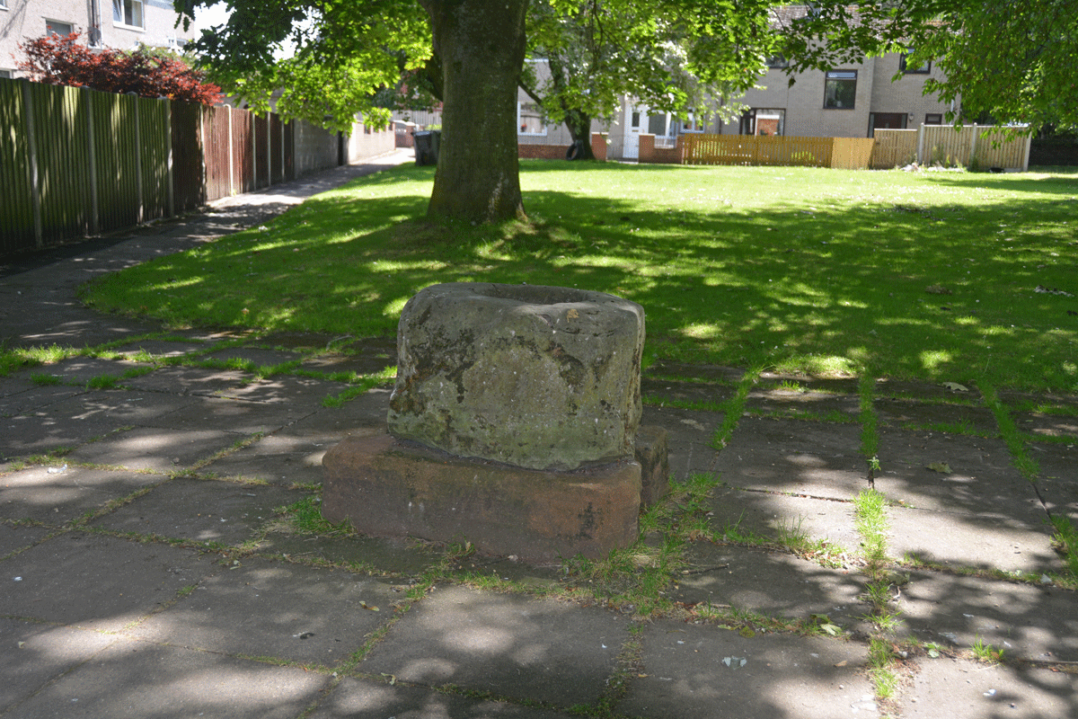
Plague Stone (Penrith) submitted by Anne T on 10th Jul 2022. The cross base/plague stone is sadly being used as a rubbish bin by all the passing walkers.
(View photo, vote or add a comment)
Log Text: Plague Stone/Cross Base, Penrith: We've driven by this site many a time without realising this stone was here. A bit difficult to find somewhere to park, as the stone is near the hospital, community college and fire station, but there is a modern housing estate, so disk parking is available along Tynefield Drive.
The stone was easily found, once we picked it out from amongst the shadows of the surrounding trees.
I wasn't aware of The Great Plague of Cumbria until I researched more about this stone. Definitely a re-purposed cross base. Shame it's being used as a rubbish bin by people who pass by.
Bampton Grange Cross
Trip No.180 Entry No.2 Date Added: 10th Jul 2022
Site Type: Ancient Cross
Country: England (Cumbria)
Visited: Yes on 9th Jul 2022. My rating: Condition 3 Ambience 4 Access 4

Bampton Grange Cross submitted by Anne T on 10th Jul 2022. The cross / boundary marker has some amazing views across the fells.
(View photo, vote or add a comment)
Log Text: Bampton Grange Cross: A glorious day. We'd previously seen this cross in August 2020, when lockdown restrictions had been briefly lifted for a short time, but I didn't post any photographs. That day had been grey and the cemetery busy with people strimming grass around family graves. Today was glorious, and we had the cemetery to ourselves (living people, that is).
This cross has had a hard life, but has spectacular views over the fells.
We finished this visit with a trip to the Bampton Village Store which served teas, toasties and cream teas, and were made very welcome. NY 51505 18200, with a parking area to the side of the store.
Cross Stone of Keverigg
Trip No.180 Entry No.3 Date Added: 11th Jul 2022
Site Type: Ancient Cross
Country: England (Cumbria)
Visited: Couldn't find on 9th Jul 2022
Log Text: Cross Stone of Keverigg: The location of the stone was clearly marked on the Historic England Map search map, but despite my husband clambering (very carefully) over the dry stone wall and stock fence at the eastern end of the access land, he was unable to find the stone. There was considerable growth of grass and weeds in the area, and plenty of moss and lichen on the surrounding stones. He did, however, find the Cross Shaped Stone that MonumentMan has submitted (SID 52464), 23m away.
Cross Shaped Stone of Keverigg
Trip No.180 Entry No.4 Date Added: 11th Jul 2022
Site Type: Ancient Cross
Country: England (Cumbria)
Visited: Yes on 9th Jul 2022. My rating: Condition 3 Ambience 3 Access 3
Cross Shaped Stone of Keverigg submitted by MonumentMan on 13th Oct 2019. 'Cross-Shaped' stone of Keverigg
in Shap Blue granite due south of the 19thC cross carved boulder of the same name which marks the parish boundaries of Shap, Crosby Ravensworth and Sleagill.
(View photo, vote or add a comment)
Log Text: Cross Shaped Stone of Keverigg: We went looking for the boundary stone inscribed with a cross, as marked on the modern OS map, but were unable to find it (grass too high and lots of lichen and moss on surrounding rocks to be able to make out the carved cross).
My impression of this particular stone is that it's the remnants of a quarried stone (or natural), as it lies on/near a long line of limestone pavement.
Roman Bridge Remains (Bitts Park)
Trip No.181 Entry No.1 Date Added: 17th Jul 2022
Site Type: Ancient Trackway
Country: England (Cumbria)
Visited: Yes on 17th Jul 2022. My rating: Condition 2 Ambience 1 Access 4

Roman Bridge Remains (Bitts Park) submitted by Anne T on 17th Jul 2022. The main bulk of the stones from the old Roman Bridge dredged from the River Eden are now displayed between the river and the main avenue through the northern side of Bitts Park. It's not at all obvious what these stones were from, as there was no information board at the time of our visit.
(View photo, vote or add a comment)
Log Text: Roman Bridge Remains, Bitts Park: A lovely park, and a lovely walk. Stones are hidden largely in deep shade between the main avenue running along the northern side of the park and the river. We needed to drop down onto the sandy paths below the avenue, and follow the river along. The four stone 'sculptures' come into view first. The rectangular 'display' of stones is about another 100m further westwards.
St Michael and All Angels (Isel)
Trip No.184 Entry No.2 Date Added: 31st Jul 2022
Site Type: Ancient Cross
Country: England (Cumbria)
Visited: Yes on 24th Jul 2022. My rating: Condition 3 Ambience 4 Access 4
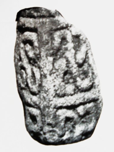
St Michael and All Angels (Isel) submitted by Sunny100 on 30th Apr 2011. The 9th-10th century 'Triskele Stone' in St Michael's church, Iselgate, Cumbria. This three armed Norse carving could well represent The Holy Trinity.
(View photo, vote or add a comment)
Log Text: St Michael and All Angels, Isel/Blindcrake: We had first visited the Grade II listed medieval well in Blindcrake at NY 1486 3482, which has a domed well head very similar to the holy well at Brompton.
This is a very, very pretty location for a church, and the inside did not disappoint. There are two fragments of the same cross shaft displayed immediately opposite as you walk in through the south porch, a couple of fragments built into the walls, and four sun-dials. We went armed with Guy Points's Cumbria Gazetteer, and found all the stones he mentioned.
Priest's Well (Catlowdy)
Trip No.187 Entry No.1 Date Added: 2nd Sep 2022
Site Type: Holy Well or Sacred Spring
Country: England (Cumbria)
Visited: Couldn't find on 30th Aug 2022

Priest's Well (Catlowdy) submitted by Anne T on 2nd Sep 2022. Priest's Well is shown on the 1864 25 inch OS map, see Priest's Well, Catlowdy. Shared under the National Library of Scotland Creative Commons Attribution-Non-Commercial-ShareAlike 4.0 International (CC-BY-NC-SA) licence.
(View photo, vote or add a comment)
Log Text: Priest's Well, Catlowdy: Tried to find, but the footpath appears block by recently constructed areas for horses. Not wanting to disturb these beautiful animals, we gave up on our search, and will try and seek permission to enter from another direction at a future date.
St Anne's Well (Shap)
Date Added: 6th Sep 2022
Site Type: Holy Well or Sacred Spring
Country: England (Cumbria)
Visited: Yes on 12th Jun 2020. My rating: Condition 4 Ambience 4 Access 4
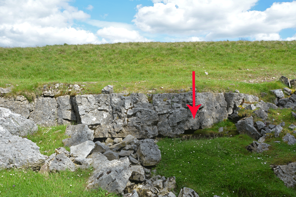
St Anne's Well (Shap) submitted by Anne T on 6th Sep 2022. The water from this well emerges from a small, easily spotted area of limestone pavement, immediately to the east of the small forested area.
(View photo, vote or add a comment)
Log Text: St Anne's Well, Shap: Stopped off for a break on one of very rare essential car journeys during lockdown, when exercise restrictions had been relaxed slightly. A lovely spot, although difficult to park as the long, thin, layby next to the motorway maintenance compound was full with cars of other walkers and dog walkers.
Heading east to walk around the forested areas, the noise of the motorway disappeared, and it was easy to spot the small area of limestone pavement this well is located in.
A very peaceful and lovely spot, although a fair way from any habitation in this era.
Stanger Spa
Date Added: 8th Sep 2022
Site Type: Holy Well or Sacred Spring
Country: England (Cumbria)
Visited: Yes on 14th Jun 2020. My rating: Condition 3 Ambience 4 Access 3

Stanger Spa submitted by DavidRaven on 13th Dec 2005. The roof-less building that houses the Stanger Spa is hidden away in a copse of birch and poplar. The site isn't easy to find, following ill-defined footpaths through pastureland. It's worth the hunt though. A very quiet place, good to spend time there, not doing much.
(View photo, vote or add a comment)
Log Text: Stanger Spa Well, Embleton: The well is approached by a narrow causeway which runs through a boggy area, terminating at the well house. At the time of our visit, the land around the well was very wet, and in places there were deep puddles of water around the edges of the well house.
Whilst there were lots of other walkers in the area, I didn't see anyone else look at the well house.
An interesting spot and well worth visiting.
St Ninian's Preconquest Monastery (Ninekirks)
Trip No.188 Entry No.2 Date Added: 18th Sep 2022
Site Type: Ancient Village or Settlement
Country: England (Cumbria)
Visited: Yes on 13th Sep 2022. My rating: Condition 1 Ambience 4 Access 3
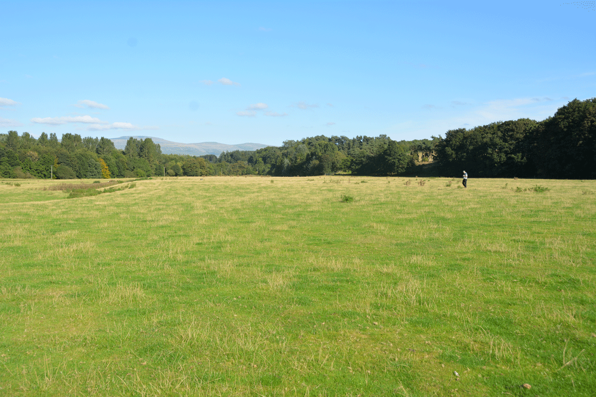
St Ninian's Preconquest Monastery (Ninekirks) submitted by Anne T on 18th Sep 2022. Husband, Andrew, stands at the grid reference given by Historic England for this site. Only a few very low 'lumps and bumps' visible in the landscape, but after a prolonged dry period, some lighter areas of grass may have identified the vague outline of foundations of buildings. Certainly some harder areas of ground (felt by our feet) seemed to run in straight lines, and could indicate stone foundations under the turf.
(View photo, vote or add a comment)
Log Text: St Ninian's Pre-Conquest Monastic Site: See visit report for St Ninian's Church (Ninekirks) for now. More details to follow.
