Contributory members are able to log private notes and comments about each site
Sites Anne T has logged. View this log as a table or view the most recent logs from everyone
Grasmere Cup-Marked Rocks
Date Added: 20th Jun 2014
Site Type: Rock Art
Country: England (Cumbria)
Visited: Yes on 2nd Jun 2014
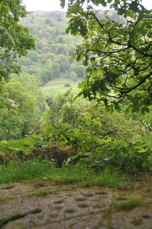
Grasmere Cup-Marked Rocks submitted by Anne T on 2nd Jun 2014. We made an impromptu visit to Grasmere yesterday (1st June) and as the café we were in had WiFi, I checked the Portal, and found the images taken by DrewParsons of the Cup-Marked Rocks at the entrance to the car park we were parked in. Thank you - this was an unexpected treat. This image shows the context of the rock outcrop, overlooking the river Rothay and (I think) Rydal Fell in the background. A beautiful spot.
(View photo, vote or add a comment)
Log Text: None
Sidwood Iron Age Settlement
Date Added: 20th Jun 2014
Site Type: Ancient Village or Settlement
Country: England (Northumberland)
Visited: Yes on 11th Jun 2014
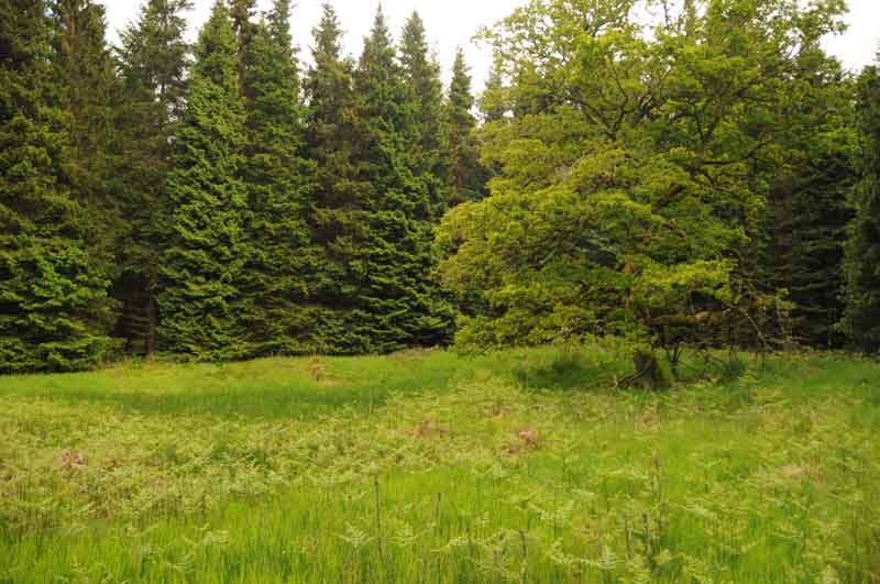
Sidwood Iron Age Settlement submitted by Anne T on 11th Jun 2014. This was our first view of the settlement, on the left hand side of the footpath from Tarset Burn. The site is in a forest clearing, demarked by an old tree which stands on its own.
The foundations of two hut circles are clearly visible through the grass and bracken, and the entrance (to the left hand middle of the photograph) and sunken yard are clearly identifiable.
(View photo, vote or add a comment)
Log Text: None
Warrior Stone (Ingoe)
Date Added: 16th Jun 2014
Site Type: Standing Stone (Menhir)
Country: England (Northumberland)
Visited: Yes on 15th Jun 2014. My rating: Condition 3 Ambience 4 Access 4
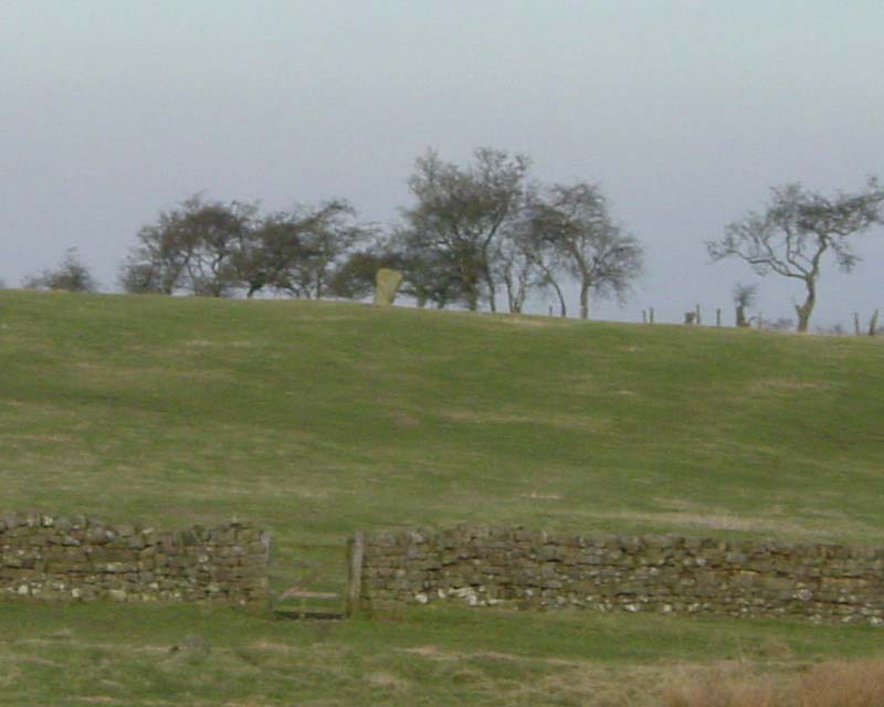
Warrior Stone (Ingoe) submitted by PaulH on 3rd Mar 2003. Northumberland
NZ044747
No public access to the stone itself
(View photo, vote or add a comment)
Log Text: We've visited Inghoe before, but to look at the remains of the medieval village and also the hut circles just beyond Sandyway Heads Farm.
Having just visited the Matfen Standing Stone, and having tried to visit the Bygate Hill site (which is a private plantation with a telecommunications mast and permission is needed to access the site), it was only a few more miles to the Warrior Stone. We parked just past the 'village green' (with a bus stop) and walked along the farm track. We were last here about 5 years ago, and the friendly farmer came out to tell us about the homestead in the field beyond the farm, showed us the cup and ring stone and quern stone by the gate to his cottage, and gave us permission to visit the Warrior Stone, which stands alone in a field just before the farm cottage. There was no-one around this time to ask permission, so I felt guilty about walking into his field.
There are beautiful views across the valley towards Matfen and Stamfordham, even though it was drizzly and misty.
A couple of web sites by local antiquarians describe cup marks on the stone, but I wasn't sure if we'd identified the right marks.
Will go back again when we've got blue skies to appreciate the site in all it's glory.
Matfen
Date Added: 16th Jun 2014
Site Type: Standing Stone (Menhir)
Country: England (Northumberland)
Visited: Yes on 15th Jun 2014. My rating: Condition 3 Ambience 3 Access 5
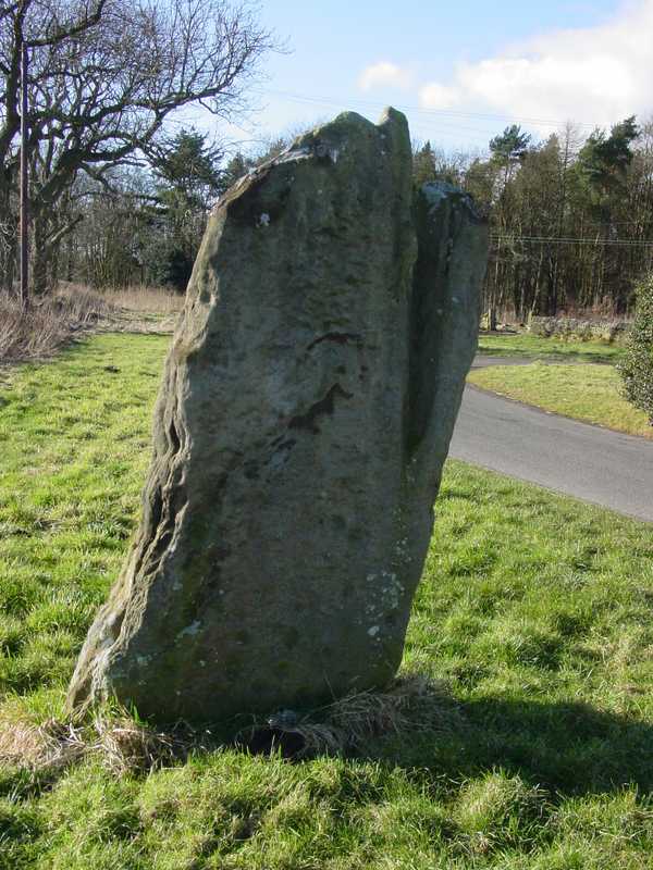
Matfen submitted by PaulH on 2nd Mar 2003. In the village of Matfen. About 2km north of the B6318, the modern road that follows the course of Hadrian's wall.
NZ032705
(View photo, vote or add a comment)
Log Text: This standing stone, near Matfen Hall Hotel/Golf Course, stands on the edge of a road in a hamlet called 'Standing Stone'. It is easy to find, being on a right hand turn just before the main entrance to Matfen Hall Golf Course, and opposite Standing Stone House, about 100 yards from the road junction.
It is difficult to park adjacent to the stone, unless you park in the entrance to the farm/farm buildings, but just opposite the road junction to Standing Stone hamlet, there is another left hand turn with room for a few cars to park at the side of the junction.
The short walk back to the stone was a little difficult, due to the stream of traffic and bicycles moving quickly along the road, but as long as you are careful, it's fine.
There are some impressive cup marks at the base of the north face of the stone, and some more at the top.
Worth seeing, and on the way to The Warrior Stone at Inghoe and Bygate Hill.
Swinburne Stone
Date Added: 15th Jun 2014
Site Type: Standing Stone (Menhir)
Country: England (Northumberland)
Visited: Yes on 13th Jun 2014. My rating: Condition 3 Ambience 4 Access 4
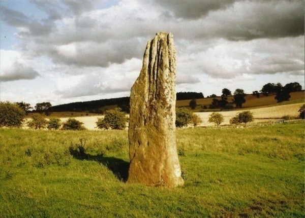
Swinburne Stone submitted by Bladup on 30th Dec 2013. The lovely tall and slender Swinburn Castle standing stone.
(View photo, vote or add a comment)
Log Text: We sought the landowner's permission prior to visiting the stone. We parked outside the Roman Catholic Church at Ox Hills, and walked back to the footpath leading firstly to Swinburne Castle, then splitting off to the left at a large tree to tumuli and the standing stone.
The footpath is easy walking. Almost immediately to the left are some impressive earthworks (possibly related to the original castle?) and some large terraces - much bigger than normal ridge and furrow ploughing. Websites from local historians say these may be medieval strip lynchets.
We first visited the tumuli just before a gate/field boundary crosses the path, before doubling back to the gate which allowed access to the field with the stone (there being sunken stone walls between the footpath and the field boundary, presumably allowing views of the stone from the upper floors of the castle (now private house).
The stone isn't visible from the footpath, but as soon as you top the brow of a small hill, the stone stands below you in the middle of the field.
The stone is impressive, being around 12 feet tall, and if the compass on my phone is correct (it switched 180 degrees several times during my visit) the wider faces are orientated north-north-west/south-south-east.
The southern face of the stone has some easily identifiable cup marks; generally there are quite a few initials carved into the stone.
There are also a couple of other tumuli, which are in private fields, but this is beautiful and peaceful part of the countryside, and we spent a very pleasant afternoon exploring.
Giants Cave Holy Well (Edenhall)
Trip No.188 Entry No.3 Date Added: 15th Sep 2022
Site Type: Holy Well or Sacred Spring
Country: England (Cumbria)
Visited: Saw from a distance on 13th Sep 2022. My rating: Condition 1 Ambience 4 Access 3
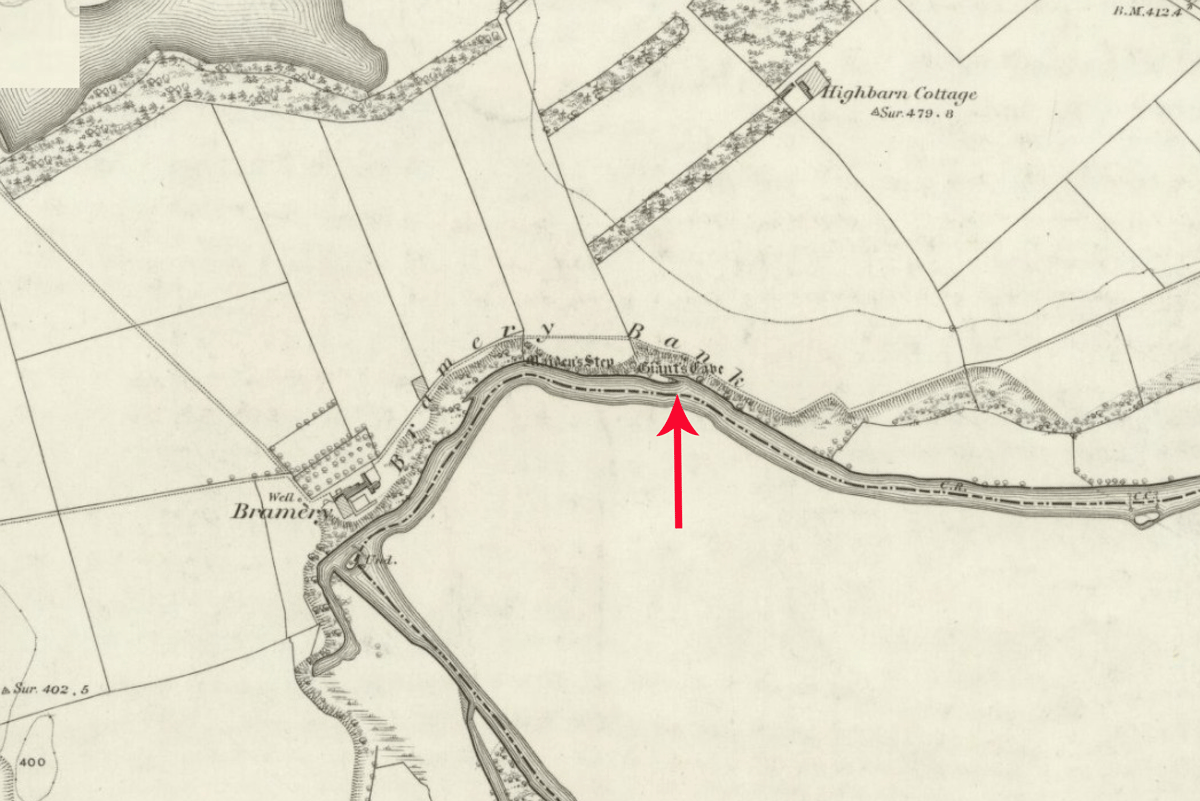
Giants Cave Holy Well (Edenhall) submitted by Anne T on 8th Sep 2022. The exact location of this well is not known. It could be either north or south of the River Eamont, in the vicinity of Giant's Cave (marked with a red arrow). Shared under the terms of the National Library of Scotland Creative Commons Attribution-NonCommercial-ShareAlike 4.0 International (CC-BY-NC-SA) licence. See Sheet Cumberland LIX.2.
(View photo, vote or add a comment)
Log Text: Giant's Cave Holy Well: Having walked to St. Ninian's Church, Ninekirks, and wandered around the site of St Ninian's preconquest monastery, it was only a short walk northwards across the field towards the location of the Giant's Cave and the River Eamont.
There was no sign of the well on the south side of the river, and the river was too big, wide and fast flowing to cross to get to the Giant's Cave, so we tried to spot it from afar.
This section of the river is dominated by red sandstone cliffs, with heavy tree cover, so it wasn't really possible to spot either the cave or the well.
The photographs show approximate locations for the well, given the 'vague' grid reference. Goodness knows how those Victorian revellers got to the cave, but there are beaches along the river, and a beautiful meadow on the south of the river for celebrations at the well to have taken place at.
Hallrigg Standing Stone
Trip No.175 Entry No.1 Date Added: 28th May 2022
Site Type: Standing Stone (Menhir)
Country: England (Cumbria)
Visited: Saw from a distance on 28th May 2022. My rating: Condition 3 Ambience 3 Access 1
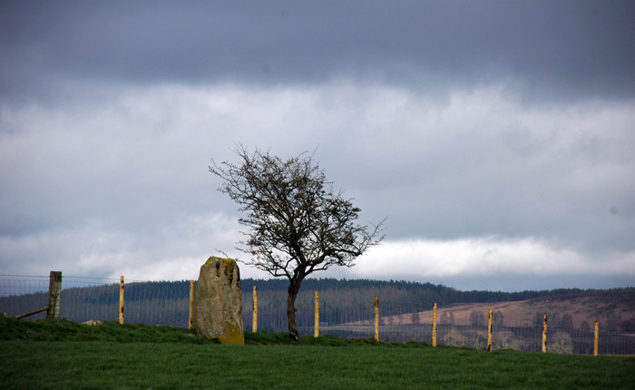
Hallrigg Standing Stone submitted by nicoladidsbury on 9th Apr 2007. Hallrigg Standing Stone - rediscovered standing stone, 2 miles north of Lowhouse Standing Stone, 5 miles north of Penrith. It appears to be red sandstone, approx 1.5m tall
(View photo, vote or add a comment)
Log Text: Hallrigg Standing Stone, Plumpton: The nearest we could get was the very back (staff only area) of the Pot Place Car Park, and we asked permission to take this photograph from the member of staff working in this area.
We did try numerous other ways to get closer to the standing stone, but couldn't even find a track and/or gate to walk across the fields, or who to ask permission off.
Photo taken with a tripod and 50-300mm zoom lens at maximum zoom, but even this didn't give an excellent photo, given the haze in the atmosphere.
St Maelog's Cross
Trip No.167 Entry No.3 Date Added: 22nd Jul 2021
Site Type: Ancient Cross
Country: Wales (Powys)
Visited: Saw from a distance on 12th Jul 2021
St Maelog's Cross submitted by Sunny100 on 11th May 2010. St Maelog's Cross, Llowes Church, Powys at SO193417
(View photo, vote or add a comment)
Log Text: St Maelog's Cross: Despite being told the church was open, and going armed with masks and hand sanitiser, the door was very firmly locked. We could see the back of the cross through the windows at the north western corner of the church, but it was impossible to photograph through the tiny, dirty panes. So disappointed. I did spot a sundial in the churchyard, built into a memorial stone, so had to be content with photographing that.
Clyro Court
Trip No.167 Entry No.1 Date Added: 22nd Jul 2021
Site Type: Chambered Tomb
Country: Wales (Powys)
Visited: Saw from a distance on 12th Jul 2021. My rating: Condition 2 Ambience 3 Access 4
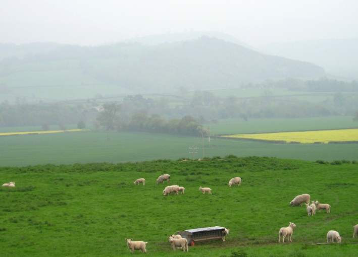
Clyro Court submitted by thecaptain on 14th May 2004. Clyro Court, Chambered Tomb, Powys, SO213432
Marked on the OS map as Chambered Long Cairn, the ruined remains of this tomb can be seen on a little hillock behind a house, beside the busy A438, overlooking the valley of the River Wye at Clyro, just over the river from Hay-on-Wye.
The remains of the tomb can be seen here from the northwest, and are the usual lumpy ground on top of the hillock. What looks like the remains of a stone chamber can be seen sticking out of the ground in the middl...
(View photo, vote or add a comment)
Log Text: Clyro Court Chambered Tomb: This tomb, marked on the OS map, lies on private ground behind a cottage. There was no one at home in the cottage, and the gates into the field had been padlocked with the largest padlocks and chains I've seen in a long time! We had to content ourselves with finding a vantage point by the barbed wire fence and photographing the cairn from there. Lumps and bumps vaguely visible. Would have loved to have climbed over for a closer look.
Wades Stone (South)
Trip No.159 Entry No.3 Date Added: 6th Mar 2020
Site Type: Standing Stone (Menhir)
Country: England (Yorkshire (North))
Visited: Saw from a distance on 4th Mar 2020
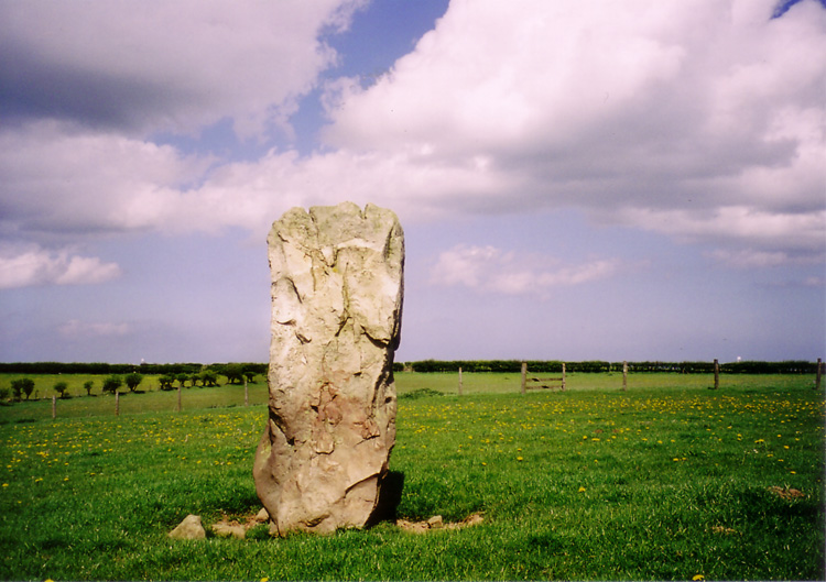
Wades Stone (South) submitted by DavidRaven on 13th May 2005. The southern Wade's Stone, looking north.
(View photo, vote or add a comment)
Log Text: Wades Stone (South): As per our last visit, we were unable to find anyone to ask at the now Council Depot (not the Outdoor Centre as marked on the map), and couldn't see any field access into the field containing the stone, either from the corner of East Barnby Lane and the A171 (at NZ 82845 13203), or off the main road. As there were other sites we were really keen to see, we drove on without making an attempt to see this stone. Shame.
Whitefield Loch Crannog
Trip No.137 Entry No.11 Date Added: 28th Jun 2019
Site Type: Crannog
Country: Scotland (Dumfries and Galloway)
Visited: Saw from a distance on 18th Jun 2019. My rating: Condition 1 Ambience 3 Access 4
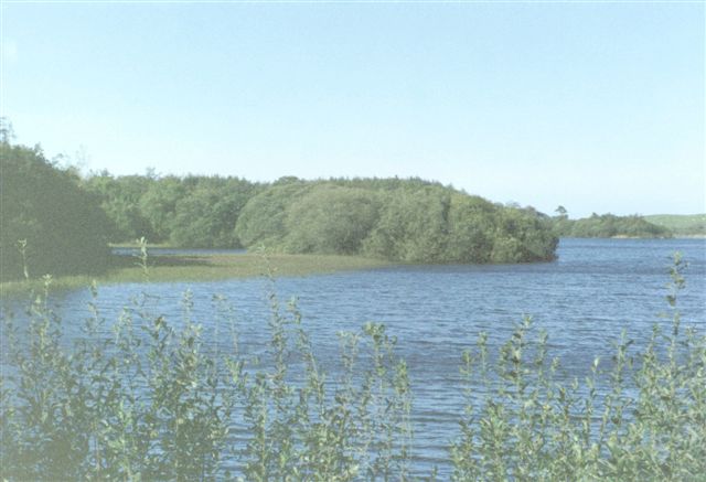
Whitefield Loch Crannog submitted by cosmic on 9th Oct 2004. Viewed from East
(View photo, vote or add a comment)
Log Text: Dorman's Island/Loch Whitefield Crannog (east): We went seeking Dorman’s Island crannog at the eastern side of the loch. Having missed the fisherman's road, and the road being too narrow to turn round, we ended up parking in the fisherman's car park at NX 23531 54887 and walked down the angler’s slipway but the tree cover was too dense to really make out anything. We could just about see round the small headland to our eastern side, and took a couple of photographs and may have just caught the crannog.
Looking at the Canmore map there is also a Tree Island crannog to the western end of the loch.
St Andrew's Well (Wells)
Trip No.136 Entry No.3 Date Added: 12th Jun 2019
Site Type: Holy Well or Sacred Spring
Country: England (Somerset)
Visited: Saw from a distance on 17th May 2019. My rating: Condition 4 Ambience 4 Access 4
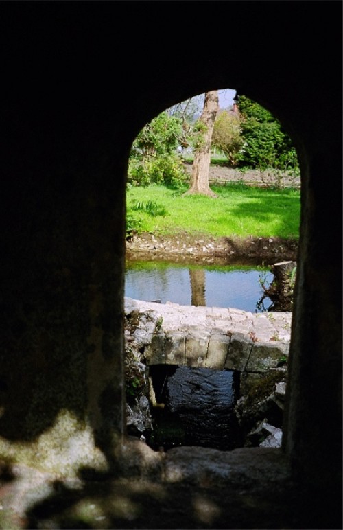
St Andrew's Well (Wells) submitted by KiwiBetsy on 21st Nov 2004. A peep hole gives a view of St Andrew's Well.
(View photo, vote or add a comment)
Log Text: St Andrew's Well, Wells Cathedral: After having had an abortive trip trying to find the sculptured Anglo Saxon stones (now shut up in boxes and cages on the triforium, only accessible by cathedral staff) I only photographed this through the hole in the garden wall separating the cathedral from the Bishop’s Palace. We didn’t have time to go to the Palace as we needed to beat the traffic and get to Deerhurst or Bradford on Avon before the churches shut for the evening.
Higher Combe Cross
Trip No.130 Entry No.7 Date Added: 30th May 2019
Site Type: Ancient Cross
Country: England (Devon)
Visited: Saw from a distance on 11th May 2019. My rating: Condition 3 Ambience 3 Access 4

Higher Combe Cross submitted by Anne T on 30th May 2019. Andrew (husband) balanced on top of the low stone wall between the minor road to Lustleigh and Cross Park Field to get this photograph of the cross head, from about 100m away. Not the best focused of photographs, but the closest we could get.
(View photo, vote or add a comment)
Log Text: Higher Combe Cross: If we could have obtained access to this cross, access would have been a short walk across a field of improved pasture. Shame the gate was double-chained with two electric fences virtually up against the gate. Lovely horse in the field, though.
Andrew resorted to standing on top of the low stone wall just to the south of the cross, where there was a sufficient enough gap in the trees/hedges to see through. A shame, because it looked as if it was in such a lovely location, just above a small stream, and against an old hollow way.
Mossknowe 2
Trip No.127 Entry No.3 Date Added: 7th May 2019
Site Type: Cairn
Country: Scotland (Dumfries and Galloway)
Visited: Saw from a distance on 2nd May 2019. My rating: Condition 2 Ambience 3 Access 4
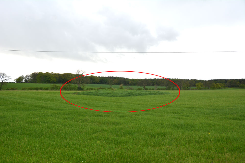
Mossknowe 2 submitted by Anne T on 7th May 2019. The location of this cairn is marked by the red oval. We could really only spot the location of the cairn by the tall grass left around it by the farmer. We were unable to open the gate into the field, and with the rain pelting down and light rapidly fading, we contented ourselves with photographing it from over the hedge.
(View photo, vote or add a comment)
Log Text: Mossknowe Cairn: the cairn nearest to the bend in the road, south east of the cottage which has Mossknowe Tumulus in its garden. Nothing special, but another site ticked off the list.
Mossknowe Tumulus
Trip No.127 Entry No.6 Date Added: 7th May 2019
Site Type: Cairn
Country: Scotland (Dumfries and Galloway)
Visited: Saw from a distance on 2nd May 2019. My rating: Condition 2 Ambience 3 Access 4
Mossknowe Tumulus submitted by graemefield on 27th Jun 2012. The cairn before excavation
(View photo, vote or add a comment)
Log Text: Mossknowe Cairn 1/ Belten Mound: We stopped outside the cottage to the west of the minor road at NY 27846 69513, but could not see much. Carrying on to where the road bends at NY 28117 69281, the only gate into the field from the road here is at NY 28067 69222 and hadn't been opened in such a long time, the hawthorn hedge had grown round the edges. With the rain starting to pelt down, and with evening rapidly falling, we decided to cut our loses, quickly photograph the cairns from a distance and go home.
Mossknowe 3
Trip No.127 Entry No.5 Date Added: 7th May 2019
Site Type: Cairn
Country: Scotland (Dumfries and Galloway)
Visited: Saw from a distance on 2nd May 2019. My rating: Condition 2 Ambience 3
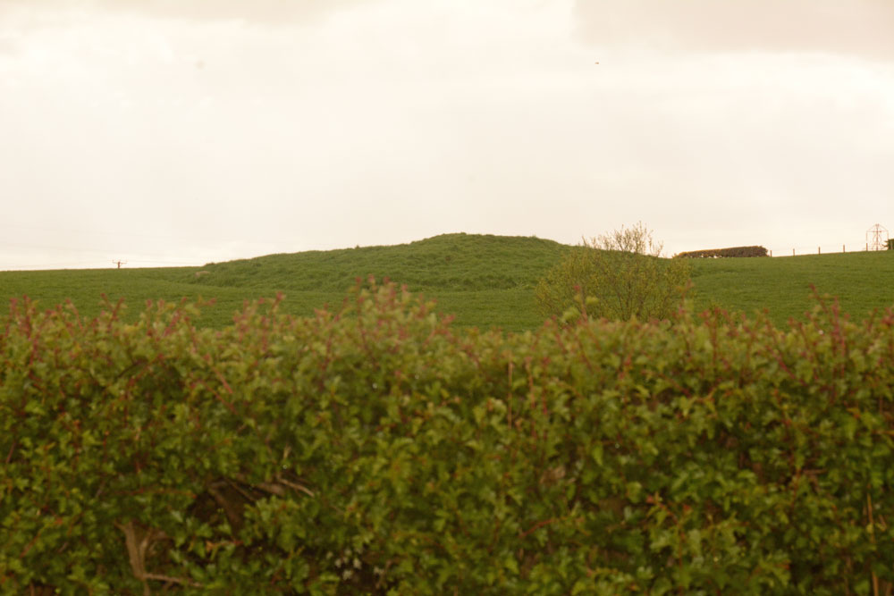
Mossknowe 3 submitted by Anne T on 7th May 2019. The third of the three cairns in close proximity. We only saw this from a distance, as the light was fading rapidly, the rain was heavy and we were unable to open the gate into the first field. Of the three cairns, this looked the most interesting to see, so I'd like to do a 'repeat visit' to all three at some time in the near future, if we pass through this area again.
(View photo, vote or add a comment)
Log Text: Mossknowe Cairn 3: Saw this from a distance only, as the light was fading rapidly, the rain was pelting down and we couldn’t open the gate into the first field. Couldn’t get too excited about this, although it looked the most interesting of the three cairns.
Wamphray Place
Trip No.124 Entry No.5 Date Added: 11th Apr 2019
Site Type: Misc. Earthwork
Country: Scotland (Dumfries and Galloway)
Visited: Saw from a distance on 4th Apr 2019. My rating: Condition 1 Ambience 3 Access 4
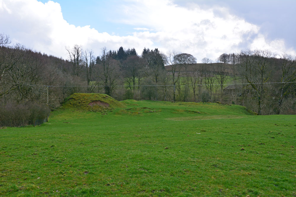
Wamphray Place submitted by Anne T on 11th Apr 2019. Having seen the cross slab at Wamphray Church, we stopped by the side of the road to photograph this picturesque motte and bailey castle, high above Wamphray Water, but as we had a rendezvous, didn't stop to explore further. This site was known to be occupied in the 12th century and was still in use until the mid 18th century. Possibly, the motte is built upon a more ancient site.
(View photo, vote or add a comment)
Log Text: Wamphray Place Motte & Bailey: Continuing down the hill (north west) from Wamphray Church, past the mill and over the narrow bridge, as we climbed the hill at the other side of the river, we spotted this small, compact motte and bailey and stopped to take a few quick photos. Wish we’d had more time to explore and photograph this site from the river, but we wanted to try and find the cairn cemetery at Pumplaburn before heading off to meet our daughter at Annandale Water services.
Pumplaburn
Trip No.124 Entry No.6 Date Added: 11th Apr 2019
Site Type: Cairn
Country: Scotland (Dumfries and Galloway)
Visited: Saw from a distance on 4th Apr 2019. My rating: Condition 1 Ambience 2 Access 4
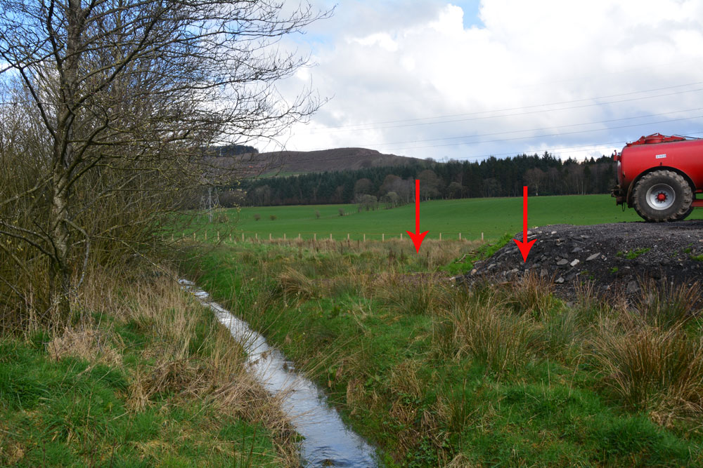
Pumplaburn submitted by Anne T on 11th Apr 2019. The two arrows show approximately where the two cairns should be - one buried (almost buried?) by the new hardstanding area; the other further back in the field. Photograph taken from the corner of the field at NY 11832 96456.
(View photo, vote or add a comment)
Log Text: Pumplaburn Cairns: Making our way back towards Annandale Water, we went under the smallest railway bridge we’d ever travelled under – 7ft tall and 7ft wide! We didn’t find these cairns, despite wandering up and down the road. Looks like they may have been buried by the large hardstanding for tractors next to Pumplaburn Steading. From plotting the ngrs on UK Grid Reference Finder, the cairn at NY 1191 9650 may still be there, but we only saw it from a distance.
Rugley Walls (Cambo)
Trip No.119 Entry No.4 Date Added: 27th Feb 2019
Site Type: Holy Well or Sacred Spring
Country: England (Northumberland)
Visited: Saw from a distance on 24th Feb 2019. My rating: Condition 2 Ambience 3 Access 4

Rugley Walls (Cambo) submitted by Anne T on 27th Feb 2019. The site of the holy well, as seen from the road, which shows up as a puddle and a brighter green grass against the rest of the pasture. A return trip in better light, more time and a pair of wellies will occur in the relatively near future …..
(View photo, vote or add a comment)
Log Text: Rugley Walls Holy Well: (note wellies a must if trying to get to the well): We stopped off here very quickly as we wanted to leave enough time to see the settlement at Catcherside.
Whilst we could see the source of the well, and there was a gate into the field, we would have need our wellies to get over the stream and boggy area to reach the well. As the light was starting to fail, we elected to carry on to Catcherside.
The well is shown on HE map but no mention on Pastscape. I need to look up the Holy Wells of Northumberland papers. All indications from Keys to the Past are that the well is connected to the deserted medieval village of Rugley Walls, which lies to the eastern side of the B342 road which runs through here.
I'd really like to see the structure that Andy Curtis photographed, so a return visit is on my wish list.
Deil's Cradle (Dollar)
Trip No.109 Entry No.5 Date Added: 11th Nov 2018
Site Type: Natural Stone / Erratic / Other Natural Feature
Country: Scotland (Clackmannanshire)
Visited: Saw from a distance on 31st Oct 2018. My rating: Condition 3 Ambience 3 Access 3
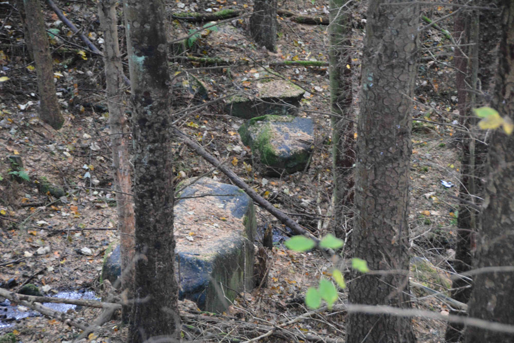
Deil's Cradle (Dollar) submitted by Anne T on 11th Nov 2018. Site in Clackmannanshire Scotland. With this large erratic at the bottom of a small gorge, with daylight failing, we wanted to get to Tullibody to see the Maiden's Stone, so photographed it from a distance only.
(View photo, vote or add a comment)
Log Text: Devil's Cradle, Dollar: With this being Halloween, I was keen to try and see this massive erratic rock. From the Wizard’s Stone eastwards, the road gets narrower, not much wider than a single track road, so we parked in Tarmangie Drive, at NS 96743 99038, and walked up Upper Hillfoot Road (the southern part) at NS 96743 99038. Looking down through the woodland, we saw a large erratic by the side of a small burn.
This stone is in a very deep gorge, and we couldn’t immediately see a way to get to it With a 70 degree slope on one side and a near vertical drop on the other, we decided, with the failing light, to carry on to Tullibody and see sites which we really wanted to get to before dark, so photographed this stone only from a distance.
