Contributory members are able to log private notes and comments about each site
Sites Anne T has logged. View this log as a table or view the most recent logs from everyone
Blennerhasset Cross
Trip No.81 Entry No.6 Date Added: 10th Jul 2018
Site Type: Ancient Cross
Country: England (Cumbria)
Visited: Yes on 9th Jul 2018. My rating: Condition 3 Ambience 4 Access 5
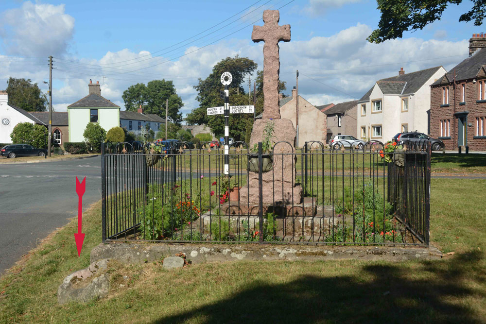
Blennerhasset Cross submitted by Anne T on 10th Jul 2018. The memorial, with discarded socket stone to the bottom left (highlighted by the red arrow), taken from the western side.
(View photo, vote or add a comment)
Log Text: Three crosses in one, Blennerhasset, Cumbria: Having been to four churches to see Anglo Saxon carved stones, and only found one unlocked, I wanted to stop and see the 'cross' marked on the OS map in this small village. This really is a stunning medieval village, and I wish we’d had more time to wander round and admire the old buildings. There was a lovely bridge over the river, although there was a children’s picnic and football match going on next to it, so we didn’t disturb them. There were two information boards outside the school, but neither mentioned the cross. Despite it looking like a war memorial, I wandered across only to find the base of the medieval cross and the discarded socket stone. Brilliant!
St Mungo's Dearham
Trip No.81 Entry No.5 Date Added: 16th Aug 2018
Site Type: Ancient Cross
Country: England (Cumbria)
Visited: Yes on 9th Jul 2018. My rating: Condition 3 Ambience 4 Access 5
St Mungo's Dearham submitted by coin on 29th Mar 2017. The Viking Cross at Dearham
(View photo, vote or add a comment)
Log Text: Ancient Crosses and a Norman font, St Mungo's Church, Dearham: After having been to two other churches which had been firmly locked, this church was, thankfully open and very welcoming.
The church was packed full of knitted scenes from the bible, jewellery and books. We missed the Adam Stone, but are going back on 14th August, and have asked for permission to get into the vestry to see AS Corpus Dearham 03, a fragment of a wheel headed cross built into the wall.
We had to move quite a few items from the west window to photograph AS Corpus Dearham 02, and it took us ages to get everything back!
The Norman font, apparently carved from the cushion capital of a column, was really interesting.
There was no church guide book, although there was a postcard (30p) and a display board, which I took a few photos of.
The first notes on the display board say: “There can be no doubt that Dearham had a church during the Dark Ages, following the withdrawal of Roman Forces from Britain. Many pre-Norman sculptured stones displayed in the present church provide evidence that Christianity was prevalent during Anglo Saxon and Viking times. The Reverend William Slater Calverley was vicar of Dearham from 1877 until 1885 and was responsible for uncovering and displaying many of these stones. He worked tirelessly on restoring the church to much of the originality as possible during his period of incumbency. In 1880 it was recorded that he did not know to whom the church was dedicated, the original dedication having been lost. It was rededicated in 1935, as a result of the inspiration of the Reverend Canon Malcolm D. Grieve, to St. Mungo, a Scottish saint whose real name was St. Kentigern. In 1937 Canon Grieve was also responsible for the addition inside the church building, of a side chapel dedicated to the Holy Name. It stands at the east end of the north aisle.”
There is a section on the display called: “A brief look at the history of St. Mungo’s. It is believed that the original stone church dating back to the early 1100s was about 48 feet long in the shape of a long, low tunnel. During the Norman period parts were added and extended later in the Early English period. The tower was added probably early 14th century. The porch was also an addition to the original building covering the Norman doorway. The north aisle was a completely new addition during the 1882 restoration when Mr. Calverley enlarged the church. The vestry, at the east end, is an extension to the north aisle, the date being cut into the pillar of an arch. Built in the north wall of the vestry is the head of the “Kenneth Cross”. It was found near the east end of the church and built into the vestry wall curing restoration. The stained glass window behind the altar was given by Mr. John Wilson of Dearham and built in at the time of the 1882 restoration. The bell, which weights almost half a ton, was given by Colonel Sewell, whose family were seated at Brandlingill end of Hayborough. The ancient windows, dating back probably to 1150 were removed during the 1815 restoration and sadly lost to this day! Had they been lying about in 1880 Rev. Calverley would have restorated them to their rightful place, when he in turn removed the sash windows and inserted new ones fashioned in the style of the originals.”
The display says: “The magnificent wheel head cross (Viking cross) stands 5ft 4ins high and is carved with “Yggdrasil”, the Norse tree of the universe. It stood in the churchyard until 1900 and then brought into the church and placed in front of the organ.”
Another section reads: “The treasures of the Church include two stones found during 1882 restoration work. Standing 4ft high is the Adam stone, dating from AD 900, which depicts the Fall and Redemption of Man, with Adam and Eve hand in hand above a serpent. The Kenneth Cross shows the legend of the 6th century hermit, S. Kenneth, who was lame from birth and after his baptism cast away in a coracle. He was saved from the gales, and brought up by seabirds.”
The small door leading up into the tower was open, with a very narrow set of steps leading up. Not even Andrew fancied venturing up.
St Mary's Well (Wreay)
Trip No.90 Entry No.1 Date Added: 31st Jul 2018
Site Type: Holy Well or Sacred Spring
Country: England (Cumbria)
Visited: Yes on 30th Jul 2018. My rating: Condition 3 Ambience 4 Access 4
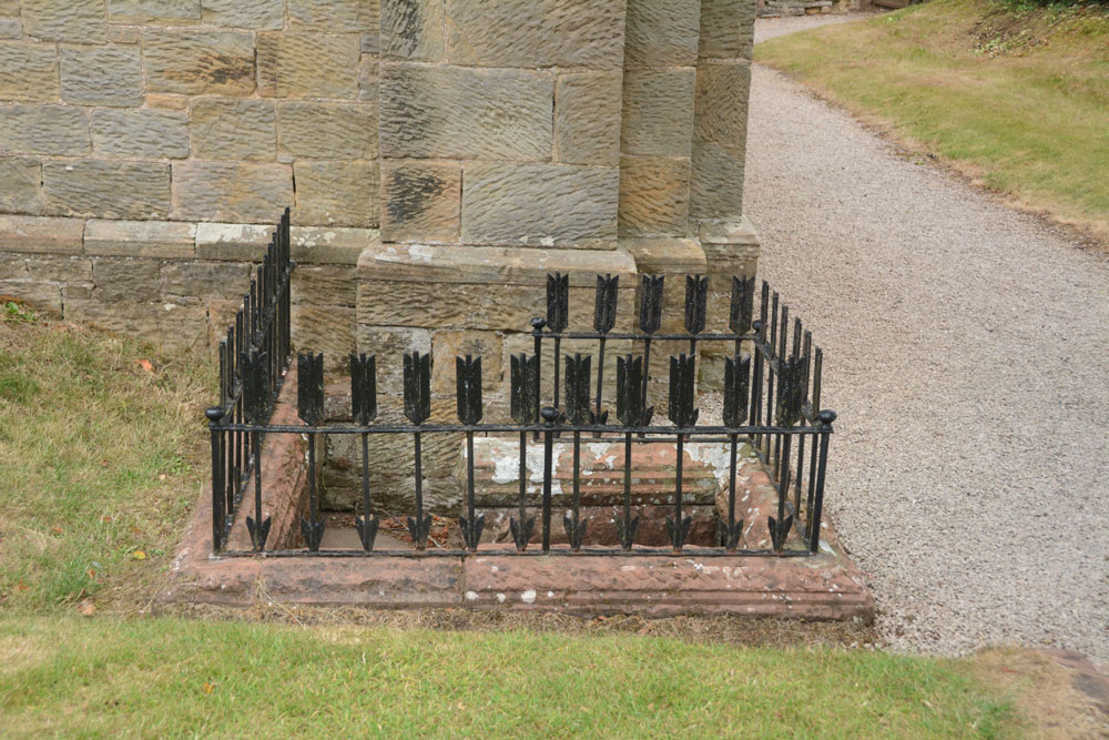
St Mary's Well (Wreay) submitted by Anne T on 31st Jul 2018. Approaching the well, with its curious railings made up of arrows, which represent 'death' according to the leaflets in the church.
(View photo, vote or add a comment)
Log Text: St Mary's Well and copy of the Bewcastle Cross, Wreay: This is a delightful little village, with some very old houses. The church is very easy to find, right in the middle of the village, opposite the colourful school, with plenty of parking on the streets nearby.
This well is to the southern side of the exterior western wall, although it has been dry for some considerable time. The well spout, in the form of an animal head, is quite superb and unusual (like the gargoyles on the roof line of the church).
The Holy Wells of Cumbria booklet (page 14) describes this well as:
Location: Approx. 9 miles south of Carlisle. The well is found by the front wall of St. Mary’s Church, Wreay.
Description: Although it is unknown whether this was a holy well, the highly unusual and attractive church is well worth a visit in itself. The original church dates back to 1319, and was rebuilt by Sarah Losh in 1840-42 – see also well 4 at Brisco – in memory of her sister Catherine and her parents. Italian in style, it is full of highly original and deeply symbolic carvings in wood and stone, many representing in forms from nature the eternal contrast between light and dark, or life and death. The well outside is a curious construction surrounded by cast iron arrows. Dog-leg stone steps lead down into the well, where water flows from a lion’s (or dog’s head) into a aquare stone piscina blessed with a solitary green fern and scattering of copper coins. The well (in 2008) was recently restored and is in excellent condition."
There was no water, no fern and no coins when we visited. Whilst the church, the sundial and the font in the churchyard are all scheduled, there is no mention of the well or the copy of the Bewcastle Cross. The church is indeed well worth looking inside. Andrew opened the door and said "I'm leaving you to go in first - it's scary!"
Cross House Incised Stone
Trip No.90 Entry No.2 Date Added: 31st Jul 2018
Site Type: Ancient Cross
Country: England (Cumbria)
Visited: Yes on 30th Jul 2018. My rating: Condition 3 Ambience 4 Access 4
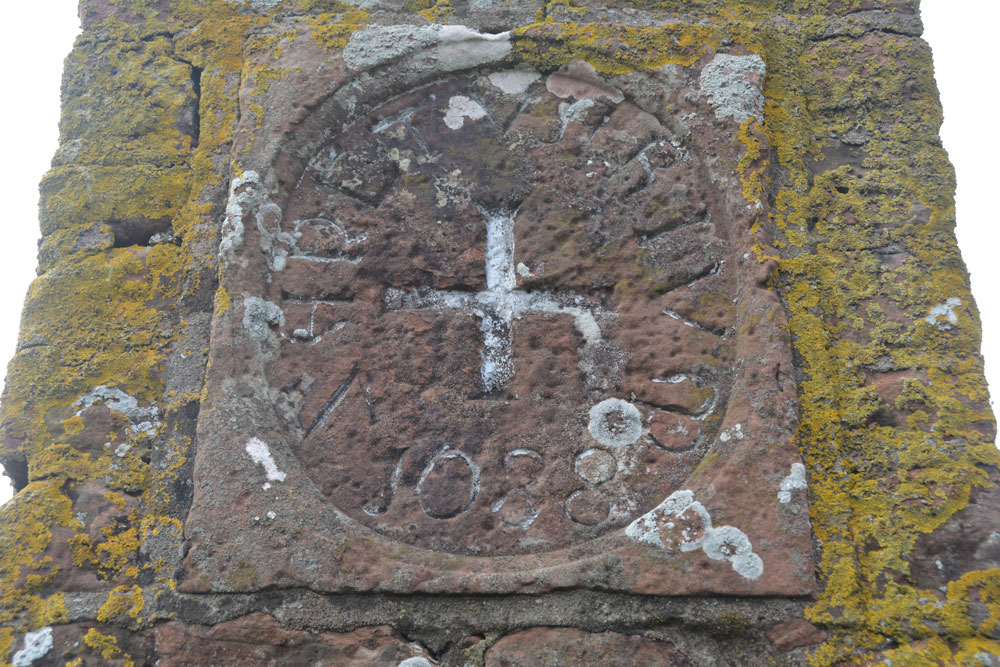
Cross House Incised Stone submitted by Anne T on 31st Jul 2018. The inscribed stone, now mounted in a 19th century pillar. The age of the stone is unknown, but it is believed to be the remains of an old wayside or boundary cross.
(View photo, vote or add a comment)
Log Text: Cross House Incised Stone, Staffield: We parked at NY 53519 43219, where a gate lets you into the footpath which goes down the hill, and joins a second footpath to Chapel Well. We walked back up the hill towards Cross House. The pillar was just visible through the hedge. We let ourselves in to the field by the gate near Cross House (there was no-one around to ask) and quickly walked to the pillar to photograph the cross.
Interesting that HE classes this as a sanctuary cross, and Pastscape as a possible wayside or boundary cross.
On processing the photographs to post to the Portal this morning, I realised we’d been to this site in October 2015, but hadn’t submitted a new site or photos to the Portal. I had asked the lady hanging out her washing in the garden of Cross House and she’d given us permission to go into the field.
Splendid views south over to the River Eden and the site of the old priory. The pillar was very near the hedge, , but it was still possible to get photos of the recut stone in its 19th century pillar.
Chapel Well (Staffield)
Trip No.90 Entry No.3 Date Added: 31st Jul 2018
Site Type: Holy Well or Sacred Spring
Country: England (Cumbria)
Visited: Yes on 30th Jul 2018. My rating: Condition 3 Ambience 5 Access 4
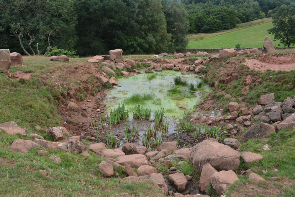
Chapel Well (Staffield) submitted by Anne T on 31st Jul 2018. The well with its pond, taken from the western end. The water bubbled out of the ground just in front of the stone bowl at the time of our visit, and was a fair flow. Between the well pool and the 'pond proper' were some lovely clumps of irises. Certainly peaceful and restful.
(View photo, vote or add a comment)
Log Text: Chapel Well, Near Staffield, Cumbria: Not far from the incised stone at Cross House. We parked near the junction down the hill where there was room to bump up onto the grass verge and walked to the gate at NY 53603 43081, which is signposted towards ‘Dale’. We kept the dry stone wall to our right hand side, and as we approached the gate into the wood, a stone drinking trough and a tree with a ditch leading from it came into view. Slightly up the slope there were some red sandstone boulders on the horizon, with a sheep track leading up to it.
The drinking trough is at NY 53774 43194 and is similar to the ones we saw at Newbeggin. The tree with its accompanying ditch is at NY 53778 43244, and there are signs of another stone structure under the tree, now dry and ruined, but possibly a secondary outlet for the well during wet weather. At the bottom of the slope, a small hole leads through the stone wall into Croglin Water just beyond.
This well is certainly in a lovely spot, hidden in a dip towards the top of the slope. There were two ‘standing stones’, one on either side of the large well pool; the rest of the large boulders had been quarried and placed around the top of the pool. A circular well bowl can be seen at the top, centre of the well, and a good flow of water came from the well (not as much as Powdonnet Well). Half a sheep had been left to rot at the south eastern end of the pool, which spoilt the ambience, and stopped me from exploring the exit pipe, but taking that away, we could have lingered for a long while. Beautiful!
Powdonnet Well (Morland)
Trip No.90 Entry No.4 Date Added: 31st Jul 2018
Site Type: Holy Well or Sacred Spring
Country: England (Cumbria)
Visited: Yes. My rating: Condition 3 Ambience 3 Access 4
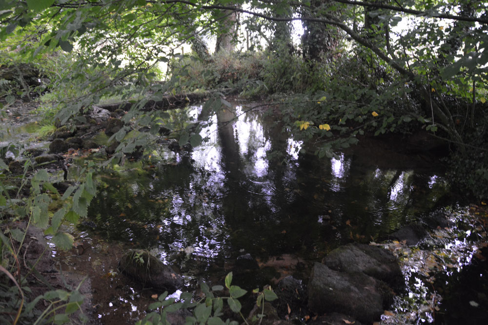
Powdonnet Well (Morland) submitted by Anne T on 31st Jul 2018. The well pool is clear and inviting. Parts of it, particularly under the tree to the right hand side of the photograph, look deep, but the stones at the bottom of the pool can be clearly seen. A little overgrown, and in the sunshine would be a lovely spot.
(View photo, vote or add a comment)
Log Text: Powdonnet Well, Morland, Cumbria: If not quite so overgrown, I'd have awarded this a '4: Good' rating on Ambience (despite the downpour after the long dry spell!). This well is marked on the OS map, but there is no mention in either Pastscape or HE.
The Holy Wells of Cumbria booklet describes this well as: “Morland. Location: Approx. 6.5 miles south east of Penrith. At the northern end of Morland village. Take road from Morland towards Cliburn. On right, as you leave village, opposite ‘Morland’ sign, is a small parking area. The standing stone and pool are close to the road.
The well had been neglected since the booklet was written in 2008 and we had to pick our way through the tangle of tree branches. We were just approaching the site of the well when the heavens opened, and there was an absolute downpour. Somewhat protected by the trees, we nevertheless decided to explore.
The easiest way to the standing stone and well is to find the overgrown footpath at the southern end of the bridge across the small stream which crosses under the road and joins the Morland Beck to the east of the well site.
The water in the pool is crystal clear. The water really does appear from nowhere. We stood at the southern end of the spring, listening to the water rushing up from the ground. The pool has been created by a couple of stone/concrete dams across the spring just to the northern part of the site. A lovely place. Next time we visit, remember to bring pruning shears!
Bessygarth Well (King's Meaburn)
Trip No.90 Entry No.5 Date Added: 31st Jul 2018
Site Type: Holy Well or Sacred Spring
Country: England (Cumbria)
Visited: Yes on 30th Jul 2018. My rating: Condition 3 Ambience 4 Access 4
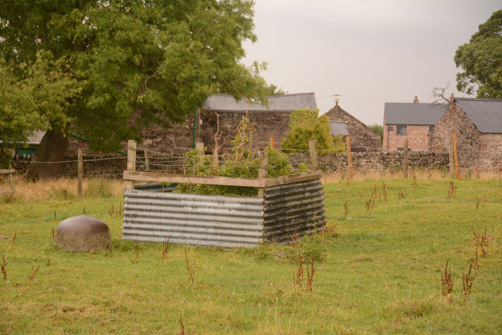
Bessygarth Well (King's Meaburn) submitted by Anne T on 31st Jul 2018. Getting closer, the peculiar cast iron 'bowl' (the cap for an old pump?) can be seen to the left hand side of the well. Thinking this was a drinking bucket for cattle/sheep, I tried to overturn it to look closer, only to find it was deeply embedded in the ground, and very heavily constructed.
(View photo, vote or add a comment)
Log Text: Bessygarth Well, King's Meaburn: This is a very old village, with a scheduled 17th century barn opposite the bus stop next to the village hall where we parked. The village runs in a long ribbon along both sides of the road, with an incongruous caravan park tucked behind the village hall.
Despite being marked on the OS map, we couldn’t find this well at first, so asked someone who’d pulled up outside one of the cottages opposite. He was only visiting, but was kind enough to ask inside the house, and relayed a message, saying that “if there’s some old tin in the field, that’s the well”. We were told it was OK to go into the field, providing we ensured the gate was shut.
Andrew dropped a stone down it, and it sounded deep! There was a most peculiar solid cast iron ‘bowl’ deeply embedded into the ground next to the well. Was this the cap of an old pump?
The field behind the well is covered in lumps and bumps. Researching it when I got home, found it was the site of the medieval settlement.
St Bridget's Church (Bridekirk)
Trip No.91 Entry No.5 Date Added: 18th Aug 2018
Site Type: Ancient Cross
Country: England (Cumbria)
Visited: Yes on 14th Aug 2018. My rating: Condition 3 Ambience 4 Access 5
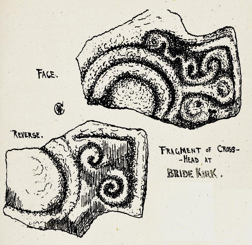
St Bridget's Church (Bridekirk) submitted by Sunny100 on 19th Apr 2011. Illustration of The Cross-Head fragment at St Bridget's Church, Bridekirk, Cumbria, by Rev William Slater Calverley 1847-98.
The above image is from his renowned work 'Early Sculptured Crosses, Shrines and Monuments in the Present Diocese of Carlisle 1899 Ed. by W.G. Collingwood.
(View photo, vote or add a comment)
Log Text: Font with Runic inscription, St. Bridget's, Bridekirk: We had an hour to fill between appointments between churches, so headed off to Bridekirk to see the font with runic inscription, which we'd missed during our last visit on 1st May 2015. The notice said the church was "normally open during daylight hours" but on this occasion the main door appeared to be bolted at the top from the inside, so we couldn't get in. This time, not having a six month old granddaughter with us, we walked round the outside of the church and noticed a collection of old grave slabs displayed against the exterior of the apse at the east end of the church, including an old cross base. None of these in mentioned on Pastscape.
Checking back in my photos, I had taken a photograph of the font. The middle band (when enlarged) does indeed have a runic inscription on it.
St Mungo's Church (Bromfield)
Trip No.91 Entry No.1 Date Added: 15th Aug 2018
Site Type: Ancient Cross
Country: England (Cumbria)
Visited: Yes on 14th Aug 2018. My rating: Condition 3 Ambience 4 Access 4

St Mungo's Church (Bromfield) submitted by Anne T on 10th Jul 2018. The dark red semi-circular stone is (the remains of) AS Corpus Bromfield 04, a 10th century hogback, as seen from the inside of the south porch. Located above the main door of the church, we stood for ages trying to make out the original hogback. The wavy edge at the top of this dark red sandstone is the only clue. According to the AS Corpus photos, the hogback can be better seen from inside the church, but the church was locked, so we were unable to see.
(View photo, vote or add a comment)
Log Text: St Mungo's Church, Bromfield: We'd arranged with the church warden for the church to be left open for us for an hour or so this morning, so this was our first stop on a 'five church stop' tour. We were looking forward to finding cross head and cross shaft fragments, and to being able to see the reverse side of the hogback stone above the doorway.
Whilst it looks quite daunting from the outside, the inside of the church is lovely, with some unique features, such as unusual corbels and the chancel arch, which is 'transitional between Norman and Gothic styles'.
I found the cemented remains of the cross head cemeted to the west end of the north aisle, and had to remove umbrellas and a carpet sweeper to see it. It was very cobwebby, and looked sadly neglected.
AS Corpus Bromfield 02 was in two pieces. There was a collection of old stones in the north transept, and we needed to move a low bench and a collection of chairs to be able to see this.
The hogback from the other side (inside the church) was much more convincing, and there was also a consecration cross on the right hand door jamb of the south door. Well worth returning to see.
St Mary's Church (Gilcrux)
Trip No.91 Entry No.2 Date Added: 16th Aug 2018
Site Type: Ancient Cross
Country: England (Cumbria)
Visited: Yes on 14th Aug 2018. My rating: Condition 3 Ambience 4 Access 5
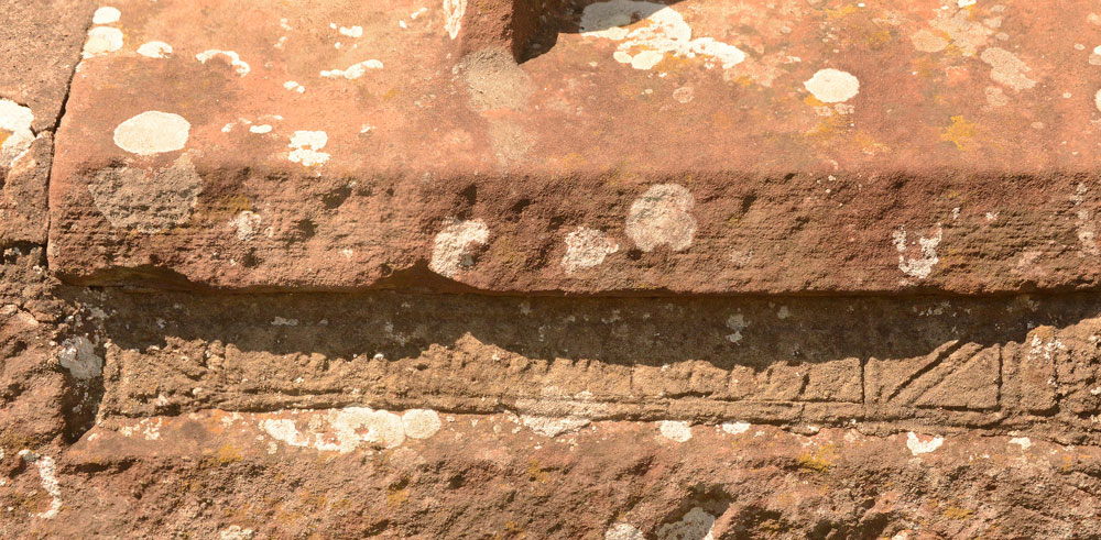
St Mary's Church (Gilcrux) submitted by Anne T on 10th Jul 2018. We may not have been able to see the Viking cross head and shaft fragment, but we did spot this underneath the window in the southern external wall of the sanctuary. The notes inside the church say it is the remains of a grave slab, recut for use as a lintel.
(View photo, vote or add a comment)
Log Text: St Mary's Church, Gilcrux: The little car park outside the church was full (3 cars and a Water Board van), so we had to park just west of the well and walk back to the church – only a little way. The church door was open for us this time.
This is a remarkable little church inside. At first site, the nave appears more like a Methodist chapel – at first glance. Then my gaze lit on the archway into the chancel, with a ‘squint’ over the right hand column and a chunk taken out of the eastern side of the left hand column. Walking into the chancel is very reminiscent of Escombe Saxon Church – this place is ancient and very peaceful.
The collection of stones was underneath a table against the south wall, near the porch, so we turned into furniture removers, carefully taking the notice board, vases and loose notices off the table, then moving the table to examine and photograph the pieces.
We managed to put together the pieces of the cross head and part of the shaft, and photographed two sides. One of the pieces left white, chalky marks on our hands, and is very white against the grey of the other two pieces. This is clearly the cast of the upper part of the cross head.
We closed the church door to indicate to the keyholder we’d been in and left again, and walked round to the north side of the church, where it is very obvious that the church has been built on a mound.
There was no church guide book, but there were some ‘notes for visitors’ which I photographed, and have typed into my walk journal.
The spring was in full flow, and it was lovely to hear it babbling away. Brilliant. Definitely worth a return visit.
St John The Evangelist (Crosscanonby)
Trip No.91 Entry No.3 Date Added: 17th Aug 2018
Site Type: Ancient Cross
Country: England (Cumbria)
Visited: Yes on 14th Aug 2018. My rating: Condition 3 Ambience 4 Access 5
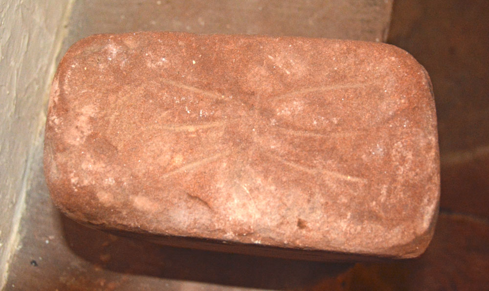
St John The Evangelist (Crosscanonby) submitted by Anne T on 17th Aug 2018. Face D of AS Corpus Cross Canonby 03, also known as The Thunder Bolt Stone. The Corpus tells us this face shows: "the incised ornament consisting of a single horizontal line on which converge three incised lines from above and below." This is the famous 'thunder bolt' symbol.
(View photo, vote or add a comment)
Log Text: St John The Evangelist, Crosscanonby: We had arranged to meet the Reverend Mary at the church at 2pm. Between Gilcrux and here we had an hour to spare, so went into Cockermouth for lunch and a quick walk round the town. Travelling through Dearham and across the A596 to Crosscanonby, as we dropped down a small hill after having crossed the A596, we realised how close this church is to the Solway Firth (according to UK Grid Finder measurements its 900m).
This little church is side on to the road, and is virtually invisible until you reach the gate into the churchyard, although the ‘this church is open’ board gave something away.
I’d not looked at the AS Corpus notes I’d brought, but straight away we spotted the hogback against the south eastern corner of the nave.
Walking inside was a real treat. This is clearly a very old building. Reverend Mary (just ‘Mary’ she said) told us this church used to be the mother church for Maryport and the farm house next door (to the west of the church) used to be part of the monastery; the monks used to process from the monastery to the church; rumour has it there is a tunnel from the farmhouse to the church, but it’s never been found.
The church is pretty special, although I focussed on photographing the stones in the porch whilst Andrew spoke to Mary about the structure of the building, as I was conscious of taking up Mary’s time and we needed her to come across to Dearham to open the vestry for us. I’d love to go back and spend more time here.
St Mungo's Well (Cumbria)
Trip No.91 Entry No.8 Date Added: 18th Aug 2018
Site Type: Holy Well or Sacred Spring
Country: England (Cumbria)
Visited: Yes on 14th Aug 2018. My rating: Condition 3 Ambience 4 Access 4
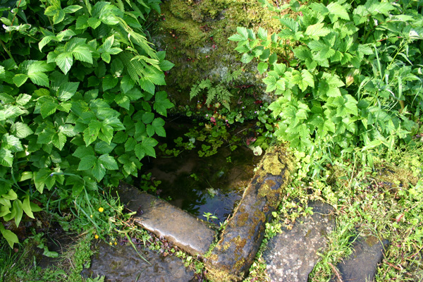
St Mungo's Well (Cumbria) submitted by ocifant on 26th Jun 2005. Looking at the various maps, the location of this well is difficult to discern. It's actually easy to find once you get to the church though.
From St Kentigern's in Caldbeck, walk through the churchyard from the road, and exit via the rear gate. Cross the footpath to the river. Immediately on entering the river path, there are a couple of steps down to the riverbank. These lead to the well.
(View photo, vote or add a comment)
Log Text: St Kentigern's Well, Caldbeck: This was our last stop of the day, and to a part of Cumbria we've never travelled through before. From St. Bridget's in Brigham, we followed the B5299 to Caldbeck village, which took us over cattle grids and moorlands, with only sheep and the occasional other car in sight.
Caldbeck is a really pretty little village, and we resolved to come back during the daytime, when the shops, church and café were open.
The well can be easily found by walking down the footpath to the west of the church, until you get to the bridge over the river. As it says in the "Holy Wells of Cumbria" booklet, turn left just before the bridge, and you immediately come to some steps down the (steep-ish) bank to the river. We heard the trickle of water down the slope, and the well basin comes into view as you look down. At the time of our visit the water missed the basin and was trickling down the rock, under the shrubbery, into the river. There was a fair flow of water coming down the bank.
We walked along the footpath along the northern side of the churchyard for about 100mand found a lovely weir with small waterfalls. It was possible to walk down to the gravel beach. A lovely spot indeed.
St Bridget's Church (Brigham)
Trip No.91 Entry No.7 Date Added: 18th Aug 2018
Site Type: Ancient Cross
Country: England (Cumbria)
Visited: Yes on 14th Aug 2018. My rating: Condition 3 Ambience 4 Access 5
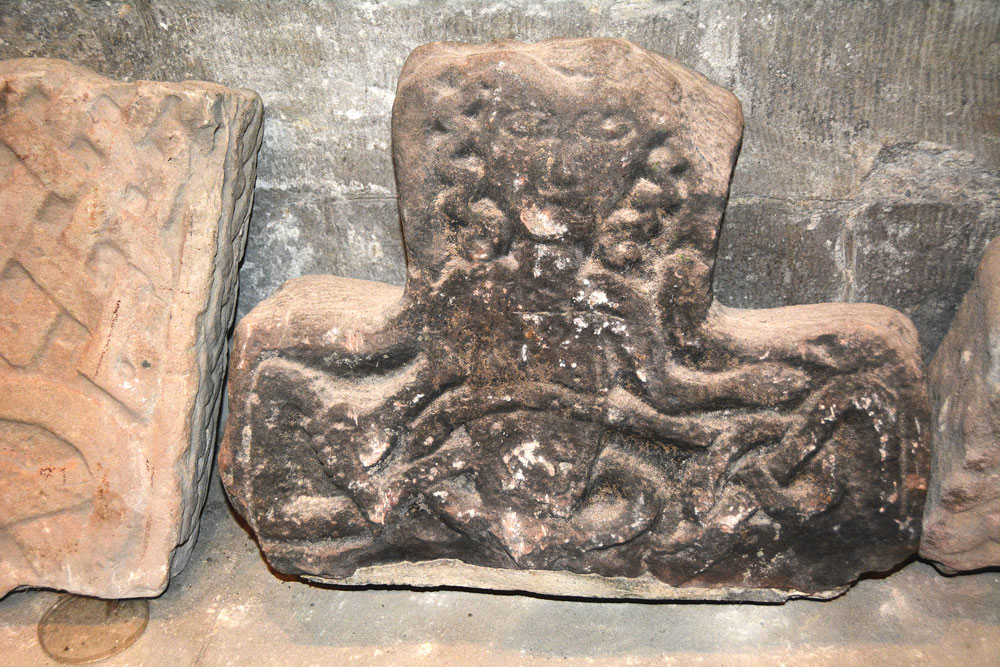
St Bridget's Church (Brigham) submitted by Anne T on 18th Aug 2018. This is Brigham 05, part of a cross-head dating to the 10th century. It was first recorded in 1881, presumed to have been found in restorations of 1864 or 1875-6. Note the curly haired naked figure, with his right hand and a snake (or interlace) bound across his stomach. His left hand is described as having an open palm, lying above the interlace of the right arm.
(View photo, vote or add a comment)
Log Text: St Bridget's, Brigham (Anglo Saxon Stones): Whilst this church looks very austere from outside, and the entrance doors dark and foreboding, once inside the church, it is a completely different picture – this church is light, airy and welcoming. The painted ceilings are fantastic.
The church warden turned up as arranged, and was so welcoming. He sought out a guide to the church and old postcards for information, then left me photographing the stones whilst Andrew walked round the church with him.
Time was all too short here, and I could have spent another hour, but we knew the church warden needed to get home, and the evening traffic was building up outside. In our haste, we missed Brigham 13, a cross base at the west end of the church (I thought I’d photographed it, as we went through all the AS Corpus pages I’d brought with me, but realised (too late) it wasn’t the correct stone).
After looking at the Fletcher family grave (now very worn and held together with large staples, I walked over to the west end of the churchyard to look at the farmhouse, which used to be the rectory for the farm).
We also looked for the site of Nun's Well, but were unable to see anything.
Newbeggin Stone Row
Trip No.96 Entry No.1 Date Added: 12th Sep 2018
Site Type: Stone Row / Alignment
Country: England (Cumbria)
Visited: Yes on 11th Sep 2018. My rating: Condition 3 Ambience 3 Access 4
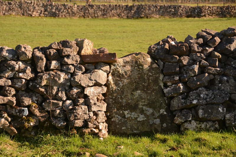
Newbiggin Stone Row (Stone 5) submitted by Anne T on 28th Mar 2017. This stone, number 5 on Dr. Rich's map, also sits on the wall to the left of the footpath running between Newbeggin and the A66. It is somewhat more obvious than the others. It is sited at NY 46849 28893.
(View photo, vote or add a comment)
Log Text: Newbeggin Stone Row: We went along to Newbeggin armed with permission from a number of landowners to walk along their boundary stone walls to look for other possible standing stones. We found a few more, but these looked more like erratics which had been shaped and used in the stone walls. I will document these and send them off to Sandy G for comment.
We got to see the stones outside Sycamore View/House with the farmer, who said the archaeologists said they were probably rubbing stones, although the farmer said they weren't (currently) tall enough even for sheep to rub against. There were certainly no signs of animals having trodden away earth at the base of the stones.
Motherby (Cumbria)
Trip No.96 Entry No.4 Date Added: 13th Sep 2018
Site Type: Holy Well or Sacred Spring
Country: England (Cumbria)
Visited: Yes on 11th Sep 2018. My rating: Condition 3 Ambience 4 Access 5
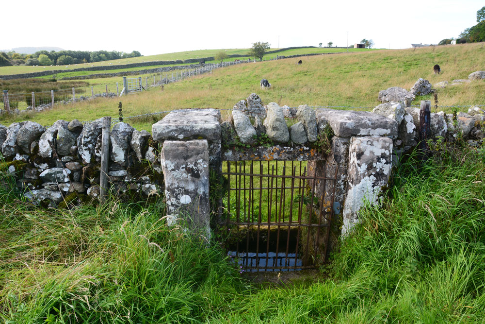
Motherby (Cumbria) submitted by Anne T on 13th Sep 2018. The well chamber is some 10+ metres further along the wall towards Motherby village, with the well chamber directly underneath the wall. An iron gate on either side of the wall gives access to the well itself.
(View photo, vote or add a comment)
Log Text: Well, Motherby, Cumbria: This is a very old village, with very picturesque cottages and farm houses. The well is not recorded on either Pastscape or Historic England.
The ‘wall’ is a strange structure. Following the line of stones up the hill, it ends in what seems to be a building platform and possibly an old quarry. The footpath at the village end of the footpath was closed due to building work, so we couldn’t investigate further.
I have emailed Mark Brennand at Cumbria County Council to see if he has any information. The line of stones follows an old footpath on the 1860 OS map, together with the letter 'T' (troughs?) where the troughs are currently located. No mention of the well.
Kells Well (Newbeggin)
Trip No.96 Entry No.5 Date Added: 13th Sep 2018
Site Type: Holy Well or Sacred Spring
Country: England (Cumbria)
Visited: Yes on 11th Sep 2018. My rating: Condition 2 Ambience 1 Access 5
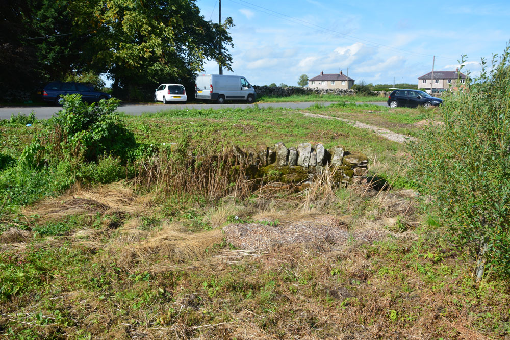
Kells Well (Newbeggin) submitted by Anne T on 13th Sep 2018. Standing to the east of the well, looking back across the road which leads into Newbeggin to the left and to the junction with the B5288 to the right. There doesn't appear to be a well trough any more, although all the ground around here is wet and spongy, indicating its the site of a spring.
(View photo, vote or add a comment)
Log Text: Kells Well, Newbeggin: This well is located opposite a house called Rockholme on the OS map, and near the Clickem Inn, just south of the B5288
The farmer from Sycamore View told us about the well, saying it had recently been “done up and claimed for the village” by the villagers. This was more like a glorified rubbish tip – the place was horrible, one of the worst places we’ve stopped at in years.
There was an old pebbled path leading round the well, together with the remains of an old stone structure, now largely covered in weeds and falling down. There was a pool of water to its northern side, and the whole of the central area around the stone structure was boggy and puddled; a small stream ran to a partly culverted ditch just to the north. Horrible. Glad to escape.
Redhills Rock Art
Trip No.96 Entry No.6 Date Added: 14th Sep 2018
Site Type: Rock Art
Country: England (Cumbria)
Visited: Yes on 11th Sep 2018. My rating: Condition -1 Ambience 4 Access 4
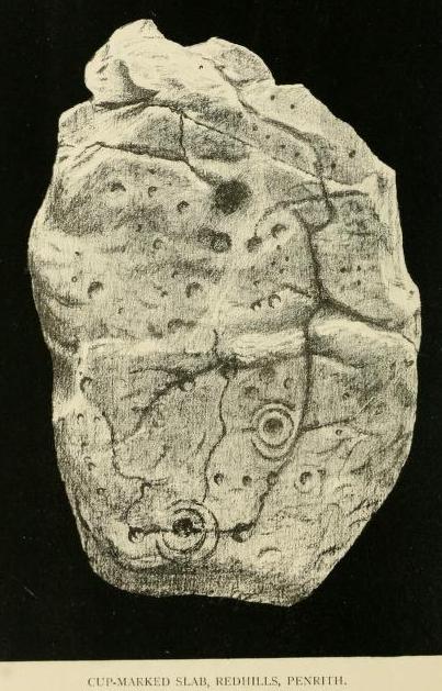
Redhills Rock Art submitted by durhamnature on 29th Oct 2012. Photograph from "Transactions of the Cumberland Archaeological Society" via archive.org
(View photo, vote or add a comment)
Log Text: Sockbridge / Redhills cist, small stone circle and round cairn (now all destroyed): We went to see this site as part of our amateur investigation of the possible Newbeggin Stone Alignment. Whilst the location is glorious, overlooking a steep scarp slope to the River Eamont below, and views to the hills of the North Lakes to the south, nothing can be seen here at all.
Just to the north of the scarp slope, there is a faint, very shallow, sub circular area, with one very broken stone at its edge, now almost buried in nettles. This stone is very unlike any of the others around Newbeggin in shape, almost looking like a mudstone rather than sandstone or limestone. This stone did have veins of quartz running through it, along with a few inclusions.
It was worth coming to this site for the walk and the scenery. We approached using the footpath from Sockbridge village, walking through a field of enormous Friesian cows, then a huge field of recently harvested sileage, then using the footbridge over the River Eamont, and up the hill, veering off to our left after the limestone pavement that ran along the top of the scarp slope.
Carlisle Cross
Trip No.114 Entry No.1 Date Added: 10th Jan 2019
Site Type: Ancient Cross
Country: England (Cumbria)
Visited: Yes on 9th Jan 2019. My rating: Condition 3 Ambience 4 Access 4

Carlisle Cross submitted by Anne T on 10th Jan 2019. The Carlisle Cross, with its base and steps in deep shade. Taken on my mobile phone, as its about the first time I've not seen anyone sat or playing around its base. Will try and get some better photos on our next trip to Carlisle. Standing just over 100m to the east of the eastern wall of the cathedral, the cross stands on the site of an earlier cross and marks the centre of Carlisle City.
(View photo, vote or add a comment)
Log Text: Carlisle Cross: in a visit to Carlisle, we decided not to make an hour to visit what we thought was a cross in Rickerby Park (turned out to be the carved stump of a tree trunk!) and a holy well nearby. This was the first time I've not seen anyone sitting or playing around the base of the cross, and not having my camera, took some photos using my mobile phone. Will return on our next trip to Carlisle and get some better photos.
Didn't realise this cross stands on the base of an earlier cross (the five steps look much older than the 1682 top), marks the centre of the City of Carlisle and stands where the Roman Forum used to stand - see the HE and Pastscape entries for more info.
Homeacres Holy Well (Stanwix)
Trip No.114 Entry No.2 Date Added: 5th Jun 2022
Site Type: Holy Well or Sacred Spring
Country: England (Cumbria)
Visited: Yes on 9th Jan 2019. My rating: Condition 2 Ambience 2 Access 4
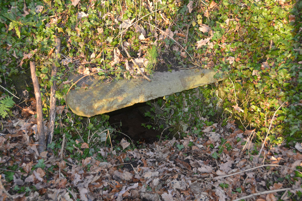
Homeacres Holy Well (Stanwix) submitted by Anne T on 10th Jan 2019. My husband was brave enough to slide down one of the old paths to the well, from the small road leading to the Rickerby Park car park. This path starts at approx. NY 40399 57112, at the top of the slope and almost immediately due north of the well.
(View photo, vote or add a comment)
Log Text: Homeacres Holy Well, Rickerby Park, Carlisle: We just about had time to stop off and find this well on our way home. Parking by the lawn tennis club just down the road, we walked to see what we thought was the stump of an old cross at approx. NY 40142 56900, but it turned out to be the stump of an old tree trunk which had been carved into what looked like an old boundary marker.
We headed off north east until we reached the junction of Well Lane and the B6264 (Brampton Road), then walked down the road leading to the car park in Rickerby Park. Reaching the junction with the footpath leading almost due west at NY 40510 57081, we walked past a marshy/boggy area which had wooden boarding at one end and a sign saying ‘deep water’.
Walking through the gate across the footpath, we peered deep into the undergrowth and eventually spotted what looked like a railway sleeper running about 6-8ft horizontally across the bank with a black void underneath. We tried to walk across the grassy area to the fence to get nearer to take a photograph, but the land was very waterlogged and we retreated.
Going back up towards Brampton Road, just past the cattle grid, there are faint traces of a footpath which runs down towards the well. Andrew made it down to the well and took some photographs. Having hurt my shoulder, I decided to stay on (this very busy) road. Andrew said there were also traces of another footpath running towards the well from the southern side of Brampton Road, just opposite Well Lane, but we would have had to climb over the metal railing to access it; the path was just visible, but very overgrown.
The well still had water in it. A couple of passers by on the lower path looked us with curiosity, one man asking us what we were looking at. When we told him a holy well, he looked at us in disbelief. I thought the nearby 'Well Lane' might have been a clue, although we initially thought the well was located down Well Lane and not in the park.
Casterton
Trip No.144 Entry No.5 Date Added: 13th Aug 2019
Site Type: Stone Circle
Country: England (Cumbria)
Visited: Yes on 8th Aug 2019. My rating: Condition 2 Ambience 3 Access 3
Casterton submitted by WindC on 26th Feb 2012. Looking eastwards, a moment when the cloud base lifted..
26/2/12
(View photo, vote or add a comment)
Log Text: Casterton Stone Circle and Settlement: I found this walk VERY difficult once we were in the field containing the stone circle, largely due to the steepness of the slope, but mainly due to all the stones and boulders hidden under the turf. I did not enjoy this visit at all, despite having really wanted to visit this stone circle.
We parked at SD 64084 79316 and walked northwards up the lane towards Brownthwaite Pike, a steady uphill plod, passing a spring which emerged from just the other side of the wall, and piped under the footpath to the field beyond.
Reaching the gate into the field with the stone circle, which the farmer allows access to, we had to wade through the first 10-15m, as water was trickling down the slope from across the footpath and pooling around the gate. I was quite astonished at all the heaps of stones (clearance cairns) and part-walls all across the field. It reminded me of the ‘5,000 tons of stones’ site in County Durham that Time Team looked at but couldn’t work out what it was.
On (finally) reaching the stone circle, which took the best part of 40 minutes, my interpretation was that this was a ring cairn, not a stone circle.
On the way back up the slope, did we find a boulder with cup mark? The interior was very smooth, unlike the solution holes, which have a rim. There was also another boulder with a large ‘solution hole’ on its side – an odd location for a solution hole.
