Contributory members are able to log private notes and comments about each site
Sites Anne T has logged. View this log as a table or view the most recent logs from everyone
The Kendal Cross
Trip No.178 Entry No.1 Date Added: 21st Jun 2022
Site Type: Ancient Cross
Country: England (Cumbria)
Visited: Yes on 21st Jun 2022. My rating: Condition 3 Ambience 3 Access 4
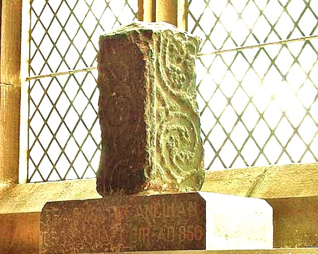
The Kendal Cross submitted by Sunny100 on 30th May 2010. The Kendal Cross, Cumbria, at SD.517922.
(View photo, vote or add a comment)
Log Text: The Kendal Cross: located on a window sill in the Lady Chapel (east end of south aisle) in the Parish Church of Kendal, Holy Trinity.
The fragment was sited in strong sunlight at the time of our visit, so difficult to photograph.
Such a huge church, apparently the widest in Cumbria, and also the oldest in Kendal, with the site older than the building, as 'evidenced by the 8th/9th century cross shaft'.
A replica of the cross sits outside the western end of the church, on the green between the western entrance gates and the church.
St Peter's Church (Heversham)
Trip No.178 Entry No.3 Date Added: 22nd Jun 2022
Site Type: Ancient Cross
Country: England (Cumbria)
Visited: Yes on 21st Jun 2022. My rating: Condition 3 Ambience 3 Access 4
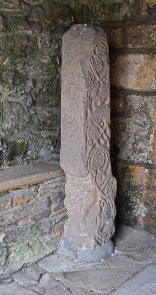
St Peter's Church (Heversham) submitted by Anne T on 22nd Jun 2022. Heversham 01, located in the south porch, near the south door. Dating to the late eighth century. The church guide says that the war memorial in the churchyard is probably a replica of what this cross would originally have looked like.
(View photo, vote or add a comment)
Log Text: St Peter's Church, Heversham: A lovely little village, but so very full of builders with loud radios, which there was no avoiding.
Inside the church was quiet, but a number of other visitors who came and went. We looked at the cross shaft (and the very old south door) in the south porch, and easily found the small fragment in the external wall to the east of the porch, in the south wall.
The church itself was simple and unremarkable, apart from an old wooden pew which was carved with the date 1626, and a huge chest at the east end of the north aisle, which dates from1400.
Anchorite Well (Kendal)
Trip No.178 Entry No.2 Date Added: 22nd Jun 2022
Site Type: Holy Well or Sacred Spring
Country: England (Cumbria)
Visited: Yes on 21st Jun 2022. My rating: Condition 4 Ambience 3 Access 4
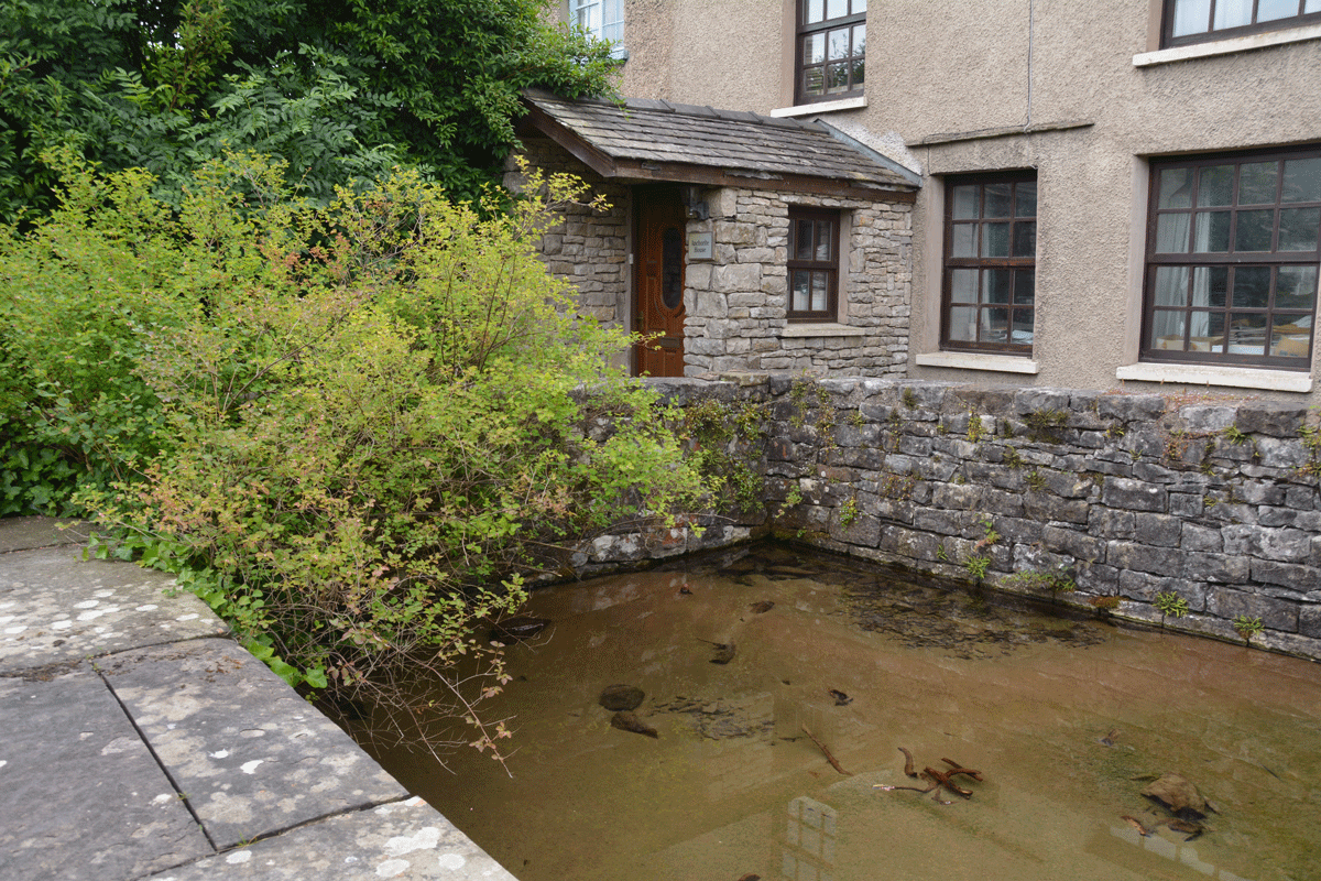
Anchorite Well (Kendal) submitted by Anne T on 22nd Jun 2022. Looking southwards towards Anchorite Cottage. Whilst the cottage looks relatively modern, the style of the windows indicate this structure is older than it looks (but not as old as the original hermitage!).
(View photo, vote or add a comment)
Log Text: Anchorite Well, Kendal: a short-ish walk from Trinity Church (Kendal Parish Church), through a modern housing estate. The roads have some interesting names: Buttery Well Road (couldn't find the well, though), Mint Cake Cottages and Kirkbarrow.
The well was easily spotted as there is a large green metal sign at the entrance to the site.
Beautifully clear water. Would have liked to have been able to walk all the way around the well pool, but the western side path was private access only to the cottages.
Plague Stone (Penrith)
Trip No.180 Entry No.1 Date Added: 10th Jul 2022
Site Type: Ancient Cross
Country: England (Cumbria)
Visited: Yes on 9th Jul 2022. My rating: Condition 3 Ambience 3 Access 4
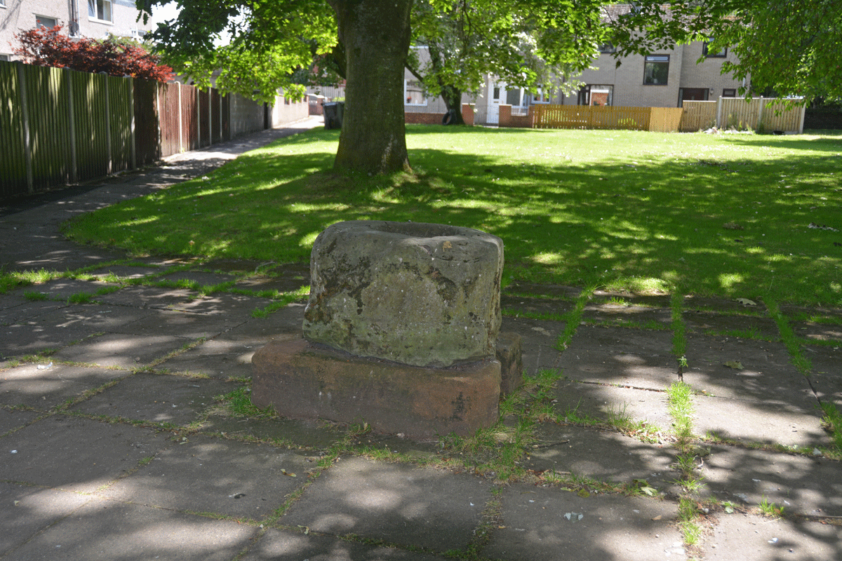
Plague Stone (Penrith) submitted by Anne T on 10th Jul 2022. The cross base/plague stone is sadly being used as a rubbish bin by all the passing walkers.
(View photo, vote or add a comment)
Log Text: Plague Stone/Cross Base, Penrith: We've driven by this site many a time without realising this stone was here. A bit difficult to find somewhere to park, as the stone is near the hospital, community college and fire station, but there is a modern housing estate, so disk parking is available along Tynefield Drive.
The stone was easily found, once we picked it out from amongst the shadows of the surrounding trees.
I wasn't aware of The Great Plague of Cumbria until I researched more about this stone. Definitely a re-purposed cross base. Shame it's being used as a rubbish bin by people who pass by.
Bampton Grange Cross
Trip No.180 Entry No.2 Date Added: 10th Jul 2022
Site Type: Ancient Cross
Country: England (Cumbria)
Visited: Yes on 9th Jul 2022. My rating: Condition 3 Ambience 4 Access 4

Bampton Grange Cross submitted by Anne T on 10th Jul 2022. The cross / boundary marker has some amazing views across the fells.
(View photo, vote or add a comment)
Log Text: Bampton Grange Cross: A glorious day. We'd previously seen this cross in August 2020, when lockdown restrictions had been briefly lifted for a short time, but I didn't post any photographs. That day had been grey and the cemetery busy with people strimming grass around family graves. Today was glorious, and we had the cemetery to ourselves (living people, that is).
This cross has had a hard life, but has spectacular views over the fells.
We finished this visit with a trip to the Bampton Village Store which served teas, toasties and cream teas, and were made very welcome. NY 51505 18200, with a parking area to the side of the store.
Cross Stone of Keverigg
Trip No.180 Entry No.3 Date Added: 11th Jul 2022
Site Type: Ancient Cross
Country: England (Cumbria)
Visited: Couldn't find on 9th Jul 2022
Log Text: Cross Stone of Keverigg: The location of the stone was clearly marked on the Historic England Map search map, but despite my husband clambering (very carefully) over the dry stone wall and stock fence at the eastern end of the access land, he was unable to find the stone. There was considerable growth of grass and weeds in the area, and plenty of moss and lichen on the surrounding stones. He did, however, find the Cross Shaped Stone that MonumentMan has submitted (SID 52464), 23m away.
Cross Shaped Stone of Keverigg
Trip No.180 Entry No.4 Date Added: 11th Jul 2022
Site Type: Ancient Cross
Country: England (Cumbria)
Visited: Yes on 9th Jul 2022. My rating: Condition 3 Ambience 3 Access 3
Cross Shaped Stone of Keverigg submitted by MonumentMan on 13th Oct 2019. 'Cross-Shaped' stone of Keverigg
in Shap Blue granite due south of the 19thC cross carved boulder of the same name which marks the parish boundaries of Shap, Crosby Ravensworth and Sleagill.
(View photo, vote or add a comment)
Log Text: Cross Shaped Stone of Keverigg: We went looking for the boundary stone inscribed with a cross, as marked on the modern OS map, but were unable to find it (grass too high and lots of lichen and moss on surrounding rocks to be able to make out the carved cross).
My impression of this particular stone is that it's the remnants of a quarried stone (or natural), as it lies on/near a long line of limestone pavement.
Roman Bridge Remains (Bitts Park)
Trip No.181 Entry No.1 Date Added: 17th Jul 2022
Site Type: Ancient Trackway
Country: England (Cumbria)
Visited: Yes on 17th Jul 2022. My rating: Condition 2 Ambience 1 Access 4

Roman Bridge Remains (Bitts Park) submitted by Anne T on 17th Jul 2022. The main bulk of the stones from the old Roman Bridge dredged from the River Eden are now displayed between the river and the main avenue through the northern side of Bitts Park. It's not at all obvious what these stones were from, as there was no information board at the time of our visit.
(View photo, vote or add a comment)
Log Text: Roman Bridge Remains, Bitts Park: A lovely park, and a lovely walk. Stones are hidden largely in deep shade between the main avenue running along the northern side of the park and the river. We needed to drop down onto the sandy paths below the avenue, and follow the river along. The four stone 'sculptures' come into view first. The rectangular 'display' of stones is about another 100m further westwards.
St Michael and All Angels (Isel)
Trip No.184 Entry No.2 Date Added: 31st Jul 2022
Site Type: Ancient Cross
Country: England (Cumbria)
Visited: Yes on 24th Jul 2022. My rating: Condition 3 Ambience 4 Access 4
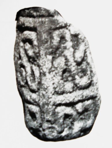
St Michael and All Angels (Isel) submitted by Sunny100 on 30th Apr 2011. The 9th-10th century 'Triskele Stone' in St Michael's church, Iselgate, Cumbria. This three armed Norse carving could well represent The Holy Trinity.
(View photo, vote or add a comment)
Log Text: St Michael and All Angels, Isel/Blindcrake: We had first visited the Grade II listed medieval well in Blindcrake at NY 1486 3482, which has a domed well head very similar to the holy well at Brompton.
This is a very, very pretty location for a church, and the inside did not disappoint. There are two fragments of the same cross shaft displayed immediately opposite as you walk in through the south porch, a couple of fragments built into the walls, and four sun-dials. We went armed with Guy Points's Cumbria Gazetteer, and found all the stones he mentioned.
Priest's Well (Catlowdy)
Trip No.187 Entry No.1 Date Added: 2nd Sep 2022
Site Type: Holy Well or Sacred Spring
Country: England (Cumbria)
Visited: Couldn't find on 30th Aug 2022

Priest's Well (Catlowdy) submitted by Anne T on 2nd Sep 2022. Priest's Well is shown on the 1864 25 inch OS map, see Priest's Well, Catlowdy. Shared under the National Library of Scotland Creative Commons Attribution-Non-Commercial-ShareAlike 4.0 International (CC-BY-NC-SA) licence.
(View photo, vote or add a comment)
Log Text: Priest's Well, Catlowdy: Tried to find, but the footpath appears block by recently constructed areas for horses. Not wanting to disturb these beautiful animals, we gave up on our search, and will try and seek permission to enter from another direction at a future date.
St Anne's Well (Shap)
Date Added: 6th Sep 2022
Site Type: Holy Well or Sacred Spring
Country: England (Cumbria)
Visited: Yes on 12th Jun 2020. My rating: Condition 4 Ambience 4 Access 4
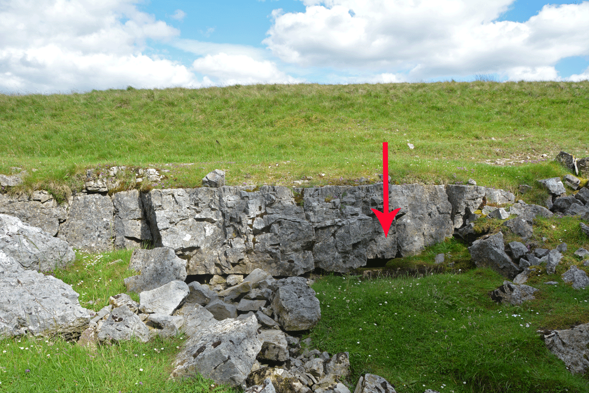
St Anne's Well (Shap) submitted by Anne T on 6th Sep 2022. The water from this well emerges from a small, easily spotted area of limestone pavement, immediately to the east of the small forested area.
(View photo, vote or add a comment)
Log Text: St Anne's Well, Shap: Stopped off for a break on one of very rare essential car journeys during lockdown, when exercise restrictions had been relaxed slightly. A lovely spot, although difficult to park as the long, thin, layby next to the motorway maintenance compound was full with cars of other walkers and dog walkers.
Heading east to walk around the forested areas, the noise of the motorway disappeared, and it was easy to spot the small area of limestone pavement this well is located in.
A very peaceful and lovely spot, although a fair way from any habitation in this era.
Stanger Spa
Date Added: 8th Sep 2022
Site Type: Holy Well or Sacred Spring
Country: England (Cumbria)
Visited: Yes on 14th Jun 2020. My rating: Condition 3 Ambience 4 Access 3

Stanger Spa submitted by DavidRaven on 13th Dec 2005. The roof-less building that houses the Stanger Spa is hidden away in a copse of birch and poplar. The site isn't easy to find, following ill-defined footpaths through pastureland. It's worth the hunt though. A very quiet place, good to spend time there, not doing much.
(View photo, vote or add a comment)
Log Text: Stanger Spa Well, Embleton: The well is approached by a narrow causeway which runs through a boggy area, terminating at the well house. At the time of our visit, the land around the well was very wet, and in places there were deep puddles of water around the edges of the well house.
Whilst there were lots of other walkers in the area, I didn't see anyone else look at the well house.
An interesting spot and well worth visiting.
St Ninian's Preconquest Monastery (Ninekirks)
Trip No.188 Entry No.2 Date Added: 18th Sep 2022
Site Type: Ancient Village or Settlement
Country: England (Cumbria)
Visited: Yes on 13th Sep 2022. My rating: Condition 1 Ambience 4 Access 3
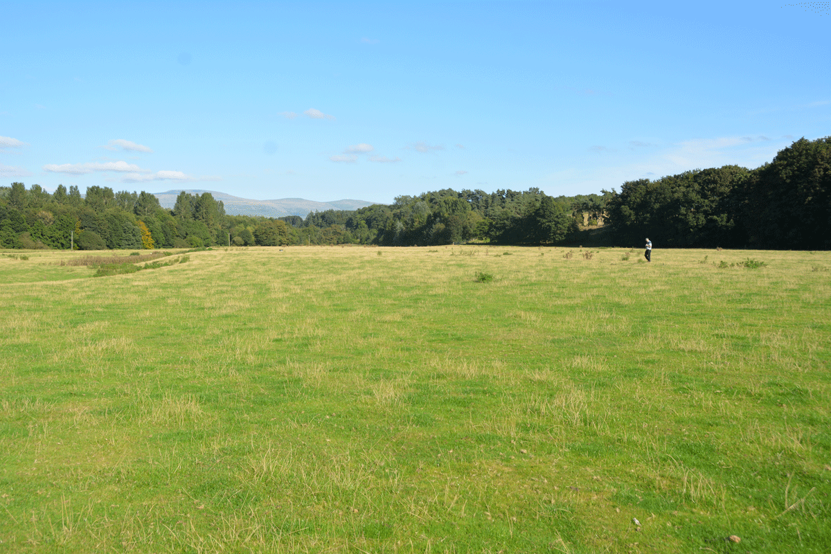
St Ninian's Preconquest Monastery (Ninekirks) submitted by Anne T on 18th Sep 2022. Husband, Andrew, stands at the grid reference given by Historic England for this site. Only a few very low 'lumps and bumps' visible in the landscape, but after a prolonged dry period, some lighter areas of grass may have identified the vague outline of foundations of buildings. Certainly some harder areas of ground (felt by our feet) seemed to run in straight lines, and could indicate stone foundations under the turf.
(View photo, vote or add a comment)
Log Text: St Ninian's Pre-Conquest Monastic Site: See visit report for St Ninian's Church (Ninekirks) for now. More details to follow.
Rockcliffe (Cumbria)
Trip No.38 Entry No.3 Date Added: 18th Aug 2017
Site Type: Ancient Cross
Country: England (Cumbria)
Visited: Yes on 17th Aug 2017. My rating: Condition 3 Ambience 4 Access 5
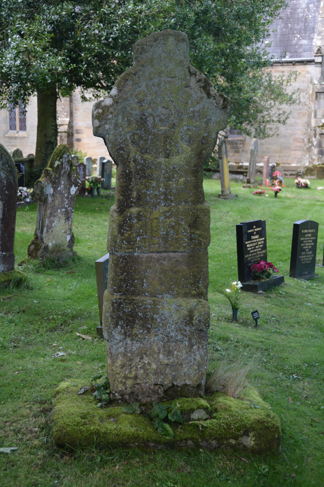
Rockcliffe (Cumbria) submitted by Anne T on 18th Aug 2017. First view of the Rockcliffe Cross from the iron gates by the mounting block. It sits to the right of the path leading to the south porch.
(View photo, vote or add a comment)
Log Text: The Rockcliffe Wheel-headed Cross, Cumbria: From the centre of Carlisle, we followed the signs heading north on the A7, out to the large Asda by the M6. Just before junction 44, a road north west into the industrial estate, clearly signposted to Rockcliffe.
This road leads straight into the village, with the church being on the south western corner of the village where the minor road turns right. There is room to park by the main iron gates to the church, next to the mounting block, in a small triangular piece of road.
Immediately inside the gates, the cross is straight in front of you, just to the right of the path leading to the south porch. Nearby is a modern grave marker in a smaller, but similar shape.
The church sits on a promontory, and as you walk down to the south porch a bend of the River Eden comes into view. On the north side of the church the land drops sharply down to Rockcliffe Beck with some graves on the terrace below. Even I was intrigued enough to walk the narrow path along the northern side of the church because I wanted to see the layout of the churchyard.
Sadly the church was locked, as I’d loved to have seen inside.
St Ninian's Well (Brisco)
Trip No.39 Entry No.2 Date Added: 31st Jul 2019
Site Type: Holy Well or Sacred Spring
Country: England (Cumbria)
Visited: Yes on 17th Aug 2017. My rating: Condition 3 Ambience 3 Access 4
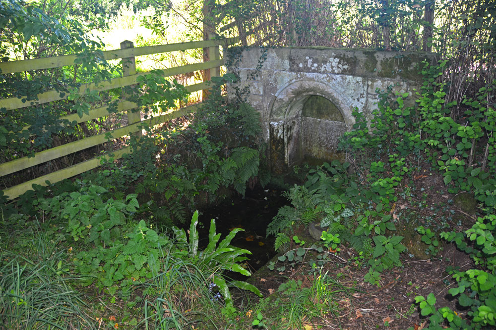
St Ninian's Well (Brisco) submitted by Anne T on 18th Aug 2017. First view of St Ninian's Well as we turned the corner of the dog-leg in the footpath.
(View photo, vote or add a comment)
Log Text: St Ninian's Well, Brisco, Cumbria: From Carlatton Demesne Standing Stone, heading back onto the A69, we took the M6 to junction 42, then the third exit towards Durdar. Brisco (Briscoe according to Pastscape) is the first turn to the right. The village is a line of houses on both sides of the road. We parked where the road widened slightly at Brisco Hall farm and walked back southwards to the footpath, which runs to the north of Well View cottage (they have a sign on the side of the house saying their drive is Elvis Presley Boulevard!), and followed the grassy lane down towards the railway line. Where the path does a right hand turn, there is a small set of stone steps. The footpath then turns north east towards the railway line, going through a gate into a field. The well is in this small enclosed area, tucked away at its south eastern end, mostly hidden by shrubs and brambles.
There is an arched well head that looks Victorian, and Pastscape and Historic England says was erected in the 1830s to 1840s. A step goes down to the well basin, in which, under the water, is a circular structure with a circular hole in its middle. In the corner of the fence facing the well is a small wooden bench, covered by brambles when we visited, but we used sticks to move these away and sit and admire this spot.
From the well, a gate leads through a fence-line down into a field of pasture below (the ground drops by 3-4 feet and there are steps down to the new ground level). This ground is wet and boggy and in line with the well head and pool is a cattle truck. A steady trickle of water comes through the bottom of the trough into a pool which has large boulders pushed around it in a partial circle, now partly destroyed. It looks like this might have been the original well pool. At the bottom of the field, the main west coast railway line runs and we watched several intercity trains and a steam train go by before returning to go into Carlisle for a late lunch then onto our next stop – a wheel-headed cross north west of Carlisle in Rockcliffe.
Carlatton Demesne
Trip No.39 Entry No.1 Date Added: 18th Aug 2017
Site Type: Standing Stone (Menhir)
Country: England (Cumbria)
Visited: Yes on 17th Aug 2017. My rating: Condition 3 Ambience 4 Access 4
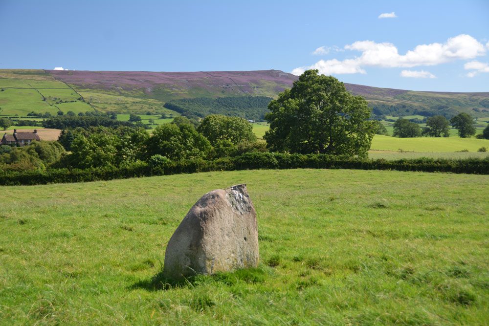
Carlatton Demesne submitted by Anne T on 18th Aug 2017. Standing on the edge of the slight mound on which the stone sits, looking south east towards Castle Carrock Fell.
(View photo, vote or add a comment)
Log Text: Carlatton Demesne Standing Stone: Following the A69 to Carlisle, the only way we could turn left off the A69 to get to Carlatton was to drive north into Brampton and back out again, under the A69. We then followed the B6413 through Castle Carrock, turning off westwards along the minor road past Moor House and Black Dub. The entrance to Carlatton Demesne Farm is around 650 metres further south of the track to Black Dub farm and there is a small hard-cored area just to the south of Carlatton Demesne Farm track, alongside the road.
At first, we walked back towards the small wood to the north-north-east to where we’d seen a gate. The gate was only held up by four pieces of wire and was very rickety, so we abandoned attempts to climb over and walked back up the farm track to where the footpath ran. I heard the farmer start his machinery up in the yard so walked along to have a word with him. It was actually a young farm worker who told me it was OK to walk through the field to look at the standing stone. He told me if we carried along the road towards Penrith, we’d get some pretty spectacular views. In the end, we retraced our steps and didn’t go down that way, but will bear that in mind for future visits.
The countryside is very pretty here, although gaining entry into the field was fun with its very muddy patch by the gate, and having stepped into the pasture, there were hidden, still soft cow pats hidden under the calf length grass. Our stone is number 4 in the list below. It appeared to be sited on top of a small, but pronounced mound with superb views around 360 degrees, with Carrock Fell to the east. It would have been a splendid setting for a stone circle.
Plotting out the points on UK Grid Reference Finder, the NGRs mentioned below form a loose alignment rather than a circle.
St Mary's Motte (Beaumont)
Trip No.40 Entry No.8 Date Added: 25th Aug 2017
Site Type: Misc. Earthwork
Country: England (Cumbria)
Visited: Yes on 20th Aug 2017. My rating: Condition 3 Ambience 4 Access 5
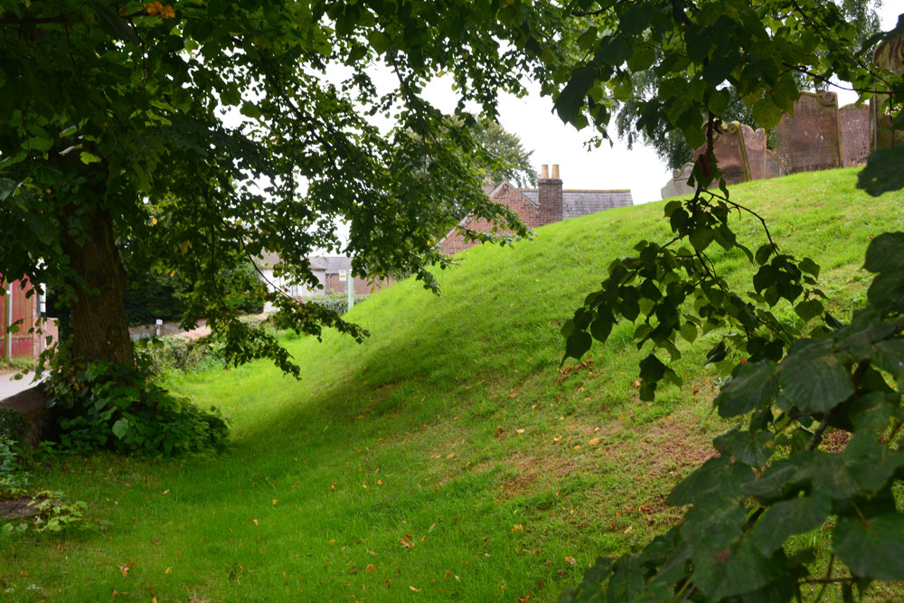
St Mary's Motte (Beaumont) submitted by Anne T on 22nd Aug 2017. Looking at the southern section of the motte, which has been partly cut by the modern road through the village. Pastscape says that the site may originally have been a Saxon or Danish settlement, then the site of turret 70a on Hadrian's Wall, then a Norman motte, finally being replaced by the church in the 12th century.
(View photo, vote or add a comment)
Log Text: St. Mary's Beaumont: Church built on a motte, on a milecastle on a possible Saxon camp: We came to try to see St. Ann’s Well, marked on the OS map as being just off the small triangular village green, but found it was in a private garden surrounded by either a tall hedge or other buildings, so there was no access and no-one around to ask. According to the Old Cumbria Gazetteer, the well is at NY35055942, which is nearer the River Eden, says the well is at NY35055942 (which is different to the OS map) and: “This provided very cold water, useful for helping set the butter. By the time you’d got back up the bank your bucket was only half full.” Dated to 1867 to 1868.
There were lots of walkers trundling along Hadrian’s Wall Path at this point, with a large notice by the interpretation board saying there was a detour due to a large landslip. By this time, my attention had been grabbed by the interpretation board saying this church was built on the line of Hadrian’s Wall and that at one point, a turret (70A) would have stood on the site of the church. The church guide continues: “When the Normans arrived they constructed a motte and baillie as a vantage point to repel invasion from the Scots …. Stones from the wall provided ready building material.”
This is a very pleasant spot. There were so many tractors driving around at this time of the evening we felt out of place! There are farms all along the road through the village. I’d have liked to have seen across to the River Eden, but the farm buildings and houses along its western bank obscured the view. We decided on one final visit, to try and see St. Edward’s Monument (so wet we couldn’t get near last time).
St Andrew's Well (Kirkandrews-on-Eden)
Trip No.40 Entry No.6 Date Added: 22nd Aug 2017
Site Type: Holy Well or Sacred Spring
Country: England (Cumbria)
Visited: Yes on 20th Aug 2017. My rating: Condition 3 Ambience 4 Access 4
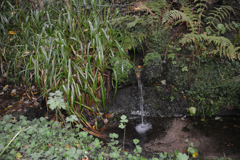
St Andrew's Well (Kirkandrews-on-Eden) submitted by Anne T on 22nd Aug 2017. Standing looking at the bank where the spring emerged, with the well pool - a rectangular stone (or brick?) basin - below. There was a steady flow of water, which could be heard from quite a way away.
(View photo, vote or add a comment)
Log Text: St Andrew's Well, Kirkandrews-on-Eden: From Stapleton, we headed to junction 44 of the M6 and stopped for refreshments at Houghton Park Garden Centre, then set off via the A689 (western part of the bypass round Carlisle, turning right at the roundabout where the A689 joins Burgh Road. Kirkandrews is almost 2.5 km to the north west of this point.
In the middle of Kirkandrews-on-Eden the road splits. The left hand fork goes directly to Monkhill, the right hand fork to Beaumont. The old churchyard is somewhat hidden behind bushes, but is approx. 120 metres from the fork in the road. We parked at the wide farm entrance a little further up the road and walked back to the footpath sign.
We followed the footpath for about 50 metres (the old grave stones peer out of the very high grass to your right hand side. As the path starts to descend, we could hear a steady trickle of water and found the well hidden behind weeds that were as tall as I was. Gently moving these aside, so we have a clear view (we thought the weeds might be poisonous) I took photographs. My husband announced this was a very spooky spot (overgrown trees next to a decidedly no longer used grave yard) although I found it strangely tranquil.
There was a channel running down the hillside taking rainwater down to the well pool. The main water came out of the bank to the side at a 90 degree angle to the sandstone basin, then trickled down into a second channel running down the hill.
The basin was much silted up with sandy soil but the flow was strong and clear. Although Pastscape says the well pool is 1.0 metre square, I thought it was rectangular, measuring 1.5 m long b about 80cm wide.
Don’t know what happened to the church, but then just discovered the small mention below – closed in the 1750s with no visible evidence remaining.
St Mary's Church (Walton)
Trip No.40 Entry No.1 Date Added: 22nd Aug 2017
Site Type: Ancient Cross
Country: England (Cumbria)
Visited: Yes on 20th Aug 2017. My rating: Condition 3 Ambience 3 Access 5
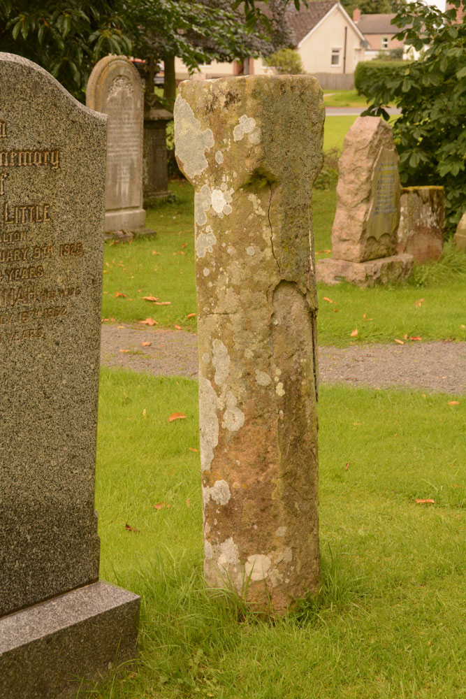
St Mary's Church (Walton) submitted by Anne T on 22nd Aug 2017. Standing nearer to the south western corner of the church looking back at the cross shaft. The stone is badly shattered and spalled off on this side.
(View photo, vote or add a comment)
Log Text: St. Mary's, Walton: Went to see a cross head, but found an 11th century market cross instead! This is a very pretty little village, and was on our way back to Stapleton to try to find the Bride’s Well (ran out of time last Thursday). We parked opposite the church on the side of the village green and walked across to the church, letting ourselves in through the rather rusty gate (it took us ages to work out how to open it). I excitedly followed my husband into the church but stopped dead as there was no sign of the cross head at all.
We hunted under pews, up and down the aisles, on window ledges, around the font, inside a chest, and all the places we could think of. The only sign of the cross was a photograph and a brief description on the display boards against the north western wall of the nave, which showed it displayed on top of the font cover. (I’ve since sent an email to the vicar to enquire where it might be located or moved to, but not had a reply yet).
We did however, see a paragraph on the display boards headed AD850 to 1066: “During the latter part of the 9th century to the middle of the 11th century, Walton, as a community, developed. The evidence for this is shown by the relics found in or around the present church. Between the years of 850 to 950, a preaching cross was erected and similarly between 1000 and 1050, a market cross was probably erected.” There is an image of the remains of the market cross in the churchyard. We then went to find this, disappointed not to have found the cross head, but pleased there was something of antiquity to have made this detour worthwhile.
King Edward's Monument
Trip No.40 Entry No.7 Date Added: 22nd Aug 2017
Site Type: Cairn
Country: England (Cumbria)
Visited: Yes on 20th Aug 2017. My rating: Condition 3 Ambience 4 Access 4
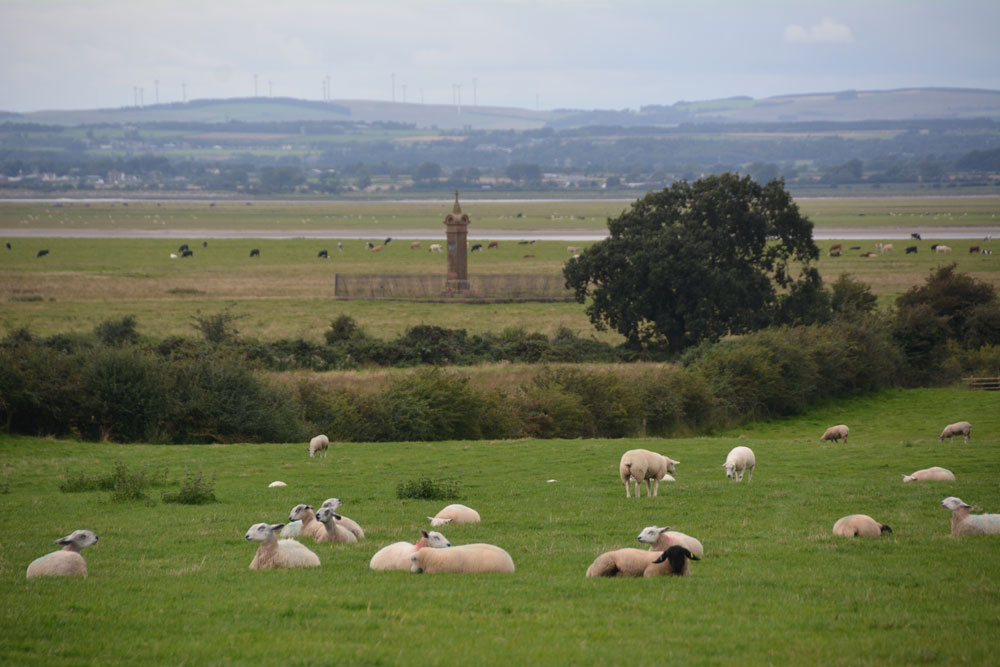
King Edward's Monument submitted by Anne T on 22nd Aug 2017. First view of the monument from the parking area at NY 32876 60329
(View photo, vote or add a comment)
Log Text: King Edward's Monument, Burgh-by-Sands: After having visited Beaumont, I was reluctant to go home without seeing something of the Solway, and looking across to Dumfries & Galloway, where we spent 12 years. When we last visited in February 2014 we were unable to get down the lane because it was so waterlogged (we got about one third of the way down and had to abandon the visit, having seen the monument only from afar). This time, the lane looked dry, so we parked by the little triangle of grass and could see the monument on the marshland below.
Appearances were certainly deceptive – parts of the lane were ankle deep in mud, and we picked our way from the track to the marshy grass land next to it, to dry stones and boulders where we could. Eventually we came to the stile over a small stream at NY 32773 60897, which led immediately down to a small wooden bridge and onto another stile. The other side of this stile was deep in water, but thankfully previous walkers had moved ‘stepping stones’ into the water. Once onto Burgh Marshes, the mounds left by ridge and furrow ploughing kept our feet dry until we got to the monument. Parts by the brick wall/metal railings surrounding the monument looked as if it was surrounded by a small moat!
What a place to have waited to cross the Solway. I think I would have preferred to have seen the original cairn rather than this Victorian monstrosity. The chimneys of Chapelcross, the decommissioned nuclear power plant, could be seen across the estuary, together with the flattened hilltop of Burnwark hillfort.
At the time of our visit, the tide was out, but I could imagine the shimmering water of the Solway to the west. A fitting end to a nice afternoon out.
