Contributory members are able to log private notes and comments about each site
Sites AngieLake has logged. View this log as a table or view the most recent logs from everyone
Lade Hill Brook Beehive Hut
Date Added: 26th Sep 2010
Site Type: Ancient Mine, Quarry or other Industry
Country: England (Devon)
Visited: Yes on 25th Aug 2008
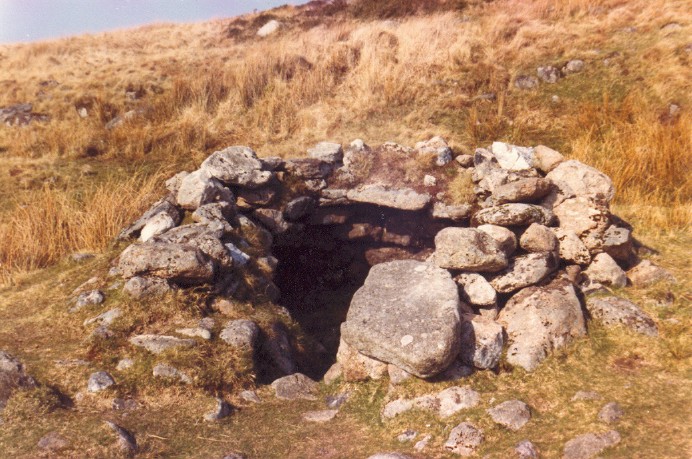
Lade Hill Brook Beehive Hut submitted by AngieLake on 25th Aug 2008. Lade Hill Brook Beehive Hut is situated on the east bank of the East Dart river. This photo was taken in the mid-1980s.
See site page for info.
(View photo, vote or add a comment)
Log Text: None
Knowlton Rings
Date Added: 26th Sep 2010
Site Type: Henge
Country: England (Dorset)
Visited: Yes on 6th Nov 2005
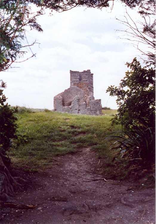
Knowlton Rings submitted by AngieLake on 6th Nov 2005. This area of the henge seemed very mystical, probably an original entrance between the two yew trees when the church was in use?
(View photo, vote or add a comment)
Log Text: None
Kinnerton
Date Added: 26th Sep 2010
Site Type: Standing Stones
Country: Wales (Powys)
Visited: Yes on 9th Aug 2008
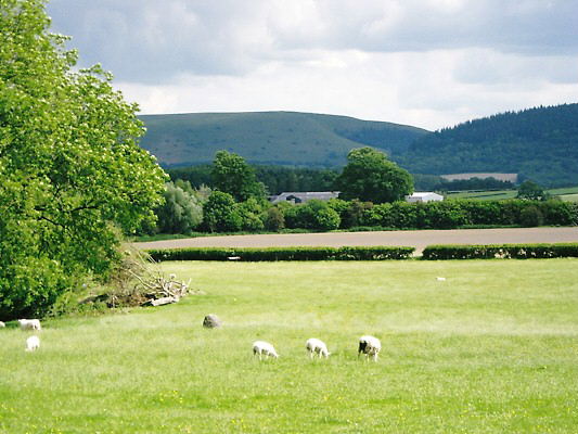
Kinnerton submitted by AngieLake on 9th Aug 2008. The stone at Kinnerton. I didn't want to disturb the ponies in the field, so had to be content with this shot from the gate.
6 June 08
(View photo, vote or add a comment)
Log Text: None
King Stone at the Rollrights
Date Added: 26th Sep 2010
Site Type: Standing Stone (Menhir)
Country: England (Oxfordshire)
Visited: Yes on 4th Jul 2006

King Stone Round Cairn submitted by AngieLake on 4th Jul 2006. The King Stone viewed from near the brow of the hill to its north, and a cairn-like circle of stones that were possibly in the area of the tumulus mentioned in the legend. Unsure if these have always been in this position.
The Kings Men are across the road behind the trees, to the far right of this view.
(View photo, vote or add a comment)
Log Text: None
King Doniert's Stone
Date Added: 26th Sep 2010
Site Type: Ancient Cross
Country: England (Cornwall)
Visited: Yes on 19th Oct 2004
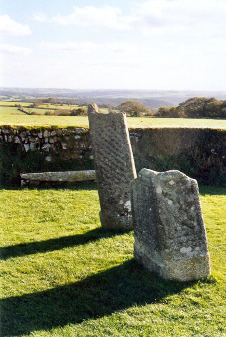
King Doniert's Stone submitted by AngieLake on 19th Oct 2004. In this picture, the interlaced engraving on the side of the tallest stone can be seen more clearly. Granite is very hard stone to carve, so it must have taken a long time to make those patterns. The inscription about King Doniert is on the shaded side of the shorter stone in the foreground.
(View photo, vote or add a comment)
Log Text: None
King Arthur's Hall
Date Added: 26th Sep 2010
Site Type: Standing Stones
Country: England (Cornwall)
Visited: Yes on 15th Jul 2005
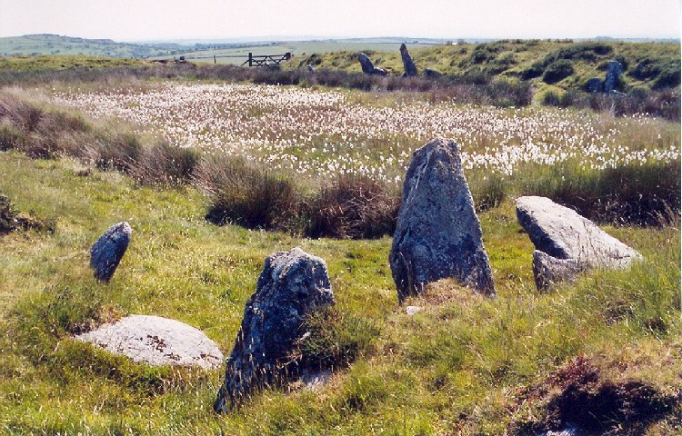
King Arthur's Hall submitted by AngieLake on 15th Jul 2005.
Blessed by lovely weather, my visit to this strange site was enhanced by the cloud of fluffy white bog cotton dancing in the breeze. This view looks diagonally back towards the entrance gate, with Roughtor behind me in the distance, at 38degs from the largest pointed stone near to the camera. Note the way the two large pointed stones stick up on the 'west' side of the site. The tallest of these aligns at 109degs with Roughtor. It struck me how much the three of them (with a shorter one bet...
(View photo, vote or add a comment)
Log Text: None
Kestor Settlement
Date Added: 26th Sep 2010
Site Type: Ancient Village or Settlement
Country: England (Devon)
Visited: Yes on 24th Oct 2004
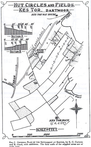
Kestor Settlement submitted by AngieLake on 24th Oct 2004. This old plan of Kes Tor hut circles and fields, includes the Round Pound. It appears that the line of parallel stones that theCaptain queried could be an old drove way. (Here referred to as 'Lower Drove Way'). In very small letters halfway up the right side of the plan, near the letter 'A', is 'Upper Drove Way'. The small print at the bottom of pic says: "Fig 2. General Plan of the Settlement at Kestor, by E.C.Curwen and R.Gurd, with additions. The field walls of the stippled areas are of...
(View photo, vote or add a comment)
Log Text: None
Kent's Cavern
Date Added: 26th Sep 2010
Site Type: Cave or Rock Shelter
Country: England (Devon)
Visited: Yes on 18th Feb 2010
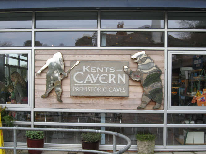
Kent's Cavern submitted by AngieLake on 18th Feb 2010. Kents Cavern which won a Best in the SW award in 2008 for its excellent attractions.
(View photo, vote or add a comment)
Log Text: None
Kenmare
Date Added: 26th Sep 2010
Site Type: Stone Circle
Country: Ireland (Republic of) (Co. Kerry)
Visited: Yes on 19th Jul 2010

Kenmare submitted by AngieLake on 19th Jul 2010. One half of the view of Kenmare circle taken in August 2001. This shows a more open view before the conifers spoiled it.
(View photo, vote or add a comment)
Log Text: None
Kenidjack Common holed stones
Date Added: 26th Sep 2010
Site Type: Stone Row / Alignment
Country: England (Cornwall)
Visited: Yes on 19th Jul 2005
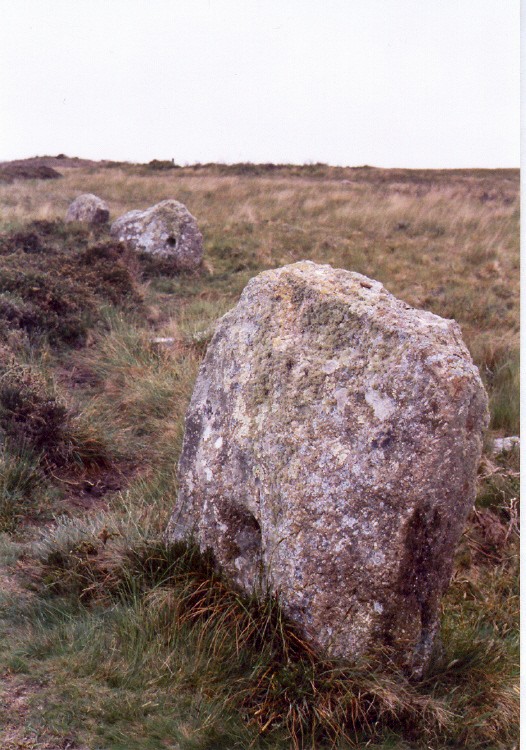
Kenidjack Common holed stones submitted by AngieLake on 19th Jul 2005. Described as Kenidjack Holed Stones in Ian McNeil Cooke's book, Journey to the Stones, this was my first view late afternoon (slightly dull then), looking approximately west from the largest one towards the other two that remain standing. Apparently they were re-erected after the mid-19th century.
(View photo, vote or add a comment)
Log Text: None
Irthlingborough and Stanwick Barrows
Date Added: 26th Sep 2010
Site Type: Barrow Cemetery
Country: England (Northamptonshire)
Visited: Yes on 20th Dec 2009
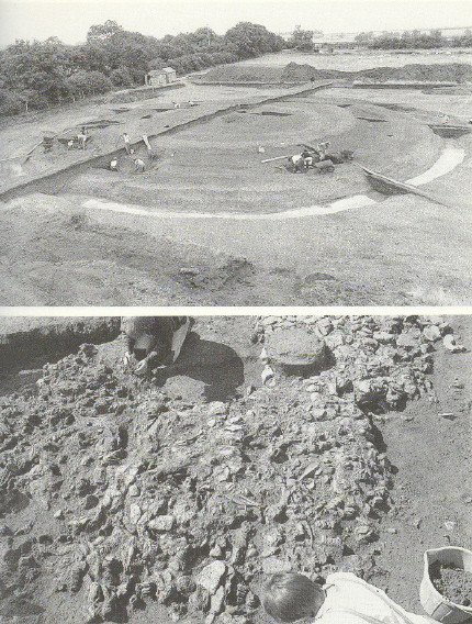
Irthlingborough and Stanwick Barrows submitted by AngieLake on 20th Dec 2009. These two old photos of Irthlingborough were found in a 1993 edition of E.H.'s 'Bronze Age Britain', by Michael Parker Pearson. [P.79]
Captions: (top) - "The round barrow at Irthlingborough (Northamptonshire) under excavation." [In 1986]
(bottom) - "The deposit of cattle skulls and other bones at Irthlingborough."
(View photo, vote or add a comment)
Log Text: None
Hurston Ridge
Date Added: 26th Sep 2010
Site Type: Multiple Stone Rows / Avenue
Country: England (Devon)
Visited: Yes on 14th Aug 2005
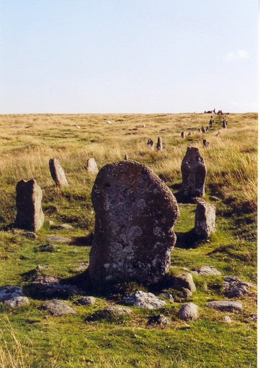
Hurston Ridge submitted by AngieLake on 14th Aug 2005. This is the lower end of the long Hurston Ridge avenue, showing how the stones turn towards another angle (19 degs) as they approach the blocking stone. Standing back beside the straight side of the avenue, looking up its length, I measured the orientation of the avenue to be 198 degs, yet there seemed to be a definite turn in this end of it. If you stand behind the stone at far left and look towards the blocking stone, you will see it aligns with Kes Tor rock at 375 degs.
(View photo, vote or add a comment)
Log Text: None
Holywell Bay
Date Added: 26th Sep 2010
Site Type: Holy Well or Sacred Spring
Country: England (Cornwall)
Visited: Yes on 12th Sep 2005
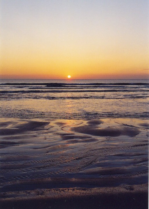
Holywell Bay submitted by AngieLake on 12th Sep 2005. "Sunset and evening star and one clear call for me......"
I would like to dedicate this Holywell Bay sunset to all those poor souls who perished in 'Nine Eleven'. If the Earth lasts out for another four thousand years someone might be investigating what our generation did, and what monuments we left behind. The former 'Twin Towers' of Manhattan, and the ensuing 'Ground Zero' would be well-documented, but I wonder how they will access their historic records then? Meanwhile, to help to ensur...
(View photo, vote or add a comment)
Log Text: None
Holyhead Mountain
Date Added: 26th Sep 2010
Site Type: Ancient Village or Settlement
Country: Wales (Anglesey)
Visited: Yes on 29th Jun 2007
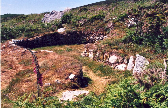
Holyhead Mountain submitted by AngieLake on 29th Jun 2007. A hut tucked into the hill, with a long curved passage entrance.
(View photo, vote or add a comment)
Log Text: None
Hindwell Enclosure
Date Added: 26th Sep 2010
Site Type: Timber Circle
Country: Wales (Powys)
Visited: Yes on 9th Aug 2008
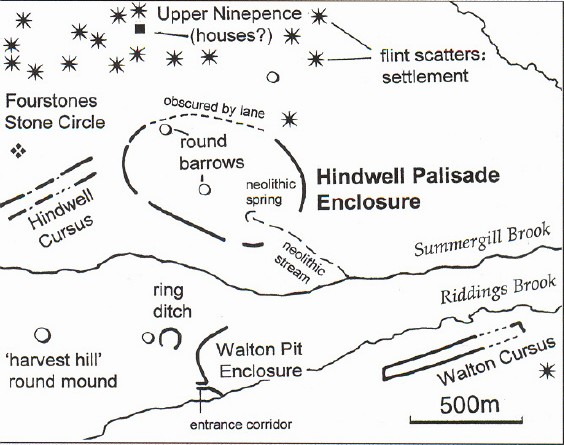
Hindwell Enclosure submitted by AngieLake on 9th Aug 2008. NB: Copyright: Rodney Castleden from his book 'Britain 3000 BC'.
I am sure Mr Castleden wouldn't begrudge us the use of this helpful map on p.71 of the above book, to enable us to understand the layout of the various sites in the Walton Basin. He describes this area's prehistory under the heading 'Hindwell - a major ceremonial focus in Wales.'
(Note the Fourstones, upper left.)
See 'Walton Palisaded Enclosure' site page for photos taken from Old Radnor Church, looking out over the fla...
(View photo, vote or add a comment)
Log Text: None
High Moorland Visitor Centre
Date Added: 26th Sep 2010
Site Type: Museum
Country: England (Devon)
Visited: Yes on 14th Aug 2010
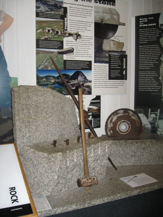
High Moorland Visitor Centre submitted by AngieLake on 14th Aug 2010. In the main permanent display area is a useful introduction to the splitting of granite by the 'feather and tare' method.
(View photo, vote or add a comment)
Log Text: None
Hengistbury Head
Date Added: 26th Sep 2010
Site Type: Promontory Fort / Cliff Castle
Country: England (Dorset)
Visited: Yes on 19th Sep 2005
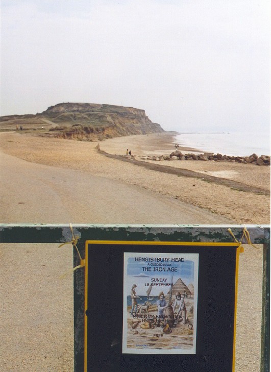
Hengistbury Head submitted by AngieLake on 19th Sep 2005. Hengistbury Head photographed on Tuesday 13th September 2005. The guided walk was due to be held the following Sunday.
(View photo, vote or add a comment)
Log Text: None
Headless Cross (Moretonhampstead)
Date Added: 26th Sep 2010
Site Type: Modern Stone Circle etc
Country: England (Devon)
Visited: Yes on 23rd Nov 2008
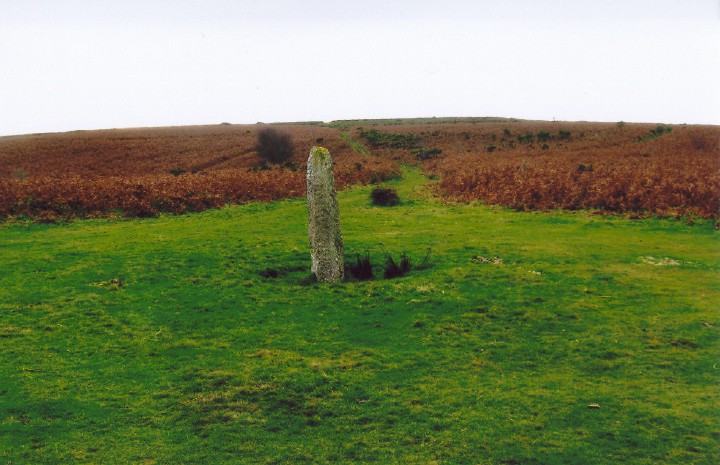
Headless Cross (Moretonhampstead) submitted by AngieLake on 23rd Nov 2008. The Headless Cross, or Maximajor Stone marking the NE end of the ridgeway path over Mardon Down. Ample parking nearby, from a minor road.
Thought to be a replacement for a pre-existing menhir. (See site notes.)
(View photo, vote or add a comment)
Log Text: None
Harolds Stones
Date Added: 26th Sep 2010
Site Type: Stone Row / Alignment
Country: Wales (Monmouthshire)
Visited: Yes on 26th Jun 2006
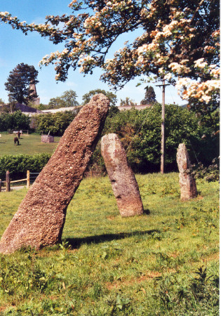
Harolds Stones submitted by AngieLake on 26th Jun 2006. Harolds Stones in Trellech with the church tower (hiding behind the tree at upper left of pic) in the background. A lovely, atmospheric site on a beautiful sunny Summer's day (11 June 2006). Note the pronounced cup-marks in the central stone (close-up to follow).
(View photo, vote or add a comment)
Log Text: None
Hamel Down row
Date Added: 26th Sep 2010
Site Type: Stone Row / Alignment
Country: England (Devon)
Visited: Yes on 22nd Apr 2007
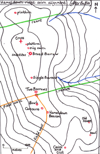
Hamel Down submitted by AngieLake on 22nd Apr 2007. A map (after Butler) of the barrows, cairns, and an ancient cross on Hamel Down.
This will be useful for referencing the individual sites to be posted very soon.
(View photo, vote or add a comment)
Log Text: None
