


<< Our Photo Pages >> North Glassmount - Standing Stones in Scotland in Fife
Submitted by Nick on Monday, 03 November 2003 Page Views: 12382
Neolithic and Bronze AgeSite Name: North GlassmountCountry: Scotland County: Fife Type: Standing Stones
Map Ref: NT244884 Landranger Map Number: 66
Latitude: 56.082406N Longitude: 3.216331W
Condition:
| 5 | Perfect |
| 4 | Almost Perfect |
| 3 | Reasonable but with some damage |
| 2 | Ruined but still recognisable as an ancient site |
| 1 | Pretty much destroyed, possibly visible as crop marks |
| 0 | No data. |
| -1 | Completely destroyed |
| 5 | Superb |
| 4 | Good |
| 3 | Ordinary |
| 2 | Not Good |
| 1 | Awful |
| 0 | No data. |
| 5 | Can be driven to, probably with disabled access |
| 4 | Short walk on a footpath |
| 3 | Requiring a bit more of a walk |
| 2 | A long walk |
| 1 | In the middle of nowhere, a nightmare to find |
| 0 | No data. |
| 5 | co-ordinates taken by GPS or official recorded co-ordinates |
| 4 | co-ordinates scaled from a detailed map |
| 3 | co-ordinates scaled from a bad map |
| 2 | co-ordinates of the nearest village |
| 1 | co-ordinates of the nearest town |
| 0 | no data |
Internal Links:
External Links:
")
This pair stand in the fields of Longloch Farm just north of the Binn Hill at the back of Burntisland. Use your map carefully, I'm not even going to try to describe the route! Permission should be sought at the farm but is readily granted. Canmore says of them: "These two standing stones are situated on the summit of a gently rising pasture. The ground immediately surrounding their bases may have been made higher. The stones are vertical, stand 19'2" across centres and exactly E-W. The bases of both are packed with small stones. The W stone is a smooth-sided block of quartziferous rock 6'2" high, 12'8" maximum girth. Close to it is a block of stone 1'4" above ground. The E stone is of much weathered whinstone and is 5'7" high. Its greatest girth is 12'9". Several small circular hollows are attributed to weathering. It is unlikely that the stones formed part of a stone circle." What you see is pretty much what is described, and there's no point in adding to it, other than to say that the two stones each have a very unique appearance from each other. The view over the Forth from here, even on a cold and windy winter afternoon, is pretty stunning.
You may be viewing yesterday's version of this page. To see the most up to date information please register for a free account.
")
")
")
")
Do not use the above information on other web sites or publications without permission of the contributor.
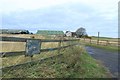
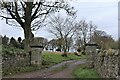
Nearby Images from Geograph Britain and Ireland:
©2010(licence)

©2005(licence)
©2022(licence)

©2023(licence)

©2022(licence)
The above images may not be of the site on this page, they are loaded from Geograph.
Please Submit an Image of this site or go out and take one for us!
Click here to see more info for this site
Nearby sites
Key: Red: member's photo, Blue: 3rd party photo, Yellow: other image, Green: no photo - please go there and take one, Grey: site destroyed
Download sites to:
KML (Google Earth)
GPX (GPS waypoints)
CSV (Garmin/Navman)
CSV (Excel)
To unlock full downloads you need to sign up as a Contributory Member. Otherwise downloads are limited to 50 sites.
Turn off the page maps and other distractions
Nearby sites listing. In the following links * = Image available
2.2km SW 226° Binn (Burntisland)* Rock Art (NT2278886891)
2.4km SSW 196° Craigkennockie (Burntisland) Cairn (NT237861)
4.0km WNW 296° Auchertool Holy Well* Holy Well or Sacred Spring (NT208902)
5.8km WSW 238° St Fillan's Well (Aberdour)* Holy Well or Sacred Spring (NT194854)
6.4km WSW 237° Aberdour Cairn Cairn (NT1985)
7.8km WSW 236° Barns Farm Dalgety Fife* Barrow Cemetery (NT178842)
8.0km SW 223° Inchcolm Sculptured Stone (NT18888260)
8.5km NE 37° Bogleys* Standing Stone (Menhir) (NT296951)
8.5km N 354° Dogton* Class III Pictish Cross Slab (NT2360996863)
9.3km WSW 244° Fordell Standing Stone* Standing Stone (Menhir) (NT1593084460)
9.6km NW 323° Hare Law (Fife)* Cairn (NT187961)
10.0km NW 317° Kirkhall, Lochore Stone Circle (NT177958)
10.2km WSW 251° St Theriot's Well* Holy Well or Sacred Spring (NT147853)
11.8km NE 39° Earlseat* Standing Stone (Menhir) (NT3197797452)
12.0km WNW 286° St Ninians Fife Earth Project* Modern Stone Circle etc (NT129919)
12.6km SSW 205° Cramond Ancient Village or Settlement (NT18957706)
12.9km WSW 257° North Wood (Dunfermline)* Cairn (NT11788565)
13.0km NE 48° Court Cave* Cave or Rock Shelter (NT34279694)
13.1km N 353° Strathhendry* Stone Circle (NO23050145)
13.1km NE 48° West Doo Cave* Cave or Rock Shelter (NT3433097007)
13.1km W 260° Pitcorthie.* Standing Stone (Menhir) (NT11398633)
13.2km NE 48° Jonathan’s Cave* Cave or Rock Shelter (NT344970)
13.3km NE 48° Well Cave (East Wemyss)* Cave or Rock Shelter (NT345971)
13.5km NE 48° Sloping Cave* Cave or Rock Shelter (NT34619727)
14.1km SW 221° Crossall Hill (South Queensferry)* Ancient Cross (NT14907791)
View more nearby sites and additional images


 We would like to know more about this location. Please feel free to add a brief description and any relevant information in your own language.
 Wir möchten mehr über diese Stätte erfahren. Bitte zögern Sie nicht, eine kurze Beschreibung und relevante Informationen in Deutsch hinzuzufügen.
 Nous aimerions en savoir encore un peu sur les lieux. S'il vous plaît n'hesitez pas à ajouter une courte description et tous les renseignements pertinents dans votre propre langue.
 Quisieramos informarnos un poco más de las lugares. No dude en añadir una breve descripción y otros datos relevantes en su propio idioma.