 with our Megalithic Portal iPhone app")


<< Our Photo Pages >> St Theriot's Well - Holy Well or Sacred Spring in Scotland in Fife
Submitted by vicky on Monday, 29 March 2004 Page Views: 8883
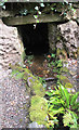
Springs and Holy WellsSite Name: St Theriot's WellCountry: Scotland County: Fife Type: Holy Well or Sacred Spring
Nearest Village: Fordell
Map Ref: NT147853 Landranger Map Number: 65
Latitude: 56.052927N Longitude: 3.371155W
Condition:
| 5 | Perfect |
| 4 | Almost Perfect |
| 3 | Reasonable but with some damage |
| 2 | Ruined but still recognisable as an ancient site |
| 1 | Pretty much destroyed, possibly visible as crop marks |
| 0 | No data. |
| -1 | Completely destroyed |
| 5 | Superb |
| 4 | Good |
| 3 | Ordinary |
| 2 | Not Good |
| 1 | Awful |
| 0 | No data. |
| 5 | Can be driven to, probably with disabled access |
| 4 | Short walk on a footpath |
| 3 | Requiring a bit more of a walk |
| 2 | A long walk |
| 1 | In the middle of nowhere, a nightmare to find |
| 0 | No data. |
| 5 | co-ordinates taken by GPS or official recorded co-ordinates |
| 4 | co-ordinates scaled from a detailed map |
| 3 | co-ordinates scaled from a bad map |
| 2 | co-ordinates of the nearest village |
| 1 | co-ordinates of the nearest town |
| 0 | no data |
Internal Links:
External Links:
I have visited· I would like to visit
feorag has visited here
")
Have you visited this site? Please add a comment below.
You may be viewing yesterday's version of this page. To see the most up to date information please register for a free account.
Do not use the above information on other web sites or publications without permission of the contributor.
Nearby Images from Geograph Britain and Ireland:
©2017(licence)
©2017(licence)
©2017(licence)
©2017(licence)
©2017(licence)
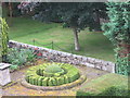
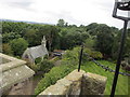
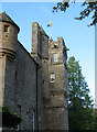
The above images may not be of the site on this page, they are loaded from Geograph.
Please Submit an Image of this site or go out and take one for us!
Click here to see more info for this site
Nearby sites
Key: Red: member's photo, Blue: 3rd party photo, Yellow: other image, Green: no photo - please go there and take one, Grey: site destroyed
Download sites to:
KML (Google Earth)
GPX (GPS waypoints)
CSV (Garmin/Navman)
CSV (Excel)
To unlock full downloads you need to sign up as a Contributory Member. Otherwise downloads are limited to 50 sites.
Turn off the page maps and other distractions
Nearby sites listing. In the following links * = Image available
1.5km ESE 123° Fordell Standing Stone* Standing Stone (Menhir) (NT15938446)
2.9km W 276° North Wood (Dunfermline)* Cairn (NT11788565)
3.3km ESE 108° Barns Farm Dalgety Fife* Barrow Cemetery (NT178842)
3.5km WNW 286° Pitcorthie.* Standing Stone (Menhir) (NT11398633)
4.3km E 93° Aberdour Cairn Cairn (NT1985)
4.7km E 88° St Fillan's Well (Aberdour)* Holy Well or Sacred Spring (NT194854)
5.0km ESE 122° Inchcolm Sculptured Stone (NT18888260)
6.8km NNW 344° St Ninians Fife Earth Project* Modern Stone Circle etc (NT129919)
7.1km SSW 194° Bell Stane (Queensferry) Standing Stone (Menhir) (NT12827840)
7.4km S 177° Crossall Hill (South Queensferry)* Ancient Cross (NT14907791)
7.8km NE 50° Auchertool Holy Well* Holy Well or Sacred Spring (NT208902)
8.2km ENE 78° Binn (Burntisland)* Rock Art (NT2278886891)
9.0km SW 225° Abercorn Sculptured Stone (NT08147910)
9.0km E 84° Craigkennockie (Burntisland) Cairn (NT237861)
9.3km SSE 152° Cramond Ancient Village or Settlement (NT18957706)
10.1km SW 219° Justice Stone Standing Stone (Menhir) (NT08087759)
10.2km ENE 71° North Glassmount* Standing Stones (NT244884)
10.7km S 184° Carlowrie (Kirkliston) Rock Art (NT138746)
10.9km NNE 15° Kirkhall, Lochore Stone Circle (NT177958)
10.9km S 178° Cat Stane (Kirkliston)* Standing Stone (Menhir) (NT1489374373)
11.0km SSE 164° Cammo Stone* Standing Stone (Menhir) (NT1747774681)
11.5km NNE 19° Hare Law (Fife)* Cairn (NT187961)
11.8km W 275° Tuilyies* Standing Stones (NT02918658)
12.8km S 188° Lochend menhir* Standing Stone (Menhir) (NT12667263)
12.9km S 189° Huly Hill Cairn* Round Cairn (NT1234272610)
View more nearby sites and additional images


 We would like to know more about this location. Please feel free to add a brief description and any relevant information in your own language.
 Wir möchten mehr über diese Stätte erfahren. Bitte zögern Sie nicht, eine kurze Beschreibung und relevante Informationen in Deutsch hinzuzufügen.
 Nous aimerions en savoir encore un peu sur les lieux. S'il vous plaît n'hesitez pas à ajouter une courte description et tous les renseignements pertinents dans votre propre langue.
 Quisieramos informarnos un poco más de las lugares. No dude en añadir una breve descripción y otros datos relevantes en su propio idioma.