

<< Our Photo Pages >> Ålberg - Barrow Cemetery in Norway in Nord-Trøndelag
Submitted by kenntha88 on Saturday, 04 November 2023 Page Views: 180
Neolithic and Bronze AgeSite Name: ÅlbergCountry: Norway Fylke: Nord-Trøndelag Type: Barrow Cemetery
Nearest Town: Steinkjer Nearest Village: Mære
Latitude: 63.954920N Longitude: 11.440932E
Condition:
| 5 | Perfect |
| 4 | Almost Perfect |
| 3 | Reasonable but with some damage |
| 2 | Ruined but still recognisable as an ancient site |
| 1 | Pretty much destroyed, possibly visible as crop marks |
| 0 | No data. |
| -1 | Completely destroyed |
| 5 | Superb |
| 4 | Good |
| 3 | Ordinary |
| 2 | Not Good |
| 1 | Awful |
| 0 | No data. |
| 5 | Can be driven to, probably with disabled access |
| 4 | Short walk on a footpath |
| 3 | Requiring a bit more of a walk |
| 2 | A long walk |
| 1 | In the middle of nowhere, a nightmare to find |
| 0 | No data. |
| 5 | co-ordinates taken by GPS or official recorded co-ordinates |
| 4 | co-ordinates scaled from a detailed map |
| 3 | co-ordinates scaled from a bad map |
| 2 | co-ordinates of the nearest village |
| 1 | co-ordinates of the nearest town |
| 0 | no data |
Internal Links:
External Links:
")
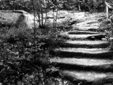
No other information about this site is avialable in Kulturminnesøk except that it is a barrow cemetery consisting of 11 round cairns. It is located just next to a small farming road inside a grazing ground for young cows. When visiting the site I was not able to get into the fence however I got some photos from the road.
One cairn looks to be very large however it could also be a cairn built on a natural rock outcrop but it is hard to tell from the distance. The hill itself or cairn is around 30 metres in diameter and 3,5 metres in height. The landscape around however have several sites with large and beautiful bronze age cairns so it could indeed be a huge cairn. It is overgrown with short grass so defining it is difficult.
It is hard to make out most of the other barrows, I could only photograph two of them, both around 8 metres in diameter and 0,5metres in height from the road but the area has several "bumps" and small hills that could be overgrown cairns. Some parts of the fenced in area also has a tight forest that more cairns could be located inside.
You may be viewing yesterday's version of this page. To see the most up to date information please register for a free account.
")
")
")
")
")
")
Do not use the above information on other web sites or publications without permission of the contributor.
Click here to see more info for this site
Nearby sites
Click here to view sites on an interactive map of the areaKey: Red: member's photo, Blue: 3rd party photo, Yellow: other image, Green: no photo - please go there and take one, Grey: site destroyed
Download sites to:
KML (Google Earth)
GPX (GPS waypoints)
CSV (Garmin/Navman)
CSV (Excel)
To unlock full downloads you need to sign up as a Contributory Member. Otherwise downloads are limited to 50 sites.
Turn off the page maps and other distractions
Nearby sites listing. In the following links * = Image available
1.4km SSW 202° Lian barrow* Round Barrow(s)
1.5km SSW 195° Lianhøgda* Cairn
1.5km WNW 300° Vist burial mound* Round Barrow(s)
1.7km S 177° Jøremsvegen Phallic Stone* Sculptured Stone
1.7km SSE 166° Leinsmyra-Jørem* Barrow Cemetery
2.1km SSE 168° Jørem* Round Barrow(s)
2.7km NNW 345° Vistavegen* Cairn
2.7km WSW 255° Kvitvang barrow cemetery* Barrow Cemetery
3.1km WNW 302° Limbuhaugen* Cist
3.6km NW 313° Toldnes cairns* Barrow Cemetery
3.7km SE 135° Skei Settlement* Ancient Village or Settlement
3.7km SSE 163° Sparbu barrows* Barrow Cemetery
4.5km NNE 17° Skrubbhaugen* Barrow Cemetery
5.9km ESE 115° Hollbruvegen-Heggstad* Round Barrow(s)
6.5km NNE 32° Ner-Trana Mounds* Barrow Cemetery
6.6km NE 36° Tranaskogvegen* Barrow Cemetery
6.7km N 358° Skåtangen* Cairn
7.5km N 8° Bergkunstmuseet / Egge Museum Museum
7.6km N 11° Egge West Eggevammen* Barrow Cemetery
7.9km E 83° Nedre Vekre* Barrow Cemetery
8.0km NNE 18° Tingvoll Stone Setting* Stone Circle
8.0km NNW 336° Hoøya Cairns* Cairn
8.1km W 281° Søndre Grønnesby Boat House* Ancient Village or Settlement
8.1km WNW 283° Grønnesby Søndre* Cairn
8.1km SW 234° Hommeldalen Standing Stones* Standing Stones
View more nearby sites and additional images


 We would like to know more about this location. Please feel free to add a brief description and any relevant information in your own language.
 Wir möchten mehr über diese Stätte erfahren. Bitte zögern Sie nicht, eine kurze Beschreibung und relevante Informationen in Deutsch hinzuzufügen.
 Nous aimerions en savoir encore un peu sur les lieux. S'il vous plaît n'hesitez pas à ajouter une courte description et tous les renseignements pertinents dans votre propre langue.
 Quisieramos informarnos un poco más de las lugares. No dude en añadir una breve descripción y otros datos relevantes en su propio idioma.