

<< Our Photo Pages >> Crearhowe - Artificial Mound in Scotland in Orkney
Submitted by howar on Thursday, 02 November 2023 Page Views: 132
Multi-periodSite Name: CrearhoweCountry: Scotland County: Orkney Type: Artificial Mound
Nearest Town: Kirkwall Nearest Village: St Mary
Map Ref: HY49300235
Latitude: 58.905451N Longitude: 2.881781W
Condition:
| 5 | Perfect |
| 4 | Almost Perfect |
| 3 | Reasonable but with some damage |
| 2 | Ruined but still recognisable as an ancient site |
| 1 | Pretty much destroyed, possibly visible as crop marks |
| 0 | No data. |
| -1 | Completely destroyed |
| 5 | Superb |
| 4 | Good |
| 3 | Ordinary |
| 2 | Not Good |
| 1 | Awful |
| 0 | No data. |
| 5 | Can be driven to, probably with disabled access |
| 4 | Short walk on a footpath |
| 3 | Requiring a bit more of a walk |
| 2 | A long walk |
| 1 | In the middle of nowhere, a nightmare to find |
| 0 | No data. |
| 5 | co-ordinates taken by GPS or official recorded co-ordinates |
| 4 | co-ordinates scaled from a detailed map |
| 3 | co-ordinates scaled from a bad map |
| 2 | co-ordinates of the nearest village |
| 1 | co-ordinates of the nearest town |
| 0 | no data |
Internal Links:
External Links:
")
The grass-covered mound is 24m N/S by 18m E/W and stands to 1.1 m. In 1981 a sandstone lamp found there was shown and mention made of a leaf arrowhead found there another time. canmore.org.uk/site/2388/crearhowe
I have only been by the field, not in it. If you come up from Graemeshall at the junctiom with the East Holm road it is opposte you and slightly to the left
You may be viewing yesterday's version of this page. To see the most up to date information please register for a free account.
")
")
")
Do not use the above information on other web sites or publications without permission of the contributor.
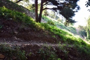
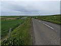
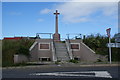
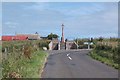
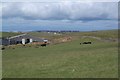
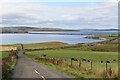
Nearby Images from Geograph Britain and Ireland:
©2023(licence)
©2013(licence)
©2015(licence)
©2015(licence)
©2021(licence)
The above images may not be of the site on this page, they are loaded from Geograph.
Please Submit an Image of this site or go out and take one for us!
Click here to see more info for this site
Nearby sites
Key: Red: member's photo, Blue: 3rd party photo, Yellow: other image, Green: no photo - please go there and take one, Grey: site destroyed
Download sites to:
KML (Google Earth)
GPX (GPS waypoints)
CSV (Garmin/Navman)
CSV (Excel)
To unlock full downloads you need to sign up as a Contributory Member. Otherwise downloads are limited to 50 sites.
Turn off the page maps and other distractions
Nearby sites listing. In the following links * = Image available
578m SSW 200° Mass Howe* Misc. Earthwork (HY49090181)
722m SSE 163° Tower of Clett* Artificial Mound (HY4949701654)
931m WNW 285° Hall of Gorn* Round Barrow(s) (HY484026)
1.1km WNW 282° Laughton's Knowe* Round Barrow(s) (HY48260258)
2.1km SSW 205° Lamb Holm* Ancient Village or Settlement (HY484005)
2.2km WNW 295° Holm Chambered Tomb* Chambered Tomb (HY473033)
2.4km SE 135° St. Nicholas Church* Ancient Village or Settlement (HY510006)
2.5km WSW 247° St Mary's Broch* Broch or Nuraghe (HY470014)
2.8km WNW 291° Gutterpool* Misc. Earthwork (HY467034)
2.9km SE 134° Castle Howe (Orkney)* Ancient Village or Settlement (HY514003)
3.6km S 186° Northfield Broch* Broch or Nuraghe (ND489988)
3.8km NNE 15° Brymer* Round Barrow(s) (HY503060)
3.8km NNE 21° Burn of Langskaill* Ancient Village or Settlement (HY507059)
3.8km NNE 22° Round Howe* Broch or Nuraghe (HY50780591)
3.9km ENE 63° Campston (Toab)* Broch or Nuraghe (HY528041)
4.0km NNE 23° Long Howe* Long Barrow (HY509060)
4.1km NNE 25° Mine Howe* Chambered Cairn (HY5106406023)
4.2km NNE 26° Longhowe Cairn (HY512061)
4.2km NNE 23° Stem Howe* Round Barrow(s) (HY510062)
4.3km NW 304° Mark Stone of Gaitnip* Standing Stone (Menhir) (HY458048)
4.3km NNW 338° Heathery Howes* Round Barrow(s) (HY477064)
4.5km NW 311° The Five Hillocks* Barrow Cemetery (HY45980536)
4.5km E 91° The Cairn* Artificial Mound (HY53840223)
4.5km NE 36° Breck Farm* Standing Stones (HY520060)
4.5km N 357° Craw Howe* Cairn (HY491069)
View more nearby sites and additional images


 We would like to know more about this location. Please feel free to add a brief description and any relevant information in your own language.
 Wir möchten mehr über diese Stätte erfahren. Bitte zögern Sie nicht, eine kurze Beschreibung und relevante Informationen in Deutsch hinzuzufügen.
 Nous aimerions en savoir encore un peu sur les lieux. S'il vous plaît n'hesitez pas à ajouter une courte description et tous les renseignements pertinents dans votre propre langue.
 Quisieramos informarnos un poco más de las lugares. No dude en añadir una breve descripción y otros datos relevantes en su propio idioma.