 with our Megalithic Portal iPhone app")

<< Our Photo Pages >> Mine Howe - Chambered Cairn in Scotland in Orkney
Submitted by jeffrep on Wednesday, 28 January 2004 Page Views: 19849
Neolithic and Bronze AgeSite Name: Mine Howe Alternative Name: MinehoweCountry: Scotland County: Orkney Type: Chambered Cairn
Map Ref: HY5106406023 Landranger Map Number: 6
Latitude: 58.938638N Longitude: 2.851977W
Condition:
| 5 | Perfect |
| 4 | Almost Perfect |
| 3 | Reasonable but with some damage |
| 2 | Ruined but still recognisable as an ancient site |
| 1 | Pretty much destroyed, possibly visible as crop marks |
| 0 | No data. |
| -1 | Completely destroyed |
| 5 | Superb |
| 4 | Good |
| 3 | Ordinary |
| 2 | Not Good |
| 1 | Awful |
| 0 | No data. |
| 5 | Can be driven to, probably with disabled access |
| 4 | Short walk on a footpath |
| 3 | Requiring a bit more of a walk |
| 2 | A long walk |
| 1 | In the middle of nowhere, a nightmare to find |
| 0 | No data. |
| 5 | co-ordinates taken by GPS or official recorded co-ordinates |
| 4 | co-ordinates scaled from a detailed map |
| 3 | co-ordinates scaled from a bad map |
| 2 | co-ordinates of the nearest village |
| 1 | co-ordinates of the nearest town |
| 0 | no data |
Internal Links:
External Links:
I have visited· I would like to visit
coin would like to visit
Runemage jeffrep Redfun have visited here
")
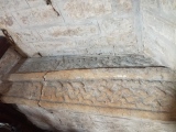
From here, like a spiral staircase, a second steep flight of steps leads down into the darkness until it reaches a sudden drop of about five feet into the lower chamber at the bottom of the structure.
Additional description by wideford: Head out to the airport and past it you will come to the Mine Howe site on the left. Little to be seen on the surface apart from where they have exposed a section of ditch, above which lies the entrance to the famous bit. Not recommended for those prone to bad backs if my experience is anything to go by.
It isn't as deep as the impression you will have gained from the literature - or maybe my spatial perceptions are awry . A good place for digital camera and flash. Mighty fine. If you don't fancy the climb down there is a truncated version close by on another hillock, less sense of adventure but only a few steps down to the floor. (Not much further along the Deerness Road, at a place where it narrows and there is sea on either side, you will find Dingieshowe Broch. And about the same in the opposite direction is Campston Broch.
You may be viewing yesterday's version of this page. To see the most up to date information please register for a free account.
")
")
")
")
")
")
")
")
")
")
")
")
")
")
")
")
")
")
")
")
")
")
")
")
These are just the first 25 photos of Mine Howe. If you log in with a free user account you will be able to see our entire collection.
Do not use the above information on other web sites or publications without permission of the contributor.
Click here to see more info for this site
Nearby sites
Key: Red: member's photo, Blue: 3rd party photo, Yellow: other image, Green: no photo - please go there and take one, Grey: site destroyed
Download sites to:
KML (Google Earth)
GPX (GPS waypoints)
CSV (Garmin/Navman)
CSV (Excel)
To unlock full downloads you need to sign up as a Contributory Member. Otherwise downloads are limited to 50 sites.
Turn off the page maps and other distractions
Nearby sites listing. In the following links * = Image available
156m ENE 60° Longhowe Cairn (HY512061)
165m W 261° Long Howe* Long Barrow (HY509060)
188m NNW 339° Stem Howe* Round Barrow(s) (HY510062)
305m WSW 248° Round Howe* Broch or Nuraghe (HY50780591)
383m WSW 251° Burn of Langskaill* Ancient Village or Settlement (HY507059)
495m NNE 15° Hawell Burnt Mound* Round Barrow(s) (HY512065)
762m W 268° Brymer* Round Barrow(s) (HY503060)
819m NNW 341° Nearhouse* Ancient Village or Settlement (HY508068)
927m NE 42° Muckle Crofty* Stone Row / Alignment (HY517067)
933m E 91° Breck Farm* Standing Stones (HY520060)
1.5km NNE 32° Loch of Messigate* Standing Stones (HY519073)
2.0km N 6° Mill Sand* Standing Stones (HY513080)
2.1km WNW 293° Craw Howe* Cairn (HY491069)
2.5km N 0° Whitecleat* Holy Well or Sacred Spring (HY511085)
2.6km SE 137° Campston (Toab)* Broch or Nuraghe (HY528041)
2.9km WNW 289° Staneloof* Cairn (HY48330698)
3.0km N 6° The Howie of The Manse* Broch or Nuraghe (HY514090)
3.0km ESE 119° St. Peter's Bay Mound* Broch or Nuraghe (HY537045)
3.1km SE 125° St. Peter's Kirk* Ancient Village or Settlement (HY536042)
3.2km NNE 20° Grieves Cottage* Standing Stone (Menhir) (HY522090)
3.2km SE 124° Campston Cairn* Cairn (HY537042)
3.4km W 276° Heathery Howes* Round Barrow(s) (HY477064)
3.4km E 84° Hurnip's Point* Chambered Cairn (HY54480634)
3.5km NNE 18° Loch of Tankerness* Ancient Village or Settlement (HY522093)
3.6km ESE 123° Comely* Cairn (HY54040403)
View more nearby sites and additional images


 We would like to know more about this location. Please feel free to add a brief description and any relevant information in your own language.
 Wir möchten mehr über diese Stätte erfahren. Bitte zögern Sie nicht, eine kurze Beschreibung und relevante Informationen in Deutsch hinzuzufügen.
 Nous aimerions en savoir encore un peu sur les lieux. S'il vous plaît n'hesitez pas à ajouter une courte description et tous les renseignements pertinents dans votre propre langue.
 Quisieramos informarnos un poco más de las lugares. No dude en añadir una breve descripción y otros datos relevantes en su propio idioma.