
, Aubrey Burl")
<< Our Photo Pages >> St Mary's Broch - Broch or Nuraghe in Scotland in Orkney
Submitted by howar on Thursday, 03 June 2004 Page Views: 4417
Iron Age and Later PrehistorySite Name: St Mary's BrochCountry: Scotland County: Orkney Type: Broch or Nuraghe
Nearest Town: Kirkwall Nearest Village: St Mary's
Map Ref: HY470014 Landranger Map Number: 6
Latitude: 58.896642N Longitude: 2.921471W
Condition:
| 5 | Perfect |
| 4 | Almost Perfect |
| 3 | Reasonable but with some damage |
| 2 | Ruined but still recognisable as an ancient site |
| 1 | Pretty much destroyed, possibly visible as crop marks |
| 0 | No data. |
| -1 | Completely destroyed |
| 5 | Superb |
| 4 | Good |
| 3 | Ordinary |
| 2 | Not Good |
| 1 | Awful |
| 0 | No data. |
| 5 | Can be driven to, probably with disabled access |
| 4 | Short walk on a footpath |
| 3 | Requiring a bit more of a walk |
| 2 | A long walk |
| 1 | In the middle of nowhere, a nightmare to find |
| 0 | No data. |
| 5 | co-ordinates taken by GPS or official recorded co-ordinates |
| 4 | co-ordinates scaled from a detailed map |
| 3 | co-ordinates scaled from a bad map |
| 2 | co-ordinates of the nearest village |
| 1 | co-ordinates of the nearest town |
| 0 | no data |
Internal Links:
External Links:
")
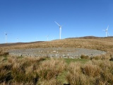
At the bottom of the hill before you finally enter St.Mary's (coming from Kirkwall) it straddles the space between the road junction and the Electricity thingy. Big but insignificant looking and covered by grassy tussocks. Closing in I was disappointed to see spaces several metres across where mucho excavation had taken place, looking as if the place had been quartered. Straight lines, curvy lines, and a ruddy great hole over in the centre . Looks very deceiving . Coming in my foot rocked on a hidden slab. Turned out most of the floor and walls are fairly intact beneath a grassy and/or mossy covering, and all the gaps are where there were gaps originally. Sitting on an outer wall I could see large exposed stones either side of what appeared to be an entrance A reasonable number of stones could be seen on the inner wall of the centre . Came back from there and was astounded I could follow the outer section of the inner wall still standing to a reasonable height all the way around. In some places sections of wall were exposed for several metres several courses high. Well worth a look for the sure-footed.
You may be viewing yesterday's version of this page. To see the most up to date information please register for a free account.
")
")
")
")
")
Do not use the above information on other web sites or publications without permission of the contributor.
Click here to see more info for this site
Nearby sites
Key: Red: member's photo, Blue: 3rd party photo, Yellow: other image, Green: no photo - please go there and take one, Grey: site destroyed
Download sites to:
KML (Google Earth)
GPX (GPS waypoints)
CSV (Garmin/Navman)
CSV (Excel)
To unlock full downloads you need to sign up as a Contributory Member. Otherwise downloads are limited to 50 sites.
Turn off the page maps and other distractions
Nearby sites listing. In the following links * = Image available
1.7km ESE 122° Lamb Holm* Ancient Village or Settlement (HY484005)
1.7km NE 46° Laughton's Knowe* Round Barrow(s) (HY48260258)
1.8km NE 49° Hall of Gorn* Round Barrow(s) (HY484026)
1.9km N 8° Holm Chambered Tomb* Chambered Tomb (HY473033)
2.0km N 351° Gutterpool* Misc. Earthwork (HY467034)
2.1km ENE 78° Mass Howe* Misc. Earthwork (HY49090181)
2.5km ENE 67° Crearhowe* Artificial Mound (HY49300235)
2.5km E 83° Tower of Clett* Artificial Mound (HY4949701654)
3.2km SE 143° Northfield Broch* Broch or Nuraghe (ND489988)
3.6km NNW 340° Mark Stone of Gaitnip* Standing Stone (Menhir) (HY458048)
4.1km E 101° St. Nicholas Church* Ancient Village or Settlement (HY510006)
4.1km NNW 345° The Five Hillocks* Barrow Cemetery (HY45980536)
4.5km ESE 103° Castle Howe (Orkney)* Ancient Village or Settlement (HY514003)
4.7km NNW 337° Burn of Deepdale* Ancient Village or Settlement (HY452057)
5.0km N 7° Heathery Howes* Round Barrow(s) (HY477064)
5.4km SSE 156° St Lawrence's Church* Broch or Nuraghe (ND4917896425)
5.6km NE 35° Brymer* Round Barrow(s) (HY503060)
5.7km NNE 13° Staneloof* Cairn (HY48330698)
5.8km NE 39° Burn of Langskaill* Ancient Village or Settlement (HY507059)
5.9km ESE 115° Rose Ness* Chambered Cairn (ND5228698813)
5.9km NE 39° Round Howe* Broch or Nuraghe (HY50780591)
5.9km NNE 20° Craw Howe* Cairn (HY491069)
6.0km NE 39° Long Howe* Long Barrow (HY509060)
6.0km ESE 111° Roseness* Chambered Cairn (ND52629917)
6.1km NE 40° Mine Howe* Chambered Cairn (HY5106406023)
View more nearby sites and additional images


 We would like to know more about this location. Please feel free to add a brief description and any relevant information in your own language.
 Wir möchten mehr über diese Stätte erfahren. Bitte zögern Sie nicht, eine kurze Beschreibung und relevante Informationen in Deutsch hinzuzufügen.
 Nous aimerions en savoir encore un peu sur les lieux. S'il vous plaît n'hesitez pas à ajouter une courte description et tous les renseignements pertinents dans votre propre langue.
 Quisieramos informarnos un poco más de las lugares. No dude en añadir una breve descripción y otros datos relevantes en su propio idioma.