


<< Text Pages >> Ings Point - Natural Stone / Erratic / Other Natural Feature in England in Lancashire
Submitted by Anonymous on Monday, 26 April 2021 Page Views: 1025
Natural PlacesSite Name: Ings PointCountry: England County: Lancashire Type: Natural Stone / Erratic / Other Natural Feature
Map Ref: SD479730
Latitude: 54.150166N Longitude: 2.799173W
Condition:
| 5 | Perfect |
| 4 | Almost Perfect |
| 3 | Reasonable but with some damage |
| 2 | Ruined but still recognisable as an ancient site |
| 1 | Pretty much destroyed, possibly visible as crop marks |
| 0 | No data. |
| -1 | Completely destroyed |
| 5 | Superb |
| 4 | Good |
| 3 | Ordinary |
| 2 | Not Good |
| 1 | Awful |
| 0 | No data. |
| 5 | Can be driven to, probably with disabled access |
| 4 | Short walk on a footpath |
| 3 | Requiring a bit more of a walk |
| 2 | A long walk |
| 1 | In the middle of nowhere, a nightmare to find |
| 0 | No data. |
| 5 | co-ordinates taken by GPS or official recorded co-ordinates |
| 4 | co-ordinates scaled from a detailed map |
| 3 | co-ordinates scaled from a bad map |
| 2 | co-ordinates of the nearest village |
| 1 | co-ordinates of the nearest town |
| 0 | no data |
Internal Links:
External Links:
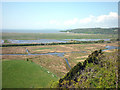
Unknown site, possibly ancient. Just to the north of Ings Point, there is a, presumably natural hill feature adjascent to the old shoreline, what is now marshland. Around the edges of this hill, there are several large stones. The site looks similar to the nearby Hunter Hill megalithic site.
But the Ings Point site is smaller. Both sites are situated in places that were once right next to the water.
You may be viewing yesterday's version of this page. To see the most up to date information please register for a free account.
Do not use the above information on other web sites or publications without permission of the contributor.
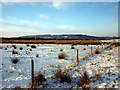
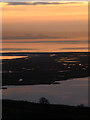
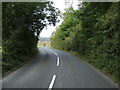
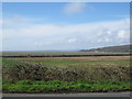
Nearby Images from Geograph Britain and Ireland:
©2010(licence)
©2012(licence)
©2015(licence)
©2011(licence)
©2010(licence)
The above images may not be of the site on this page, they are loaded from Geograph.
Please Submit an Image of this site or go out and take one for us!
Click here to see more info for this site
Nearby sites
Key: Red: member's photo, Blue: 3rd party photo, Yellow: other image, Green: no photo - please go there and take one, Grey: site destroyed
Download sites to:
KML (Google Earth)
GPX (GPS waypoints)
CSV (Garmin/Navman)
CSV (Excel)
To unlock full downloads you need to sign up as a Contributory Member. Otherwise downloads are limited to 50 sites.
Turn off the page maps and other distractions
Nearby sites listing. In the following links * = Image available
317m ESE 118° Badger Hole (Lancashire)* Cave or Rock Shelter (SD48187285)
430m E 85° Dog Holes* Cave or Rock Shelter (SD48337303)
1.1km SSE 164° Cote Stones Cairn (SD482719)
1.3km ESE 102° Warton Crag* Hillfort (SD492727)
1.7km ENE 72° The Three brothers* Natural Stone / Erratic / Other Natural Feature (SD495735)
2.0km E 86° Warton Crag giant wall Misc. Earthwork (SD499731)
2.1km WNW 297° Woodwell* Holy Well or Sacred Spring (SD4674)
2.5km ENE 57° Summerhouse Hill* Modern Stone Circle etc (SD50037437)
2.6km ENE 60° Summerhouse Hill Cairn* Cairn (SD50147428)
2.6km SSE 154° Hunting Hill* Round Barrow(s) (SD49037065)
3.7km N 353° Bowk Stone Natural Stone / Erratic / Other Natural Feature (SD475767)
3.8km ENE 65° Yealand ancient stone walls or rows 1 Misc. Earthwork (SD514746)
3.9km N 359° Haweswater Cairns and Propped Stone Cairn (SD479769)
4.0km N 358° Haweswater Stones* Misc. Earthwork (SD478770)
4.1km NE 55° Yealand ancient stone walls or rows 2 Misc. Earthwork (SD513753)
4.5km E 91° Manor Farm* Round Barrow(s) (SD52387285)
5.2km S 175° St Michael's Well (Lancashire) Holy Well or Sacred Spring (SD4828567831)
5.3km N 353° Hazelslack Stone* Standing Stone (Menhir) (SD473783)
5.4km S 175° Bolton Le Sands Early Christian Sculptured Stone (SD48336765)
5.5km SSE 168° Bolton-le-Sands Barrow* Ring Cairn (SD4901467624)
6.0km NW 326° Grubbins Wood Stone Natural Stone / Erratic / Other Natural Feature (SD446780)
6.1km N 8° The Fairy Steps* Natural Stone / Erratic / Other Natural Feature (SD488790)
6.5km NE 52° St James's Church (Burton-in-Kendal) Ancient Cross (SD5305076921)
6.5km NNE 16° The Rent Stone* Natural Stone / Erratic / Other Natural Feature (SD498792)
7.1km N 1° Dog Hole possible dolmen/propped stone* Natural Stone / Erratic / Other Natural Feature (SD481801)
View more nearby sites and additional images


 We would like to know more about this location. Please feel free to add a brief description and any relevant information in your own language.
 Wir möchten mehr über diese Stätte erfahren. Bitte zögern Sie nicht, eine kurze Beschreibung und relevante Informationen in Deutsch hinzuzufügen.
 Nous aimerions en savoir encore un peu sur les lieux. S'il vous plaît n'hesitez pas à ajouter une courte description et tous les renseignements pertinents dans votre propre langue.
 Quisieramos informarnos un poco más de las lugares. No dude en añadir una breve descripción y otros datos relevantes en su propio idioma.