


<< Other Photo Pages >> Bolton-le-Sands Barrow - Ring Cairn in England in Lancashire
Submitted by SumDoood on Friday, 24 February 2017 Page Views: 3991
DigsSite Name: Bolton-le-Sands Barrow Alternative Name: Digventures Barrowed Time ProjectCountry: England County: Lancashire Type: Ring Cairn
Nearest Town: Morecambe
Map Ref: SD4901467624
Latitude: 54.101966N Longitude: 2.781209W
Condition:
| 5 | Perfect |
| 4 | Almost Perfect |
| 3 | Reasonable but with some damage |
| 2 | Ruined but still recognisable as an ancient site |
| 1 | Pretty much destroyed, possibly visible as crop marks |
| 0 | No data. |
| -1 | Completely destroyed |
| 5 | Superb |
| 4 | Good |
| 3 | Ordinary |
| 2 | Not Good |
| 1 | Awful |
| 0 | No data. |
| 5 | Can be driven to, probably with disabled access |
| 4 | Short walk on a footpath |
| 3 | Requiring a bit more of a walk |
| 2 | A long walk |
| 1 | In the middle of nowhere, a nightmare to find |
| 0 | No data. |
| 5 | co-ordinates taken by GPS or official recorded co-ordinates |
| 4 | co-ordinates scaled from a detailed map |
| 3 | co-ordinates scaled from a bad map |
| 2 | co-ordinates of the nearest village |
| 1 | co-ordinates of the nearest town |
| 0 | no data |
Internal Links:
External Links:
I have visited· I would like to visit
SumDoood visited - their rating: Cond: 1 Amb: 3 Access: 3 It looks like nothing more than a drumlin. Access is across fields. No public rights of way, so to avoid hassle, be polite.
")
Almost as soon as we hit the Bronze Age layer, the Venturers started uncovering big blocks of stone, as well as dense concentrations of pebbles at the far end of each arm of our cross-shaped trench. We knew the barrow monument reached to the furthest corners of our trench, making it at least 20m in diameter.
To find out, we’d sunk slots into each of the trenches to reveal the features in section. We even sunk one in along the full length of the eastern arm. Sure enough, there was distinct and concentrated layer of stone showing up, just like in the south arm.
With more excavation a clear pattern emerged. What had been separate, but similarly dense, concentrations of stone in each arm of the trench seemed to be joining up, allowing us to say with ever-increasing confidence that we were in fact dealing with a continuous ring of cobbles enclosing the hilltop like a donut – enough to pronounce that this barrow had at one point in its life, probably been a ring cairn.
More at DigVentures:
http://digventures.com/tag/barrowed-time/
Note: DigVentures find a barrow / ring cairn, and an amazingly well preserved Bronze Age cremation burial, a rare occurrence in northwest England
You may be viewing yesterday's version of this page. To see the most up to date information please register for a free account.
Do not use the above information on other web sites or publications without permission of the contributor.
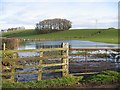
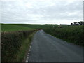
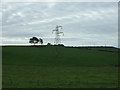
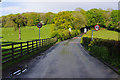
Nearby Images from Geograph Britain and Ireland:

©2007(licence)
©2007(licence)
©2015(licence)
©2015(licence)
©2012(licence)
The above images may not be of the site on this page, they are loaded from Geograph.
Please Submit an Image of this site or go out and take one for us!
Click here to see more info for this site
Nearby sites
Key: Red: member's photo, Blue: 3rd party photo, Yellow: other image, Green: no photo - please go there and take one, Grey: site destroyed
Download sites to:
KML (Google Earth)
GPX (GPS waypoints)
CSV (Garmin/Navman)
CSV (Excel)
To unlock full downloads you need to sign up as a Contributory Member. Otherwise downloads are limited to 50 sites.
Turn off the page maps and other distractions
Nearby sites listing. In the following links * = Image available
682m W 272° Bolton Le Sands Early Christian Sculptured Stone (SD48336765)
756m WNW 285° St Michael's Well (Lancashire) Holy Well or Sacred Spring (SD4828567831)
3.0km N 360° Hunting Hill* Round Barrow(s) (SD49037065)
3.1km SSE 152° The Lancaster Cross* Ancient Cross (SD504649)
3.1km SSE 162° Halton St Wilfrid's Churchyard* Ancient Cross (SD49916469)
4.3km NNW 349° Cote Stones Cairn (SD482719)
4.5km SW 221° Torrisholme* Round Barrow(s) (SD45966425)
5.1km N 1° Warton Crag* Hillfort (SD492727)
5.3km N 350° Badger Hole (Lancashire)* Cave or Rock Shelter (SD48187285)
5.4km N 352° Dog Holes* Cave or Rock Shelter (SD48337303)
5.5km NNW 348° Ings Point Natural Stone / Erratic / Other Natural Feature (SD479730)
5.5km N 9° Warton Crag giant wall Misc. Earthwork (SD499731)
5.8km WSW 242° Fartle Barrow* Cairn (SD4380364966)
5.9km N 4° The Three brothers* Natural Stone / Erratic / Other Natural Feature (SD495735)
5.9km SSW 195° Lancaster Priory Cross* Ancient Cross (SD474619)
6.1km SSW 193° Lancaster City Museum* Museum (SD4761161729)
6.2km NNE 32° Manor Farm* Round Barrow(s) (SD52387285)
6.4km SE 144° Askew Heights* Ancient Village or Settlement (SD52726239)
6.4km S 183° Golgotha Lodge (Williamson Park) Cairn (SD48666121)
6.7km N 9° Summerhouse Hill Cairn* Cairn (SD50147428)
6.8km N 8° Summerhouse Hill* Modern Stone Circle etc (SD50037437)
7.0km NNW 334° Woodwell* Holy Well or Sacred Spring (SD4674)
7.4km NNE 18° Yealand ancient stone walls or rows 1 Misc. Earthwork (SD514746)
8.0km NNE 16° Yealand ancient stone walls or rows 2 Misc. Earthwork (SD513753)
8.5km ENE 74° St John the Evangelist (Gressingham)* Ancient Cross (SD5725069915)
View more nearby sites and additional images


 We would like to know more about this location. Please feel free to add a brief description and any relevant information in your own language.
 Wir möchten mehr über diese Stätte erfahren. Bitte zögern Sie nicht, eine kurze Beschreibung und relevante Informationen in Deutsch hinzuzufügen.
 Nous aimerions en savoir encore un peu sur les lieux. S'il vous plaît n'hesitez pas à ajouter une courte description et tous les renseignements pertinents dans votre propre langue.
 Quisieramos informarnos un poco más de las lugares. No dude en añadir una breve descripción y otros datos relevantes en su propio idioma.