<< Text Pages >> Buckland Ridge South - Ring Cairn in England in Devon
Submitted by Anne T on Tuesday, 25 October 2016 Page Views: 1299
Neolithic and Bronze AgeSite Name: Buckland Ridge South Alternative Name: Buckland Ridge SCountry: England County: Devon Type: Ring Cairn
Nearest Town: Newton Abbot Nearest Village: Buckand in the Moor
Map Ref: SX73577324
Latitude: 50.545218N Longitude: 3.785752W
Condition:
| 5 | Perfect |
| 4 | Almost Perfect |
| 3 | Reasonable but with some damage |
| 2 | Ruined but still recognisable as an ancient site |
| 1 | Pretty much destroyed, possibly visible as crop marks |
| 0 | No data. |
| -1 | Completely destroyed |
| 5 | Superb |
| 4 | Good |
| 3 | Ordinary |
| 2 | Not Good |
| 1 | Awful |
| 0 | No data. |
| 5 | Can be driven to, probably with disabled access |
| 4 | Short walk on a footpath |
| 3 | Requiring a bit more of a walk |
| 2 | A long walk |
| 1 | In the middle of nowhere, a nightmare to find |
| 0 | No data. |
| 5 | co-ordinates taken by GPS or official recorded co-ordinates |
| 4 | co-ordinates scaled from a detailed map |
| 3 | co-ordinates scaled from a bad map |
| 2 | co-ordinates of the nearest village |
| 1 | co-ordinates of the nearest town |
| 0 | no data |
Be the first person to rate this site - see the 'Contribute!' box in the right hand menu.
Internal Links:
External Links:
Ring Cairn in Devon
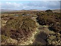
Sited immediately next to a footpath, information about the Buckland Ridge (S) Stone Ring Cairn Circle comes from the Prehistoric Dartmoor Walks (PDW) website. Their notes tell us this is a "robbed cairn. Stone ring is 13m inside diameter bank 1.80m wide and 50cms high, much of the bank on the eastern side has been destroyed. The central area has been disturbed, modern stone wall running north to south through the eastern section of the stone ring."
There is no Pastscape record for this site, although the Heritage Gateway for Devon & Dartmoor includes information on this monument: HER number MDV30630. They date this round cairn from the Early Neolithic to the Late Bronze Age (4000BC to 701BC) and give us the description: "a round cairn 160 metres north-north-west of Buckland Beacon. A flattened round cairn is set close by the west side of the newtake wall that defines the ridge between Buckland and Welstor Commons. Condition is declining erosion caused by footpath."
Note: Have you visited this site? Do you have any photographs, images or further information you can add?
You may be viewing yesterday's version of this page. To see the most up to date information please register for a free account.
Do not use the above information on other web sites or publications without permission of the contributor.
Nearby Images from Geograph Britain and Ireland:
©2009(licence)

©2009(licence)

©2016(licence)

©2021(licence)

©2016(licence)
The above images may not be of the site on this page, they are loaded from Geograph.
Please Submit an Image of this site or go out and take one for us!
Click here to see more info for this site
Nearby sites
Key: Red: member's photo, Blue: 3rd party photo, Yellow: other image, Green: no photo - please go there and take one, Grey: site destroyed
Download sites to:
KML (Google Earth)
GPX (GPS waypoints)
CSV (Garmin/Navman)
CSV (Excel)
To unlock full downloads you need to sign up as a Contributory Member. Otherwise downloads are limited to 50 sites.
Turn off the page maps and other distractions
Nearby sites listing. In the following links * = Image available
156m SSW 205° Ten Commandments Stone* Natural Stone / Erratic / Other Natural Feature (SX735731)
347m S 190° Stidwell* Holy Well or Sacred Spring (SX735729)
2.0km N 352° Wittaburrow Cairn* Cairn (SX73347521)
2.3km N 355° Blackslade Down Cairn and Cist* Cist (SX7341275510)
2.6km NNE 24° Rippon Tor* Cairn (SX74667558)
2.6km N 350° Tunhill Rocks* Ancient Village or Settlement (SX7318975796)
2.6km N 3° Foales Arrishes* Ancient Village or Settlement (SX73777587)
3.0km N 9° Seven Lords' Lands* Stone Circle (SX74127623)
3.2km N 357° Top Tor row Stone Row / Alignment (SX735764)
3.2km NW 323° Dunstone Cup Stone Rock Art (SX71677585)
3.2km N 359° Top Tor Cairns* Cairn (SX7357476472)
4.0km NNW 332° Saxon Well* Holy Well or Sacred Spring (SX718768)
4.3km SSE 153° St Gudula's Well* Holy Well or Sacred Spring (SX754694)
4.5km W 268° Sherberton Common Multiple Stone Rows / Avenue (SX691732)
4.9km W 271° Sherril Down Multiple Stone Rows / Avenue (SX687734)
4.9km S 190° Hembury Castle* Hillfort (SX7263868449)
5.0km N 351° Chinkwell Tor Cairn* Cairn (SX7293078250)
5.1km W 272° Ouldsbroom Cross* Ancient Cross (SX6850173504)
5.1km W 279° Corndon Down Cairns* Barrow Cemetery (SX68557420)
5.2km WNW 285° Corndon Down N Cairns* Barrow Cemetery (SX68587473)
5.4km NNE 21° Smallacombe Rocks Settlement* Ancient Village or Settlement (SX7558378211)
5.4km W 275° Money Pit cairn* Stone Circle (SX6818173865)
5.4km W 275° Yar Tor SE* Multiple Stone Rows / Avenue (SX68187388)
5.4km W 275° Money Pit Cairns* Cairn (SX68147384)
5.5km W 277° Yar Tor NW* Multiple Stone Rows / Avenue (SX6806674043)
View more nearby sites and additional images


 We would like to know more about this location. Please feel free to add a brief description and any relevant information in your own language.
 Wir möchten mehr über diese Stätte erfahren. Bitte zögern Sie nicht, eine kurze Beschreibung und relevante Informationen in Deutsch hinzuzufügen.
 Nous aimerions en savoir encore un peu sur les lieux. S'il vous plaît n'hesitez pas à ajouter une courte description et tous les renseignements pertinents dans votre propre langue.
 Quisieramos informarnos un poco más de las lugares. No dude en añadir una breve descripción y otros datos relevantes en su propio idioma.