

<< Our Photo Pages >> Torshov - Barrow Cemetery in Norway in Akershus
Submitted by kenntha88 on Tuesday, 14 October 2014 Page Views: 1221
Neolithic and Bronze AgeSite Name: Torshov Alternative Name: BrushaugenCountry: Norway Fylke: Akershus Type: Barrow Cemetery
Nearest Town: Kløfta Nearest Village: Gjerdrum
Latitude: 60.101954N Longitude: 11.087265E
Condition:
| 5 | Perfect |
| 4 | Almost Perfect |
| 3 | Reasonable but with some damage |
| 2 | Ruined but still recognisable as an ancient site |
| 1 | Pretty much destroyed, possibly visible as crop marks |
| 0 | No data. |
| -1 | Completely destroyed |
| 5 | Superb |
| 4 | Good |
| 3 | Ordinary |
| 2 | Not Good |
| 1 | Awful |
| 0 | No data. |
| 5 | Can be driven to, probably with disabled access |
| 4 | Short walk on a footpath |
| 3 | Requiring a bit more of a walk |
| 2 | A long walk |
| 1 | In the middle of nowhere, a nightmare to find |
| 0 | No data. |
| 5 | co-ordinates taken by GPS or official recorded co-ordinates |
| 4 | co-ordinates scaled from a detailed map |
| 3 | co-ordinates scaled from a bad map |
| 2 | co-ordinates of the nearest village |
| 1 | co-ordinates of the nearest town |
| 0 | no data |
Internal Links:
External Links:
")
19 barrows are known around the large farm called Torshov. The Torshov is located on a large flat area with some spread out forests and mostly wheat fields. The highway 429 goes north-south through the area.
Some of the barrows are single barrows, one large to the east of the highway and one large to the west. They are located in the middle of the wheat fields. There are two small barrow cemeteries to the east of the highway. I will describe them individually.
- At the west of the highway and at the edge of a larger forest is a large round barrow. The barrow is 22 metres in diameter and 3.5 metres in height. The barrow is overgrown with some huge trees and some smaller forest vegetation. It is still easy to observe from the road. There is also a signpost showing the barrows in the area. This barrow is called "Sletthaugen".
- To the east of the highway and south-east of Sletthaugen and in the middle of a wheat field is another pretty round barrow. It is 19 metres in diameter and 2.5 metres in height. It is overgrown with forest vegetation and large trees. It is called "Stashaugen".
- To the east of the highway are two barrow cemeteries. The one to the north has 8 barrows, six round barrows and two elongated barrows. This cemetery only has a few trees and smaller forest vegetation. The other barrow cemetery has three barrows, one is large.
The northern barrow cemetery consists of 8 round and 2 elongated barrows. The barrows are very close to one another, almost touching each other. The largest barrow is 15 metres in diameter and 2.5 metres in height. It has a beautiful rounded shape. The other round barrows are from 7 to 14 metres in diameter and from 0.7 to 2.5 metres in height. The two elongated barrows are in the south-east part of the cemetery. They are around 14 metres in length, around 4.5 metres wide and around 1.5 metres in height.
The smaller barrow cemetery to the south consists of three round barrows. The largest barrow is 22 metres in diameter and around 3 metres in height. The other two barrows are around 11 metres in diameter and 1.5 metres in height. This barrow cemetery is very heavily overgrown with trees and brush.
The presence of such large burial monuments shows that this area had a large and wealthy population in the Iron Age. There has originally been more barrows, but some of them have been erased because of plowing and road construction. The name "Torshov" is from the word "Hov" which means pagan place of worship and the Norse god Tor. Many of the barrows have also been excavated by amateurs and have craters on top. The barrows have been dated to late Iron Age, around 700 to 900AD.
You may be viewing yesterday's version of this page. To see the most up to date information please register for a free account.
")
")
")
")
")
")
")
")
")
")
")
")
Do not use the above information on other web sites or publications without permission of the contributor.
Click here to see more info for this site
Nearby sites
Click here to view sites on an interactive map of the areaKey: Red: member's photo, Blue: 3rd party photo, Yellow: other image, Green: no photo - please go there and take one, Grey: site destroyed
Download sites to:
KML (Google Earth)
GPX (GPS waypoints)
CSV (Garmin/Navman)
CSV (Excel)
To unlock full downloads you need to sign up as a Contributory Member. Otherwise downloads are limited to 50 sites.
Turn off the page maps and other distractions
Nearby sites listing. In the following links * = Image available
4.9km NNE 21° The Prince's Mound* Round Barrow(s)
4.9km SSE 161° Brotnuhaugen-Snilehaugen* Round Barrow(s)
5.4km NNE 14° Villashaugen* Round Barrow(s)
5.5km NNE 23° Hertelshaugen* Round Barrow(s)
5.7km NNE 29° Rakni's Mound* Round Barrow(s)
8.0km ENE 64° Bekkedalsgutua* Round Barrow(s)
8.3km ENE 66° Skinnfellbråtan* Barrow Cemetery
8.4km ENE 70° Åssand* Round Barrow(s)
9.5km ENE 68° Fonbekkhagan* Barrow Cemetery
11.2km N 356° Kjosholtet* Barrow Cemetery
11.4km NNW 337° Lysthaugen* Long Barrow
12.0km SSW 192° Sten-Tærud* Barrow Cemetery
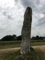
12.2km S 190° Skedsmo Kirke Phallitic Stone* Standing Stone (Menhir)
12.2km N 357° Vigstein* Standing Stone (Menhir)
12.3km N 358° Kneppefeltet-Vigsteinmoen* Barrow Cemetery
13.2km S 176° Asak Cemetery* Barrow Cemetery
13.7km SE 141° Valsmoen* Barrow Cemetery
15.3km SE 143° Bingsfossen Helleristninger* Rock Art
17.0km SE 132° Lille Huseby og Kjempehaugen* Round Barrow(s)
17.3km SE 131° Hellerudåsen cemetery* Barrow Cemetery
19.5km SSE 162° Guriholtet barrow cemetery* Barrow Cemetery
19.8km NNW 342° Vålaug* Round Barrow(s)
20.8km SE 140° Jødal Lille* Barrow Cemetery
20.8km NNW 342° Bårhaugkampen Hillfort* Hillfort
21.2km SSE 167° Ridderhaugen* Round Barrow(s)
View more nearby sites and additional images


 We would like to know more about this location. Please feel free to add a brief description and any relevant information in your own language.
 Wir möchten mehr über diese Stätte erfahren. Bitte zögern Sie nicht, eine kurze Beschreibung und relevante Informationen in Deutsch hinzuzufügen.
 Nous aimerions en savoir encore un peu sur les lieux. S'il vous plaît n'hesitez pas à ajouter une courte description et tous les renseignements pertinents dans votre propre langue.
 Quisieramos informarnos un poco más de las lugares. No dude en añadir una breve descripción y otros datos relevantes en su propio idioma.