
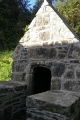

<< Our Photo Pages >> Warebeth - Chambered Tomb in Scotland in Orkney
Submitted by howar on Monday, 11 February 2013 Page Views: 3991
Neolithic and Bronze AgeSite Name: WarebethCountry: Scotland County: Orkney Type: Chambered Tomb
Nearest Town: Stromness
Map Ref: HY238085
Latitude: 58.956890N Longitude: 3.326412W
Condition:
| 5 | Perfect |
| 4 | Almost Perfect |
| 3 | Reasonable but with some damage |
| 2 | Ruined but still recognisable as an ancient site |
| 1 | Pretty much destroyed, possibly visible as crop marks |
| 0 | No data. |
| -1 | Completely destroyed |
| 5 | Superb |
| 4 | Good |
| 3 | Ordinary |
| 2 | Not Good |
| 1 | Awful |
| 0 | No data. |
| 5 | Can be driven to, probably with disabled access |
| 4 | Short walk on a footpath |
| 3 | Requiring a bit more of a walk |
| 2 | A long walk |
| 1 | In the middle of nowhere, a nightmare to find |
| 0 | No data. |
| 5 | co-ordinates taken by GPS or official recorded co-ordinates |
| 4 | co-ordinates scaled from a detailed map |
| 3 | co-ordinates scaled from a bad map |
| 2 | co-ordinates of the nearest village |
| 1 | co-ordinates of the nearest town |
| 0 | no data |
Internal Links:
External Links:
")
This was reported in the Orkney Archaeology Society's "Newsletter No 08 Autumn 2012", where there is a photo of the surrounding area and a close-up of the slabs. Thanks to the farmer backfilling with light soil this will remain undug for future generations. Hopefully further info will turn up on the OAS new website http://www.orkneyarchaeologysociety.org.uk after they have published updates on this year's digs.
You may be viewing yesterday's version of this page. To see the most up to date information please register for a free account.
")
")
Do not use the above information on other web sites or publications without permission of the contributor.
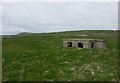
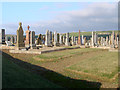
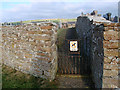
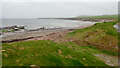
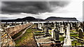
Nearby Images from Geograph Britain and Ireland:
©2005(licence)
©2011(licence)
©2011(licence)
©2021(licence)
©2015(licence)
The above images may not be of the site on this page, they are loaded from Geograph.
Please Submit an Image of this site or go out and take one for us!
Click here to see more info for this site
Nearby sites
Key: Red: member's photo, Blue: 3rd party photo, Yellow: other image, Green: no photo - please go there and take one, Grey: site destroyed
Download sites to:
KML (Google Earth)
GPX (GPS waypoints)
CSV (Garmin/Navman)
CSV (Excel)
To unlock full downloads you need to sign up as a Contributory Member. Otherwise downloads are limited to 50 sites.
Turn off the page maps and other distractions
Nearby sites listing. In the following links * = Image available
1.1km NW 315° Leafea* Standing Stones (HY23060927)
1.3km NE 49° Haley Hole Well (Brownstown) Holy Well or Sacred Spring (HY2477609314)
1.3km NNW 326° Brockan* Ancient Village or Settlement (HY231096)
1.5km WNW 301° Broch of Breckness* Broch or Nuraghe (HY225093)
2.7km E 80° Quoyelsh* Ancient Village or Settlement (HY265089)
4.1km SW 216° Braebister* Promontory Fort / Cliff Castle (HY21300522)
4.2km NNE 13° Una* Artificial Mound (HY24841254)
4.4km NE 40° Deepdale Cottages* Standing Stones (HY267118)
4.5km ENE 57° Howe Chambered Tomb* Chambered Tomb (HY276109)
4.7km NE 45° Deepdale Stones* Standing Stone (Menhir) (HY272118)
4.8km ENE 65° Cummi Howe* Broch or Nuraghe (HY282104)
4.9km ENE 69° Corn Hillock* Cairn (HY28481015)
5.4km ENE 74° The Cairns* Cairn (HY29050987)
5.5km NE 52° Diamond Cottage* Promontory Fort / Cliff Castle (HY28211176)
5.5km NE 53° Unstan* Chambered Cairn (HY28291172)
5.8km SSE 167° Quoyness, Greenhill Broch* Broch or Nuraghe (HY25000284)
6.0km ESE 111° Sower Castle* Ancient Village or Settlement (HY29400620)
6.3km S 174° Whiteglen Standing Stone Standing Stone (Menhir) (HY24350221)
6.6km NNE 12° Voy.* Ancient Village or Settlement (HY25351497)
6.8km NNE 19° Voy Crannogs* Crannog (HY261149)
7.1km NE 50° Possible large stone circle in Loch of Stenness Stone Circle (HY2933112934)
7.2km ENE 63° Standing Stones Hotel* Chambered Cairn (HY30251165)
7.2km NE 50° Fairy Well (Stenness)* Holy Well or Sacred Spring (HY2943212982)
7.3km NE 43° Wasbister Disc Barrow* Round Barrow(s) (HY289137)
7.3km NE 43° Dyke o'Sean* Ancient Village or Settlement (HY289137)
View more nearby sites and additional images


 We would like to know more about this location. Please feel free to add a brief description and any relevant information in your own language.
 Wir möchten mehr über diese Stätte erfahren. Bitte zögern Sie nicht, eine kurze Beschreibung und relevante Informationen in Deutsch hinzuzufügen.
 Nous aimerions en savoir encore un peu sur les lieux. S'il vous plaît n'hesitez pas à ajouter une courte description et tous les renseignements pertinents dans votre propre langue.
 Quisieramos informarnos un poco más de las lugares. No dude en añadir una breve descripción y otros datos relevantes en su propio idioma.