<< Our Photo Pages >> Alte Burg Singhofen - Hillfort in Germany in Rhineland-Palatinate
Submitted by KaiHofmann on Tuesday, 10 November 2020 Page Views: 1955
Iron Age and Later PrehistorySite Name: Alte Burg SinghofenCountry: Germany
NOTE: This site is 11.226 km away from the location you searched for.
Land: Rhineland-Palatinate Type: Hillfort
Nearest Town: Nassau Nearest Village: Singhofen
Latitude: 50.281370N Longitude: 7.805160E
Condition:
| 5 | Perfect |
| 4 | Almost Perfect |
| 3 | Reasonable but with some damage |
| 2 | Ruined but still recognisable as an ancient site |
| 1 | Pretty much destroyed, possibly visible as crop marks |
| 0 | No data. |
| -1 | Completely destroyed |
| 5 | Superb |
| 4 | Good |
| 3 | Ordinary |
| 2 | Not Good |
| 1 | Awful |
| 0 | No data. |
| 5 | Can be driven to, probably with disabled access |
| 4 | Short walk on a footpath |
| 3 | Requiring a bit more of a walk |
| 2 | A long walk |
| 1 | In the middle of nowhere, a nightmare to find |
| 0 | No data. |
| 5 | co-ordinates taken by GPS or official recorded co-ordinates |
| 4 | co-ordinates scaled from a detailed map |
| 3 | co-ordinates scaled from a bad map |
| 2 | co-ordinates of the nearest village |
| 1 | co-ordinates of the nearest town |
| 0 | no data |
Internal Links:
External Links:
I have visited· I would like to visit
Janek visited on 10th Oct 2020 - their rating: Cond: 4 Amb: 4 Access: 3
")
You may be viewing yesterday's version of this page. To see the most up to date information please register for a free account.
")
")
Do not use the above information on other web sites or publications without permission of the contributor.
Nearby Images from Flickr

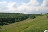
The above images may not be of the site on this page, but were taken nearby. They are loaded from Flickr so please click on them for image credits.
Click here to see more info for this site
Nearby sites
Click here to view sites on an interactive map of the areaKey: Red: member's photo, Blue: 3rd party photo, Yellow: other image, Green: no photo - please go there and take one, Grey: site destroyed
Download sites to:
KML (Google Earth)
GPX (GPS waypoints)
CSV (Garmin/Navman)
CSV (Excel)
To unlock full downloads you need to sign up as a Contributory Member. Otherwise downloads are limited to 50 sites.
Turn off the page maps and other distractions
Nearby sites listing. In the following links * = Image available
14.9km NW 325° Grabhügelfeld Simmern Barrow Cemetery
15.5km SSW 200° Befestigung auf dem Hünenberg Hillfort
16.2km WNW 285° Wallanlage Dommelberg* Hillfort
18.5km NNE 23° Bornkasten* Hillfort
18.6km S 180° Grabhügel Weisel* Round Barrow(s)
19.2km W 265° Bruder Tönnes Hügel* Round Barrow(s)
19.8km W 263° Grabhügelfeld Waldesch* Barrow Cemetery
22.6km NE 34° Hundsangen Early Cross Ancient Cross
23.2km E 92° Ringwall Altschloss* Hillfort
24.7km SW 221° Flammensäule Pfalzfeld* Sculptured Stone
24.9km W 261° Keltenburg Alken Hillfort
25.6km E 83° Kirrberg Menhir* Standing Stone (Menhir)
26.0km WNW 284° Hügelgräberfeld Chorsang Barrow Cemetery
26.5km E 81° Dauborn Hinkelstein Standing Stone (Menhir)
26.5km WSW 237° Gondershausen paleolithic horse engravings* Rock Art
26.5km WNW 285° Gollenbusch Graeberfeld Barrow Cemetery
26.6km ENE 62° Menhir Lindenholzhausen Standing Stone (Menhir)
26.7km SSW 200° Breitscheid Grabhuegel Round Barrow(s)
26.7km WNW 284° Goloring* Henge
27.5km NE 36° Niederzeuzheim* Chambered Tomb
28.6km NE 54° Niedertiefenbach Galeriegrab Chambered Tomb
28.7km NW 320° Grabhügelfeld Heimbach-Weis* Barrow Cemetery
28.8km W 280° Dreitonnenkuppe Grabhügel* Round Barrow(s)
28.8km W 280° Dreitonnenkuppe Stein* Standing Stone (Menhir)
29.1km SW 227° Grabhügelgruppe Beltheim Barrow Cemetery
View more nearby sites and additional images


 We would like to know more about this location. Please feel free to add a brief description and any relevant information in your own language.
 Wir möchten mehr über diese Stätte erfahren. Bitte zögern Sie nicht, eine kurze Beschreibung und relevante Informationen in Deutsch hinzuzufügen.
 Nous aimerions en savoir encore un peu sur les lieux. S'il vous plaît n'hesitez pas à ajouter une courte description et tous les renseignements pertinents dans votre propre langue.
 Quisieramos informarnos un poco más de las lugares. No dude en añadir una breve descripción y otros datos relevantes en su propio idioma.