 with our Megalithic Portal iPhone app")


<< Our Photo Pages >> Cae Forgan Standing Stone - Standing Stone (Menhir) in Wales in Gwynedd
Submitted by TAlanJones on Monday, 09 November 2020 Page Views: 712
Neolithic and Bronze AgeSite Name: Cae Forgan Standing StoneCountry: Wales County: Gwynedd Type: Standing Stone (Menhir)
Nearest Town: Pen Y Groes Nearest Village: Carmel
Map Ref: SH490547
Latitude: 53.068137N Longitude: 4.255121W
Condition:
| 5 | Perfect |
| 4 | Almost Perfect |
| 3 | Reasonable but with some damage |
| 2 | Ruined but still recognisable as an ancient site |
| 1 | Pretty much destroyed, possibly visible as crop marks |
| 0 | No data. |
| -1 | Completely destroyed |
| 5 | Superb |
| 4 | Good |
| 3 | Ordinary |
| 2 | Not Good |
| 1 | Awful |
| 0 | No data. |
| 5 | Can be driven to, probably with disabled access |
| 4 | Short walk on a footpath |
| 3 | Requiring a bit more of a walk |
| 2 | A long walk |
| 1 | In the middle of nowhere, a nightmare to find |
| 0 | No data. |
| 5 | co-ordinates taken by GPS or official recorded co-ordinates |
| 4 | co-ordinates scaled from a detailed map |
| 3 | co-ordinates scaled from a bad map |
| 2 | co-ordinates of the nearest village |
| 1 | co-ordinates of the nearest town |
| 0 | no data |
Internal Links:
External Links:
")
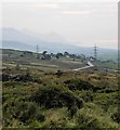
The menhir stands elegantly within a low lying field to the West of the village of Carmel. It can be seen from the road that links Carmel to Pen Y Groes. There is a footpath that leads to the stone however it has not been maintained and permission may need to be sought from Cae Forgan farm to access it from a different route.
The stone stands at 1.5m high. It has a much wider base than it's upper parts and it's shape is charmingly skewed.
You may be viewing yesterday's version of this page. To see the most up to date information please register for a free account.
")
")
")
")
Do not use the above information on other web sites or publications without permission of the contributor.
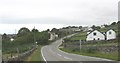
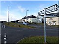
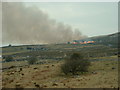
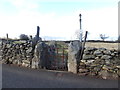
Nearby Images from Geograph Britain and Ireland:
©2008(licence)
©2018(licence)
©2006(licence)
©2018(licence)
©2017(licence)
The above images may not be of the site on this page, they are loaded from Geograph.
Please Submit an Image of this site or go out and take one for us!
Click here to see more info for this site
Nearby sites
Key: Red: member's photo, Blue: 3rd party photo, Yellow: other image, Green: no photo - please go there and take one, Grey: site destroyed
Download sites to:
KML (Google Earth)
GPX (GPS waypoints)
CSV (Garmin/Navman)
CSV (Excel)
To unlock full downloads you need to sign up as a Contributory Member. Otherwise downloads are limited to 50 sites.
Turn off the page maps and other distractions
Nearby sites listing. In the following links * = Image available
315m WSW 250° Cae Forgan Cairn* Cairn (SH487546)
582m WSW 237° Pen Llwyn Farm Hut Circle Settlement* Ancient Village or Settlement (SH485544)
804m ESE 118° Mynydd Y Cilgwyn Cairn* Cairn (SH497543)
2.5km SSW 210° Caer Engan* Hillfort (SH4767052590)
2.5km SSW 211° Carreg Caer Engan* Standing Stone (Menhir) (SH4762352591)
3.3km WNW 283° Glynllifon Monolith Standing Stone (Menhir) (SH4577055574)
3.7km WSW 256° Penbryn Mawr Standing Stone* Standing Stone (Menhir) (SH4537253927)
3.8km ESE 106° Gelli Ffrydiau Hillfort* Hillfort (SH5259053560)
3.8km NNE 15° Gaerwen Ancient Village or Settlement (SH501583)
3.9km W 261° Plas Newydd Ancient Village or Settlement (SH4507954192)
4.0km NW 317° Dinas y Prif Camp* Ancient Village or Settlement (SH4633957760)
4.1km W 278° Ffynnon Adliw Holy Well or Sacred Spring (SH4490155385)
4.5km W 261° Maen Llwyd (Gwynedd)* Standing Stone (Menhir) (SH4449554155)
4.8km W 276° Bodfan Standing Stone* Standing Stone (Menhir) (SH4420555327)
4.9km E 88° Mynydd Mawr Cairn* Cairn (SH53965469)
5.0km SW 235° Craig-y-Dinas (Penygroes)* Hillfort (SH44825198)
5.1km ESE 120° Cwmyffynnon alignment* Natural Stone / Erratic / Other Natural Feature (SH533520)
5.4km E 80° Craig Cwmbychan Cairn* Cairn (SH54335542)
5.5km WNW 285° Dinas Dinlle* Hillfort (SH437563)
5.6km SSE 156° Garnedd Goch Round Cairn* Round Cairn (SH511495)
5.7km SE 140° Craig Cwm Silyn Round Cairn* Round Cairn (SH525502)
6.2km SSW 211° Graianog Long Mound* Misc. Earthwork (SH45634951)
6.5km ESE 107° Y Garn (Gwynedd)* Cairn (SH55135262)
6.5km S 170° Mynydd Graig Goch Round Cairn* Round Cairn (SH499483)
6.5km SSW 210° Graianog Standing Stone* Standing Stone (Menhir) (SH45524918)
View more nearby sites and additional images


 We would like to know more about this location. Please feel free to add a brief description and any relevant information in your own language.
 Wir möchten mehr über diese Stätte erfahren. Bitte zögern Sie nicht, eine kurze Beschreibung und relevante Informationen in Deutsch hinzuzufügen.
 Nous aimerions en savoir encore un peu sur les lieux. S'il vous plaît n'hesitez pas à ajouter une courte description et tous les renseignements pertinents dans votre propre langue.
 Quisieramos informarnos un poco más de las lugares. No dude en añadir una breve descripción y otros datos relevantes en su propio idioma.