


<< Our Photo Pages >> The Hill of Health - Round Barrow(s) in England in Suffolk
Submitted by willowman1 on Friday, 11 December 2020 Page Views: 973
Neolithic and Bronze AgeSite Name: The Hill of HealthCountry: England
NOTE: This site is 1.4 km away from the location you searched for.
County: Suffolk Type: Round Barrow(s)
Nearest Town: Bury St Edmunds Nearest Village: Culford
Map Ref: TL8365171319
Latitude: 52.309264N Longitude: 0.692508E
Condition:
| 5 | Perfect |
| 4 | Almost Perfect |
| 3 | Reasonable but with some damage |
| 2 | Ruined but still recognisable as an ancient site |
| 1 | Pretty much destroyed, possibly visible as crop marks |
| 0 | No data. |
| -1 | Completely destroyed |
| 5 | Superb |
| 4 | Good |
| 3 | Ordinary |
| 2 | Not Good |
| 1 | Awful |
| 0 | No data. |
| 5 | Can be driven to, probably with disabled access |
| 4 | Short walk on a footpath |
| 3 | Requiring a bit more of a walk |
| 2 | A long walk |
| 1 | In the middle of nowhere, a nightmare to find |
| 0 | No data. |
| 5 | co-ordinates taken by GPS or official recorded co-ordinates |
| 4 | co-ordinates scaled from a detailed map |
| 3 | co-ordinates scaled from a bad map |
| 2 | co-ordinates of the nearest village |
| 1 | co-ordinates of the nearest town |
| 0 | no data |
Internal Links:
External Links:
")
In the 1930s, two large sarsen boulders were reported to be on its southern side, but there's no sign of them today. T.C. Lethbridge in 1957 related the tradition that the Danes had once skinned a young shepherd on its slopes, but when I first visited it in the 1970s, the house owner had only heard that it was "where the Saxons were buried."
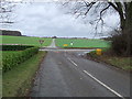
Although on private property, the mound can be seen from the gateway, or through the thin hedge beside the footpath.
Historic England List Entry 1020717
You may be viewing yesterday's version of this page. To see the most up to date information please register for a free account.
Do not use the above information on other web sites or publications without permission of the contributor.
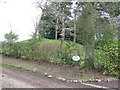
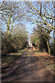
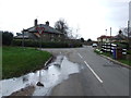
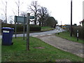
Nearby Images from Geograph Britain and Ireland:
©2012(licence)
©2009(licence)
©2012(licence)
©2012(licence)
©2012(licence)
The above images may not be of the site on this page, they are loaded from Geograph.
Please Submit an Image of this site or go out and take one for us!
Click here to see more info for this site
Nearby sites
Key: Red: member's photo, Blue: 3rd party photo, Yellow: other image, Green: no photo - please go there and take one, Grey: site destroyed
Download sites to:
KML (Google Earth)
GPX (GPS waypoints)
CSV (Garmin/Navman)
CSV (Excel)
To unlock full downloads you need to sign up as a Contributory Member. Otherwise downloads are limited to 50 sites.
Turn off the page maps and other distractions
Nearby sites listing. In the following links * = Image available
2.0km ESE 107° Ingham Puddingstone* Marker Stone (TL8556770828)
2.6km SSW 199° Fornham All Saints A Cursus Cursus (TL829688)
2.9km W 266° West Stow* Ancient Village or Settlement (TL808710)
3.0km SE 136° Timworth Puddingstone* Marker Stone (TL8580969281)
3.2km NNE 12° Traveller's Hill* Round Barrow(s) (TL842745)
3.4km WSW 240° Flempton Cursus Cursus (TL808695)
3.4km S 187° Fornham All Saints B Cursus Cursus (TL83346794)
3.4km WNW 300° West Stow Field Barrow* Round Barrow(s) (TL806729)
3.6km NE 50° Seven hills, Rymer* Barrow Cemetery (TL8630073700)
3.7km S 182° Fornham All Saints C Cursus Cursus (TL83636765)
4.1km S 176° Fornham All Saints A Cursus Cursus (TL841672)
4.9km SSE 148° Hall Farm Puddingstone Marker Stone (TL864672)
5.7km ENE 62° Black Hill-Suffolk* Round Barrow(s) (TL886742)
6.1km SSE 149° Plum Pudding Covert Artificial Mound (TL870662)
6.5km ENE 67° Troston Mount* Round Barrow(s) (TL896741)
6.8km SE 132° St. John's Well (Suffolk)* Holy Well or Sacred Spring (TL889669)
7.1km S 169° Moyse's Hall Museum Museum (TL8530264367)
7.3km ENE 61° Honington Barrows Round Barrow(s) (TL899751)
7.6km SE 143° Cattishall Tumulus Artificial Mound (TL88476541)
8.2km NNE 30° Barnham [East Farm Pit]* Ancient Mine, Quarry or other Industry (TL8750078600)
8.2km NNE 24° Millfield Barn Round Barrow(s) (TL86717898)
8.3km NNE 24° Mill House Barrow Round Barrow(s) (TL867790)
8.7km NNE 21° Barnham Puddingstone Marker Stone (TL865796)
9.1km NW 305° How Hill Round Barrow(s) (TL75987626)
9.8km NNE 33° Barnham Heath Pit Natural Stone / Erratic / Other Natural Feature (TL887797)
View more nearby sites and additional images


 We would like to know more about this location. Please feel free to add a brief description and any relevant information in your own language.
 Wir möchten mehr über diese Stätte erfahren. Bitte zögern Sie nicht, eine kurze Beschreibung und relevante Informationen in Deutsch hinzuzufügen.
 Nous aimerions en savoir encore un peu sur les lieux. S'il vous plaît n'hesitez pas à ajouter une courte description et tous les renseignements pertinents dans votre propre langue.
 Quisieramos informarnos un poco más de las lugares. No dude en añadir una breve descripción y otros datos relevantes en su propio idioma.