<< Our Photo Pages >> Oldbury Rock Shelters - Cave or Rock Shelter in England in Kent

Submitted by ocifant on Wednesday, 18 February 2004  Page Views: 17465

Natural PlacesSite Name: Oldbury Rock Shelters
Country: England County: Kent Type: Cave or Rock Shelter
 Nearest Village: Igtham
Map Ref: TQ5848056439  Landranger Map Number: 188
Latitude: 51.285045N  Longitude: 0.271158E
Condition:
5Perfect
4Almost Perfect
3Reasonable but with some damage
2Ruined but still recognisable as an ancient site
1Pretty much destroyed, possibly visible as crop marks
0No data.
-1Completely destroyed
4 Ambience:
5Superb
4Good
3Ordinary
2Not Good
1Awful
0No data.
4 Access:
5Can be driven to, probably with disabled access
4Short walk on a footpath
3Requiring a bit more of a walk
2A long walk
1In the middle of nowhere, a nightmare to find
0No data.
4 Accuracy:
5co-ordinates taken by GPS or official recorded co-ordinates
4co-ordinates scaled from a detailed map
3co-ordinates scaled from a bad map
2co-ordinates of the nearest village
1co-ordinates of the nearest town
0no data
3

Internal Links:
External Links:

Oldbury Rock Shelters
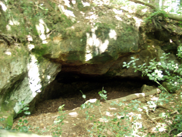
Oldbury Rock Shelters submitted by ocifant : I had no tripod on me this day, and light levels were low, hence the evident camera shake. On the eastern fringe of the public part of the hillfort is a footpath leading down towards Oldbury Lane. This cave is just off that footpath. (Vote or comment on this photo)
Rock Shelter in Kent. On the eastern fringe of the public part of the hillfort is a footpath leading down towards Oldbury Lane. This cave is just off that footpath.

Note: Hand axes found here are in the British Museum, London and Maidstone Museums.
You may be viewing yesterday's version of this page. To see the most up to date information please register for a free account.
Oldbury Rock Shelters
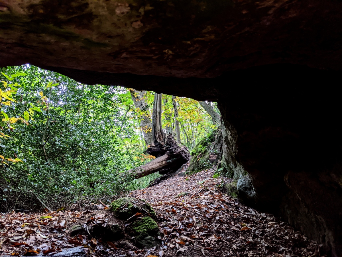
Oldbury Rock Shelters submitted by Jonik : View from inside the rock shelter looking out at the surrounding woodland. (Vote or comment on this photo)

Oldbury Rock Shelters
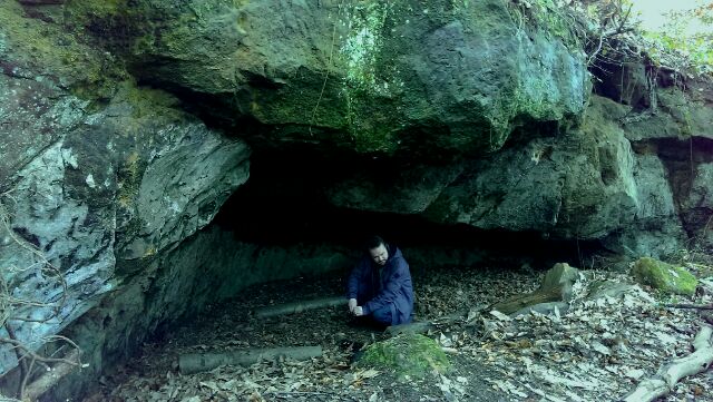
Oldbury Rock Shelters submitted by Jonik : Rock shelter with figure included for scale. (Vote or comment on this photo)

Do not use the above information on other web sites or publications without permission of the contributor.

Nearby Images from Geograph Britain and Ireland:
TQ5856 : Large house, Oldbury Lane by N Chadwick
by N Chadwick
©2008(licence)
TQ5856 : Muddy byway by N Chadwick
by N Chadwick
©2021(licence)
TQ5856 : Steps on a steep path, Oldbury Woods by N Chadwick
by N Chadwick
©2008(licence)
TQ5856 : Byway, Oldbury Hill by N Chadwick
by N Chadwick
©2024(licence)
TQ5856 : The Coach House by N Chadwick
by N Chadwick
©2024(licence)

The above images may not be of the site on this page, they are loaded from Geograph.
Please Submit an Image of this site or go out and take one for us!


Click here to see more info for this site

Nearby sites

Click here to view sites on an interactive OS map

Key: Red: member's photo, Blue: 3rd party photo, Yellow: other image, Green: no photo - please go there and take one, Grey: site destroyed

Download sites to:
KML (Google Earth)
GPX (GPS waypoints)
CSV (Garmin/Navman)
CSV (Excel)

To unlock full downloads you need to sign up as a Contributory Member. Otherwise downloads are limited to 50 sites.


Turn off the page maps and other distractions

Nearby sites listing. In the following links * = Image available
 367m SW 231° Oldbury Hillfort* Hillfort (TQ582562)
 889m SE 138° Redwell springs Holy Well or Sacred Spring (TQ591558)
 3.7km SSE 149° Plaxtol Not Known (by us) (TQ605533)
 3.7km NW 309° St Edith's Well (Kemsing)* Holy Well or Sacred Spring (TQ5548458678)
 3.9km NE 46° Gateway granites* Ancient Trackway (TQ61175924)
 4.7km W 274° Millpond Wood Barrow* Round Barrow(s) (TQ53815661)
 5.4km W 276° Saint John's Spring (Greatness) Holy Well or Sacred Spring (TQ531568)
 5.6km NW 307° Stumblebury Round Barrow(s) (TQ53845966)
 5.9km WNW 299° St Thomas a Becket's Well* Holy Well or Sacred Spring (TQ532592)
 6.1km ENE 63° Mount Mead* Round Barrow(s) (TQ63835933)
 6.3km WNW 299° Colet's Well* Holy Well or Sacred Spring (TQ5283459333)
 7.3km ENE 70° Chestnuts* Long Barrow (TQ65265917)
 7.3km ENE 70° Addington Long Barrow* Long Barrow (TQ65335910)
 8.1km ENE 62° Addington Sarsens Natural Stone / Erratic / Other Natural Feature (TQ65516047)
 8.2km ENE 60° Coldrum* Chambered Tomb (TQ65446072)
 8.5km NE 50° White Horse Wood Barrow Round Barrow(s) (TQ649621)
 8.8km ENE 61° Ryarsh Sarson Stones Natural Stone / Erratic / Other Natural Feature (TQ66076089)
 8.9km ESE 112° Pizien Well Holy Well or Sacred Spring (TQ668533)
 9.2km E 88° St Leonard's Well (West Malling)* Holy Well or Sacred Spring (TQ6763557095)
 9.8km NE 48° Cock Adam Shaw Natural Stone / Erratic / Other Natural Feature (TQ65576323)
 10.1km NNW 336° Eynsford Stone* Natural Stone / Erratic / Other Natural Feature (TQ540655)
 11.0km NE 51° Dode Church Well* Holy Well or Sacred Spring (TQ668637)
 11.4km NNE 33° St John The Baptist Church Sarson Stone Natural Stone / Erratic / Other Natural Feature (TQ644662)
 11.7km SE 129° Hob's pool Holy Well or Sacred Spring (TQ678494)
 11.9km E 80° Larkfield Cairnfield (Maidstone) Cairn (TQ70155891)
View more nearby sites and additional images

<< Kenidjack Common holed stones

Countess Close >>

Please add your thoughts on this site

New Book: Heavenly Art - Rock Art in Israel

New Book: Heavenly Art - Rock Art in Israel

Sponsors

Auto-Translation (Google)

Translate from English into:

"Oldbury Rock Shelters" | Login/Create an Account | 4 News and Comments
  
Go back to top of page    Comments are owned by the poster. We aren't responsible for their content.
Re: Oldbury Rock Shelters by Jonik on Sunday, 01 March 2015
(User Info | Send a Message)
I was unable to find the site using the given GPS coordinates. I found it at 51.2850421 N 0.2711557 E [updated, thanks]. From inside the fort, go as far north as you are allowed to go; head east until you see a footpath down with a concrete marker. This is right along the edge of the public and private land. The site is then just to the left of the short flight of steps, a little way down the path.
[ Reply to This ]

Re: Oldbury Rock Shelters by coldrum on Sunday, 03 January 2010
(User Info | Send a Message)
The following is from the Pastscape website and gives a bit more detail about the shelters.

"The caves or shelters on the eastern face of Oldbury Hill were excavated by B. Harrison in 1890 when 49 Palaeolithic implements and 648 flakes were found. (2-3)

A series of small caves and shallow rock shelters in an outcropping shelf of sandstone, just below the summit of Oldbury. Some of the caves have been blocked up with cemented stone walling. Harrison's collection is in store in Maidstone Museum but it is impossible to distinguish individual finds. (4)

Description of rock shelters. (5)

Many Palaeoliths were collected from the east side of the hill during the 19th century and it was believed that they originally came from "shelters" formed by the hollows in the sandstone, which it was suggested, were habitation sites. These, however, have been eroded in post-glacial times and it seems that the Palaeoliths were not associated with them. (6)

Excavations at Oldbury in Kent: The Palaeolithic Occupation. Although excavations were carried out at Oldbury by Harrison in 1890, there remains some uncertainty surrounding the exact position of the excavation. In 1965 further excavations were carried out in the area TQ 5856 5653. As a result of these excavations it was concluded that the rock shelters on the east edge of Oldbury Hill were not likely to have been occupied by Pleistocene man. Their present form may be very different from their Pleistocene form, and unless all trace of occupation was removed by erosion before the commencement of sedimentation, no cultural debris of Pleistocene man was left near them. A highly characteristic series of stone tools was found in situ both by Harrison and the 1965 excavators at point N (see Illustration Card). Extensive quarrying has altered the configuration of the spur, but it was once capped by hard rock which was weathered by frost shattering to form the stony cultural layer of site N. The excavators suggest that a rock overhang existed at the end of the spur in Pleistocene times and that it afforded protection from the south-west and west and possibly the north as well. The site is a vantage point looking east towards the Medway valley. The lithic assemblage from Oldbury N is typical of the Mousterian of Acheulian tradition, and it is the richest Mousterian assemblage in Britain. In comparison to French sites it seems that occupation here was less concentrated, perhaps seasonal. There is no geological means of dating the Oldbury site, but it would seem most likely to belong to the ??????? interstadial or conceivably the succeeding interstadial. (7-8)

Flint implements and rock shelters at Oldbury Hill. (9)

Harrison's excavations in 1890 at Oldbury Hill. (Authority not consulted.) (10)

Oldbury Hill as a "Handaxe Mousterian" occupation site with Levalloisian flakes and a number of "bout coupe" handaxes. About 31 Palaeolithic axes have been found at Oldbury altogether, they are now in the British Museum (21); Maidstone Museum (8); and Manchester Museum (2). (11)

Palaeoliths, rock shelters and Neolithic implements. (12)

TQ 584565 Findspot of 45 Lower Palaeolithic handaxes, three cores, 21 retouched flakes, 494 flakes and eleven Levallois flakes in Head geology. (13)"

http://www.pastscape.org.uk/hob.aspx?hob_id=409496
[ Reply to This ]

Re: Oldbury Rock Shelters by coldrum on Monday, 15 June 2009
(User Info | Send a Message)
Campsite website:

http://www.siteseeker.co.uk/aspx/details.aspx?id=7220
[ Reply to This ]

Re: Oldbury Rock Shelters by coldrum on Friday, 15 June 2007
(User Info | Send a Message)
Link:

http://www.nationaltrust.org.uk/main/w-global/w-localtoyou/w-south_east/w-south_east-countryside/w-south_east-places-north_kent/w-south_east-places-north_kent-oldbury_styants_one_tree.htm

http://www.magic.gov.uk/rsm/23018.pdf
[ Reply to This ]

Your Name: Anonymous [ Register Now ]
Subject:


Add your comment or contribution to this page. Spam or offensive posts are deleted immediately, don't even bother

<<< What is five plus one as a number? (Please type the answer to this question in the little box on the left)
You can also embed videos and other things. For Youtube please copy and paste the 'embed code'.
For Google Street View please include Street View in the text.
Create a web link like this: <a href="https://www.megalithic.co.uk">This is a link</a>  

Allowed HTML is:
<p> <b> <i> <a> <img> <em> <br> <strong> <blockquote> <tt> <li> <ol> <ul> <object> <param> <embed> <iframe>

We would like to know more about this location. Please feel free to add a brief description and any relevant information in your own language.
Wir möchten mehr über diese Stätte erfahren. Bitte zögern Sie nicht, eine kurze Beschreibung und relevante Informationen in Deutsch hinzuzufügen.
Nous aimerions en savoir encore un peu sur les lieux. S'il vous plaît n'hesitez pas à ajouter une courte description et tous les renseignements pertinents dans votre propre langue.
Quisieramos informarnos un poco más de las lugares. No dude en añadir una breve descripción y otros datos relevantes en su propio idioma.