<< Our Photo Pages >> Eynsford Stone - Natural Stone / Erratic / Other Natural Feature in England in Kent
Submitted by njbarton on Tuesday, 29 April 2008 Page Views: 5233
Natural PlacesSite Name: Eynsford StoneCountry: England
NOTE: This site is 1.907 km away from the location you searched for.
County: Kent Type: Natural Stone / Erratic / Other Natural Feature
Nearest Town: Eynsford
Map Ref: TQ540655
Latitude: 51.367686N Longitude: 0.210881E
Condition:
| 5 | Perfect |
| 4 | Almost Perfect |
| 3 | Reasonable but with some damage |
| 2 | Ruined but still recognisable as an ancient site |
| 1 | Pretty much destroyed, possibly visible as crop marks |
| 0 | No data. |
| -1 | Completely destroyed |
| 5 | Superb |
| 4 | Good |
| 3 | Ordinary |
| 2 | Not Good |
| 1 | Awful |
| 0 | No data. |
| 5 | Can be driven to, probably with disabled access |
| 4 | Short walk on a footpath |
| 3 | Requiring a bit more of a walk |
| 2 | A long walk |
| 1 | In the middle of nowhere, a nightmare to find |
| 0 | No data. |
| 5 | co-ordinates taken by GPS or official recorded co-ordinates |
| 4 | co-ordinates scaled from a detailed map |
| 3 | co-ordinates scaled from a bad map |
| 2 | co-ordinates of the nearest village |
| 1 | co-ordinates of the nearest town |
| 0 | no data |
Internal Links:
External Links:
I have visited· I would like to visit
njbarton would like to visit
")
"A sarsen stone at Eynsford was "re-erected" in the 1970s. Located between the ford and the church, the stone had been lying "embedded in the ground" but was re-erected to "what was probably its original position". However, there appears to be little evidence that it ever stood upright in the first place."
Above taken form ArchSearch.
There is a Norman castle (English Heritage, The Heritage Trail) near by worth visiting.
Lullingstone Roman Villa is 1/2 mile away.
Page originally by Coldrum
You may be viewing yesterday's version of this page. To see the most up to date information please register for a free account.
")
Do not use the above information on other web sites or publications without permission of the contributor.
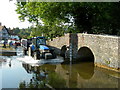
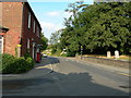
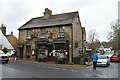
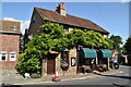
Nearby Images from Geograph Britain and Ireland:
©2006(licence)
©2006(licence)
©2021(licence)
©2020(licence)
©2009(licence)
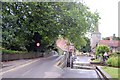
The above images may not be of the site on this page, they are loaded from Geograph.
Please Submit an Image of this site or go out and take one for us!
Click here to see more info for this site
Nearby sites
Key: Red: member's photo, Blue: 3rd party photo, Yellow: other image, Green: no photo - please go there and take one, Grey: site destroyed
Download sites to:
KML (Google Earth)
GPX (GPS waypoints)
CSV (Garmin/Navman)
CSV (Excel)
To unlock full downloads you need to sign up as a Contributory Member. Otherwise downloads are limited to 50 sites.
Turn off the page maps and other distractions
Nearby sites listing. In the following links * = Image available
4.2km NNE 23° Sutton At Hone Enclosures Ancient Village or Settlement (TQ555694)
5.8km S 183° Stumblebury Round Barrow(s) (TQ53845966)
6.0km N 6° Holy well (Hawley) Holy Well or Sacred Spring (TQ545715)
6.3km SSW 192° Colet's Well* Holy Well or Sacred Spring (TQ5283459333)
6.3km S 189° St Thomas a Becket's Well* Holy Well or Sacred Spring (TQ532592)
6.4km NNW 329° Stonebill Green Deneholes Ancient Mine, Quarry or other Industry (TQ505709)
7.0km S 169° St Edith's Well (Kemsing)* Holy Well or Sacred Spring (TQ5548458678)
7.1km NW 318° Chalk Wood Denehole Ancient Mine, Quarry or other Industry (TQ491706)
7.1km NNW 329° Joyden's Wood Ancient Village or Settlement (TQ501715)
7.5km W 279° Bromley Museum Museum (TQ465665)
8.2km NNW 334° Cavey's Springs Deneholes Ancient Mine, Quarry or other Industry (TQ502728)
8.4km N 4° Dartford Borough Museum* Museum (TQ5431773920)
8.7km S 188° Saint John's Spring (Greatness) Holy Well or Sacred Spring (TQ531568)
8.9km S 183° Millpond Wood Barrow* Round Barrow(s) (TQ53815661)
9.0km NE 42° Lustrating Pool Holy Well or Sacred Spring (TQ598724)
9.1km WNW 295° Hobling Well Holy Well or Sacred Spring (TQ456691)
9.4km ENE 73° Chalk Well Holy Well or Sacred Spring (TQ629685)
9.5km SE 133° Gateway granites* Ancient Trackway (TQ61175924)
10.1km SSE 155° Oldbury Rock Shelters* Cave or Rock Shelter (TQ5848056439)
10.2km SSE 157° Oldbury Hillfort* Hillfort (TQ582562)
10.4km E 88° St John The Baptist Church Sarson Stone Natural Stone / Erratic / Other Natural Feature (TQ644662)
10.4km NE 50° Spring Head Holy Well or Sacred Spring (TQ61767246)
10.6km NE 44° Southfleet Road Ebbsfleet Elephant Butchery Site Not Known (by us) (TQ6117573260)
10.8km NE 34° Swanscombe* Ancient Mine, Quarry or other Industry (TQ598746)
10.8km NNE 30° The Monks Well Holy Well or Sacred Spring (TQ5918474982)
View more nearby sites and additional images


 We would like to know more about this location. Please feel free to add a brief description and any relevant information in your own language.
 Wir möchten mehr über diese Stätte erfahren. Bitte zögern Sie nicht, eine kurze Beschreibung und relevante Informationen in Deutsch hinzuzufügen.
 Nous aimerions en savoir encore un peu sur les lieux. S'il vous plaît n'hesitez pas à ajouter une courte description et tous les renseignements pertinents dans votre propre langue.
 Quisieramos informarnos un poco más de las lugares. No dude en añadir una breve descripción y otros datos relevantes en su propio idioma.