


<< Our Photo Pages >> The Caburn - Hillfort in England in East Sussex
Submitted by jonnee23 on Thursday, 15 February 2001 Page Views: 10370
Iron Age and Later PrehistorySite Name: The Caburn Alternative Name: Mount CaburnCountry: England County: East Sussex Type: Hillfort
Nearest Town: Lewes Nearest Village: Glynde
Map Ref: TQ445089 Landranger Map Number: 198
Latitude: 50.861561N Longitude: 0.051852E
Condition:
| 5 | Perfect |
| 4 | Almost Perfect |
| 3 | Reasonable but with some damage |
| 2 | Ruined but still recognisable as an ancient site |
| 1 | Pretty much destroyed, possibly visible as crop marks |
| 0 | No data. |
| -1 | Completely destroyed |
| 5 | Superb |
| 4 | Good |
| 3 | Ordinary |
| 2 | Not Good |
| 1 | Awful |
| 0 | No data. |
| 5 | Can be driven to, probably with disabled access |
| 4 | Short walk on a footpath |
| 3 | Requiring a bit more of a walk |
| 2 | A long walk |
| 1 | In the middle of nowhere, a nightmare to find |
| 0 | No data. |
| 5 | co-ordinates taken by GPS or official recorded co-ordinates |
| 4 | co-ordinates scaled from a detailed map |
| 3 | co-ordinates scaled from a bad map |
| 2 | co-ordinates of the nearest village |
| 1 | co-ordinates of the nearest town |
| 0 | no data |
Internal Links:
External Links:
")
on OS map Explorer 123
You may be viewing yesterday's version of this page. To see the most up to date information please register for a free account.
Do not use the above information on other web sites or publications without permission of the contributor.
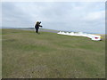
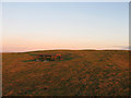
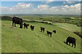
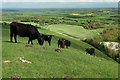
Nearby Images from Geograph Britain and Ireland:

©2011(licence)
©2012(licence)
©2011(licence)
©2018(licence)
©2018(licence)
The above images may not be of the site on this page, they are loaded from Geograph.
Please Submit an Image of this site or go out and take one for us!
Click here to see more info for this site
Nearby sites
Key: Red: member's photo, Blue: 3rd party photo, Yellow: other image, Green: no photo - please go there and take one, Grey: site destroyed
Download sites to:
KML (Google Earth)
GPX (GPS waypoints)
CSV (Garmin/Navman)
CSV (Excel)
To unlock full downloads you need to sign up as a Contributory Member. Otherwise downloads are limited to 50 sites.
![]()
Turn off the page maps and other distractions
Nearby sites listing. In the following links * = Image available
726m WNW 288° Ranscombe Camp* Ancient Village or Settlement (TQ438091)
1.1km NNW 328° Oxteddle Bottom Field System. Misc. Earthwork (TQ439098)
1.4km NNW 328° The Bible Earthwork Misc. Earthwork (TQ437101)
1.5km N 358° Oxteddle Bottom Barrow Cemetery (TQ444104)
2.2km NNW 329° Cliffe Hill Tumuli Round Barrow(s) (TQ433108)
2.5km NNW 328° Malling Hill Long Barrow Long Barrow (TQ4311810996)
2.8km NW 321° Malling Hill Field System Misc. Earthwork (TQ427110)
3.6km S 178° Itford Hill Ancient Village or Settlement (TQ447053)
3.8km S 185° Pook's Dyke Misc. Earthwork (TQ44270507)
4.1km ESE 104° Adder Wells Cross Early Christian Sculptured Stone (TQ485080)
4.1km SE 137° Firle Plantation Tumuli* Barrow Cemetery (TQ474060)
4.8km SE 144° Lord’s Burghs Tumuli Barrow Cemetery (TQ474051)
5.0km SE 130° Firle Beacon Long Barrow* Long Barrow (TQ484058)
5.1km W 261° The Gurdy Stone* Modern Stone Circle etc (TQ3948408002)
5.2km SE 128° Firle East Barrow* Round Barrow(s) (TQ4867305813)
5.2km SE 128° Firle Beacon Tumuli* Barrow Cemetery (TQ487058)
5.4km WNW 303° Offham Hill Causewayed Enclosure (TQ399117)
5.4km SE 128° Trilton Tumuli* Barrow Cemetery (TQ4885205728)
5.6km N 349° Bridge Farm Romano British settlement site* Ancient Village or Settlement (TQ433144)
5.7km SE 129° Loose Plantation crossways group* Barrow Cemetery (TQ4903405436)
5.9km SE 130° Loose Plantation Tumuli* Barrow Cemetery (TQ491052)
6.0km SE 129° Bopeep West tumulus* Round Barrow(s) (TQ4926905232)
6.3km SE 139° Bostal Bottom Tumuli Barrow Cemetery (TQ488043)
6.7km SE 146° Five Lord's Burgh Tumulus Round Barrow(s) (TQ484035)
6.9km SE 130° Bostal Hill Tumuli* Barrow Cemetery (TQ499046)
View more nearby sites and additional images

")
 We would like to know more about this location. Please feel free to add a brief description and any relevant information in your own language.
 Wir möchten mehr über diese Stätte erfahren. Bitte zögern Sie nicht, eine kurze Beschreibung und relevante Informationen in Deutsch hinzuzufügen.
 Nous aimerions en savoir encore un peu sur les lieux. S'il vous plaît n'hesitez pas à ajouter une courte description et tous les renseignements pertinents dans votre propre langue.
 Quisieramos informarnos un poco más de las lugares. No dude en añadir una breve descripción y otros datos relevantes en su propio idioma.