


<< Our Photo Pages >> Standon Puddingstone - Standing Stone (Menhir) in England in Hertfordshire
Submitted by Thorgrim on Friday, 15 August 2003 Page Views: 16939
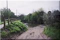
Neolithic and Bronze AgeSite Name: Standon PuddingstoneCountry: England
NOTE: This site is 0.5 km away from the location you searched for.
County: Hertfordshire Type: Standing Stone (Menhir)
Nearest Village: Standon
Map Ref: TL390224 Landranger Map Number: 166
Latitude: 51.882842N Longitude: 0.018113E
Condition:
| 5 | Perfect |
| 4 | Almost Perfect |
| 3 | Reasonable but with some damage |
| 2 | Ruined but still recognisable as an ancient site |
| 1 | Pretty much destroyed, possibly visible as crop marks |
| 0 | No data. |
| -1 | Completely destroyed |
| 5 | Superb |
| 4 | Good |
| 3 | Ordinary |
| 2 | Not Good |
| 1 | Awful |
| 0 | No data. |
| 5 | Can be driven to, probably with disabled access |
| 4 | Short walk on a footpath |
| 3 | Requiring a bit more of a walk |
| 2 | A long walk |
| 1 | In the middle of nowhere, a nightmare to find |
| 0 | No data. |
| 5 | co-ordinates taken by GPS or official recorded co-ordinates |
| 4 | co-ordinates scaled from a detailed map |
| 3 | co-ordinates scaled from a bad map |
| 2 | co-ordinates of the nearest village |
| 1 | co-ordinates of the nearest town |
| 0 | no data |
Internal Links:
External Links:
")
It is the focus of Standon's May Day festivals every year.
You may be viewing yesterday's version of this page. To see the most up to date information please register for a free account.
")
")
Do not use the above information on other web sites or publications without permission of the contributor.
Nearby Images from Geograph Britain and Ireland:
©2019(licence)
©2013(licence)
©2013(licence)
©2013(licence)
©2015(licence)
The above images may not be of the site on this page, they are loaded from Geograph.
Please Submit an Image of this site or go out and take one for us!
Click here to see more info for this site
Nearby sites
Key: Red: member's photo, Blue: 3rd party photo, Yellow: other image, Green: no photo - please go there and take one, Grey: site destroyed
Download sites to:
KML (Google Earth)
GPX (GPS waypoints)
CSV (Garmin/Navman)
CSV (Excel)
To unlock full downloads you need to sign up as a Contributory Member. Otherwise downloads are limited to 50 sites.
Turn off the page maps and other distractions
Nearby sites listing. In the following links * = Image available
3.3km ESE 107° Caley Wood Misc. Earthwork (TL422215)
3.7km SW 227° Lunardi Stone* Natural Stone / Erratic / Other Natural Feature (TL364198)
6.3km ENE 59° Patmore Heath* Marker Stone (TL44262581)
9.3km NNE 29° Brent Pelham* Natural Stone / Erratic / Other Natural Feature (TL433307)
9.7km SSW 207° Chadwell Spring* Holy Well or Sacred Spring (TL349136)
10.0km NW 315° Cottered Stones* Natural Stone / Erratic / Other Natural Feature (TL318293)
10.0km E 99° Glasscock Stone* Natural Stone / Erratic / Other Natural Feature (TL4894821169)
10.1km SSW 192° Emma's Well* Holy Well or Sacred Spring (TL372125)
10.5km NNE 17° Anstey Cursus Cursus (TL41863249)
11.3km ESE 116° Wallbury Camp* Hillfort (TL493178)
11.7km E 90° Birchanger* Early Christian Sculptured Stone (TL507228)
11.8km NW 312° Cumberlow Green hoard Ancient Mine, Quarry or other Industry (TL3030)
11.8km NNW 337° Sandon Cursus Cursus (TL3409733124)
12.1km N 2° Barkway Golf Club hoard Ancient Mine, Quarry or other Industry (TL3908434456)
12.5km NE 42° Clavering Castle* Misc. Earthwork (TL471319)
13.9km SSE 166° Harlow Puddingstone* Natural Stone / Erratic / Other Natural Feature (TL428090)
14.2km SE 144° Harlow Cursus Cursus (TL477112)
14.2km WSW 249° Perry's Grove Boundary Ditch* Misc. Earthwork (TL25851700)
14.2km ENE 72° Ugley Green Puddingstone* Natural Stone / Erratic / Other Natural Feature (TL5242327126)
14.2km SE 143° Harlow Barrow* Round Barrow(s) (TL478112)
14.3km SE 144° Matching Cursus Cursus (TL47791113)
14.3km E 100° Hatfield Forest* Ancient Village or Settlement (TL532204)
15.3km W 276° Six Hills* Round Barrow(s) (TL23742365)
15.3km ESE 101° Hatfield Forest Puddingstones* Natural Stone / Erratic / Other Natural Feature (TL541198)
15.3km NNW 338° Orwellbury Holy Well or Sacred Spring (TL3279836387)
View more nearby sites and additional images


 We would like to know more about this location. Please feel free to add a brief description and any relevant information in your own language.
 Wir möchten mehr über diese Stätte erfahren. Bitte zögern Sie nicht, eine kurze Beschreibung und relevante Informationen in Deutsch hinzuzufügen.
 Nous aimerions en savoir encore un peu sur les lieux. S'il vous plaît n'hesitez pas à ajouter une courte description et tous les renseignements pertinents dans votre propre langue.
 Quisieramos informarnos un poco más de las lugares. No dude en añadir una breve descripción y otros datos relevantes en su propio idioma.