<< Other Photo Pages >> Caesar's Camp (Bedfordshire) - Hillfort in England in Bedfordshire
Submitted by vicky on Tuesday, 17 September 2002 Page Views: 11932
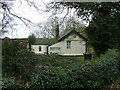
Iron Age and Later PrehistorySite Name: Caesar's Camp (Bedfordshire) Alternative Name: The LodgeCountry: England
NOTE: This site is 0.2 km away from the location you searched for.
County: Bedfordshire Type: Hillfort
Nearest Town: Sandy
Map Ref: TL180490 Landranger Map Number: 153
Latitude: 52.126722N Longitude: 0.277681W
Condition:
| 5 | Perfect |
| 4 | Almost Perfect |
| 3 | Reasonable but with some damage |
| 2 | Ruined but still recognisable as an ancient site |
| 1 | Pretty much destroyed, possibly visible as crop marks |
| 0 | No data. |
| -1 | Completely destroyed |
| 5 | Superb |
| 4 | Good |
| 3 | Ordinary |
| 2 | Not Good |
| 1 | Awful |
| 0 | No data. |
| 5 | Can be driven to, probably with disabled access |
| 4 | Short walk on a footpath |
| 3 | Requiring a bit more of a walk |
| 2 | A long walk |
| 1 | In the middle of nowhere, a nightmare to find |
| 0 | No data. |
| 5 | co-ordinates taken by GPS or official recorded co-ordinates |
| 4 | co-ordinates scaled from a detailed map |
| 3 | co-ordinates scaled from a bad map |
| 2 | co-ordinates of the nearest village |
| 1 | co-ordinates of the nearest town |
| 0 | no data |
Internal Links:
External Links:
I have visited· I would like to visit
wardrop04 visited on 16th Sep 2021 - their rating: Cond: 2 Amb: 3 Access: 4 The site is enclosed on private land so is unfortunately not accessible but can be viewed from nearby footpaths.
JohnLindsay visited on 2nd Apr 2016 There seem to be three places called Ceasar's Camp, one might be Sandy Lodge, which is what it is called when excavation written up, another might be Galley Hill, not to be confused with Streatley, so not sure which I visited or whether there are simply different names for the same thing.
Caesar's Camp and The Lodge were two listings 100m apart. This site is bigger than this all together so I've combined the two listings. - AB
You may be viewing yesterday's version of this page. To see the most up to date information please register for a free account.
Do not use the above information on other web sites or publications without permission of the contributor.
Andy B has found this location on Google Street View:
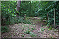
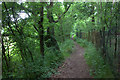
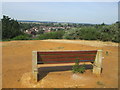
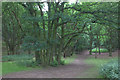
Nearby Images from Geograph Britain and Ireland:
©2018(licence)
©2018(licence)
©2018(licence)
©2018(licence)
©2006(licence)
The above images may not be of the site on this page, they are loaded from Geograph.
Please Submit an Image of this site or go out and take one for us!
Click here to see more info for this site
Nearby sites
Key: Red: member's photo, Blue: 3rd party photo, Yellow: other image, Green: no photo - please go there and take one, Grey: site destroyed
Download sites to:
KML (Google Earth)
GPX (GPS waypoints)
CSV (Garmin/Navman)
CSV (Excel)
To unlock full downloads you need to sign up as a Contributory Member. Otherwise downloads are limited to 50 sites.
Turn off the page maps and other distractions
Nearby sites listing. In the following links * = Image available
1.4km SSE 151° Sandy Lodge Promontory Fort / Cliff Castle (TL187478)
2.7km SSE 150° Biggleswade Cursus Cursus (TL194467)
2.9km SE 146° Biggleswade Cursus Cursus (TL197466)
4.7km N 3° Eynesbury Hodwick 2 Long Barrow (TL181537)
5.9km NNW 344° Willow Row Barrow* Barrow Cemetery (TL162546)
6.3km W 267° Willington Cursus (TL117485)
6.8km NNW 334° Roundhill Barrow* Round Barrow(s) (TL1487755016)
6.8km W 267° Willington Cursus (TL112485)
8.6km W 278° Willington N/W cursus Cursus (TL094500)
8.7km W 278° Cople Cursus Cursus (TL09325000)
8.9km W 277° Cardington E Cursus Cursus (TL091498)
9.0km W 276° Cardington C Cursus Cursus (TL090497)
9.1km W 276° Cardington B Cursus Cursus (TL089497)
9.1km W 277° Cardington E Cursus Cursus (TL089499)
9.2km N 2° Eynesbury Hardwicke A Cursus Cursus (TL181582)
9.4km N 4° Eynesbury Hardwicke B Cursus Cursus (TL184584)
9.5km N 1° Eynesbury Hodwick 1 Long Barrow (TL180585)
10.2km W 279° Goldington* Timber Circle (TL0784050440)
11.1km S 175° Etonbury Fort* Hillfort (TL1929637984)
12.1km WNW 292° Mowsbury Hill Hillfort (TL066532)
12.7km SE 138° Ashwell Village Museum* Museum (TL2668539684)
12.8km W 275° Bedford Museum* Museum (TL0522349738)
12.8km SE 137° Seven Springs (Ashwell)* Holy Well or Sacred Spring (TL270398)
12.9km SE 144° Arbury Banks Barrow/hut circle Round Barrow(s) (TL2584638770)
13.1km SE 143° Arbury Banks (Hertfordshire)* Hillfort (TL262387)
View more nearby sites and additional images


 We would like to know more about this location. Please feel free to add a brief description and any relevant information in your own language.
 Wir möchten mehr über diese Stätte erfahren. Bitte zögern Sie nicht, eine kurze Beschreibung und relevante Informationen in Deutsch hinzuzufügen.
 Nous aimerions en savoir encore un peu sur les lieux. S'il vous plaît n'hesitez pas à ajouter une courte description et tous les renseignements pertinents dans votre propre langue.
 Quisieramos informarnos un poco más de las lugares. No dude en añadir una breve descripción y otros datos relevantes en su propio idioma.