<< Our Photo Pages >> Tingley Field Plantation Round Barrow - Round Barrow(s) in England in Bedfordshire
Submitted by Brian_Eyes on Tuesday, 01 January 2019 Page Views: 1299
Neolithic and Bronze AgeSite Name: Tingley Field Plantation Round BarrowCountry: England County: Bedfordshire Type: Round Barrow(s)
Nearest Town: Hitchin Nearest Village: Pegsdon
Map Ref: TL1324030475
Latitude: 51.961234N Longitude: 0.353313W
Condition:
| 5 | Perfect |
| 4 | Almost Perfect |
| 3 | Reasonable but with some damage |
| 2 | Ruined but still recognisable as an ancient site |
| 1 | Pretty much destroyed, possibly visible as crop marks |
| 0 | No data. |
| -1 | Completely destroyed |
| 5 | Superb |
| 4 | Good |
| 3 | Ordinary |
| 2 | Not Good |
| 1 | Awful |
| 0 | No data. |
| 5 | Can be driven to, probably with disabled access |
| 4 | Short walk on a footpath |
| 3 | Requiring a bit more of a walk |
| 2 | A long walk |
| 1 | In the middle of nowhere, a nightmare to find |
| 0 | No data. |
| 5 | co-ordinates taken by GPS or official recorded co-ordinates |
| 4 | co-ordinates scaled from a detailed map |
| 3 | co-ordinates scaled from a bad map |
| 2 | co-ordinates of the nearest village |
| 1 | co-ordinates of the nearest town |
| 0 | no data |
Internal Links:
External Links:
")
A round barrow in Tingley Field Plantation. Trees and bushes growing on it but still a recognisable round barrow. Described in the Historic England webpage entry for Knocking Knoll Bowl/Long Barrow as being 600m south of Knocking Knoll.
For more information see Historic England List ID 101369 and Pastscape Monument No. 362597.
You may be viewing yesterday's version of this page. To see the most up to date information please register for a free account.
Do not use the above information on other web sites or publications without permission of the contributor.
Nearby Images from Geograph Britain and Ireland:
©2022(licence)

©2011(licence)
©2011(licence)
©2022(licence)
©2014(licence)
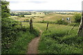
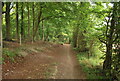
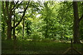
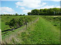
The above images may not be of the site on this page, they are loaded from Geograph.
Please Submit an Image of this site or go out and take one for us!
Click here to see more info for this site
Nearby sites
Key: Red: member's photo, Blue: 3rd party photo, Yellow: other image, Green: no photo - please go there and take one, Grey: site destroyed
Download sites to:
KML (Google Earth)
GPX (GPS waypoints)
CSV (Garmin/Navman)
CSV (Excel)
To unlock full downloads you need to sign up as a Contributory Member. Otherwise downloads are limited to 50 sites.
Turn off the page maps and other distractions
Nearby sites listing. In the following links * = Image available
528m N 8° Knocking Knoll* Long Barrow (TL133310)
914m SW 226° Deacon Hill* Hillfort (TL12602982)
2.3km SW 222° Telegraph Hill (Lilley Hoo) Bowl Barrow Round Barrow(s) (TL117287)
2.9km W 268° St Faith's Well* Holy Well or Sacred Spring (TL103303)
3.5km WSW 255° Ravensburgh Castle* Hillfort (TL099295)
5.2km ESE 105° North Herts Museum* Museum (TL18342926)
5.3km SW 231° Galley Hill (Streatley)* Round Barrow(s) (TL092270)
6.1km SW 230° Dray's Ditches* Misc. Earthwork (TL08642641)
6.4km W 261° Sharpenhoe Burial Mound* Round Barrow(s)
6.7km W 271° Sharpenhoe Clappers* Hillfort (TL065304)
7.2km ENE 75° Wilbury Hill* Hillfort (TL202325)
8.8km ESE 108° Priory Well (Hertfordshire)* Holy Well or Sacred Spring (TL217279)
9.1km SW 232° Waulud's Bank* Henge (TL062247)
9.6km NE 40° Etonbury Fort* Hillfort (TL1929637984)
10.6km ENE 71° Norton Henge Henge (TL232341)
11.3km ENE 71° Letchworth Cursus Cursus (TL239344)
12.2km W 264° Conger Hill* Hillfort (TL011289)
12.4km E 85° Weston Hill Henge* Henge (TL256319)
12.5km SE 124° Six Hills* Round Barrow(s) (TL23742365)
12.6km NW 324° Houghton Conquest Long Barrow (TL055405)
13.8km ENE 74° Barrows under A505 Barrow Cemetery (TL264346)
15.1km ENE 58° Arbury Banks Barrow/hut circle Round Barrow(s) (TL2584638770)
15.3km ENE 59° Arbury Banks (Hertfordshire)* Hillfort (TL262387)
15.3km ENE 70° Bygrave Barrows Barrow Cemetery (TL2759935981)
15.6km ENE 76° Tree Barrow Round Barrow(s) (TL2831834612)
View more nearby sites and additional images


 We would like to know more about this location. Please feel free to add a brief description and any relevant information in your own language.
 Wir möchten mehr über diese Stätte erfahren. Bitte zögern Sie nicht, eine kurze Beschreibung und relevante Informationen in Deutsch hinzuzufügen.
 Nous aimerions en savoir encore un peu sur les lieux. S'il vous plaît n'hesitez pas à ajouter une courte description et tous les renseignements pertinents dans votre propre langue.
 Quisieramos informarnos un poco más de las lugares. No dude en añadir una breve descripción y otros datos relevantes en su propio idioma.