


<< Our Photo Pages >> Texas Barrows - Round Barrow(s) in England in Hampshire
Submitted by SolarMegalith on Sunday, 29 January 2012 Page Views: 4937
Neolithic and Bronze AgeSite Name: Texas BarrowsCountry: England
NOTE: This site is 1.1 km away from the location you searched for.
County: Hampshire Type: Round Barrow(s)
Nearest Town: Winchester
Map Ref: SU4558926993
Latitude: 51.040492N Longitude: 1.351128W
Condition:
| 5 | Perfect |
| 4 | Almost Perfect |
| 3 | Reasonable but with some damage |
| 2 | Ruined but still recognisable as an ancient site |
| 1 | Pretty much destroyed, possibly visible as crop marks |
| 0 | No data. |
| -1 | Completely destroyed |
| 5 | Superb |
| 4 | Good |
| 3 | Ordinary |
| 2 | Not Good |
| 1 | Awful |
| 0 | No data. |
| 5 | Can be driven to, probably with disabled access |
| 4 | Short walk on a footpath |
| 3 | Requiring a bit more of a walk |
| 2 | A long walk |
| 1 | In the middle of nowhere, a nightmare to find |
| 0 | No data. |
| 5 | co-ordinates taken by GPS or official recorded co-ordinates |
| 4 | co-ordinates scaled from a detailed map |
| 3 | co-ordinates scaled from a bad map |
| 2 | co-ordinates of the nearest village |
| 1 | co-ordinates of the nearest town |
| 0 | no data |
Internal Links:
External Links:
I have visited· I would like to visit
SolarMegalith visited on 29th Jan 2012 - their rating: Cond: 3 Amb: 3 Access: 4
")
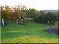
The northern barrow (SU 4559 2700) is 2.5 m high and it’s bowl shape is perfectly distinguishable. Unfortunately, it is particularly damaged by badgers.
The southern barrow is in much poorer condition, it is only 1 m high and has 19 m in diameter. It is partly gutted, in it’s central part there is a significant hollow.
Read More at Pastscape.
You may be viewing yesterday's version of this page. To see the most up to date information please register for a free account.
")
")
")
Do not use the above information on other web sites or publications without permission of the contributor.
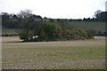
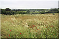
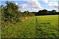
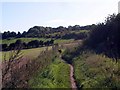
Nearby Images from Geograph Britain and Ireland:
©2008(licence)
©2008(licence)
©2015(licence)
©2009(licence)
©2005(licence)
The above images may not be of the site on this page, they are loaded from Geograph.
Please Submit an Image of this site or go out and take one for us!
Click here to see more info for this site
Nearby sites
Key: Red: member's photo, Blue: 3rd party photo, Yellow: other image, Green: no photo - please go there and take one, Grey: site destroyed
Download sites to:
KML (Google Earth)
GPX (GPS waypoints)
CSV (Garmin/Navman)
CSV (Excel)
To unlock full downloads you need to sign up as a Contributory Member. Otherwise downloads are limited to 50 sites.
Turn off the page maps and other distractions
Nearby sites listing. In the following links * = Image available
1.2km ESE 109° Compton Down Barrows* Round Barrow(s) (SU46762660)
2.9km ENE 77° St Catherine's Hill (Hampshire)* Hillfort (SU48422766)
3.0km ENE 77° Mizmaze* Maze or Labyrinth (SU48482769)
3.2km SE 129° Twyford stone circle* Stone Circle (SU481250)
3.3km NE 41° Hampshire Jubilee Sculpture* Modern Stone Circle etc (SU477295)
3.3km NE 36° Oram's Arbour Hillfort (SU475297)
3.4km E 81° Twyford Down monument* Modern Stone Circle etc (SU48962757)
3.4km NE 50° Winchester Cathedral Wells* Holy Well or Sacred Spring (SU482292)
3.5km NE 47° Winchester City Museum* Museum (SU4809729407)
3.5km W 261° Merdon Castle* Hillfort (SU421264)
3.6km E 81° The Dongas* Ancient Trackway (SU491276)
3.9km NW 310° West Wood Bowl Barrow* Round Barrow(s) (SU42522949)
4.8km WNW 299° Robin Hood's Barrow (Winchester)* Round Barrow(s) (SU41322927)
5.0km ENE 62° Magdalen Hill Down* Barrow Cemetery (SU49992933)
5.0km N 4° Flowerdown Barrows* Barrow Cemetery (SU459320)
5.6km WNW 291° Farley Mount* Round Barrow(s) (SU403290)
6.4km WNW 290° Withering Corner Barrow Cemetery (SU395291)
6.5km ESE 106° Morestead Warren* Long Barrow (SU519253)
6.6km E 81° Telegraph Hill Bowl Barrow* Round Barrow(s) (SU521281)
7.0km E 84° Cheesefoot Head Barrows* Barrow Cemetery (SU52572777)
8.2km ESE 109° Longwood Barrow Long Barrow (SU534244)
9.2km W 272° Stubb's Copse Round Barrow(s) (SU36362722)
9.2km N 11° South Wonston* Barrow Cemetery (SU4723736091)
10.7km NW 317° Stockbridge Down field boundary* Misc. Earthwork (SU382348)
10.9km SSW 204° Chilworth Ring* Hillfort (SU413170)
View more nearby sites and additional images


 We would like to know more about this location. Please feel free to add a brief description and any relevant information in your own language.
 Wir möchten mehr über diese Stätte erfahren. Bitte zögern Sie nicht, eine kurze Beschreibung und relevante Informationen in Deutsch hinzuzufügen.
 Nous aimerions en savoir encore un peu sur les lieux. S'il vous plaît n'hesitez pas à ajouter une courte description et tous les renseignements pertinents dans votre propre langue.
 Quisieramos informarnos un poco más de las lugares. No dude en añadir una breve descripción y otros datos relevantes en su propio idioma.