<< Our Photo Pages >> Offerton Moor East - Stone Circle in England in Derbyshire
Submitted by Vicky on Wednesday, 18 September 2002 Page Views: 14056
Neolithic and Bronze AgeSite Name: Offerton Moor East Alternative Name: Offerton Moor WestCountry: England
NOTE: This site is 0.3 km away from the location you searched for.
County: Derbyshire Type: Stone Circle
Nearest Town: Hathersage Nearest Village: Abney
Map Ref: SK213805 Landranger Map Number: 110
Latitude: 53.321001N Longitude: 1.681706W
Condition:
| 5 | Perfect |
| 4 | Almost Perfect |
| 3 | Reasonable but with some damage |
| 2 | Ruined but still recognisable as an ancient site |
| 1 | Pretty much destroyed, possibly visible as crop marks |
| 0 | No data. |
| -1 | Completely destroyed |
| 5 | Superb |
| 4 | Good |
| 3 | Ordinary |
| 2 | Not Good |
| 1 | Awful |
| 0 | No data. |
| 5 | Can be driven to, probably with disabled access |
| 4 | Short walk on a footpath |
| 3 | Requiring a bit more of a walk |
| 2 | A long walk |
| 1 | In the middle of nowhere, a nightmare to find |
| 0 | No data. |
| 5 | co-ordinates taken by GPS or official recorded co-ordinates |
| 4 | co-ordinates scaled from a detailed map |
| 3 | co-ordinates scaled from a bad map |
| 2 | co-ordinates of the nearest village |
| 1 | co-ordinates of the nearest town |
| 0 | no data |
Internal Links:
External Links:
")
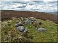
This site is often referred to as a stone circle but may possibly be a ringcairn. Located about a kilometre to the east of Smelting Hill circle, it consists of a rubble bank 2m to 3m wide with an external diameter of 27m by 23m. Only one stone to the SSE remains.
You may be viewing yesterday's version of this page. To see the most up to date information please register for a free account.
")
")
Do not use the above information on other web sites or publications without permission of the contributor.
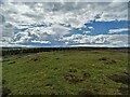
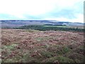
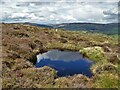
Nearby Images from Geograph Britain and Ireland:
©2021(licence)
©2010(licence)
©2021(licence)
©2021(licence)

©2021(licence)
The above images may not be of the site on this page, they are loaded from Geograph.
Please Submit an Image of this site or go out and take one for us!
Click here to see more info for this site
Nearby sites
Key: Red: member's photo, Blue: 3rd party photo, Yellow: other image, Green: no photo - please go there and take one, Grey: site destroyed
Download sites to:
KML (Google Earth)
GPX (GPS waypoints)
CSV (Garmin/Navman)
CSV (Excel)
To unlock full downloads you need to sign up as a Contributory Member. Otherwise downloads are limited to 50 sites.
![]()
Turn off the page maps and other distractions
Nearby sites listing. In the following links * = Image available
153m WNW 289° Offerton Moor West* Ring Cairn (SK2115580550)
447m SSE 154° Highlow Bank* Standing Stone (Menhir) (SK215801)
1.0km W 265° Smelting Hill* Stone Circle (SK203804)
1.1km W 260° Abney Moor I* Stone Circle (SK202803)
1.8km S 174° Stanage* Cairn (SK215787)
1.9km ENE 58° Healing Spring* Holy Well or Sacred Spring (SK229815)
1.9km W 273° Burton Bole* Round Barrow(s) (SK194806)
1.9km SE 141° Eyam Moor Barrow* Long Barrow (SK22547900)
1.9km SE 141° Wet Withens* Stone Circle (SK22557900)
2.4km SE 129° Eyam Moor II* Stone Circle (SK232790)
2.4km SSW 198° Derwic Well* Holy Well or Sacred Spring (SK2054978171)
2.5km SE 132° Eyam Moor III* Stone Circle (SK232788)
3.2km WNW 283° The Grey Ditch* Misc. Earthwork (SK182812)
3.4km SSE 165° Mompesson's Well* Holy Well or Sacred Spring (SK222772)
3.6km WSW 242° Crow Chin cairns* Cairn (SK1815578818)
3.6km NE 36° Trinity Well (Hathersage)* Holy Well or Sacred Spring (SK234834)
3.8km S 176° Eyam Museum* Museum (SK2159176729)
3.8km NE 34° North Lees Romano British Village* Ancient Village or Settlement (SK2343083673)
3.9km NNE 23° Dennis Knoll* Cairn (SK228841)
3.9km SSE 161° Top Of Riley Stone Circle (SK226768)
4.0km W 268° Hazlebadge Round Barrow 1* Round Barrow(s) (SK17268034)
4.0km E 100° Lawrence Field* Stone Circle (SK253798)
4.1km E 79° Winyards Nick* Round Barrow(s) (SK253813)
4.1km NNE 25° Sheepwash Bank Cairn (SK230842)
4.1km W 262° Hazlebadge Round Barrow 2* Round Barrow(s) (SK17257991)
View more nearby sites and additional images


 We would like to know more about this location. Please feel free to add a brief description and any relevant information in your own language.
 Wir möchten mehr über diese Stätte erfahren. Bitte zögern Sie nicht, eine kurze Beschreibung und relevante Informationen in Deutsch hinzuzufügen.
 Nous aimerions en savoir encore un peu sur les lieux. S'il vous plaît n'hesitez pas à ajouter une courte description et tous les renseignements pertinents dans votre propre langue.
 Quisieramos informarnos un poco más de las lugares. No dude en añadir una breve descripción y otros datos relevantes en su propio idioma.