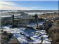
<< Our Photo Pages >> Abney Moor I - Stone Circle in England in Derbyshire
Submitted by vicky on Wednesday, 18 September 2002 Page Views: 10138
Neolithic and Bronze AgeSite Name: Abney Moor ICountry: England County: Derbyshire Type: Stone Circle
Nearest Village: Abney
Map Ref: SK202803 Landranger Map Number: 119
Latitude: 53.319246N Longitude: 1.698232W
Condition:
| 5 | Perfect |
| 4 | Almost Perfect |
| 3 | Reasonable but with some damage |
| 2 | Ruined but still recognisable as an ancient site |
| 1 | Pretty much destroyed, possibly visible as crop marks |
| 0 | No data. |
| -1 | Completely destroyed |
| 5 | Superb |
| 4 | Good |
| 3 | Ordinary |
| 2 | Not Good |
| 1 | Awful |
| 0 | No data. |
| 5 | Can be driven to, probably with disabled access |
| 4 | Short walk on a footpath |
| 3 | Requiring a bit more of a walk |
| 2 | A long walk |
| 1 | In the middle of nowhere, a nightmare to find |
| 0 | No data. |
| 5 | co-ordinates taken by GPS or official recorded co-ordinates |
| 4 | co-ordinates scaled from a detailed map |
| 3 | co-ordinates scaled from a bad map |
| 2 | co-ordinates of the nearest village |
| 1 | co-ordinates of the nearest town |
| 0 | no data |
Internal Links:
External Links:
I have visited· I would like to visit
elad13 would like to visit
MartinRS has visited here
")
You may be viewing yesterday's version of this page. To see the most up to date information please register for a free account.
Do not use the above information on other web sites or publications without permission of the contributor.
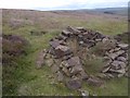
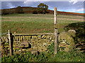
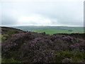
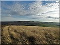
Nearby Images from Geograph Britain and Ireland:
©2013(licence)
©2006(licence)
©2010(licence)
©2016(licence)
©2024(licence)
The above images may not be of the site on this page, they are loaded from Geograph.
Please Submit an Image of this site or go out and take one for us!
Click here to see more info for this site
Nearby sites
Key: Red: member's photo, Blue: 3rd party photo, Yellow: other image, Green: no photo - please go there and take one, Grey: site destroyed
Download sites to:
KML (Google Earth)
GPX (GPS waypoints)
CSV (Garmin/Navman)
CSV (Excel)
To unlock full downloads you need to sign up as a Contributory Member. Otherwise downloads are limited to 50 sites.
Turn off the page maps and other distractions
Nearby sites listing. In the following links * = Image available
141m NE 45° Smelting Hill* Stone Circle (SK203804)
852m WNW 291° Burton Bole* Round Barrow(s) (SK194806)
984m ENE 76° Offerton Moor West* Ring Cairn (SK2115580550)
1.1km E 80° Offerton Moor East* Stone Circle (SK213805)
1.3km E 99° Highlow Bank* Standing Stone (Menhir) (SK215801)
2.1km SE 141° Stanage* Cairn (SK215787)
2.2km S 171° Derwic Well* Holy Well or Sacred Spring (SK2054978171)
2.2km WNW 295° The Grey Ditch* Misc. Earthwork (SK182812)
2.5km SW 234° Crow Chin cairns* Cairn (SK1815578818)
2.7km ESE 119° Eyam Moor Barrow* Long Barrow (SK22547900)
2.7km ESE 119° Wet Withens* Stone Circle (SK22557900)
2.9km W 271° Hazlebadge Round Barrow 1* Round Barrow(s) (SK17268034)
2.9km ENE 66° Healing Spring* Holy Well or Sacred Spring (SK229815)
3.0km W 263° Hazlebadge Round Barrow 2* Round Barrow(s) (SK17257991)
3.1km SW 228° Burr Tor* Hillfort (SK179782)
3.3km ESE 114° Eyam Moor II* Stone Circle (SK232790)
3.3km WNW 302° Bath Spring Holy Well or Sacred Spring (SK174820)
3.3km ESE 117° Eyam Moor III* Stone Circle (SK232788)
3.5km WSW 252° Stan Low* Round Barrow(s) (SK169792)
3.7km SSE 147° Mompesson's Well* Holy Well or Sacred Spring (SK222772)
3.8km WSW 252° Cop Low* Round Barrow(s) (SK16627912)
3.8km W 270° Fissure Cave Cave or Rock Shelter (SK164803)
3.8km SSE 159° Eyam Museum* Museum (SK2159176729)
4.2km SSE 158° St Lawrence (Eyam)* Ancient Cross (SK218764)
4.2km SE 146° Top Of Riley Stone Circle (SK226768)
View more nearby sites and additional images


 We would like to know more about this location. Please feel free to add a brief description and any relevant information in your own language.
 Wir möchten mehr über diese Stätte erfahren. Bitte zögern Sie nicht, eine kurze Beschreibung und relevante Informationen in Deutsch hinzuzufügen.
 Nous aimerions en savoir encore un peu sur les lieux. S'il vous plaît n'hesitez pas à ajouter une courte description et tous les renseignements pertinents dans votre propre langue.
 Quisieramos informarnos un poco más de las lugares. No dude en añadir una breve descripción y otros datos relevantes en su propio idioma.