 with our Megalithic Portal iPhone app")


<< Our Photo Pages >> Fortress Dyke camp - Ancient Village or Settlement in England in Yorkshire (North)
Submitted by Bungie on Friday, 08 March 2019 Page Views: 1178
Multi-periodSite Name: Fortress Dyke campCountry: England County: Yorkshire (North) Type: Ancient Village or Settlement
Nearest Town: Kirkby Malzeard Nearest Village: Dallowgill
Map Ref: SE1789173178
Latitude: 54.154112N Longitude: 1.727553W
Condition:
| 5 | Perfect |
| 4 | Almost Perfect |
| 3 | Reasonable but with some damage |
| 2 | Ruined but still recognisable as an ancient site |
| 1 | Pretty much destroyed, possibly visible as crop marks |
| 0 | No data. |
| -1 | Completely destroyed |
| 5 | Superb |
| 4 | Good |
| 3 | Ordinary |
| 2 | Not Good |
| 1 | Awful |
| 0 | No data. |
| 5 | Can be driven to, probably with disabled access |
| 4 | Short walk on a footpath |
| 3 | Requiring a bit more of a walk |
| 2 | A long walk |
| 1 | In the middle of nowhere, a nightmare to find |
| 0 | No data. |
| 5 | co-ordinates taken by GPS or official recorded co-ordinates |
| 4 | co-ordinates scaled from a detailed map |
| 3 | co-ordinates scaled from a bad map |
| 2 | co-ordinates of the nearest village |
| 1 | co-ordinates of the nearest town |
| 0 | no data |
Internal Links:
External Links:
")
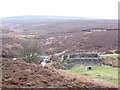
Described on PastScape as a probable Iron Age / Romano British square enclosure, formed by a stone rampart with outer ditch. Monuments Record No 50756
A Scheduled site. No. NY/1053 - see Historic England List ID 1004081. Also mentioned in Yorkshire Arch. Journal 46, 1974 Pages 23-33.
A Bronze Age barbed and tanged arrowhead found on site. An Iron Age mace head was found in a wall filling, a short distance away, in 1937. ( Lillian Chandler-Dallowgill Through the Ages )
To the north, an Iron Age field system is recorded, Pastscapes Monument 50771 with large, irregular fields and lynchets defined by large boulder walls. These are now pretty much covered over with heather.
I found this enclosure is very hard to spot from a distance, in fact, until you are on top of it, it’s quite elusive. There are no footpaths to this site. Due to bird-nesting/grouse shooting season, this site is best visited Dec- March. ( No dogs allowed )
You may be viewing yesterday's version of this page. To see the most up to date information please register for a free account.
")
")
")
Do not use the above information on other web sites or publications without permission of the contributor.
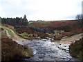
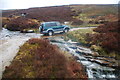
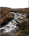
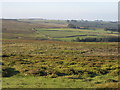
Nearby Images from Geograph Britain and Ireland:
©2005(licence)
©2015(licence)
©2007(licence)
©2006(licence)
©2007(licence)
The above images may not be of the site on this page, they are loaded from Geograph.
Please Submit an Image of this site or go out and take one for us!
Click here to see more info for this site
Nearby sites
Key: Red: member's photo, Blue: 3rd party photo, Yellow: other image, Green: no photo - please go there and take one, Grey: site destroyed
Download sites to:
KML (Google Earth)
GPX (GPS waypoints)
CSV (Garmin/Navman)
CSV (Excel)
To unlock full downloads you need to sign up as a Contributory Member. Otherwise downloads are limited to 50 sites.
Turn off the page maps and other distractions
Nearby sites listing. In the following links * = Image available
1.0km N 350° Carle Tower* Marker Stone (SE177742)
1.8km SE 135° Hell Holme Bank (Dallowgill) Rock Art (SE1917071909)
3.0km SE 125° Cast Hills* Ancient Village or Settlement (SE20377147)
3.9km SSE 159° Pateley Moor* Standing Stone (Menhir) (SE193695)
5.0km N 10° Skew Skell Well* Holy Well or Sacred Spring (SE1876078084)
5.1km W 281° Jenny Twig and Tib* Rock Outcrop (SE129741)
5.5km NE 40° Himalayan Gardens & Sculpture Park* Modern Stone Circle etc (SE2139577417)
5.5km ENE 57° Billey Keld* Holy Well or Sacred Spring (SE2251376193)
5.5km N 356° Swinton Druid's Temple* Modern Stone Circle etc (SE1746478713)
5.6km NE 50° Lime Tree Roundhouse* Modern Stone Circle etc (SE2216776849)
5.6km NE 49° Lime Tree Modern Stone Circle* Modern Stone Circle etc (SE2212876922)
6.0km W 264° Fountains Earth 01 Rock Art (SE1188572499)
6.7km N 8° Fearby, Masham* Stone Circle (SE188798)
7.1km SW 234° Gouthwaite Lodge Farm 03* Rock Art (SE1213568998)
7.1km SW 234° Gouthwaite Lodge Farm 02* Rock Art (SE1213468996)
7.1km SW 234° Gouthwaite Lodge Farm 01* Rock Art (SE1213168992)
7.3km ENE 60° Dropping Well* Holy Well or Sacred Spring (SE242769)
7.3km NNE 29° Berry Well* Holy Well or Sacred Spring (SE2140479628)
7.5km SW 231° Gouthwaite Lodge Farm* Rock Art (SE121684)
7.8km SE 138° Wine Wife Well* Holy Well or Sacred Spring (SE23216742)
7.9km N 354° Healey Stone Circles (Masham) Stone Circle (SE170810)
8.3km NNE 14° Fearby Cross (Masham) Ancient Cross (SE1984081273)
8.5km SSE 162° Brimham Rocks Circle Stone Circle (SE20566507)
8.7km W 277° St Chad (Middlesmoor)* Ancient Cross (SE09257414)
8.8km SSE 164° Brimham Rocks Rock Art Rock Art (SE2039764782)
View more nearby sites and additional images


 We would like to know more about this location. Please feel free to add a brief description and any relevant information in your own language.
 Wir möchten mehr über diese Stätte erfahren. Bitte zögern Sie nicht, eine kurze Beschreibung und relevante Informationen in Deutsch hinzuzufügen.
 Nous aimerions en savoir encore un peu sur les lieux. S'il vous plaît n'hesitez pas à ajouter une courte description et tous les renseignements pertinents dans votre propre langue.
 Quisieramos informarnos un poco más de las lugares. No dude en añadir una breve descripción y otros datos relevantes en su propio idioma.