


<< Our Photo Pages >> Condicote henge - Henge in England in Gloucestershire
Submitted by TimPrevett on Tuesday, 18 May 2010 Page Views: 10691
Neolithic and Bronze AgeSite Name: Condicote hengeCountry: England County: Gloucestershire Type: Henge
Nearest Town: Stow on the Wold Nearest Village: Condicote
Map Ref: SP15392837
Latitude: 51.953610N Longitude: 1.777468W
Condition:
| 5 | Perfect |
| 4 | Almost Perfect |
| 3 | Reasonable but with some damage |
| 2 | Ruined but still recognisable as an ancient site |
| 1 | Pretty much destroyed, possibly visible as crop marks |
| 0 | No data. |
| -1 | Completely destroyed |
| 5 | Superb |
| 4 | Good |
| 3 | Ordinary |
| 2 | Not Good |
| 1 | Awful |
| 0 | No data. |
| 5 | Can be driven to, probably with disabled access |
| 4 | Short walk on a footpath |
| 3 | Requiring a bit more of a walk |
| 2 | A long walk |
| 1 | In the middle of nowhere, a nightmare to find |
| 0 | No data. |
| 5 | co-ordinates taken by GPS or official recorded co-ordinates |
| 4 | co-ordinates scaled from a detailed map |
| 3 | co-ordinates scaled from a bad map |
| 2 | co-ordinates of the nearest village |
| 1 | co-ordinates of the nearest town |
| 0 | no data |
Internal Links:
External Links:
I have visited· I would like to visit
SumDoood would like to visit
TimPrevett has visited here
")
The presence and location of entrances is uncertain, with parts of the bank, ditches and interior obscured by buildings and a minor road.
Note: It's that time of year to get out and find those obscure sites in your area. Can you help turn our map from green to red?
You may be viewing yesterday's version of this page. To see the most up to date information please register for a free account.
")
")
")
Do not use the above information on other web sites or publications without permission of the contributor.
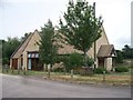
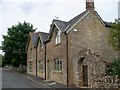
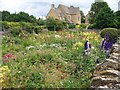
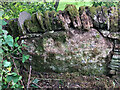
Nearby Images from Geograph Britain and Ireland:
©2010(licence)
©2010(licence)
©2010(licence)
©2022(licence)
©2005(licence)
The above images may not be of the site on this page, they are loaded from Geograph.
Please Submit an Image of this site or go out and take one for us!
Click here to see more info for this site
Nearby sites
Key: Red: member's photo, Blue: 3rd party photo, Yellow: other image, Green: no photo - please go there and take one, Grey: site destroyed
Download sites to:
KML (Google Earth)
GPX (GPS waypoints)
CSV (Garmin/Navman)
CSV (Excel)
To unlock full downloads you need to sign up as a Contributory Member. Otherwise downloads are limited to 50 sites.
Turn off the page maps and other distractions
Nearby sites listing. In the following links * = Image available
287m WSW 250° Cross Well (Condicote)* Holy Well or Sacred Spring (SP15122827)
2.1km WNW 285° Oak Piece Chambered Tomb (SP134289)
2.1km ENE 75° Ganborough* Chambered Tomb (SP174289)
2.3km SW 214° Swell Wold round barrow* Round Barrow(s) (SP14132648)
2.4km SE 138° Pole's Wood West* Chambered Tomb (SP170266)
2.4km SSE 147° Poles Wood South* Long Barrow (SP16732636)
2.6km SW 227° Cow Common Long Barrow* Chambered Cairn (SP135266)
2.6km SE 136° Poles Wood East* Long Barrow (SP172265)
2.7km SSE 154° The Tump* Round Barrow(s) (SP166259)
2.8km SSW 203° Eyeford Chambered Cairn (SP143258)
2.9km SSW 202° New Close Chambered Tomb (SP143257)
2.9km S 172° Condicote Lane Chambered Tomb (SP158255)
3.0km SW 227° Cow Common Barrow Cemetery* Barrow Cemetery (SP132263)
3.0km SSE 148° Lower Swell barrow* Chambered Tomb (SP17032580)
3.4km SE 144° Whittlestone* Standing Stone (Menhir) (SP174256)
3.5km SE 138° Our Lady's Well (near Stow)* Holy Well or Sacred Spring (SP177258)
3.6km SW 223° Huntsmans Quarry Timber Circle (SP129257)
3.8km SSE 155° The Horestone (Lower Swell)* Standing Stone (Menhir) (SP170249)
3.9km ESE 110° Broadwell Chambered Tomb (SP191270)
4.3km NNE 19° Bourton on the Hill* Chambered Tomb (SP168324)
4.6km ESE 121° St Edwards (Stow Well) Well* Holy Well or Sacred Spring (SP1931126039)
4.7km ESE 121° Stow Camp* Hillfort (SP19442595)
5.4km SE 136° St Edwards well* Holy Well or Sacred Spring (SP191245)
6.4km WNW 288° Cutsdean Henge (SP09263038)
6.8km NE 47° Batsford Camp* Ancient Village or Settlement (SP2038932974)
View more nearby sites and additional images


 We would like to know more about this location. Please feel free to add a brief description and any relevant information in your own language.
 Wir möchten mehr über diese Stätte erfahren. Bitte zögern Sie nicht, eine kurze Beschreibung und relevante Informationen in Deutsch hinzuzufügen.
 Nous aimerions en savoir encore un peu sur les lieux. S'il vous plaît n'hesitez pas à ajouter une courte description et tous les renseignements pertinents dans votre propre langue.
 Quisieramos informarnos un poco más de las lugares. No dude en añadir una breve descripción y otros datos relevantes en su propio idioma.