


<< Our Photo Pages >> Whittlestone - Standing Stone (Menhir) in England in Gloucestershire
Submitted by thecaptain on Tuesday, 16 March 2004 Page Views: 7219
Neolithic and Bronze AgeSite Name: Whittlestone Alternative Name: Swell VIICountry: England
NOTE: This site is 0.158 km away from the location you searched for.
County: Gloucestershire Type: Standing Stone (Menhir)
Nearest Town: Stow on the Wold Nearest Village: Lower Swell
Map Ref: SP174256 Landranger Map Number: 163
Latitude: 51.928647N Longitude: 1.74836W
Condition:
| 5 | Perfect |
| 4 | Almost Perfect |
| 3 | Reasonable but with some damage |
| 2 | Ruined but still recognisable as an ancient site |
| 1 | Pretty much destroyed, possibly visible as crop marks |
| 0 | No data. |
| -1 | Completely destroyed |
| 5 | Superb |
| 4 | Good |
| 3 | Ordinary |
| 2 | Not Good |
| 1 | Awful |
| 0 | No data. |
| 5 | Can be driven to, probably with disabled access |
| 4 | Short walk on a footpath |
| 3 | Requiring a bit more of a walk |
| 2 | A long walk |
| 1 | In the middle of nowhere, a nightmare to find |
| 0 | No data. |
| 5 | co-ordinates taken by GPS or official recorded co-ordinates |
| 4 | co-ordinates scaled from a detailed map |
| 3 | co-ordinates scaled from a bad map |
| 2 | co-ordinates of the nearest village |
| 1 | co-ordinates of the nearest town |
| 0 | no data |
Internal Links:
External Links:
I have visited· I would like to visit
NickyD visited on 25th Mar 2016 - their rating: Cond: 2 Amb: 2 Access: 5
TheCaptain have visited here
")
It sits on a grassy bank with a little sign stating that it was once part of a neolithic burial chamber, and had originally been further up the hill near to the churchyard.
The 1903 OS Map marks a long barrow on this site and it is believed that the Whittlestone may be one of the stones from the burial chamber.
You may be viewing yesterday's version of this page. To see the most up to date information please register for a free account.
")
")
")
Do not use the above information on other web sites or publications without permission of the contributor.
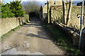
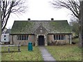
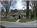
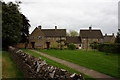
Nearby Images from Geograph Britain and Ireland:
©2014(licence)
©2010(licence)
©2013(licence)
©2016(licence)
©2013(licence)
The above images may not be of the site on this page, they are loaded from Geograph.
Please Submit an Image of this site or go out and take one for us!
Click here to see more info for this site
Nearby sites
Key: Red: member's photo, Blue: 3rd party photo, Yellow: other image, Green: no photo - please go there and take one, Grey: site destroyed
Download sites to:
KML (Google Earth)
GPX (GPS waypoints)
CSV (Garmin/Navman)
CSV (Excel)
To unlock full downloads you need to sign up as a Contributory Member. Otherwise downloads are limited to 50 sites.
Turn off the page maps and other distractions
Nearby sites listing. In the following links * = Image available
360m ENE 56° Our Lady's Well (near Stow)* Holy Well or Sacred Spring (SP177258)
420m WNW 299° Lower Swell barrow* Chambered Tomb (SP17032580)
806m SSW 210° The Horestone (Lower Swell)* Standing Stone (Menhir) (SP170249)
852m WNW 291° The Tump* Round Barrow(s) (SP166259)
922m NNW 348° Poles Wood East* Long Barrow (SP172265)
1.0km NW 319° Poles Wood South* Long Barrow (SP16732636)
1.1km NNW 338° Pole's Wood West* Chambered Tomb (SP170266)
1.6km W 267° Condicote Lane Chambered Tomb (SP158255)
2.0km ENE 77° St Edwards (Stow Well) Well* Holy Well or Sacred Spring (SP1931126039)
2.0km ESE 123° St Edwards well* Holy Well or Sacred Spring (SP191245)
2.1km E 80° Stow Camp* Hillfort (SP19442595)
2.2km NE 51° Broadwell Chambered Tomb (SP191270)
3.1km W 272° New Close Chambered Tomb (SP143257)
3.1km W 274° Eyeford Chambered Cairn (SP143258)
3.3km N 0° Ganborough* Chambered Tomb (SP174289)
3.4km WNW 285° Swell Wold round barrow* Round Barrow(s) (SP14132648)
3.4km NW 324° Condicote henge* Henge (SP15392837)
3.5km NW 320° Cross Well (Condicote)* Holy Well or Sacred Spring (SP15122827)
3.8km SE 130° Icomb Camp* Hillfort (SP20352315)
4.0km WNW 285° Cow Common Long Barrow* Chambered Cairn (SP135266)
4.2km W 280° Cow Common Barrow Cemetery* Barrow Cemetery (SP132263)
4.5km W 271° Huntsmans Quarry Timber Circle (SP129257)
4.8km S 179° Salmonsbury Camp* Hillfort (SP175208)
5.2km NW 310° Oak Piece Chambered Tomb (SP134289)
5.6km SSE 150° Wyck Beacon bowl barrow* Round Barrow(s) (SP20182078)
View more nearby sites and additional images


 We would like to know more about this location. Please feel free to add a brief description and any relevant information in your own language.
 Wir möchten mehr über diese Stätte erfahren. Bitte zögern Sie nicht, eine kurze Beschreibung und relevante Informationen in Deutsch hinzuzufügen.
 Nous aimerions en savoir encore un peu sur les lieux. S'il vous plaît n'hesitez pas à ajouter une courte description et tous les renseignements pertinents dans votre propre langue.
 Quisieramos informarnos un poco más de las lugares. No dude en añadir una breve descripción y otros datos relevantes en su propio idioma.