<< Our Photo Pages >> Long Tom (Avebury) - Standing Stone (Menhir) in England in Wiltshire
Submitted by PaulH on Sunday, 14 December 2003 Page Views: 11985
Date UncertainSite Name: Long Tom (Avebury)Country: England
NOTE: This site is 0.3 km away from the location you searched for.
County: Wiltshire Type: Standing Stone (Menhir)
Nearest Village: Avebury
Map Ref: SU1438371290 Landranger Map Number: 173
Latitude: 51.440424N Longitude: 1.794456W
Condition:
| 5 | Perfect |
| 4 | Almost Perfect |
| 3 | Reasonable but with some damage |
| 2 | Ruined but still recognisable as an ancient site |
| 1 | Pretty much destroyed, possibly visible as crop marks |
| 0 | No data. |
| -1 | Completely destroyed |
| 5 | Superb |
| 4 | Good |
| 3 | Ordinary |
| 2 | Not Good |
| 1 | Awful |
| 0 | No data. |
| 5 | Can be driven to, probably with disabled access |
| 4 | Short walk on a footpath |
| 3 | Requiring a bit more of a walk |
| 2 | A long walk |
| 1 | In the middle of nowhere, a nightmare to find |
| 0 | No data. |
| 5 | co-ordinates taken by GPS or official recorded co-ordinates |
| 4 | co-ordinates scaled from a detailed map |
| 3 | co-ordinates scaled from a bad map |
| 2 | co-ordinates of the nearest village |
| 1 | co-ordinates of the nearest town |
| 0 | no data |
Internal Links:
External Links:
I have visited· I would like to visit
Couplands would like to visit
SimonBlackmore visited on 9th Apr 2023 - their rating: Cond: 4 Amb: 4 Access: 4
kith visited - their rating: Cond: 4 Amb: 4 Access: 4
Phillwhite visited - their rating: Cond: 4 Amb: 3 Access: 4
Bladup ocifant have visited here
Average ratings for this site from all visit loggers: Condition: 4 Ambience: 3.67 Access: 4
 (PID:11247)")
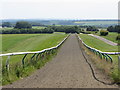
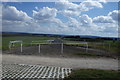
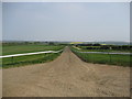
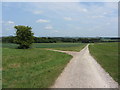
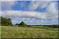
Between two gallops, on the right just before the reservoir on the old London road from Avebury, east of Fyfield Down, on Clatford Down. Known to an old jockey, possibly Fred Archer, as "my winning post." In favour of Long Tom being prehistoric or at least an ancient waymarker is the fact that he stands out absolutely clear on the skyline if you walk towards Downs Barn and look back from the next hill.
You may be viewing yesterday's version of this page. To see the most up to date information please register for a free account.
 (PID:98383)")
 (PID:133515)")
 (PID:133514)")
Do not use the above information on other web sites or publications without permission of the contributor.
Nearby Images from Geograph Britain and Ireland:
©2013(licence)
©2016(licence)
©2007(licence)
©2013(licence)
©2021(licence)
The above images may not be of the site on this page, they are loaded from Geograph.
Please Submit an Image of this site or go out and take one for us!
Click here to see more info for this site
Nearby sites
Key: Red: member's photo, Blue: 3rd party photo, Yellow: other image, Green: no photo - please go there and take one, Grey: site destroyed
Download sites to:
KML (Google Earth)
GPX (GPS waypoints)
CSV (Garmin/Navman)
CSV (Excel)
To unlock full downloads you need to sign up as a Contributory Member. Otherwise downloads are limited to 50 sites.
Turn off the page maps and other distractions
Nearby sites listing. In the following links * = Image available
343m SSW 212° Fyfield Down* Ancient Village or Settlement (SU142710)
767m NW 311° Totterdown Wood dew pond holed stone* Sculptured Stone (SU13807179)
822m E 82° Manton Long Barrow* Long Barrow (SU152714)
978m WNW 284° Fyfield Down (Avebury)* Rock Art (SU13437152)
1.0km SW 222° Mother's Jam* Natural Stone / Erratic / Other Natural Feature (SU13697052)
1.1km SW 232° The Toad Stone* Natural Stone / Erratic / Other Natural Feature (SU135706)
1.5km E 84° Manton Circle* Modern Stone Circle etc (SU1587971446)
1.5km WSW 240° Overton Downs Tumuli* Round Barrow(s) (SU13057051)
1.5km W 278° Holed Stone (West Overton)* Ancient Village or Settlement (SU12857151)
1.6km W 278° The Polisher (Fyfield Down)* Polissoir (SU12837150)
1.8km W 262° Overton Down Barrow* Round Barrow(s) (SU12607104)
1.8km WNW 293° Ridgeway* Ancient Trackway (SU127720)
1.8km SSE 153° Devils Den* Burial Chamber or Dolmen (SU1521169654)
1.8km NNW 335° Rough Hill barrow cemetery Barrow Cemetery (SU1359172953)
1.8km SW 220° Pickledean Stone Circle (SU13196988)
1.9km W 272° Monkton Down Bowl Barrow Round Barrow(s) (SU12487134)
2.1km W 266° Overton Down* Barrow Cemetery (SU12307113)
2.2km NW 318° Old Chapel.* Long Barrow (SU12907290)
2.3km SW 218° Down Barn* Standing Stones (SU12966949)
2.5km NE 54° Rockley Plantation Barrows* Barrow Cemetery (SU1643372778)
2.6km NE 49° Rockley Down Barrows* Round Barrow(s) (SU16317300)
2.7km S 186° Piggle Dene* Natural Stone / Erratic / Other Natural Feature (SU14126858)
2.8km WSW 244° Avebury Down barrow cemetery* Barrow Cemetery (SU11877007)
2.8km WNW 292° Monkton Down* Barrow Cemetery (SU1176472347)
2.8km WNW 301° Monkton Down N* Barrow Cemetery (SU11937274)
View more nearby sites and additional images


 We would like to know more about this location. Please feel free to add a brief description and any relevant information in your own language.
 Wir möchten mehr über diese Stätte erfahren. Bitte zögern Sie nicht, eine kurze Beschreibung und relevante Informationen in Deutsch hinzuzufügen.
 Nous aimerions en savoir encore un peu sur les lieux. S'il vous plaît n'hesitez pas à ajouter une courte description et tous les renseignements pertinents dans votre propre langue.
 Quisieramos informarnos un poco más de las lugares. No dude en añadir una breve descripción y otros datos relevantes en su propio idioma.