<< Our Photo Pages >> Swell Wold round barrow - Round Barrow(s) in England in Gloucestershire
Submitted by h_fenton on Sunday, 10 April 2011 Page Views: 5914
Neolithic and Bronze AgeSite Name: Swell Wold round barrowCountry: England County: Gloucestershire Type: Round Barrow(s)
Nearest Town: Stow-on-the-Wold
Map Ref: SP14132648
Latitude: 51.936650N Longitude: 1.795879W
Condition:
| 5 | Perfect |
| 4 | Almost Perfect |
| 3 | Reasonable but with some damage |
| 2 | Ruined but still recognisable as an ancient site |
| 1 | Pretty much destroyed, possibly visible as crop marks |
| 0 | No data. |
| -1 | Completely destroyed |
| 5 | Superb |
| 4 | Good |
| 3 | Ordinary |
| 2 | Not Good |
| 1 | Awful |
| 0 | No data. |
| 5 | Can be driven to, probably with disabled access |
| 4 | Short walk on a footpath |
| 3 | Requiring a bit more of a walk |
| 2 | A long walk |
| 1 | In the middle of nowhere, a nightmare to find |
| 0 | No data. |
| 5 | co-ordinates taken by GPS or official recorded co-ordinates |
| 4 | co-ordinates scaled from a detailed map |
| 3 | co-ordinates scaled from a bad map |
| 2 | co-ordinates of the nearest village |
| 1 | co-ordinates of the nearest town |
| 0 | no data |
Be the first person to rate this site - see the 'Contribute!' box in the right hand menu.
Internal Links:
External Links:
I have visited· I would like to visit
4clydesdale7 visited on 14th Jun 2011 - their rating: Cond: 3 Amb: 4 Access: 4 Close to but North of Cow Common LB
h_fenton have visited here
")
Bowl barrow on a gentle slope on the west side of a shallow valley. The barrow is about 26metres in diameter and upto 2metres high, there are possible remains of the surrounding ditch on the northern side. In 1935 sherds of a Middle-Late Bronze Age urn containing fragments of burnt bone were found in a rabbit scrape, these finds are now held by Cheltenham Museum. Pastscape suggests that the urn and burnt bone may belong to a secondary cremation.
Pastscape: http://www.pastscape.org.uk/hob.aspx?hob_id=330314
You may be viewing yesterday's version of this page. To see the most up to date information please register for a free account.
Do not use the above information on other web sites or publications without permission of the contributor.
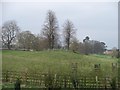
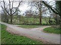
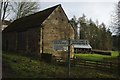
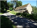
Nearby Images from Geograph Britain and Ireland:
©2010(licence)
©2010(licence)
©2017(licence)
©2018(licence)
©2011(licence)
The above images may not be of the site on this page, they are loaded from Geograph.
Please Submit an Image of this site or go out and take one for us!
Click here to see more info for this site
Nearby sites
Key: Red: member's photo, Blue: 3rd party photo, Yellow: other image, Green: no photo - please go there and take one, Grey: site destroyed
Download sites to:
KML (Google Earth)
GPX (GPS waypoints)
CSV (Garmin/Navman)
CSV (Excel)
To unlock full downloads you need to sign up as a Contributory Member. Otherwise downloads are limited to 50 sites.
Turn off the page maps and other distractions
Nearby sites listing. In the following links * = Image available
640m W 281° Cow Common Long Barrow* Chambered Cairn (SP135266)
701m SSE 166° Eyeford Chambered Cairn (SP143258)
798m SSE 168° New Close Chambered Tomb (SP143257)
945m W 259° Cow Common Barrow Cemetery* Barrow Cemetery (SP132263)
1.5km WSW 238° Huntsmans Quarry Timber Circle (SP129257)
1.9km ESE 121° Condicote Lane Chambered Tomb (SP158255)
2.0km NNE 29° Cross Well (Condicote)* Holy Well or Sacred Spring (SP15122827)
2.3km NE 34° Condicote henge* Henge (SP15392837)
2.5km NNW 343° Oak Piece Chambered Tomb (SP134289)
2.5km ESE 103° The Tump* Round Barrow(s) (SP166259)
2.6km E 93° Poles Wood South* Long Barrow (SP16732636)
2.9km E 88° Pole's Wood West* Chambered Tomb (SP170266)
3.0km ESE 103° Lower Swell barrow* Chambered Tomb (SP17032580)
3.1km E 90° Poles Wood East* Long Barrow (SP172265)
3.3km ESE 119° The Horestone (Lower Swell)* Standing Stone (Menhir) (SP170249)
3.4km ESE 105° Whittlestone* Standing Stone (Menhir) (SP174256)
3.6km E 101° Our Lady's Well (near Stow)* Holy Well or Sacred Spring (SP177258)
4.1km NE 54° Ganborough* Chambered Tomb (SP174289)
4.9km WSW 246° Guiting Power Round Barrow 3* Timber Circle (SP096245)
5.0km E 84° Broadwell Chambered Tomb (SP191270)
5.2km E 95° St Edwards (Stow Well) Well* Holy Well or Sacred Spring (SP1931126039)
5.3km E 96° Stow Camp* Hillfort (SP19442595)
5.3km ESE 112° St Edwards well* Holy Well or Sacred Spring (SP191245)
5.8km S 178° Cold Aston* Chambered Tomb (SP14342065)
6.0km WSW 251° Greenfield Hill Barn Round Barrow* Round Barrow(s) (SP0844224465)
View more nearby sites and additional images


 We would like to know more about this location. Please feel free to add a brief description and any relevant information in your own language.
 Wir möchten mehr über diese Stätte erfahren. Bitte zögern Sie nicht, eine kurze Beschreibung und relevante Informationen in Deutsch hinzuzufügen.
 Nous aimerions en savoir encore un peu sur les lieux. S'il vous plaît n'hesitez pas à ajouter une courte description et tous les renseignements pertinents dans votre propre langue.
 Quisieramos informarnos un poco más de las lugares. No dude en añadir una breve descripción y otros datos relevantes en su propio idioma.