<< Our Photo Pages >> Gratton Hill - Round Barrow(s) in England in Staffordshire
Submitted by twentytrees on Sunday, 03 September 2006 Page Views: 5698
Neolithic and Bronze AgeSite Name: Gratton HillCountry: England County: Staffordshire Type: Round Barrow(s)
Nearest Town: Ashbourne Nearest Village: Alstonefield
Map Ref: SK13205715
Latitude: 53.111375N Longitude: 1.80426W
Condition:
| 5 | Perfect |
| 4 | Almost Perfect |
| 3 | Reasonable but with some damage |
| 2 | Ruined but still recognisable as an ancient site |
| 1 | Pretty much destroyed, possibly visible as crop marks |
| 0 | No data. |
| -1 | Completely destroyed |
| 5 | Superb |
| 4 | Good |
| 3 | Ordinary |
| 2 | Not Good |
| 1 | Awful |
| 0 | No data. |
| 5 | Can be driven to, probably with disabled access |
| 4 | Short walk on a footpath |
| 3 | Requiring a bit more of a walk |
| 2 | A long walk |
| 1 | In the middle of nowhere, a nightmare to find |
| 0 | No data. |
| 5 | co-ordinates taken by GPS or official recorded co-ordinates |
| 4 | co-ordinates scaled from a detailed map |
| 3 | co-ordinates scaled from a bad map |
| 2 | co-ordinates of the nearest village |
| 1 | co-ordinates of the nearest town |
| 0 | no data |
Internal Links:
External Links:
I have visited· I would like to visit
BrownEdger would like to visit
")
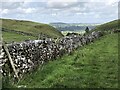
Gratton Hill has three scheduled bowl barrows located at its summit: 13527, 13528 and 13529. Their condition is not good making it difficult to discern each - there appear to be more than three.
Excellent views in all directions including Narrowdale Hill, Wolfscote Hill, Ecton Hill and Wetton Hill, all of which have barrows at their summit, and north into the Upper Manifold Valley and beyond to Five Wells.
Park at Alstonefield as for Pea Low.
You may be viewing yesterday's version of this page. To see the most up to date information please register for a free account.
Do not use the above information on other web sites or publications without permission of the contributor.
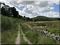
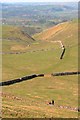
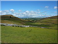
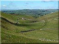
Nearby Images from Geograph Britain and Ireland:
©2023(licence)
©2013(licence)
©2010(licence)
©2012(licence)
©2023(licence)
The above images may not be of the site on this page, they are loaded from Geograph.
Please Submit an Image of this site or go out and take one for us!
Click here to see more info for this site
Nearby sites
Key: Red: member's photo, Blue: 3rd party photo, Yellow: other image, Green: no photo - please go there and take one, Grey: site destroyed
Download sites to:
KML (Google Earth)
GPX (GPS waypoints)
CSV (Garmin/Navman)
CSV (Excel)
To unlock full downloads you need to sign up as a Contributory Member. Otherwise downloads are limited to 50 sites.
Turn off the page maps and other distractions
Nearby sites listing. In the following links * = Image available
657m S 189° Pea Low* Chambered Cairn (SK131565)
1.3km N 357° Frank i’ th’ Rocks Cave* Cave or Rock Shelter (SK1313558408)
1.5km ESE 112° Stoney Low Round Barrow(s) (SK146566)
1.8km S 180° Alstonefield Cross* Ancient Cross (SK132553)
2.0km WSW 254° Gateham Grange* Round Barrow(s) (SK11305659)
2.2km ENE 75° Liffs Low* Round Barrow(s) (SK153577)
2.3km ESE 118° Nettly Knowe* Round Barrow(s) (SK15225610)
2.6km SE 133° Green Low (Alsop)* Round Barrow(s) (SK151554)
2.8km NNE 26° Dale End* Modern Stone Circle etc (SK14455970)
2.9km S 180° Stanshope Cairn 1* Cairn (SK132542)
2.9km WSW 251° Wetton Hill* Round Barrow(s) (SK104562)
3.0km S 174° Stanshope Cairn 2* Cairn (SK135542)
3.0km W 267° Sycamore Cave Ecton Cave or Rock Shelter (SK102570)
3.1km WNW 303° Archford Moor Barrow* Round Barrow(s) (SK106588)
3.1km SW 218° Wetton Low* Round Barrow(s) (SK113547)
3.2km ESE 119° Cross Low 2* Round Barrow(s) (SK15965561)
3.4km ESE 119° Cross Low 1* Round Barrow(s) (SK16185552)
3.4km SSW 197° Long Low* Long Barrow (SK122539)
3.5km S 187° Damgate Cairns 2* Cairn (SK128537)
3.5km SSW 207° Bincliff Bowl Barrows* Round Barrow(s) (SK11635402)
3.5km S 170° Ravens Tor Bowl Barrow* Round Barrow(s) (SK13855368)
3.6km WSW 246° Old Hannah’s Hole Cave or Rock Shelter (SK099557)
3.6km WSW 250° Darfar Ridge Cave Cave or Rock Shelter (SK098559)
3.6km WSW 253° Mill Pot Cave Cave or Rock Shelter (SK097561)
3.8km SSW 198° Highfields Bowl Barrow* Round Barrow(s) (SK12035354)
View more nearby sites and additional images


 We would like to know more about this location. Please feel free to add a brief description and any relevant information in your own language.
 Wir möchten mehr über diese Stätte erfahren. Bitte zögern Sie nicht, eine kurze Beschreibung und relevante Informationen in Deutsch hinzuzufügen.
 Nous aimerions en savoir encore un peu sur les lieux. S'il vous plaît n'hesitez pas à ajouter une courte description et tous les renseignements pertinents dans votre propre langue.
 Quisieramos informarnos un poco más de las lugares. No dude en añadir una breve descripción y otros datos relevantes en su propio idioma.