<< Text Pages >> Saltway Barn - Chambered Cairn in England
Submitted by vicky on Sunday, 25 January 2004 Page Views: 7029
Neolithic and Bronze AgeSite Name: Saltway Barn Alternative Name: Bibury IICountry: England Type: Chambered Cairn
Map Ref: SP115091 Landranger Map Number: 163
Latitude: 51.780449N Longitude: 1.834706W
Condition:
| 5 | Perfect |
| 4 | Almost Perfect |
| 3 | Reasonable but with some damage |
| 2 | Ruined but still recognisable as an ancient site |
| 1 | Pretty much destroyed, possibly visible as crop marks |
| 0 | No data. |
| -1 | Completely destroyed |
| 5 | Superb |
| 4 | Good |
| 3 | Ordinary |
| 2 | Not Good |
| 1 | Awful |
| 0 | No data. |
| 5 | Can be driven to, probably with disabled access |
| 4 | Short walk on a footpath |
| 3 | Requiring a bit more of a walk |
| 2 | A long walk |
| 1 | In the middle of nowhere, a nightmare to find |
| 0 | No data. |
| 5 | co-ordinates taken by GPS or official recorded co-ordinates |
| 4 | co-ordinates scaled from a detailed map |
| 3 | co-ordinates scaled from a bad map |
| 2 | co-ordinates of the nearest village |
| 1 | co-ordinates of the nearest town |
| 0 | no data |
Internal Links:
External Links:
Chambered Cairn in Gloucestershire
This site is composed of a circular chamber built from dry-stone walling with a corbelled roof and short passage, set in a rock-cut pit. It may originally have been covered by a cairn.
Ref: Megalithic Enquiries in the West of Britain, T.G.E.Powell et Al (Liverpool 1969)
Extract from Pastscape: The Saltway Barn long barrow was excavated 1939/45, prior to its destruction for defence purposes, by W F Grimes, who found it to be constructed upon a rock-cut pit 185 ft long by 85 ft wide by 2 to 3 ft deep. Sunk into a central "island" in the pit was a bee-hive chamber 5 1/2 ft high with an entrance passage to the SE. There were two niches in the chamber wall, round which ran a dry-stone-wall bench, and there was also a bench in the entrance passage. A round cairn, possibly built to mislead tomb robbers, adjoined the chamber, and the two structures were surrounded by a complicated system of revetment walls. At the west end between horns was a forecourt closed by dry-stone-walling, and the whole construction was finally covered by a secondary cairn.
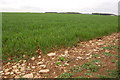
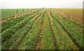
The field in which the barrow lies is under a young crop and no surface features are visible. The area has been restored from its former wartime use, as an air field, to arable land.
You may be viewing yesterday's version of this page. To see the most up to date information please register for a free account.
Do not use the above information on other web sites or publications without permission of the contributor.
Nearby Images from Geograph Britain and Ireland:
![SP1108 : A circular walk around Bibury and Ablington [22] by Michael Dibb](https://s0.geograph.org.uk/geophotos/07/49/06/7490668_00fa3e1e_120x120.jpg)
©2023(licence)
![SP1109 : A circular walk around Bibury and Ablington [23] by Michael Dibb](https://s1.geograph.org.uk/geophotos/07/49/06/7490669_fb7c6b89_120x120.jpg)
©2023(licence)
©2008(licence)
©2015(licence)
![SP1109 : A circular walk around Bibury and Ablington [24] by Michael Dibb](https://s2.geograph.org.uk/geophotos/07/49/06/7490670_fe2ff8d6_120x120.jpg)
©2023(licence)
The above images may not be of the site on this page, they are loaded from Geograph.
Please Submit an Image of this site or go out and take one for us!
Click here to see more info for this site
Nearby sites
Key: Red: member's photo, Blue: 3rd party photo, Yellow: other image, Green: no photo - please go there and take one, Grey: site destroyed
Download sites to:
KML (Google Earth)
GPX (GPS waypoints)
CSV (Garmin/Navman)
CSV (Excel)
To unlock full downloads you need to sign up as a Contributory Member. Otherwise downloads are limited to 50 sites.
Turn off the page maps and other distractions
Nearby sites listing. In the following links * = Image available
607m WNW 284° Ablington Long Barrow Chambered Tomb (SP10910925)
804m WNW 294° Lamborough Banks* Chambered Cairn (SP10760942)
2.0km SSW 211° Ablington Camp* Hillfort (SP105074)
3.0km NNW 333° Crickley Barrow Chambered Tomb (SP101118)
4.4km NE 39° Lodge Park* Long Barrow (SP1426712550)
4.7km W 262° Colnpen* Chambered Tomb (SP068084)
5.0km E 95° Ladborough Camp* Hillfort (SP16540870)
5.1km E 83° Lad Barrow* Chambered Tomb (SP166097)
5.7km NW 304° Woodbarrow (Glos)* Chambered Tomb (SP06731228)
5.8km NW 305° Royal Oak* Round Barrow(s) (SP06701239)
6.5km N 8° Norbury Hillfort Barrow* Chambered Tomb (SP124155)
6.6km NNW 335° Hangman's Stone (Northleach)* Standing Stone (Menhir) (SP087151)
6.7km SE 137° Barrow Elm* Round Barrow(s) (SP16110420)
6.7km N 11° Norbury Hillfort (Farmington)* Hillfort (SP128157)
6.9km WNW 296° Chedworth spring* Holy Well or Sacred Spring (SP053121)
7.0km W 266° Calmsden spring* Holy Well or Sacred Spring (SP04540863)
7.1km N 351° Burn Ground* Chambered Cairn (SP104161)
7.1km WNW 282° Pinkwell (Chedworth)* Chambered Cairn (SP04531058)
7.3km ENE 64° Windrush Camp* Hillfort (SP181123)
7.4km NNW 337° Furzenhill Barn* Chambered Tomb (SP086159)
7.5km N 5° Leygore Manor II* Chambered Tomb (SP121166)
7.6km N 2° Leygore Manor* Chambered Tomb (SP1178816648)
7.6km NNW 337° Cheltenham Road Plantation* Chambered Cairn (SP085161)
7.6km NW 305° Chedworth Villa Nymphaeum* Holy Well or Sacred Spring (SP05241350)
8.0km NW 307° Round barrow N of Chedworth Roman villa* Round Barrow(s) (SP0511013931)
View more nearby sites and additional images


 We would like to know more about this location. Please feel free to add a brief description and any relevant information in your own language.
 Wir möchten mehr über diese Stätte erfahren. Bitte zögern Sie nicht, eine kurze Beschreibung und relevante Informationen in Deutsch hinzuzufügen.
 Nous aimerions en savoir encore un peu sur les lieux. S'il vous plaît n'hesitez pas à ajouter une courte description et tous les renseignements pertinents dans votre propre langue.
 Quisieramos informarnos un poco más de las lugares. No dude en añadir una breve descripción y otros datos relevantes en su propio idioma.