


<< Our Photo Pages >> Coarse Stone Edge 01a - Rock Art in England in Yorkshire (West)
Submitted by Anne T on Sunday, 28 January 2018 Page Views: 1271
Rock ArtSite Name: Coarse Stone Edge 01a Alternative Name: ERA-2319; IAG225b; CSE01aCountry: England County: Yorkshire (West) Type: Rock Art
Nearest Town: Ilkley
Map Ref: SE1036946404
Latitude: 53.913684N Longitude: 1.843631W
Condition:
| 5 | Perfect |
| 4 | Almost Perfect |
| 3 | Reasonable but with some damage |
| 2 | Ruined but still recognisable as an ancient site |
| 1 | Pretty much destroyed, possibly visible as crop marks |
| 0 | No data. |
| -1 | Completely destroyed |
| 5 | Superb |
| 4 | Good |
| 3 | Ordinary |
| 2 | Not Good |
| 1 | Awful |
| 0 | No data. |
| 5 | Can be driven to, probably with disabled access |
| 4 | Short walk on a footpath |
| 3 | Requiring a bit more of a walk |
| 2 | A long walk |
| 1 | In the middle of nowhere, a nightmare to find |
| 0 | No data. |
| 5 | co-ordinates taken by GPS or official recorded co-ordinates |
| 4 | co-ordinates scaled from a detailed map |
| 3 | co-ordinates scaled from a bad map |
| 2 | co-ordinates of the nearest village |
| 1 | co-ordinates of the nearest town |
| 0 | no data |
Be the first person to rate this site - see the 'Contribute!' box in the right hand menu.
Internal Links:
External Links:
")
This rock art panel is recorded as having one definite cup with groove leading out of it, and another with either natural erosion occurring at one end or another cup countersunk in its bottom. For more information see England's Rock Art entry for ERA-2319 Coarse Stone Edge 01a, which includes a detailed description along with photographs, a plan of the stone and its motifs, photogrammetry and a 3D model.
This panel is also recorded in Boughey & Vickerman's "Prehistoric Rock Art of the West Riding Supplement (2018)", pages 129 to 132 inclusive. The Supplement includes a drawing of the panel, a map showing it's location along Coarse Stone Edge, plus photograph of the rock in the landscape and close up of its motifs. B&V adds: "(this panel) lies in a cluster of large loose rocks on Coarse Stone Edge, 25-30m west of the wall that runs up south from Silver Well on the same side as the better known 'Neb Stone', 5m north of the right of way across the edge … it is an angular, low lying, very coarse grained sandstone bedrock measuring 2.98m x 2.10m x 021m."
This rock is located on Open Access land.
Note: Have you seen this rock art panel? Do you have any photographs or information to add?
You may be viewing yesterday's version of this page. To see the most up to date information please register for a free account.
Do not use the above information on other web sites or publications without permission of the contributor.
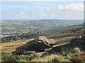
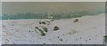
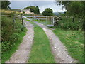
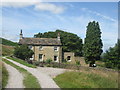
Nearby Images from Geograph Britain and Ireland:
©2022(licence)
©2005(licence)
©2009(licence)
©2014(licence)
©2010(licence)
The above images may not be of the site on this page, they are loaded from Geograph.
Please Submit an Image of this site or go out and take one for us!
Click here to see more info for this site
Nearby sites
Key: Red: member's photo, Blue: 3rd party photo, Yellow: other image, Green: no photo - please go there and take one, Grey: site destroyed
Download sites to:
KML (Google Earth)
GPX (GPS waypoints)
CSV (Garmin/Navman)
CSV (Excel)
To unlock full downloads you need to sign up as a Contributory Member. Otherwise downloads are limited to 50 sites.
Turn off the page maps and other distractions
Nearby sites listing. In the following links * = Image available
24m ESE 109° Coarse Stone Edge 03* Rock Art (SE1039246396)
25m SE 124° Coarse Stone Edge 04* Rock Art (SE1039046390)
25m SE 124° Neb Stone* Rock Art (SE10394639)
27m ENE 57° Coarse Stone Edge 02a* Rock Art (SE1039246419)
210m NNW 326° Silver Well 01* Rock Art (SE1025246579)
214m ESE 109° Weary Hill 01* Rock Art (SE1057246336)
229m WNW 295° Course Stone Edge Ark* Rock Art (SE10164650)
249m NNE 29° Silver Well 04* Rock Art (SE1048946623)
253m NNE 25° Silver Well 02* Rock Art (SE1047446635)
264m NE 37° Silver Well 05* Rock Art (SE1052746616)
288m ESE 122° Weary Hill 02* Rock Art (SE1061446251)
303m NNE 23° Silver Well 03* Rock Art (SE1048946682)
305m NE 54° Weary Hill Stone* Rock Art (SE1061546585)
305m NE 54° Weary Hill 03* Rock Art (SE1061546585)
352m W 264° Coarse Stone Edge 01.* Rock Art (SE1001846364)
361m WNW 300° Black Beck Hole 05* Rock Art (SE1005646585)
367m WNW 296° Black Beck Hole 04* Rock Art (SE1003746563)
406m ENE 78° Graining's Head 01* Rock Art (SE1076746492)
596m N 3° Tree Stone (Ilkley) Rock Art (SE104470)
600m N 354° Panorama Stone (226) Rock Art (SE1030047000)
623m N 1° Panorama Woods 01* Rock Art (SE1037747027)
623m N 1° Panorama Woods 02a* Rock Art (SE1037847027)
623m N 1° Panorama Woods 03* Rock Art (SE1038047027)
623m N 1° Panorama Woods 04* Rock Art (SE1038247027)
624m NW 321° Black Beck Hole 02* Rock Art (SE0997646890)
View more nearby sites and additional images


 We would like to know more about this location. Please feel free to add a brief description and any relevant information in your own language.
 Wir möchten mehr über diese Stätte erfahren. Bitte zögern Sie nicht, eine kurze Beschreibung und relevante Informationen in Deutsch hinzuzufügen.
 Nous aimerions en savoir encore un peu sur les lieux. S'il vous plaît n'hesitez pas à ajouter une courte description et tous les renseignements pertinents dans votre propre langue.
 Quisieramos informarnos un poco más de las lugares. No dude en añadir una breve descripción y otros datos relevantes en su propio idioma.