<< Our Photo Pages >> Panorama Woods 04 - Rock Art in England in Yorkshire (West)
Submitted by Anne T on Wednesday, 14 February 2018 Page Views: 684
Rock ArtSite Name: Panorama Woods 04 Alternative Name: ERA-2664; Boughey & Vickerman (233); SAM 25359; PRN25359; PRN154; Group PRN 7230Country: England County: Yorkshire (West) Type: Rock Art
Nearest Town: ilkley
Map Ref: SE1038247027
Latitude: 53.919283N Longitude: 1.843413W
Condition:
| 5 | Perfect |
| 4 | Almost Perfect |
| 3 | Reasonable but with some damage |
| 2 | Ruined but still recognisable as an ancient site |
| 1 | Pretty much destroyed, possibly visible as crop marks |
| 0 | No data. |
| -1 | Completely destroyed |
| 5 | Superb |
| 4 | Good |
| 3 | Ordinary |
| 2 | Not Good |
| 1 | Awful |
| 0 | No data. |
| 5 | Can be driven to, probably with disabled access |
| 4 | Short walk on a footpath |
| 3 | Requiring a bit more of a walk |
| 2 | A long walk |
| 1 | In the middle of nowhere, a nightmare to find |
| 0 | No data. |
| 5 | co-ordinates taken by GPS or official recorded co-ordinates |
| 4 | co-ordinates scaled from a detailed map |
| 3 | co-ordinates scaled from a bad map |
| 2 | co-ordinates of the nearest village |
| 1 | co-ordinates of the nearest town |
| 0 | no data |
Be the first person to rate this site - see the 'Contribute!' box in the right hand menu.
Internal Links:
External Links:
")
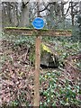
This rock art pane is recorded as having eight cups of different sizes, a large (probably natural) hollow close to its northern end, plus six elongated carved hollows and two faint linked rings with cups. Along the S edge are a series of very faint interlinked curved and circular grooves. For more information see England's Rock Art entry for ERA-2664 Panorama Woods 04, which includes a description, photographs, a plan of the rock and its motifs, plus photogrammetry.
This rock art panel is located on Open Access land.
Note: Have you seen this rock art panel? Do you have any photographs or information to add?
You may be viewing yesterday's version of this page. To see the most up to date information please register for a free account.
Do not use the above information on other web sites or publications without permission of the contributor.
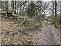
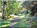
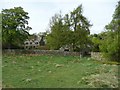
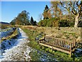
Nearby Images from Geograph Britain and Ireland:
©2024(licence)
©2005(licence)
©2010(licence)
©2023(licence)
©2024(licence)
The above images may not be of the site on this page, they are loaded from Geograph.
Please Submit an Image of this site or go out and take one for us!
Click here to see more info for this site
Nearby sites
Key: Red: member's photo, Blue: 3rd party photo, Yellow: other image, Green: no photo - please go there and take one, Grey: site destroyed
Download sites to:
KML (Google Earth)
GPX (GPS waypoints)
CSV (Garmin/Navman)
CSV (Excel)
To unlock full downloads you need to sign up as a Contributory Member. Otherwise downloads are limited to 50 sites.
Turn off the page maps and other distractions
Nearby sites listing. In the following links * = Image available
2m W 270° Panorama Woods 03* Rock Art (SE1038047027)
4m W 270° Panorama Woods 02a* Rock Art (SE1037847027)
5m W 270° Panorama Woods 01* Rock Art (SE1037747027)
22m NNE 16° Panorama Rocks 05* Rock Art (SE1038847048)
32m SSE 147° Tree Stone (Ilkley) Rock Art (SE104470)
86m WSW 252° Panorama Stone (226) Rock Art (SE1030047000)
361m SSE 163° Silver Well 03* Rock Art (SE1048946682)
402m SSE 167° Silver Well 02* Rock Art (SE1047446635)
418m SSE 165° Silver Well 04* Rock Art (SE1048946623)
427m WSW 252° Black Beck Hole 03* Rock Art (SE0997546895)
427m WSW 251° Black Beck Hole 02* Rock Art (SE0997646890)
435m SSE 161° Silver Well 05* Rock Art (SE1052746616)
466m SSW 196° Silver Well 01* Rock Art (SE1025246579)
499m SSE 152° Weary Hill 03* Rock Art (SE1061546585)
499m SSE 152° Weary Hill Stone* Rock Art (SE1061546585)
512m WSW 258° Heber's Ghyll Chalybeate (Ilkley)* Holy Well or Sacred Spring (SE09884692)
548m SW 216° Black Beck Hole 05* Rock Art (SE1005646585)
571m SSW 203° Course Stone Edge Ark* Rock Art (SE10164650)
577m SW 217° Black Beck Hole 04* Rock Art (SE1003746563)
608m S 179° Coarse Stone Edge 02a* Rock Art (SE1039246419)
615m ESE 103° Westwood Drive 01* Rock Art (SE1098346887)
623m S 181° Coarse Stone Edge 01a* Rock Art (SE1036946404)
625m E 99° Westwood Drive 02* Rock Art (SE1100146927)
631m S 179° Coarse Stone Edge 03* Rock Art (SE1039246396)
637m S 179° Coarse Stone Edge 04* Rock Art (SE1039046390)
View more nearby sites and additional images


 We would like to know more about this location. Please feel free to add a brief description and any relevant information in your own language.
 Wir möchten mehr über diese Stätte erfahren. Bitte zögern Sie nicht, eine kurze Beschreibung und relevante Informationen in Deutsch hinzuzufügen.
 Nous aimerions en savoir encore un peu sur les lieux. S'il vous plaît n'hesitez pas à ajouter une courte description et tous les renseignements pertinents dans votre propre langue.
 Quisieramos informarnos un poco más de las lugares. No dude en añadir una breve descripción y otros datos relevantes en su propio idioma.