<< Text Pages >> Beckhampton Penning barrows - Barrow Cemetery in England in Wiltshire
Submitted by coldrum on Monday, 06 September 2010 Page Views: 4432
Neolithic and Bronze AgeSite Name: Beckhampton Penning barrowsCountry: England County: Wiltshire Type: Barrow Cemetery
Nearest Town: Marlborough Nearest Village: Beckhampton
Map Ref: SU09356717
Latitude: 51.403483N Longitude: 1.866975W
Condition:
| 5 | Perfect |
| 4 | Almost Perfect |
| 3 | Reasonable but with some damage |
| 2 | Ruined but still recognisable as an ancient site |
| 1 | Pretty much destroyed, possibly visible as crop marks |
| 0 | No data. |
| -1 | Completely destroyed |
| 5 | Superb |
| 4 | Good |
| 3 | Ordinary |
| 2 | Not Good |
| 1 | Awful |
| 0 | No data. |
| 5 | Can be driven to, probably with disabled access |
| 4 | Short walk on a footpath |
| 3 | Requiring a bit more of a walk |
| 2 | A long walk |
| 1 | In the middle of nowhere, a nightmare to find |
| 0 | No data. |
| 5 | co-ordinates taken by GPS or official recorded co-ordinates |
| 4 | co-ordinates scaled from a detailed map |
| 3 | co-ordinates scaled from a bad map |
| 2 | co-ordinates of the nearest village |
| 1 | co-ordinates of the nearest town |
| 0 | no data |
Internal Links:
External Links:
A Bronze Age barrow cemetery comprising 6 or 7 barrows located south of Beckhampton Penning. The group comprises four disc barrows (Grinsell's All Canning's Cross 23 and Avebury 65-7), 2 saucer barrows (Avebury 67a and b), and a cropmark ring ditch discovered subsequent to Grinsell's gazetteer. The four saucer barrows were excavated by Thurnham, probably in the 1850s. Few details were published by him, but one contained a pottery vessel ("Aldbourne Cup") with a cremation; a second contained a further Aldbourne Cup and cremation, this time with a bronze awl.
The other two were "unproductive". However, it is impossible to say which of the barrows contained the cremation deposits. Thurnham may also have excavated the two saucer barrows, again withut result. All 6 of the barrows Thurnham refers to had apparently been dug into previously by persons unknown. The individual barrows are recorded separately. This record comprises general information about the group, plus specific information on the saucer barrow Avebury 66. Ordnance Survey field investigation in 1973 recorded this barrow as being 35 metres in diameter, surrounded by a ditch 0.2 metres deep. There was no trace of any central "tump" or outer bank surviving.
Source: Pastscape
You may be viewing yesterday's version of this page. To see the most up to date information please register for a free account.
Do not use the above information on other web sites or publications without permission of the contributor.
Nearby Images from Geograph Britain and Ireland:
©2008(licence)
©2008(licence)

©2008(licence)
©2014(licence)
![SU0867 : A circular walk on the Downs from Avebury [27] by Michael Dibb](https://s1.geograph.org.uk/geophotos/06/47/17/6471765_e0c396be_120x120.jpg)
©2020(licence)
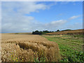
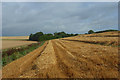
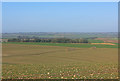
The above images may not be of the site on this page, they are loaded from Geograph.
Please Submit an Image of this site or go out and take one for us!
Click here to see more info for this site
Nearby sites
Key: Red: member's photo, Blue: 3rd party photo, Yellow: other image, Green: no photo - please go there and take one, Grey: site destroyed
Download sites to:
KML (Google Earth)
GPX (GPS waypoints)
CSV (Garmin/Navman)
CSV (Excel)
To unlock full downloads you need to sign up as a Contributory Member. Otherwise downloads are limited to 50 sites.
Turn off the page maps and other distractions
Nearby sites listing. In the following links * = Image available
520m E 95° Beckhampton Penning circle* Stone Circle (SU09876713)
986m S 179° Allington Down Tumulus* Round Barrow(s) (SU0936366184)
1.1km NE 51° West Kennet Barrow Round Barrow(s) (SU10246788)
1.2km NE 39° Swallowhead Spring* Holy Well or Sacred Spring (SU101681)
1.3km ENE 64° West Kennett Long Barrow* Long Barrow (SU10506774)
1.5km NNE 26° Silbury Hill* Artificial Mound (SU10016853)
1.5km WNW 292° Bishops Cannings 88 Bell Barrow* Round Barrow(s) (SU0793367741)
1.6km WNW 292° Bishops Cannings 89 Bowl Barrow* Round Barrow(s) (SU0785467757)
1.7km NE 47° Silbaby* Misc. Earthwork (SU1062668354)
1.9km W 269° Hemp Knoll Enclosures 2 Misc. Earthwork (SU07496713)
1.9km ENE 58° West Kennet Palisaded Enclosures* Ancient Village or Settlement (SU110682)
2.0km SSE 154° All Cannings Down Tumulus* Round Barrow(s) (SU1023765380)
2.1km W 260° Hemp Knoll Enclosures 1 Misc. Earthwork (SU07326682)
2.1km NNW 342° Longstones Barrow* Long Barrow (SU08706914)
2.1km NW 309° Beckhampton Bowl Barrow Round Barrow(s) (SU07726847)
2.1km ESE 122° Harestone Down Tumulus* Round Barrow(s) (SU1111766058)
2.1km ESE 112° Harestone Down* Stone Circle (SU113664)
2.1km N 351° South Street Long Barrow* Chambered Tomb (SU09006927)
2.1km SW 230° Horton Down Chambered Tomb (SU077658)
2.2km NNW 348° Longstone Cove* Standing Stones (SU0888769301)
2.2km WNW 289° Beckhampton Firs Barrows* Barrow Cemetery (SU07276787)
2.2km NNW 338° South of Penning Barn* Round Barrow(s) (SU08506921)
2.2km WSW 254° Horton Down Enclosures Ancient Village or Settlement (SU07206657)
2.3km E 98° East Kennett longbarrow* Long Barrow (SU11636684)
2.3km NNW 335° North of The Grange Round Barrow(s) (SU08346928)
View more nearby sites and additional images


 We would like to know more about this location. Please feel free to add a brief description and any relevant information in your own language.
 Wir möchten mehr über diese Stätte erfahren. Bitte zögern Sie nicht, eine kurze Beschreibung und relevante Informationen in Deutsch hinzuzufügen.
 Nous aimerions en savoir encore un peu sur les lieux. S'il vous plaît n'hesitez pas à ajouter une courte description et tous les renseignements pertinents dans votre propre langue.
 Quisieramos informarnos un poco más de las lugares. No dude en añadir una breve descripción y otros datos relevantes en su propio idioma.