<< Our Photo Pages >> Beanley Plantation Fort - Hillfort in England in Northumberland
Submitted by SolarMegalith on Wednesday, 08 March 2017 Page Views: 1846
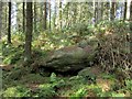
Iron Age and Later PrehistorySite Name: Beanley Plantation FortCountry: England County: Northumberland Type: Hillfort
Nearest Town: Alnwick Nearest Village: Eglingham
Map Ref: NU09291781
Latitude: 55.454061N Longitude: 1.854667W
Condition:
| 5 | Perfect |
| 4 | Almost Perfect |
| 3 | Reasonable but with some damage |
| 2 | Ruined but still recognisable as an ancient site |
| 1 | Pretty much destroyed, possibly visible as crop marks |
| 0 | No data. |
| -1 | Completely destroyed |
| 5 | Superb |
| 4 | Good |
| 3 | Ordinary |
| 2 | Not Good |
| 1 | Awful |
| 0 | No data. |
| 5 | Can be driven to, probably with disabled access |
| 4 | Short walk on a footpath |
| 3 | Requiring a bit more of a walk |
| 2 | A long walk |
| 1 | In the middle of nowhere, a nightmare to find |
| 0 | No data. |
| 5 | co-ordinates taken by GPS or official recorded co-ordinates |
| 4 | co-ordinates scaled from a detailed map |
| 3 | co-ordinates scaled from a bad map |
| 2 | co-ordinates of the nearest village |
| 1 | co-ordinates of the nearest town |
| 0 | no data |
Internal Links:
External Links:
I have visited· I would like to visit
SolarMegalith visited on 2nd Mar 2017 - their rating: Cond: 3 Amb: 4 Access: 4
")
Pastscape entry.
You may be viewing yesterday's version of this page. To see the most up to date information please register for a free account.
")
")
")
")
Do not use the above information on other web sites or publications without permission of the contributor.
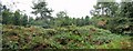
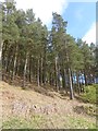
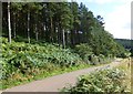
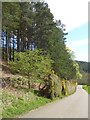
Nearby Images from Geograph Britain and Ireland:
©2010(licence)
©2018(licence)
©2013(licence)
©2018(licence)
©2010(licence)
The above images may not be of the site on this page, they are loaded from Geograph.
Please Submit an Image of this site or go out and take one for us!
Click here to see more info for this site
Nearby sites
Key: Red: member's photo, Blue: 3rd party photo, Yellow: other image, Green: no photo - please go there and take one, Grey: site destroyed
Download sites to:
KML (Google Earth)
GPX (GPS waypoints)
CSV (Garmin/Navman)
CSV (Excel)
To unlock full downloads you need to sign up as a Contributory Member. Otherwise downloads are limited to 50 sites.
Turn off the page maps and other distractions
Nearby sites listing. In the following links * = Image available
365m S 171° Beanley Plantation Cist* Cist (NU09351745)
475m NNW 344° Beanley Moor Enclosure* Ancient Village or Settlement (NU0915718266)
666m NNE 28° Beanley Moor 1.* Rock Art (NU0960018400)
788m NNE 31° Beanley Moor* Rock Art (NU0969118490)
813m NNE 30° Beanley Moor 2* Rock Art (NU0969718515)
1000m NE 34° Beanley Portable b Rock Art (NU0985018640)
1.1km NE 42° Ringses (Beanley Moor)* Hillfort (NU1000618600)
1.1km E 82° Beanley Moor 8 & 9 Rock Art (NU1039017960)
1.2km WNW 290° Beanley Portable a Rock Art (NU0820018200)
1.2km ENE 65° Beanley Moor 7* Rock Art (NU1037418318)
1.2km NE 51° Beanley Moor 3* Rock Art (NU1022318561)
1.4km SE 143° Titlington Mount N01* Rock Art (NU1016616675)
1.5km ENE 78° Beanley Moor 11 Rock Art (NU1075118117)
1.5km ENE 63° Beanley Moor 4 Rock Art (NU1064018511)
1.5km ENE 65° Beanley Moor 5 Rock Art (NU1068818475)
1.5km ENE 64° Beanley Moor 6 Rock Art (NU1068818484)
1.6km ENE 77° Beanley Moor 10 Rock Art (NU1081118173)
1.7km S 170° Titlington North Camp* Hillfort (NU0959016107)
1.8km SE 145° Titlington Mount N02* Rock Art (NU1029016368)
1.9km SSW 196° Titlington Pike Cairn B* Round Cairn (NU0875515991)
2.0km NNE 26° Eglingham Hall Barrow* Round Barrow(s) (NU10161960)
2.0km SSW 192° Titlington Pike Cairn A* Round Cairn (NU0887415852)
2.3km ESE 113° Hunterheugh 6b Rock Art (NU1139216904)
2.3km ESE 113° Hunterheugh 6* Rock Art (NU1141816904)
2.4km ESE 113° Hunterheugh 11 Rock Art (NU1147216873)
View more nearby sites and additional images


 We would like to know more about this location. Please feel free to add a brief description and any relevant information in your own language.
 Wir möchten mehr über diese Stätte erfahren. Bitte zögern Sie nicht, eine kurze Beschreibung und relevante Informationen in Deutsch hinzuzufügen.
 Nous aimerions en savoir encore un peu sur les lieux. S'il vous plaît n'hesitez pas à ajouter une courte description et tous les renseignements pertinents dans votre propre langue.
 Quisieramos informarnos un poco más de las lugares. No dude en añadir una breve descripción y otros datos relevantes en su propio idioma.