

<< Our Photo Pages >> Titlington North Camp - Hillfort in England in Northumberland
Submitted by SolarMegalith on Saturday, 30 July 2016 Page Views: 1919
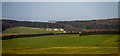
Iron Age and Later PrehistorySite Name: Titlington North CampCountry: England County: Northumberland Type: Hillfort
Map Ref: NU0959016107
Latitude: 55.438753N Longitude: 1.849981W
Condition:
| 5 | Perfect |
| 4 | Almost Perfect |
| 3 | Reasonable but with some damage |
| 2 | Ruined but still recognisable as an ancient site |
| 1 | Pretty much destroyed, possibly visible as crop marks |
| 0 | No data. |
| -1 | Completely destroyed |
| 5 | Superb |
| 4 | Good |
| 3 | Ordinary |
| 2 | Not Good |
| 1 | Awful |
| 0 | No data. |
| 5 | Can be driven to, probably with disabled access |
| 4 | Short walk on a footpath |
| 3 | Requiring a bit more of a walk |
| 2 | A long walk |
| 1 | In the middle of nowhere, a nightmare to find |
| 0 | No data. |
| 5 | co-ordinates taken by GPS or official recorded co-ordinates |
| 4 | co-ordinates scaled from a detailed map |
| 3 | co-ordinates scaled from a bad map |
| 2 | co-ordinates of the nearest village |
| 1 | co-ordinates of the nearest town |
| 0 | no data |
Internal Links:
External Links:
I have visited· I would like to visit
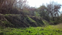
SolarMegalith visited on 29th Jul 2016 - their rating: Cond: 3 Amb: 4 Access: 4
")
The site is accessible both from Titlington Mount Lane (gently rising footpath) and from Titlington Pike (the footpath running alongside the edge of a forest leading to a gate).
Pastcape entry.
You may be viewing yesterday's version of this page. To see the most up to date information please register for a free account.
")
")
")
")
Do not use the above information on other web sites or publications without permission of the contributor.
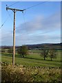
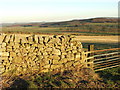
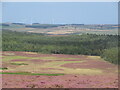
Nearby Images from Geograph Britain and Ireland:
©2013(licence)
©2007(licence)
©2022(licence)
©2014(licence)

©2007(licence)
The above images may not be of the site on this page, they are loaded from Geograph.
Please Submit an Image of this site or go out and take one for us!
Click here to see more info for this site
Nearby sites
Key: Red: member's photo, Blue: 3rd party photo, Yellow: other image, Green: no photo - please go there and take one, Grey: site destroyed
Download sites to:
KML (Google Earth)
GPX (GPS waypoints)
CSV (Garmin/Navman)
CSV (Excel)
To unlock full downloads you need to sign up as a Contributory Member. Otherwise downloads are limited to 50 sites.
Turn off the page maps and other distractions
Nearby sites listing. In the following links * = Image available
745m ENE 70° Titlington Mount N02* Rock Art (NU1029016368)
758m WSW 250° Titlington Pike Cairn A* Round Cairn (NU0887415852)
807m NE 45° Titlington Mount N01* Rock Art (NU1016616675)
841m W 262° Titlington Pike Cairn B* Round Cairn (NU0875515991)
1.3km SW 236° Shawdonwood Enclosure* Ancient Village or Settlement (NU08471535)
1.4km N 350° Beanley Plantation Cist* Cist (NU09351745)
1.7km N 350° Beanley Plantation Fort* Hillfort (NU09291781)
2.0km ENE 66° Hunterheugh 6b Rock Art (NU1139216904)
2.0km ENE 73° Hunterheugh 10 Rock Art (NU1148116674)
2.0km ENE 67° Hunterheugh 6* Rock Art (NU1141816904)
2.0km NNE 23° Beanley Moor 8 & 9 Rock Art (NU1039017960)
2.0km ENE 73° Hunterheugh 9 Rock Art (NU1152616691)
2.0km ENE 68° Hunterheugh 11 Rock Art (NU1147216873)
2.1km ENE 74° Hunterheugh 8a Rock Art (NU1160516686)
2.1km ENE 74° Hunterheugh 8f Rock Art (NU1160516688)
2.1km ENE 74° Hunterheugh 8e Rock Art (NU1160716690)
2.1km ENE 74° Hunterheugh 8d Rock Art (NU1160916689)
2.1km ENE 74° Hunterheugh 8g Rock Art (NU1161216692)
2.1km ENE 74° Hunterheugh 8c Rock Art (NU1161516693)
2.1km ENE 69° Hunterheugh 13* Rock Art (NU1156116863)
2.1km ENE 69° Hunterheugh 14* Rock Art (NU1156016866)
2.1km ENE 74° Hunterheugh 8b Rock Art (NU1162316709)
2.1km ENE 74° Hunterheugh 8h Rock Art (NU1163016708)
2.2km ENE 73° Hunterheugh 12 Rock Art (NU1167116754)
2.2km N 349° Beanley Moor Enclosure* Ancient Village or Settlement (NU0915718266)
View more nearby sites and additional images


 We would like to know more about this location. Please feel free to add a brief description and any relevant information in your own language.
 Wir möchten mehr über diese Stätte erfahren. Bitte zögern Sie nicht, eine kurze Beschreibung und relevante Informationen in Deutsch hinzuzufügen.
 Nous aimerions en savoir encore un peu sur les lieux. S'il vous plaît n'hesitez pas à ajouter une courte description et tous les renseignements pertinents dans votre propre langue.
 Quisieramos informarnos un poco más de las lugares. No dude en añadir una breve descripción y otros datos relevantes en su propio idioma.