<< Our Photo Pages >> Upper Edge - Cairn in England in Derbyshire
Submitted by postman on Wednesday, 15 January 2014 Page Views: 2056
Neolithic and Bronze AgeSite Name: Upper EdgeCountry: England
NOTE: This site is 0.9 km away from the location you searched for.
County: Derbyshire Type: Cairn
Nearest Town: Buxton Nearest Village: Earl Sterndale
Map Ref: SK07656845
Latitude: 53.213057N Longitude: 1.886905W
Condition:
| 5 | Perfect |
| 4 | Almost Perfect |
| 3 | Reasonable but with some damage |
| 2 | Ruined but still recognisable as an ancient site |
| 1 | Pretty much destroyed, possibly visible as crop marks |
| 0 | No data. |
| -1 | Completely destroyed |
| 5 | Superb |
| 4 | Good |
| 3 | Ordinary |
| 2 | Not Good |
| 1 | Awful |
| 0 | No data. |
| 5 | Can be driven to, probably with disabled access |
| 4 | Short walk on a footpath |
| 3 | Requiring a bit more of a walk |
| 2 | A long walk |
| 1 | In the middle of nowhere, a nightmare to find |
| 0 | No data. |
| 5 | co-ordinates taken by GPS or official recorded co-ordinates |
| 4 | co-ordinates scaled from a detailed map |
| 3 | co-ordinates scaled from a bad map |
| 2 | co-ordinates of the nearest village |
| 1 | co-ordinates of the nearest town |
| 0 | no data |
Internal Links:
External Links:
")
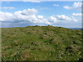
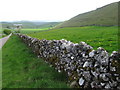
It is a short walk but it's not really on a footpath, and to be honest the cairn is a ruined and battered mess, but it is part of the collective round here and seeing as I intend to see the whole place and everthing in it I have had to come and take a look.
You may be viewing yesterday's version of this page. To see the most up to date information please register for a free account.
")
Do not use the above information on other web sites or publications without permission of the contributor.
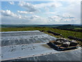
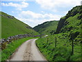
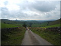
Nearby Images from Geograph Britain and Ireland:
©2010(licence)
©2010(licence)
©2005(licence)
©2009(licence)
©2009(licence)
The above images may not be of the site on this page, they are loaded from Geograph.
Please Submit an Image of this site or go out and take one for us!
Click here to see more info for this site
Nearby sites
Key: Red: member's photo, Blue: 3rd party photo, Yellow: other image, Green: no photo - please go there and take one, Grey: site destroyed
Download sites to:
KML (Google Earth)
GPX (GPS waypoints)
CSV (Garmin/Navman)
CSV (Excel)
To unlock full downloads you need to sign up as a Contributory Member. Otherwise downloads are limited to 50 sites.
Turn off the page maps and other distractions
Nearby sites listing. In the following links * = Image available
709m SE 129° Harley Grange Tumulus* Round Barrow(s) (SK082680)
851m S 183° Dowel Cave* Cave or Rock Shelter (SK076676)
951m S 183° Etches cave* Cave or Rock Shelter (SK076675)
1.2km SSE 159° Hatch-a-way* Cairn (SK081673)
1.5km W 268° Stoup High Edge* Cairn (SK061684)
1.7km WSW 252° Hollins Hill* Cairn (SK060679)
2.0km SSE 149° Hitter hill* Cairn (SK087667)
2.1km E 97° Hind Low* Ancient Village or Settlement (SK097682)
2.3km WNW 294° The Frith* Round Barrow(s) (SK055694)
2.5km SSW 212° Coatestown Barrow Round Barrow(s) (SK063663)
2.8km W 268° Brand End standing stones* Standing Stones (SK0488868373)
2.9km NNW 342° Fox Low Round Barrow(s) (SK06737122)
3.2km SE 135° Fox Hole Cave* Cave or Rock Shelter (SK099662)
3.2km NNE 17° Gospel Hillocks* Long Barrow (SK086715)
3.2km SE 136° Fox Hole Cave (Earl Sterndale)* Cave or Rock Shelter (SK099661)
3.3km ENE 78° Nether Low* Round Barrow(s) (SK10896917)
3.5km NE 36° Hob Thirst's Cave* Cave or Rock Shelter (SK097713)
3.7km NW 307° Anthony Hill bowl barrow* Round Barrow(s) (SK04657066)
3.7km NNW 349° Staden Low* Misc. Earthwork (SK06917212)
4.0km NW 326° Grin Low* Cairn (SK05397173)
4.3km ENE 60° Chelmorton Low* Round Barrow(s) (SK114706)
4.3km ESE 120° Cronkston Low* Round Barrow(s) (SK114663)
4.3km ENE 75° Chelmorton 2 Bowl Barrow* Round Barrow(s) (SK11866956)
4.8km NNW 327° Poole’s Cavern* Cave or Rock Shelter (SK050725)
5.2km NNW 340° Buxton Museum & Art Gallery* Museum (SK059733)
View more nearby sites and additional images


 We would like to know more about this location. Please feel free to add a brief description and any relevant information in your own language.
 Wir möchten mehr über diese Stätte erfahren. Bitte zögern Sie nicht, eine kurze Beschreibung und relevante Informationen in Deutsch hinzuzufügen.
 Nous aimerions en savoir encore un peu sur les lieux. S'il vous plaît n'hesitez pas à ajouter une courte description et tous les renseignements pertinents dans votre propre langue.
 Quisieramos informarnos un poco más de las lugares. No dude en añadir una breve descripción y otros datos relevantes en su propio idioma.