<< Our Photo Pages >> Staden Low - Misc. Earthwork in England in Derbyshire
Submitted by Vicky on Wednesday, 18 September 2002 Page Views: 10527
Multi-periodSite Name: Staden Low Alternative Name: Staden HengeCountry: England County: Derbyshire Type: Misc. Earthwork
Nearest Town: Buxton Nearest Village: Staden
Map Ref: SK06917212 Landranger Map Number: 119
Latitude: 53.246056N Longitude: 1.897907W
Condition:
| 5 | Perfect |
| 4 | Almost Perfect |
| 3 | Reasonable but with some damage |
| 2 | Ruined but still recognisable as an ancient site |
| 1 | Pretty much destroyed, possibly visible as crop marks |
| 0 | No data. |
| -1 | Completely destroyed |
| 5 | Superb |
| 4 | Good |
| 3 | Ordinary |
| 2 | Not Good |
| 1 | Awful |
| 0 | No data. |
| 5 | Can be driven to, probably with disabled access |
| 4 | Short walk on a footpath |
| 3 | Requiring a bit more of a walk |
| 2 | A long walk |
| 1 | In the middle of nowhere, a nightmare to find |
| 0 | No data. |
| 5 | co-ordinates taken by GPS or official recorded co-ordinates |
| 4 | co-ordinates scaled from a detailed map |
| 3 | co-ordinates scaled from a bad map |
| 2 | co-ordinates of the nearest village |
| 1 | co-ordinates of the nearest town |
| 0 | no data |
Internal Links:
External Links:
")
This site, which lies in an Industrial Estate close to Buxton, has been suggested to be either a Neolithic henge or an Iron Age/Romano British enclosure, but as no excavations have been carried out on the site, it is impossible to say.
More at Pastscape
You may be viewing yesterday's version of this page. To see the most up to date information please register for a free account.
")
Do not use the above information on other web sites or publications without permission of the contributor.
Nearby Images from Geograph Britain and Ireland:
©2010(licence)
©2015(licence)
©2010(licence)
©2010(licence)
©2010(licence)
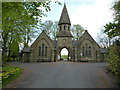
The above images may not be of the site on this page, they are loaded from Geograph.
Please Submit an Image of this site or go out and take one for us!
Click here to see more info for this site
Nearby sites
Key: Red: member's photo, Blue: 3rd party photo, Yellow: other image, Green: no photo - please go there and take one, Grey: site destroyed
Download sites to:
KML (Google Earth)
GPX (GPS waypoints)
CSV (Garmin/Navman)
CSV (Excel)
To unlock full downloads you need to sign up as a Contributory Member. Otherwise downloads are limited to 50 sites.
![]()
Turn off the page maps and other distractions
Nearby sites listing. In the following links * = Image available
917m SSW 191° Fox Low Round Barrow(s) (SK06737122)
1.6km NW 320° Buxton Museum & Art Gallery* Museum (SK059733)
1.6km WSW 256° Grin Low* Cairn (SK05397173)
1.8km ESE 110° Gospel Hillocks* Long Barrow (SK086715)
1.8km NW 319° St Ann's Well (Buxton)* Holy Well or Sacred Spring (SK057735)
1.9km WNW 281° Poole’s Cavern* Cave or Rock Shelter (SK050725)
2.0km NNE 26° Fairfield Low Round Barrow(s) (SK07817396)
2.7km WSW 237° Anthony Hill bowl barrow* Round Barrow(s) (SK04657066)
2.9km ESE 106° Hob Thirst's Cave* Cave or Rock Shelter (SK097713)
3.1km SSW 207° The Frith* Round Barrow(s) (SK055694)
3.7km SSE 169° Upper Edge* Cairn (SK07656845)
3.8km SSW 192° Stoup High Edge* Cairn (SK061684)
4.3km SSW 208° Brand End standing stones* Standing Stones (SK0488868373)
4.3km SSE 163° Harley Grange Tumulus* Round Barrow(s) (SK082680)
4.3km SSW 192° Hollins Hill* Cairn (SK060679)
4.6km S 171° Dowel Cave* Cave or Rock Shelter (SK076676)
4.6km WSW 248° Dane Head* Marker Stone (SK02657036)
4.7km S 172° Etches cave* Cave or Rock Shelter (SK076675)
4.7km ESE 109° Chelmorton Low* Round Barrow(s) (SK114706)
4.8km SE 145° Hind Low* Ancient Village or Settlement (SK097682)
4.9km SE 127° Nether Low* Round Barrow(s) (SK10896917)
5.0km SSE 166° Hatch-a-way* Cairn (SK081673)
5.1km NE 47° Bole Hill Round Barrow* Round Barrow(s) (SK10637555)
5.5km NE 56° Wind Low* Chambered Cairn (SK115752)
5.6km ESE 117° Chelmorton 2 Bowl Barrow* Round Barrow(s) (SK11866956)
View more nearby sites and additional images


 We would like to know more about this location. Please feel free to add a brief description and any relevant information in your own language.
 Wir möchten mehr über diese Stätte erfahren. Bitte zögern Sie nicht, eine kurze Beschreibung und relevante Informationen in Deutsch hinzuzufügen.
 Nous aimerions en savoir encore un peu sur les lieux. S'il vous plaît n'hesitez pas à ajouter une courte description et tous les renseignements pertinents dans votre propre langue.
 Quisieramos informarnos un poco más de las lugares. No dude en añadir una breve descripción y otros datos relevantes en su propio idioma.