<< Our Photo Pages >> Catstones Ring - Misc. Earthwork in England in Yorkshire (West)
Submitted by DavidRaven on Wednesday, 22 December 2004 Page Views: 11945
Multi-periodSite Name: Catstones Ring Alternative Name: Blood DykesCountry: England County: Yorkshire (West) Type: Misc. Earthwork
Nearest Town: Keighley Nearest Village: Harden
Map Ref: SE0680638145
Latitude: 53.839512N Longitude: 1.898054W
Condition:
| 5 | Perfect |
| 4 | Almost Perfect |
| 3 | Reasonable but with some damage |
| 2 | Ruined but still recognisable as an ancient site |
| 1 | Pretty much destroyed, possibly visible as crop marks |
| 0 | No data. |
| -1 | Completely destroyed |
| 5 | Superb |
| 4 | Good |
| 3 | Ordinary |
| 2 | Not Good |
| 1 | Awful |
| 0 | No data. |
| 5 | Can be driven to, probably with disabled access |
| 4 | Short walk on a footpath |
| 3 | Requiring a bit more of a walk |
| 2 | A long walk |
| 1 | In the middle of nowhere, a nightmare to find |
| 0 | No data. |
| 5 | co-ordinates taken by GPS or official recorded co-ordinates |
| 4 | co-ordinates scaled from a detailed map |
| 3 | co-ordinates scaled from a bad map |
| 2 | co-ordinates of the nearest village |
| 1 | co-ordinates of the nearest town |
| 0 | no data |
Internal Links:
External Links:
I have visited· I would like to visit
drolaf visited on 21st Jun 2017 - their rating: Cond: 2 Amb: 3 Access: 4 good vantage point over the valley
")
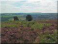
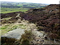
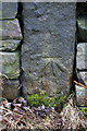
A curious feature of the moors near Harden, West Yorkshire. The earthwork covers almost sixteen acres and can barely be discerned, especially the part that lies on the moorland. The remnants of extensive quarrying also makes it difficult to follow the path of the banks.
It's hard to find much information about this site. Perhaps future excavations will enlighten us!
Update May 2017: Further information on Catstanes Ring (aka Blood Dykes) can be found on The Northern Antiquarian (TNA) - see their entry for Catstones Ring, Harden, West Yorkshire, which includes directions for finding the site from Keighley together with an image of the Ring on the 1852 OS-map and a brief archaeology and history.
Pastscape Monument No. 47871 tells us: "the enclosure at Catstones Ring is visible on air photographs ..... the western side is visible as a cropmark ditch, but the north-western corner although ploughed, still survives as a slight earthwork . The north, eastern and part of the southern sides, comprising a bank and outer ditch, survives as earthworks. Inside the enclosure is a small (11m) circular embanked enclosure (centred at SE 0680 3813), which may be associated with it and of contemporary date. The outwork to the north ..... is visible as a cropmark, showing just the northern and eastern sides of the ditched enclosure (centred at SE 0685 3830). The exact relationship with the larger quadrangular enclosure is uncertain. Other Iron Age enclosures are recorded in the area (SE 03 NE 13) and their inter relationship and visibilty from one another in the landscape suggests Catstones Ring may also be Iron Age rather than Roman."
Historic England List Entry 1018240 also has more information.
You may be viewing yesterday's version of this page. To see the most up to date information please register for a free account.
")
Do not use the above information on other web sites or publications without permission of the contributor.
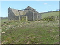
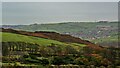
Nearby Images from Geograph Britain and Ireland:
©2005(licence)
©2018(licence)
©2013(licence)
©2022(licence)
©2018(licence)
The above images may not be of the site on this page, they are loaded from Geograph.
Please Submit an Image of this site or go out and take one for us!
Click here to see more info for this site
Nearby sites
Key: Red: member's photo, Blue: 3rd party photo, Yellow: other image, Green: no photo - please go there and take one, Grey: site destroyed
Download sites to:
KML (Google Earth)
GPX (GPS waypoints)
CSV (Garmin/Navman)
CSV (Excel)
To unlock full downloads you need to sign up as a Contributory Member. Otherwise downloads are limited to 50 sites.
Turn off the page maps and other distractions
Nearby sites listing. In the following links * = Image available
242m SE 127° Harden Moor Stone Row (Bingley) Stone Row / Alignment (SE0738)
868m NE 52° Harden Moor Ring Cairn* Ring Cairn (SE0749638675)
941m NW 316° Goff Well* Holy Well or Sacred Spring (SE0615038822)
948m NE 54° Harden Moor Cairnfield* Cairn (SE0757838699)
2.5km SW 222° Castle Stead Ring* Misc. Earthwork (SE05143627)
2.7km S 182° Castle Stead Misc. Earthwork (SE067354)
2.8km NW 315° Exley Head Cross* Ancient Cross (SE0481840146)
3.0km NNW 345° Market Cross (Keighley) Ancient Cross (SE0604241002)
3.0km E 95° Cottingley Woods* Rock Art (SE09803789)
3.0km NE 54° Druid's Altar (Bingley) Natural Stone / Erratic / Other Natural Feature (SE09243994)
3.1km NE 56° Druid's Well (Bingley)* Holy Well or Sacred Spring (SE094399)
3.1km N 354° Railway Station Cist (Keighley) Cist (SE06474127)
3.5km ENE 74° Elm Crag Well (Bingley) Holy Well or Sacred Spring (SE102391)
3.8km SW 218° Armshaw Lowe Artificial Mound (SE04423513)
3.9km ENE 70° Eadberht's Cross Ancient Cross (SE105395)
4.0km NE 47° Lund Well (Bingley) Holy Well or Sacred Spring (SE09734091)
4.0km SE 126° Shaygate* Ancient Village or Settlement (SE10073576)
4.1km NNE 16° East Riddlesden Cross (Keighley) Ancient Cross (SE07904208)
4.1km NNW 344° Cliffe Castle Museum* Rock Art (SE057421)
4.2km NNW 331° Whin Knoll Well (Keighley) Holy Well or Sacred Spring (SE04794179)
4.3km NNW 329° Jennet's Well/Spring* Holy Well or Sacred Spring (SE04614180)
4.4km NNE 30° Carr Lane* Rock Art (SE0900042000)
4.5km WNW 296° True Well (Oakworth) Holy Well or Sacred Spring (SE02724017)
4.6km NW 309° Laycock Cross (Keighley)* Early Christian Sculptured Stone (SE032410)
4.7km NNE 23° How Beck 01* Rock Art (SE0865542435)
View more nearby sites and additional images


 We would like to know more about this location. Please feel free to add a brief description and any relevant information in your own language.
 Wir möchten mehr über diese Stätte erfahren. Bitte zögern Sie nicht, eine kurze Beschreibung und relevante Informationen in Deutsch hinzuzufügen.
 Nous aimerions en savoir encore un peu sur les lieux. S'il vous plaît n'hesitez pas à ajouter une courte description et tous les renseignements pertinents dans votre propre langue.
 Quisieramos informarnos un poco más de las lugares. No dude en añadir una breve descripción y otros datos relevantes en su propio idioma.