<< Text Pages >> Sales Lot - Chambered Cairn in England in Gloucestershire
Submitted by vicky on Tuesday, 24 September 2002 Page Views: 5676
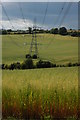
Neolithic and Bronze AgeSite Name: Sales LotCountry: England County: Gloucestershire Type: Chambered Cairn
Map Ref: SP04871578 Landranger Map Number: 163
Latitude: 51.840604N Longitude: 1.930718W
Condition:
| 5 | Perfect |
| 4 | Almost Perfect |
| 3 | Reasonable but with some damage |
| 2 | Ruined but still recognisable as an ancient site |
| 1 | Pretty much destroyed, possibly visible as crop marks |
| 0 | No data. |
| -1 | Completely destroyed |
| 5 | Superb |
| 4 | Good |
| 3 | Ordinary |
| 2 | Not Good |
| 1 | Awful |
| 0 | No data. |
| 5 | Can be driven to, probably with disabled access |
| 4 | Short walk on a footpath |
| 3 | Requiring a bit more of a walk |
| 2 | A long walk |
| 1 | In the middle of nowhere, a nightmare to find |
| 0 | No data. |
| 5 | co-ordinates taken by GPS or official recorded co-ordinates |
| 4 | co-ordinates scaled from a detailed map |
| 3 | co-ordinates scaled from a bad map |
| 2 | co-ordinates of the nearest village |
| 1 | co-ordinates of the nearest town |
| 0 | no data |
Internal Links:
External Links:
Chambered Long Cairn with concave forecourt in Gloucestershire
Have you visited this site? Please add a comment below.
You may be viewing yesterday's version of this page. To see the most up to date information please register for a free account.
Do not use the above information on other web sites or publications without permission of the contributor.
Nearby Images from Geograph Britain and Ireland:
©2006(licence)
©2008(licence)
©2017(licence)
©2017(licence)
©2008(licence)
The above images may not be of the site on this page, they are loaded from Geograph.
Please Submit an Image of this site or go out and take one for us!
Click here to see more info for this site
Nearby sites
Key: Red: member's photo, Blue: 3rd party photo, Yellow: other image, Green: no photo - please go there and take one, Grey: site destroyed
Download sites to:
KML (Google Earth)
GPX (GPS waypoints)
CSV (Garmin/Navman)
CSV (Excel)
To unlock full downloads you need to sign up as a Contributory Member. Otherwise downloads are limited to 50 sites.
Turn off the page maps and other distractions
Nearby sites listing. In the following links * = Image available
1.9km S 173° Round barrow N of Chedworth Roman villa* Round Barrow(s) (SP0511013931)
2.3km S 171° Chedworth Villa Nymphaeum* Holy Well or Sacred Spring (SP05241350)
2.4km SW 228° Withington Woods Chambered Tomb (SP031142)
2.7km WSW 240° Withington Woods Cross Dyke* Misc. Earthwork (SP025144)
3.6km E 85° Cheltenham Road Plantation* Chambered Cairn (SP085161)
3.7km S 173° Chedworth spring* Holy Well or Sacred Spring (SP053121)
3.7km E 88° Furzenhill Barn* Chambered Tomb (SP086159)
3.8km NE 38° Hazleton South* Chambered Tomb (SP072188)
3.8km SSE 152° Royal Oak* Round Barrow(s) (SP06701239)
3.9km E 100° Hangman's Stone (Northleach)* Standing Stone (Menhir) (SP087151)
3.9km NE 38° Hazleton North* Chambered Tomb (SP073189)
4.0km SSE 152° Woodbarrow (Glos)* Chambered Tomb (SP06731228)
4.2km NNE 27° Penhill Farm Bowl Barrow* Round Barrow(s) (SP06761954)
4.2km SW 224° Monument Number 327710* Artificial Mound (SP0193712749)
4.5km SSW 209° Shawswell Farm Long Barrow* Long Barrow (SP027118)
5.2km S 184° Pinkwell (Chedworth)* Chambered Cairn (SP04531058)
5.3km WNW 302° South Dowdeswell Hillfort (SP0040018600)
5.5km E 87° Burn Ground* Chambered Cairn (SP104161)
6.0km WNW 304° North Dowdeswell* Hillfort (SO99851910)
6.0km W 262° Norbury Hillfort (Colesbourne)* Hillfort (SO989149)
6.3km WNW 296° Lineover* Chambered Tomb (SO99231856)
6.4km NNE 18° Slade Barn Chambered Cairn (SP069219)
6.6km SE 127° Crickley Barrow Chambered Tomb (SP101118)
7.0km E 83° Leygore Manor* Chambered Tomb (SP1178816648)
7.2km S 183° Calmsden spring* Holy Well or Sacred Spring (SP04540863)
View more nearby sites and additional images


 We would like to know more about this location. Please feel free to add a brief description and any relevant information in your own language.
 Wir möchten mehr über diese Stätte erfahren. Bitte zögern Sie nicht, eine kurze Beschreibung und relevante Informationen in Deutsch hinzuzufügen.
 Nous aimerions en savoir encore un peu sur les lieux. S'il vous plaît n'hesitez pas à ajouter une courte description et tous les renseignements pertinents dans votre propre langue.
 Quisieramos informarnos un poco más de las lugares. No dude en añadir una breve descripción y otros datos relevantes en su propio idioma.