<< Our Photo Pages >> Martin Down Enclosure - Ancient Village or Settlement in England in Hampshire
Submitted by JimChampion on Sunday, 21 July 2002 Page Views: 10906
Multi-periodSite Name: Martin Down EnclosureCountry: England County: Hampshire Type: Ancient Village or Settlement
Nearest Village: Martin
Map Ref: SU043200 Landranger Map Number: 184
Latitude: 50.979394N Longitude: 1.940122W
Condition:
| 5 | Perfect |
| 4 | Almost Perfect |
| 3 | Reasonable but with some damage |
| 2 | Ruined but still recognisable as an ancient site |
| 1 | Pretty much destroyed, possibly visible as crop marks |
| 0 | No data. |
| -1 | Completely destroyed |
| 5 | Superb |
| 4 | Good |
| 3 | Ordinary |
| 2 | Not Good |
| 1 | Awful |
| 0 | No data. |
| 5 | Can be driven to, probably with disabled access |
| 4 | Short walk on a footpath |
| 3 | Requiring a bit more of a walk |
| 2 | A long walk |
| 1 | In the middle of nowhere, a nightmare to find |
| 0 | No data. |
| 5 | co-ordinates taken by GPS or official recorded co-ordinates |
| 4 | co-ordinates scaled from a detailed map |
| 3 | co-ordinates scaled from a bad map |
| 2 | co-ordinates of the nearest village |
| 1 | co-ordinates of the nearest town |
| 0 | no data |
Internal Links:
External Links:
I have visited· I would like to visit
JimChampion has visited here
")
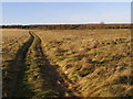
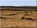
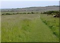
This rectangular enclosure was excavated by General Pitt-Rivers in 1895 and the existing earthworks are his reconstruction of the site. It is 90m long and 60m wide and believed to date from the mid Bronze Age, with continued use by the Romano-British. [source]
If you have visited this site please add a comment below.
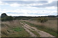
Access The enclosure is within the Martin Down National Nature Reserve which has two car parks: one just off the A354 at Bokerley Junction and the other at the end of Sillens Lane from the village of Martin. The enclosure is about 400m east of the A354 car park, but bear in mind that this part of the nature reserve is roped off in the spring to prevent walkers from disturbing ground-nesting birds.
You may be viewing yesterday's version of this page. To see the most up to date information please register for a free account.
")
")
")
Do not use the above information on other web sites or publications without permission of the contributor.
Nearby Images from Geograph Britain and Ireland:
©2008(licence)
©2008(licence)
©2018(licence)
©2006(licence)
©2012(licence)
The above images may not be of the site on this page, they are loaded from Geograph.
Please Submit an Image of this site or go out and take one for us!
Click here to see more info for this site
Nearby sites
Key: Red: member's photo, Blue: 3rd party photo, Yellow: other image, Green: no photo - please go there and take one, Grey: site destroyed
Download sites to:
KML (Google Earth)
GPX (GPS waypoints)
CSV (Garmin/Navman)
CSV (Excel)
To unlock full downloads you need to sign up as a Contributory Member. Otherwise downloads are limited to 50 sites.
![]()
Turn off the page maps and other distractions
Nearby sites listing. In the following links * = Image available
640m SW 219° Pentridge 3* Long Barrow (SU039195)
854m SSW 201° Pentridge Cursus Cursus (SU040192)
892m WNW 297° Vernditch Chase (South)* Long Barrow (SU035204)
949m SSW 192° Pentridge 2* Long Barrow (SU04111907)
1.2km S 187° Pentridge 1* Long Barrow (SU04151877)
1.3km SW 219° Bokerley Dyke* Misc. Earthwork (SU035190)
1.4km NW 322° Vernditch Chase (North)* Long Barrow (SU03402113)
2.2km ENE 74° Longbarrow House* Long Barrow (SU064206)
2.2km SSE 150° Blagdon Hill tumuli* Round Barrow(s) (SU054181)
2.4km SE 146° Grim's Ditch (Hampshire) Misc. Earthwork (SU05651802)
2.8km SE 132° Tidpit Common Down Long Barrow (SU064181)
2.9km S 188° Penbury Knoll* Hillfort (SU039171)
3.1km W 268° Bokerley Dyke Misc. Earthwork (SU01241990)
3.5km NW 319° Marleycombe Hill, earthworks* Misc. Earthwork (SU020226)
3.6km SSW 210° Pentridge 4* Long Barrow (SU025169)
3.7km SW 223° Oakley Down Barrows* Barrow Cemetery (SU01821731)
4.1km ENE 62° Furze Down Long Barrow (SU0791621895)
4.1km SW 228° Wor Barrow* Long Barrow (SU01241729)
4.6km ESE 101° Knoll Down tumuli* Round Barrow(s) (SU088191)
4.7km E 91° Knap Barrow* Long Barrow (SU090199)
4.7km E 92° Grans Barrow* Long Barrow (SU090198)
4.7km W 264° Mistlebury* Hillfort (ST99581948)
4.7km SSW 212° Dorset Cursus* Cursus (SU01751600)
4.7km ESE 120° Soldiers Ring (Dorset)* Misc. Earthwork (SU084176)
4.7km SW 218° Bottlebush Down barrows* Barrow Cemetery (SU01381625)
View more nearby sites and additional images


 We would like to know more about this location. Please feel free to add a brief description and any relevant information in your own language.
 Wir möchten mehr über diese Stätte erfahren. Bitte zögern Sie nicht, eine kurze Beschreibung und relevante Informationen in Deutsch hinzuzufügen.
 Nous aimerions en savoir encore un peu sur les lieux. S'il vous plaît n'hesitez pas à ajouter une courte description et tous les renseignements pertinents dans votre propre langue.
 Quisieramos informarnos un poco más de las lugares. No dude en añadir una breve descripción y otros datos relevantes en su propio idioma.