


<< Our Photo Pages >> Pentridge 3 - Long Barrow in England in Dorset
Submitted by JimChampion on Friday, 01 April 2005 Page Views: 6104
Neolithic and Bronze AgeSite Name: Pentridge 3 Alternative Name: WoodyatesCountry: England County: Dorset Type: Long Barrow
Nearest Village: Pentridge
Map Ref: SU039195
Latitude: 50.974900N Longitude: 1.945825W
Condition:
| 5 | Perfect |
| 4 | Almost Perfect |
| 3 | Reasonable but with some damage |
| 2 | Ruined but still recognisable as an ancient site |
| 1 | Pretty much destroyed, possibly visible as crop marks |
| 0 | No data. |
| -1 | Completely destroyed |
| 5 | Superb |
| 4 | Good |
| 3 | Ordinary |
| 2 | Not Good |
| 1 | Awful |
| 0 | No data. |
| 5 | Can be driven to, probably with disabled access |
| 4 | Short walk on a footpath |
| 3 | Requiring a bit more of a walk |
| 2 | A long walk |
| 1 | In the middle of nowhere, a nightmare to find |
| 0 | No data. |
| 5 | co-ordinates taken by GPS or official recorded co-ordinates |
| 4 | co-ordinates scaled from a detailed map |
| 3 | co-ordinates scaled from a bad map |
| 2 | co-ordinates of the nearest village |
| 1 | co-ordinates of the nearest town |
| 0 | no data |
Internal Links:
External Links:
I have visited· I would like to visit
JimChampion has visited here
")
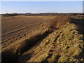
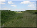
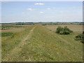
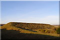
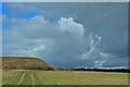
Little remains of this neolithic barrow, originally 30m long, as a result of ploughing. It is aligned NW-SE, with its larger end directed towards the (no longer visible) earthworks of the north-eastern terminal of the Dorset Cursus, a feature it shares with several other long barrows in this area. It stands in the same arable field as the cursus terminal and the Pentridge 2 barrows, with the Bokerley Dyke to the north, and is surrounded by public rights of way.
You may be viewing yesterday's version of this page. To see the most up to date information please register for a free account.
")
")
Do not use the above information on other web sites or publications without permission of the contributor.
Nearby Images from Geograph Britain and Ireland:
©2008(licence)
©2010(licence)
©2010(licence)
©2008(licence)
©2007(licence)
The above images may not be of the site on this page, they are loaded from Geograph.
Please Submit an Image of this site or go out and take one for us!
Click here to see more info for this site
Nearby sites
Key: Red: member's photo, Blue: 3rd party photo, Yellow: other image, Green: no photo - please go there and take one, Grey: site destroyed
Download sites to:
KML (Google Earth)
GPX (GPS waypoints)
CSV (Garmin/Navman)
CSV (Excel)
To unlock full downloads you need to sign up as a Contributory Member. Otherwise downloads are limited to 50 sites.
Turn off the page maps and other distractions
Nearby sites listing. In the following links * = Image available
316m SSE 162° Pentridge Cursus Cursus (SU040192)
478m SSE 154° Pentridge 2* Long Barrow (SU04111907)
640m NE 39° Martin Down Enclosure* Ancient Village or Settlement (SU043200)
640m SW 219° Bokerley Dyke* Misc. Earthwork (SU035190)
771m SSE 161° Pentridge 1* Long Barrow (SU04151877)
984m NNW 336° Vernditch Chase (South)* Long Barrow (SU035204)
1.7km NNW 343° Vernditch Chase (North)* Long Barrow (SU03402113)
2.0km SE 133° Blagdon Hill tumuli* Round Barrow(s) (SU054181)
2.3km SE 130° Grim's Ditch (Hampshire) Misc. Earthwork (SU05651802)
2.4km S 180° Penbury Knoll* Hillfort (SU039171)
2.7km W 279° Bokerley Dyke Misc. Earthwork (SU01241990)
2.7km ENE 66° Longbarrow House* Long Barrow (SU064206)
2.9km ESE 119° Tidpit Common Down Long Barrow (SU064181)
3.0km SSW 208° Pentridge 4* Long Barrow (SU025169)
3.0km SW 223° Oakley Down Barrows* Barrow Cemetery (SU01821731)
3.5km SW 230° Wor Barrow* Long Barrow (SU01241729)
3.5km SSW 201° Bottlebush Down Tumuli* Barrow Cemetery (SU02631620)
3.6km NNW 329° Marleycombe Hill, earthworks* Misc. Earthwork (SU020226)
4.1km SSW 212° Dorset Cursus* Cursus (SU01751600)
4.1km SW 218° Bottlebush Down barrows* Barrow Cemetery (SU01381625)
4.3km W 270° Mistlebury* Hillfort (ST99581948)
4.6km SSW 212° Pentridge Cursus Cursus (SU015156)
4.6km SSW 212° Gussage St Michael Cursus Cursus (SU015156)
4.7km ENE 59° Furze Down Long Barrow (SU0791621895)
4.9km ESE 113° Soldiers Ring (Dorset)* Misc. Earthwork (SU084176)
View more nearby sites and additional images


 We would like to know more about this location. Please feel free to add a brief description and any relevant information in your own language.
 Wir möchten mehr über diese Stätte erfahren. Bitte zögern Sie nicht, eine kurze Beschreibung und relevante Informationen in Deutsch hinzuzufügen.
 Nous aimerions en savoir encore un peu sur les lieux. S'il vous plaît n'hesitez pas à ajouter une courte description et tous les renseignements pertinents dans votre propre langue.
 Quisieramos informarnos un poco más de las lugares. No dude en añadir una breve descripción y otros datos relevantes en su propio idioma.