<< Our Photo Pages >> Rempstone - Stone Circle in England in Dorset
Submitted by TimPrevett on Tuesday, 24 March 2020 Page Views: 38850
Neolithic and Bronze AgeSite Name: Rempstone Alternative Name: #NoRTRCountry: England County: Dorset Type: Stone Circle
Nearest Town: Corfe Castle Nearest Village: Studland
Map Ref: SY99468208 Landranger Map Number: 195
Latitude: 50.638412N Longitude: 2.008998W
Condition:
| 5 | Perfect |
| 4 | Almost Perfect |
| 3 | Reasonable but with some damage |
| 2 | Ruined but still recognisable as an ancient site |
| 1 | Pretty much destroyed, possibly visible as crop marks |
| 0 | No data. |
| -1 | Completely destroyed |
| 5 | Superb |
| 4 | Good |
| 3 | Ordinary |
| 2 | Not Good |
| 1 | Awful |
| 0 | No data. |
| 5 | Can be driven to, probably with disabled access |
| 4 | Short walk on a footpath |
| 3 | Requiring a bit more of a walk |
| 2 | A long walk |
| 1 | In the middle of nowhere, a nightmare to find |
| 0 | No data. |
| 5 | co-ordinates taken by GPS or official recorded co-ordinates |
| 4 | co-ordinates scaled from a detailed map |
| 3 | co-ordinates scaled from a bad map |
| 2 | co-ordinates of the nearest village |
| 1 | co-ordinates of the nearest town |
| 0 | no data |
Internal Links:
External Links:
I have visited· I would like to visit
LouRock AsgardW0lf hoya105 ArchieRob would like to visit
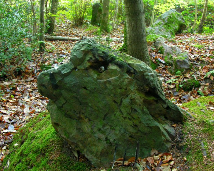
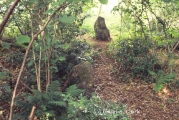
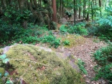
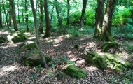
TheCaptain visited on 15th Oct 2021 - their rating: Cond: 3 Amb: 3 Access: 4 A quick look during a weekend in Purbeck. I found about 8 or 9 stones in the woods at the side of the road, probably in a circular shape, mostly well overgrown with brambles and ferns, with no way of telling what was really there, and could not see more than two stones at a time! Many of the stones had coins placed on them. A bit further along was a sort of stone setting, perhaps once part of an avenue, of which there was no way of telling whether ancient or some sort of stone clearance.
Geojazz visited on 17th May 2021 - their rating: Cond: 3 Amb: 4 Access: 4
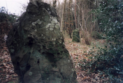
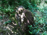
TheCaptain visited on 1st Sep 2002 Visit after a cycling weekend in Purbeck. I remember it being difficult to get into the wood to look at the stones, but once in there seeing a lot of stones seemingly littered around, with a few standing making a part of a small circle near to the road. Once known where it was, seeing one or two stones from the road as passing was possible, with one nice large stone stood at the edge of the woodland. Some of the stones had coins inserted into crevices.
NoRTR saw from a distance Inaccessible site #NoRTR
TimPrevett have visited here
Average ratings for this site from all visit loggers: Condition: 3 Ambience: 3.5 Access: 4
The circle and surrounds must once have formed a major site for south Dorset, though the first edition Ordnance Survey map in the 1890s did not show it, and even now, the Internet Megalith Map does not list it [that's cos our circles are based on Burl's 1976 data - Andy].
My parents also knew nothing of it until I mentioned it to them, and my mum is from Swanage (a couple miles away).The Rempstone stone circle (grid reference SY994821) is a fading part of Purbeck's heritage, and seemingly unknown or ignored among megaraks. For me this circle is special, as it is the nearest megalithic monument to where I grew up, though I knew nothing of its existence until October 1999 when I noticed Cope's brief comments on it in "The Modern Antiquarian". I hastily checked it on my OS map, and then raved about visiting it at the earliest opportunity when next in Dorset.
I have now visited it twice, on Friday 31st December 1999 and Tuesday 22nd February 2000 This is quite an impressive circle (though not in the vein of Castlerigg), but neglected, lost in undergrowth, eaten by ditches and swallowed by embankments. Given that I had near nil amount of description for this site, I had to do my own reconnoitre to see what could be seen. The lighting was poor as dusk was biting on the final day of the millennium, so the wood had a surreal feel to it. This was pierced a few times by the alarming sound of gunshot, which was probably coming from the Foxground Plantation across the road!
Given that my dad, wife and daughter were waiting in the car, I could only spend about 20 minutes trying manically to soak in what I could of the wood and its megalithic denizens. The onset of a new millennium, and the imminent passing of the old also gave this visit a particularly piquant memory On my first visit I managed to find 10 stones, a few still standing, several lop-sided, and some nearly completely sunken into the ground. Some would have been near 6 feet tall, others not even knee high. Of those still erect, a few are about 5 feet tall. To the east, maybe 80 feet from what remains of the circle, I found a pile of identical stones, (8 fairly large chunks) which perhaps suggests this circle had a large outlier which has fallen and crumbled.
The stone nearest the road is speckled with holes and cracks, and had numerous coins left in them (which had been removed by my second visit). On my second visit, I had my dad with me, who roamed the wood and helped me locate numerous other stones (some very substantial) which are clearly related to the circle; given that it was mid morning on a bright winter day with a heart-warming sun and a slight body cooling breeze, we took around an hour and a half to look around, during which time I made myself a plan of the area, noting as many details as I could.
This was also a good visit, elavating my spirit and bringing to my senses the first tentative awakenings of spring. On both occasions there were some rather large 'puddles' around (ponds would be more appropriate) so great care had to be taken with my footing. The foliage was also problematical; I visited in the depths of winter on both occasions, and had to duck many branches and push through bushes, so goodness knows what a visit at another time of year may be like.
I will try to get back there on subsequent visits, and further acquaint myself with the circle in other seasons There was one very unexpected development from my first visit. As always I took photos on this visit, which were not developed until many weeks later. On one of the photos, of the crumbled stone to the east of the circle, there are some light patterns on the top right of the photo; I am a man who likes proof, but who also wants to believe in the mystical world of fairies. Well the light phenomena in this photo strikingly resemble fairies dancing in a ring, in my opinion. Other folk have said it looks like five hooded figures. The case remains open!
From research I had done between the New Year and February, I knew that this circle had previously had many more stones associated with it. A stone avenue of 26 stones was discovered around half a mile to the west in 1957, but were removed by the farmer. It is not given where these stones are now, but it is believed that the circle had / has alignments for the autumn and spring equinoxes.
Getting There: Taking the A351 Wareham to Corfe Castle road, turn left at the base of the ruined, but still imposing Corfe Castle, under a railway bridge, onto the B3351 Studland road. About 3 miles along, parking can found on the left, in a layby on a corner just up from the wood where the circle is located. Take care on this road; out of summer holiday season it is deceptively quiet - and cars travel much too fast on this road. If visiting on summer bank holidays / summer holidays, and the weather is good, beware of traffic jams as this is the sole, most direct road for Studland (one of the area's finest beaches), and a large nature reserve. As a child, I remember spending hours (or so it seemed) stuck in the car on this road!
The best point of access is towards the westernmost end of the wood. There does appear to be a barbed-wire fence in places, so I am not sure what the official line on access is at this end of the wood. If that should prove inaccessible, use the marked footpath for Nine Barrow Down, turning right immediately as you enter the wood. Other points of possible interest nearby: (SE) Long Barrow 997985, (SEE) Giant's Grave 013811, Giant's Trencher 014811, (NEE) Fishing Barrow 020822, (NE) Puckstone 022832, Agglestone 024827.
Additional text by Postman
See historicengland.org.uk #InaccessibleRTR
You may be viewing yesterday's version of this page. To see the most up to date information please register for a free account.










These are just the first 25 photos of Rempstone. If you log in with a free user account you will be able to see our entire collection.
Do not use the above information on other web sites or publications without permission of the contributor.
Click here to see more info for this site
Nearby sites
Key: Red: member's photo, Blue: 3rd party photo, Yellow: other image, Green: no photo - please go there and take one, Grey: site destroyed
Download sites to:
KML (Google Earth)
GPX (GPS waypoints)
CSV (Garmin/Navman)
CSV (Excel)
To unlock full downloads you need to sign up as a Contributory Member. Otherwise downloads are limited to 50 sites.
Turn off the page maps and other distractions
Nearby sites listing. In the following links * = Image available
482m S 175° Nine Barrow Down* Barrow Cemetery (SY995816)
2.3km E 90° The Fishing Barrow* Round Barrow(s) (SZ01818210)
2.8km ENE 69° Puckstone* Natural Stone / Erratic / Other Natural Feature (SZ021831)
2.9km ESE 106° The Ulwell Barrow* Round Barrow(s) (SZ02228131)
3.0km ENE 76° Agglestone* Natural Stone / Erratic / Other Natural Feature (SZ0236182826)
3.1km W 275° Corfe Castle East Hill barrows* Round Barrow(s) (SY96388237)
3.5km W 274° Corfe Castle & St. Edward the Martyr's Well* Holy Well or Sacred Spring (SY9595082317)
3.6km WSW 251° Corfe Common* Barrow Cemetery (SY961809)
4.0km W 274° Corfe Castle West Hill barrows* Round Barrow(s) (SY95478237)
4.2km SW 218° Afflington Barrow* Round Barrow(s) (SY96867880)
4.5km NE 44° Studland* Stone Row / Alignment (SZ026853)
4.6km E 100° Ballard Down* Round Barrow(s) (SZ03988130)
4.9km W 273° Knowle Hill Barrows* Round Barrow(s) (SY94578233)
5.1km W 273° Knowle Hill Cross Dyke* Misc. Earthwork (SY94398237)
5.1km E 91° The King Barrow (Isle of Purbeck)* Round Barrow(s) (SZ04618201)
6.0km WNW 293° Three Barrows (Furzebrook)* Barrow Cemetery (SY939844)
7.0km WSW 239° Swyre Head* Round Barrow(s) (SY93417845)
7.4km WSW 258° The Harp Stone* Standing Stone (Menhir) (SY92168058)
7.7km NNW 336° Conygar Hill Timber Circle Timber Circle (SY964891)
8.0km WNW 288° Creech Bottom Standing Stones (SY918846)
8.5km WNW 288° Three Lord's Round Barrow(s) (SY914847)
8.6km NW 306° Lady St Mary (Wareham)* Ancient Cross (SY92498719)
8.9km W 281° Grange Heath Bell Barrow Round Barrow(s) (SY90658374)
9.2km NW 308° Wareham Walls* Misc. Earthwork (SY92218771)
10.7km WNW 300° Wareham Barrows Barrow Cemetery (SY90128737)
View more nearby sites and additional images


 We would like to know more about this location. Please feel free to add a brief description and any relevant information in your own language.
 Wir möchten mehr über diese Stätte erfahren. Bitte zögern Sie nicht, eine kurze Beschreibung und relevante Informationen in Deutsch hinzuzufügen.
 Nous aimerions en savoir encore un peu sur les lieux. S'il vous plaît n'hesitez pas à ajouter une courte description et tous les renseignements pertinents dans votre propre langue.
 Quisieramos informarnos un poco más de las lugares. No dude en añadir una breve descripción y otros datos relevantes en su propio idioma.