 with our Megalithic Portal iPhone app")


<< Our Photo Pages >> Lineover - Chambered Tomb in England in Gloucestershire
Submitted by vicky on Tuesday, 24 September 2002 Page Views: 8775
Neolithic and Bronze AgeSite Name: Lineover Alternative Name: Dowdeswell ICountry: England County: Gloucestershire Type: Chambered Tomb
Nearest Town: Cheltenham Nearest Village: Dowdeswell
Map Ref: SO99231856 Landranger Map Number: 163
Latitude: 51.865619N Longitude: 2.012588W
Condition:
| 5 | Perfect |
| 4 | Almost Perfect |
| 3 | Reasonable but with some damage |
| 2 | Ruined but still recognisable as an ancient site |
| 1 | Pretty much destroyed, possibly visible as crop marks |
| 0 | No data. |
| -1 | Completely destroyed |
| 5 | Superb |
| 4 | Good |
| 3 | Ordinary |
| 2 | Not Good |
| 1 | Awful |
| 0 | No data. |
| 5 | Can be driven to, probably with disabled access |
| 4 | Short walk on a footpath |
| 3 | Requiring a bit more of a walk |
| 2 | A long walk |
| 1 | In the middle of nowhere, a nightmare to find |
| 0 | No data. |
| 5 | co-ordinates taken by GPS or official recorded co-ordinates |
| 4 | co-ordinates scaled from a detailed map |
| 3 | co-ordinates scaled from a bad map |
| 2 | co-ordinates of the nearest village |
| 1 | co-ordinates of the nearest town |
| 0 | no data |
Internal Links:
External Links:
I have visited· I would like to visit
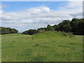
TheCaptain visited on 14th Jun 2021 - their rating: Cond: 2 Amb: 3 Access: 4 Cotswold Way walk north around Cheltenham from Seven Springs to Cleeve Hill. Small detour for a look at the remains of Lineover longbarrow, in a field of cows
4clydesdale7 visited on 17th Nov 2011 - their rating: Cond: 3 Amb: 3 Access: 5 This site lies 50m E from a layby on the busy A436 Cheltenham - Andoversford - Bourton on the Water road with heavy daytime traffic - be careful - the road is narrow and heavily used by 41ft artics
Average ratings for this site from all visit loggers: Condition: 2.5 Ambience: 3 Access: 4.5
")
Have you visited this site? Please add a comment below.
You may be viewing yesterday's version of this page. To see the most up to date information please register for a free account.
")
")
")
Do not use the above information on other web sites or publications without permission of the contributor.
Nearby Images from Geograph Britain and Ireland:
©2014(licence)

©2025(licence)

©2025(licence)

©2009(licence)

©2025(licence)
The above images may not be of the site on this page, they are loaded from Geograph.
Please Submit an Image of this site or go out and take one for us!
Click here to see more info for this site
Nearby sites
Key: Red: member's photo, Blue: 3rd party photo, Yellow: other image, Green: no photo - please go there and take one, Grey: site destroyed
Download sites to:
KML (Google Earth)
GPX (GPS waypoints)
CSV (Garmin/Navman)
CSV (Excel)
To unlock full downloads you need to sign up as a Contributory Member. Otherwise downloads are limited to 50 sites.
Turn off the page maps and other distractions
Nearby sites listing. In the following links * = Image available
821m NE 49° North Dowdeswell* Hillfort (SO99851910)
1.2km E 88° South Dowdeswell Hillfort (SP0040018600)
3.1km WSW 238° Seven Springs (Gloucestershire)* Holy Well or Sacred Spring (SO96631694)
3.7km S 185° Norbury Hillfort (Colesbourne)* Hillfort (SO989149)
4.3km W 268° Leckhampton Hill Barrow* Round Barrow(s) (SO94911838)
4.4km W 268° Leckhampton Hill* Hillfort (SO948184)
4.7km SW 232° Coberley* Chambered Tomb (SO95521564)
4.8km N 350° Prestbury (Glos) Chambered Tomb (SO984233)
5.3km SE 142° Withington Woods Cross Dyke* Misc. Earthwork (SP025144)
5.8km SE 138° Withington Woods Chambered Tomb (SP031142)
5.9km WSW 256° Dry Heathfield Barrow Round Barrow(s) (SO93521711)
5.9km WSW 259° Crippet's Barrow* Chambered Tomb (SO93421739)
5.9km NW 313° Cheltenham Centre Stone* Marker Stone (SO9488422583)
6.0km SSW 207° High Cross Stone (Elkstone)* Standing Stone (Menhir) (SO9653213246)
6.0km NW 311° Cheltenham Museum* Museum (SO947225)
6.2km NW 317° The Wish Stone* Marker Stone (SO950231)
6.3km ESE 116° Sales Lot Chambered Cairn (SP04871578)
6.3km WSW 245° Emma's Grove Round Barrows* Round Barrow(s) (SO93481594)
6.4km SSE 155° Monument Number 327710* Artificial Mound (SP0193712749)
6.4km WSW 245° Barrow Wake Barrow Round Barrow(s) (SO93381585)
6.7km SSW 202° Elkstone Churchyard Stones* Holed Stone (SO9671012316)
6.9km WSW 249° Crickley Hill* Hillfort (SO928161)
6.9km N 354° Cleeve Hill (Gloucestershire)* Hillfort (SO98492546)
7.1km WSW 241° Birdlip Barrow* Round Barrow(s) (SO9301015150)
7.2km SSW 195° Barrow Clump* Round Barrow(s) (SO974116)
View more nearby sites and additional images


 We would like to know more about this location. Please feel free to add a brief description and any relevant information in your own language.
 Wir möchten mehr über diese Stätte erfahren. Bitte zögern Sie nicht, eine kurze Beschreibung und relevante Informationen in Deutsch hinzuzufügen.
 Nous aimerions en savoir encore un peu sur les lieux. S'il vous plaît n'hesitez pas à ajouter une courte description et tous les renseignements pertinents dans votre propre langue.
 Quisieramos informarnos un poco más de las lugares. No dude en añadir una breve descripción y otros datos relevantes en su propio idioma.